Earthquakes
S


Bizarro Earth

Vinton County, Ohio has its first recorded earthquake, 20km deep and 3.8 magnitude

vinton county oh
An earthquake around 12:24 p.m. on Wednesday near Elk Township of Vinton County had worried individuals calling 911.

"People were just wondering what was going on," said William Faught, the director of the Vinton County Emergency Management Agency, who also felt a tremor from the earthquake.

"It's the first indication that we have in our catalog of any earthquake occurring in Vinton County," said Jeff Fox, a seismologist at the Ohio Department of Natural Resources (ODNR).

He classified yesterday's earthquake at a 3.8 magnitude instead of the 3.4 magnitude that was reported through the U.S. Geological Survey (USGS). John Bellini, a geophysicist at the USGS, didn't think much of yesterday's event other than it being another sporadic earthquake. Bellini says yesterday's earthquake did not reach the level of intensity to do any real damage.

Bizarro Earth

Risk of natural disasters doubles since 1975

earthquake hazard map
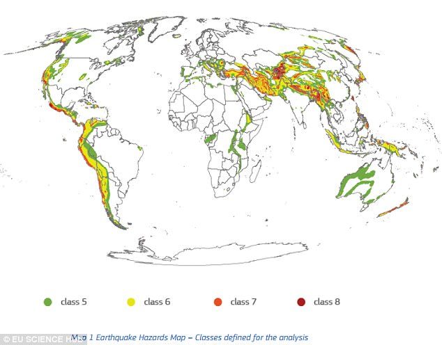
Earthquakes were found to be the largest hazard, with the number of people potentially affected jumping from 1.4 billion in 1975 to 2.7 billion in 2015. Now, they say one in three people is exposed to the risk of earthquakes.
Billions of people around the world are now exposed to devastating natural disasters, including earthquakes, tsunamis, and volcanic eruptions, according to a new study.

In the last few decades, the risk has dramatically increased; the number of people living in seismic areas, for example, has increased by 93 percent in just 40 years.

The findings, compiled in the Atlas of the Human Planet 2017, reveal the global exposure to natural disasters has doubled since 1975, largely as a result of population growth and development.

Additional images

Seismograph

Shallow 5.8 magnitude earthquake off Unalaska, Alaska

graph image
5.8 magnitude earthquake 163 km from Unalaska, Alaska, United States

USGS page: M 5.8 - 161km ESE of Nikolski, Alaska
USGS status: Reviewed by a seismologist
Reports from the public: 1 person

2017-05-24 16:36:01 UTC 5.8 magnitude, 11 km depth

Bizarro Earth

Explosion at Rincón de la Vieja Volcano spews vapor, gases into the air

Rincón de la Vieja Volcano
Rincón de la Vieja Volcano recorded a strong explosion of hot water, vapor, gases and mud that, according to the Volcanological and Seismological Observatory of Costa Rica (OVSICORI), began at around 10:12 a.m. on Tuesday.

Expelled materials were visible on the north slope of the volcano, located some 270 kilometers (167 miles) northwest of San José in the province of Guanacaste.

Residents of the nearby community of Upala reported hearing a loud sound during the explosion, similar to that of a jet turbine. Mud and other materials from the volcano also fell on the Penjamo River and changed the water color, OVSICORI report stated.

Bizarro Earth

Magnitude 5 earthquake rattles central Taiwan

taiwan earthquake map
A magnitude 5 earthquake struck central Taiwan at 9:10 p.m. on Wednesday, according to a Central Weather Bureau (CWB) report.

The epicenter of Wednesday's tremor was located 9.5 kilometers southeast of Chiayi City Hall, at a depth of 18.3 kilometers, according to the CWB. Earlier in the day, a magnitude 4.1 temblor also shook the area.

USGS data

Bizarro Earth

The San Andreas' sister faults are active in Northern California

Maacama Fault northern CA
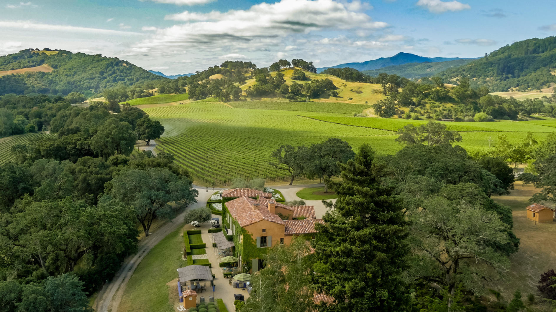
© TruliaThe city of Ukiah, in Northern California sits right next to the Maacama Fault, which is capable of M=7.5 earthquakes and poses a significant threat to the region.
In California, when most people think about faults, their thoughts are immediately drawn to the San Andreas, and to a lesser extent, the Hayward Fault. However, in Northern California, there is almost no seismicity on the San Andreas. Instead, the majority of the earthquakes occur on faults that are parallel to and east of the San Andreas. These faults are part of the greater San Andreas system, and are capable of generating large magnitude earthquakes. Today, we thought we'd take a look at two of them.

The Maacama and Bartlett Spring faults lie approximately 50 km and 80 km east of the San Andreas respectively. All of these faults are members of the greater transform boundary between the Pacific and North American plates, a margin primarily composed of nearly pure right-lateral strike-slip faults. Both the Maacama and Bartlett Springs faults are known to be active based on seismicity and creep. Creep implies there is very slow, relatively continuous motion on a fault due to tectonic deformation. While faults that creep tend to not rupture in large earthquakes, the Hayward Fault running through the San Francisco East Bay creeps and has ruptured in M=7+ quakes. So, it is not a black and white rule.

Bizarro Earth

A seismic swarm in progress beneath the Seattle Fault

Puget Sound
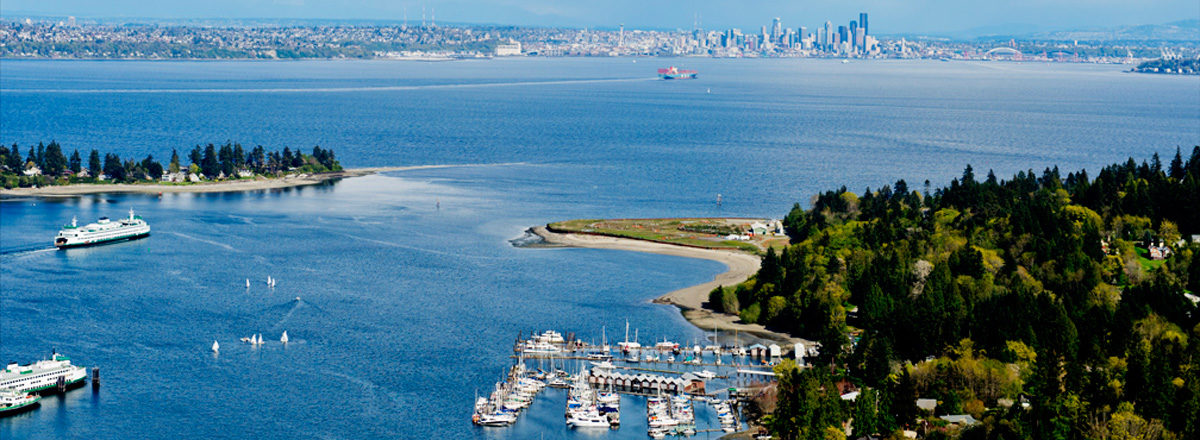
© johanssonclark.comThis view from Bainbridge Island towards Seattle looks out across Puget Sound. The active Seattle Fault Zone runs through this area and poses a significant threat to the region.
About two weeks ago, a seismic swarm just west of the city of Seattle, Washington, and southwest of Bainbridge Island started. It began with a M=3.3, which was followed a week later by a M=3.4 and a M=3.5. In total, the USGS has recorded 72 earthquakes in the area over the last two weeks. While there has only been one earthquake in the last few days (a M=1.1 at 2:13 a.m. this morning), we thought we'd take a look at the activity and the regional tectonics, with help from the people at the Pacific Northwest Seismic Network.

The city of Seattle sits right on top of the Seattle Fault zone, an east-west-striking system of reverse faults within the Puget Lowland. While active, the Seattle Fault Zone is largely concealed as it lies at the southern end of the Seattle Basin, which is covered by surface deposits, water and dense vegetation. Nonetheless, by using LiDAR (light detection and ranging) the faults can be clearly seen (See image below). This complex system of reverse faults formed due to regional compression on the order of 0.5 cm/yr.
LiDAR map Seattle
© PNSNThis LiDAR image from the Pacific Northwest Seismic Network clearly shows traces of the active Seattle Fault. If this fault were to rupture in a large earthquake like it did 1,100 years ago (M=7.0) it would have devastating effects on the region.

Attention

Earthquake swarm continues shaking near Bremerton, Kitsap Peninsula

Bremerton earthquake swarm
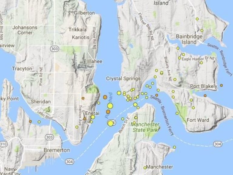
© Kitsap SunA map from the Pacific Northwest Seismic Network shows where the earthquake swarm is centered.
Scientists say hundreds of tiny earthquakes have rumbled through the Bremerton area since the start of May— most too weak for humans to feel.

How long the shaking will continue is anyone's guess.

"Sometimes these swarms last years, sometimes they're over in an hour," Pacific Northwest Seismic Network Director John Vidale said Thursday.

The chances of a significant earthquake still remain low.

"The overwhelming odds are there is nothing damaging in our near future," Vidale said.

Though disconcerting to some residents, seismologists hope the ongoing earthquake swarm, centered between East Bremerton and Bainbridge Island, will reveal new information about the orientation of fault lines running beneath central Puget Sound.

The quakes have already offered some intriguing clues. Their depth for example — some 15 miles below the earth's surface — is below the level where the Seattle Fault is believed to lie, suggesting the activity could originate from another source.

"We just don't know," Vidale said, adding more research is needed to draw firm conclusions. "We're still figuring out what details we can decipher."
Comment: Small earthquake shakes Seattle area days after swarm near Kitsap Peninsula


Seismograph

Shallow magnitude 5.8 earthquake hits Pacific coast of Mexico

graph image
The quake was registered at 00:02 a.m. local time (06:02 GMT) some 209 kilometers (129 miles) to the south-west of the city of San Patricio at the depth of 10 kilometers.

No reports of damages or tsunami warnings have been released.

Mexico is part of the so-called Pacific Ring of Fire, the most seismically active region of the Earth, where almost 90 percent of the world's earthquakes and volcanic eruptions occur.

Hardhat

Earthquake, 'loud sonic boom' startles southwestern Ontario couple watching hockey game

Wheatley, Ontario earthquake
© USGS
A Wheatley woman says a minor earthquake Saturday night startled her and her husband while they watched the hockey game.

The United States Geological Survey says a 2.2 magnitude earthquake hit around 9:50pm on Saturday.

It was reportedly centred about 5 km below the surface near the intersection of Wheatley Rd. and Essex Rd. 8.

Siobhan Cence says it sounded like a sonic boom shook the house, and it freaked her out a little.

"We heard a loud boom and felt the house shake just once really hard and I was shocked and thought was that me or did I feel something? My husband then looked at me and asked did you feel that and I said yeah," says Cence.

Cence says she can't ever remember an earthquake in Wheatley.

Cence says her husband quickly jumped into action because the bang was so loud.