Earthquakes
S


Bizarro Earth

Swarm of earthquakes rattle Bay of Plenty, New Zealand

earthquake graph image
More than 450 people felt a 'moderate' earthquake near Whakatane when it hit at 9pm yesterday. It was followed hours later with another shake in the Bay of Plenty.
More earthquakes have been felt in the Bay of Plenty. Geonet recorded four moderate quakes throughout the past 24 hours about 30km northwest of Whakatane. The last hit at 1.41am with a magnitude of 3.6 and was felt in Tauranga.

At 9.06pm yesterday a 4.2 magnitude quake struck at 10km deep. Only eight people reported feeling the early morning quake, but 454 said they felt last night's tremor. The quakes follow a 4.1 shake in the same spot at 1.35pm and another at 11.39am. Geonet recorded at least 86 "felt" reports from people describing yesterday afternoon's quake between "strong" and "light".

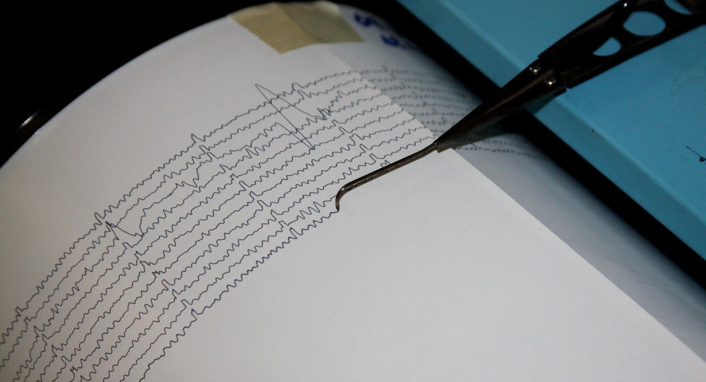
Seismograph

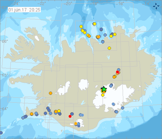
Three earthquakes in 5 minutes reported at Bárðarbunga volcano in Iceland

Bárðarbunga is a stratovolcano located under Vatnajökull, Iceland's largest glacier.
This morning, three earthquakes over the magnitude of 3 occurred in Bárðarbunga at a five minute interval.

All occurred in the northern part of the caldera, the first at 9:49, the second at 9:53 and the third at 9:54. This is reported by the Iceland Met Office.

Last week, nearly 600 earthquakes were measured in Iceland which is similar to the preceeding week. Only six of them exceeded the magnitude of 3, the largest occurring on May 27th in Bárðarbunga.

Iceland met office graph
Iceland Met Office link for current earthquake graphs

Bizarro Earth

An earthquake in the Arctic Circle?

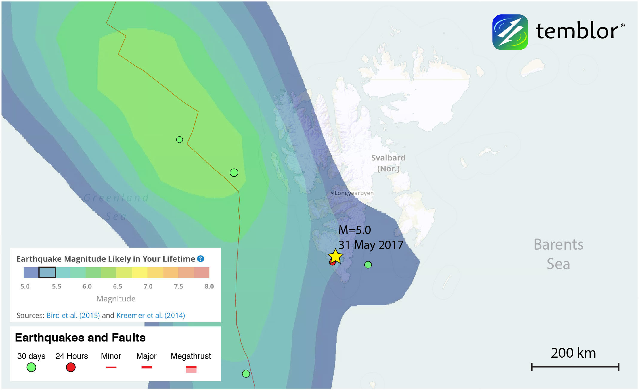
Global Earthquake Activity Rate (GEAR) model for Svalbard
This Temblor map shows the Global Earthquake Activity Rate (GEAR) model for Svalbard in the Arctic Circle. This map shows that today’s M=5.0 earthquake (magnitude from the USGS) should not be considered surprising and that the region could experience larger quakes.
At 3:59 p.m. local time, a M=5.0 earthquake shook the island of Spitsbergen, the largest island in the Svalbard archipelago in the Arctic Circle. According to the USGS, the quake occurred at a depth of 7.7 km, and was centered 133 km from Longyearbyen, the archipelago's largest settlement, which is home to a little over 2,000 people. This M=5.0 quake was preceded several hours earlier by a M=3.0. While very few people likely felt this earthquake, it highlights a lesser-known area, and the idea that seemingly inactive faults can rupture in earthquakes.

The Svalbard archipelago represents an uplifted portion of the Barents Sea, which separates Svalbard from Northern Europe. To the west of the archipelago is the Mid-Atlantic Ridge, and the Spitsbergen Fracture Zone, a divergent plate boundary between the North American and Eurasian plates. Much of the seismicity in this part of the Arctic Ocean occurs on or near the Mid-Atlantic Ridge, which has a spreading rate of approximately 2.5 cm/yr (1 inch). However, by examining the historical seismicity of the island of Spitsbergen and the rest of Svalbard, it is clear that this remote archipelago is no stranger to earthquakes.
Seismograph

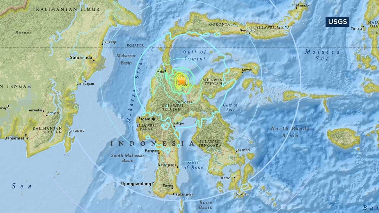
Strong shallow 6.6 earthquake rocks Indonesia's Sulawesi island

This U.S. Geological Survey map shows the location of a powerful earthquake that struck Indonesia's central Sulawesi province on Monday, May 29, 2107.
© U.S. Geological SurveyThis U.S. Geological Survey map shows the location of a powerful earthquake that struck Indonesia's central Sulawesi province on Monday, May 29, 2107.
A strong, shallow earthquake has rocked Indonesia's central Sulawesi province. There were no immediate reports of damage or casualties.

The U.S. Geological Survey says the quake Monday evening near the city of Poso had a preliminary magnitude of 6.6 and was located at a depth of 9 kilometers (6 miles).

Al Shinto radio reported that residents ran from their homes in panic.

Shallow earthquakes tend to cause more damage on the Earth's surface.

Source: AP

Attention

Another earthquake registered around Bardarbunga volcano in Iceland

Bardarbunga volcano
Bardarbunga volcano
An earthquake of 3.9 magnitude was measured in Bardarbunda caldera this morning at 9.35 (local time) according to a RUV report and according to the Icelandic Met Office around seventy tremmors and quakes were measured there last week and an additional thirty the week before that. Three of those earthquakes were above 3.0 magnitude and they all originated by the calderas edge in the evening of 20 May, last week.

A large earthquake also rocked south Iceland in early May 17 with reports of Hekla Volcano being ready to erupt.

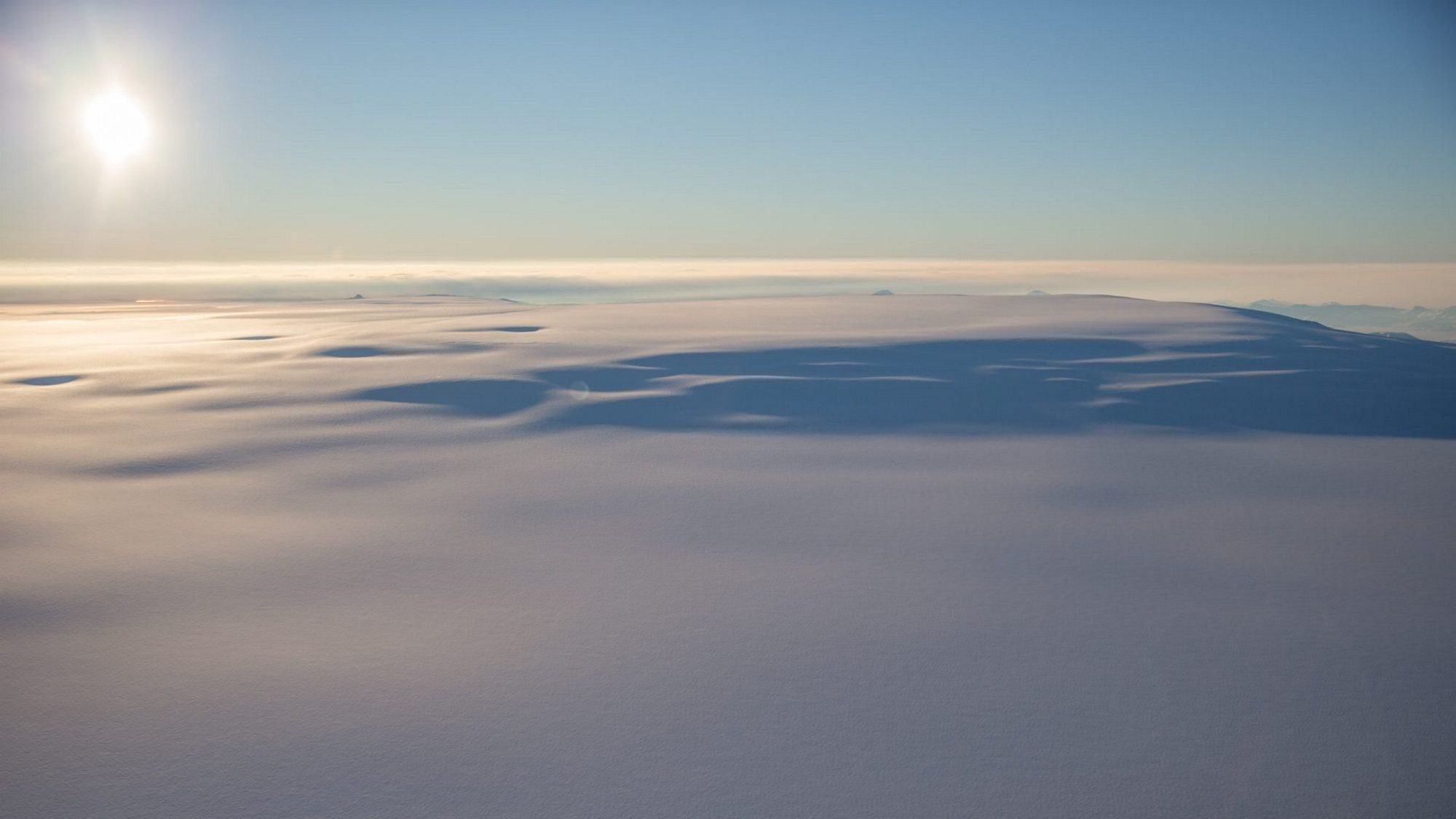
Bardarbunga, is a volcano located under Iceland's most extensive glacier, Vatnajokull glacier to the north. Bardarbunga is the second highest mountain in Iceland and is a part of a volcanic system that is approximately 200 kilometers long and 25 kilometers wide, that system includes Hekla Volcano.

Bizarro Earth

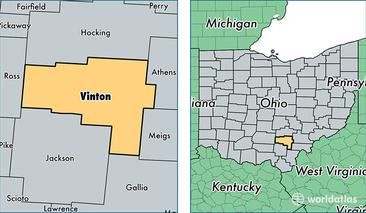
Vinton County, Ohio has its first recorded earthquake, 20km deep and 3.8 magnitude

vinton county oh
An earthquake around 12:24 p.m. on Wednesday near Elk Township of Vinton County had worried individuals calling 911.

"People were just wondering what was going on," said William Faught, the director of the Vinton County Emergency Management Agency, who also felt a tremor from the earthquake.

"It's the first indication that we have in our catalog of any earthquake occurring in Vinton County," said Jeff Fox, a seismologist at the Ohio Department of Natural Resources (ODNR).

He classified yesterday's earthquake at a 3.8 magnitude instead of the 3.4 magnitude that was reported through the U.S. Geological Survey (USGS). John Bellini, a geophysicist at the USGS, didn't think much of yesterday's event other than it being another sporadic earthquake. Bellini says yesterday's earthquake did not reach the level of intensity to do any real damage.

Bizarro Earth

Risk of natural disasters doubles since 1975

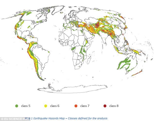
earthquake hazard map
Earthquakes were found to be the largest hazard, with the number of people potentially affected jumping from 1.4 billion in 1975 to 2.7 billion in 2015. Now, they say one in three people is exposed to the risk of earthquakes.
Billions of people around the world are now exposed to devastating natural disasters, including earthquakes, tsunamis, and volcanic eruptions, according to a new study.

In the last few decades, the risk has dramatically increased; the number of people living in seismic areas, for example, has increased by 93 percent in just 40 years.

The findings, compiled in the Atlas of the Human Planet 2017, reveal the global exposure to natural disasters has doubled since 1975, largely as a result of population growth and development.

Additional images

Seismograph

Shallow 5.8 magnitude earthquake off Unalaska, Alaska

graph image
5.8 magnitude earthquake 163 km from Unalaska, Alaska, United States

USGS page: M 5.8 - 161km ESE of Nikolski, Alaska
USGS status: Reviewed by a seismologist
Reports from the public: 1 person

2017-05-24 16:36:01 UTC 5.8 magnitude, 11 km depth

Bizarro Earth

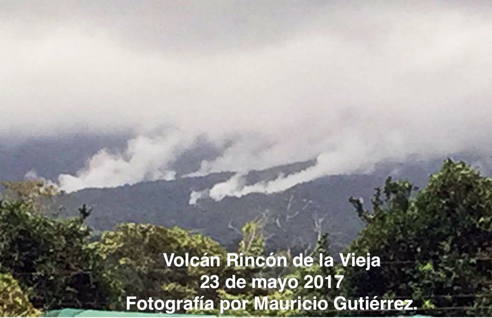
Explosion at Rincón de la Vieja Volcano spews vapor, gases into the air

Rincón de la Vieja Volcano
Rincón de la Vieja Volcano recorded a strong explosion of hot water, vapor, gases and mud that, according to the Volcanological and Seismological Observatory of Costa Rica (OVSICORI), began at around 10:12 a.m. on Tuesday.

Expelled materials were visible on the north slope of the volcano, located some 270 kilometers (167 miles) northwest of San José in the province of Guanacaste.

Residents of the nearby community of Upala reported hearing a loud sound during the explosion, similar to that of a jet turbine. Mud and other materials from the volcano also fell on the Penjamo River and changed the water color, OVSICORI report stated.

Bizarro Earth

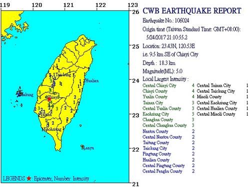
Magnitude 5 earthquake rattles central Taiwan

taiwan earthquake map
A magnitude 5 earthquake struck central Taiwan at 9:10 p.m. on Wednesday, according to a Central Weather Bureau (CWB) report.

The epicenter of Wednesday's tremor was located 9.5 kilometers southeast of Chiayi City Hall, at a depth of 18.3 kilometers, according to the CWB. Earlier in the day, a magnitude 4.1 temblor also shook the area.

USGS data