Earthquakes
S


Seismograph

Unusual M4 earthquake sparks tsunami in Greenland, four missing (VIDEO)

Greenland: M4 earthquake sparks tsnuami, four missing (VIDEO)
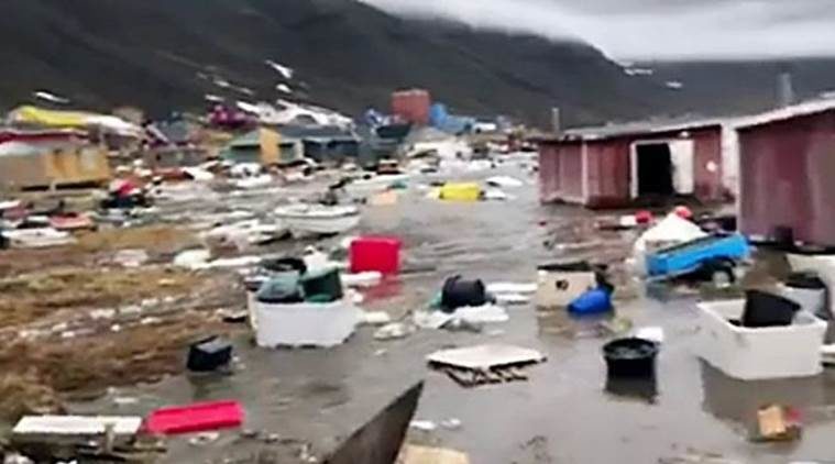
© AFP11 houses had been swept away after a magnitude 4 overnight quake off Uummannaq, a small island well above the Arctic Circle, Bay reported
Four people were listed as missing today after an earthquake sparked a tsunami off Greenland and forced some residents to be evacuated. "Four people are missing," local broadcaster KNR quoted local police chief Bjorn Tegner Bay as telling a news conference in the autonomous Danish territory.

There were no confirmed fatalities, but Bay said 11 houses had been swept away after a magnitude 4 overnight quake off Uummannaq, a small island well above the Arctic Circle.

"The huge waves risk breaking over Upernavik and its environs. The residents of Nuugaatsiaq are going to be evacuated," police said on Facebook, referring to nearby hamlets.

Seismograph

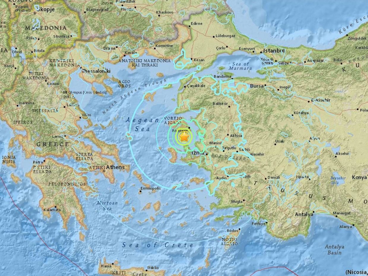
Two earthquakes rattle Aegean Sea off western Turkey

Aegean Sea earthquake

No casualties or damage reported so far, Turkey's disaster authority says


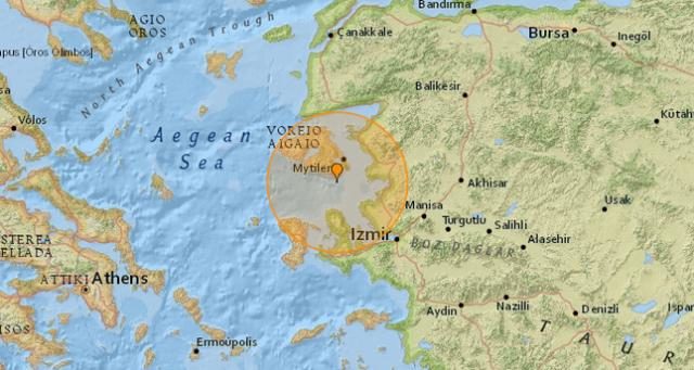
A pair of earthquakes shook Aegean Sea, western Turkey late Saturday, according to the country's Disaster and Emergency Management Authority (AFAD).

One quake measuring 4.2 on the Richter scale hit at 10.33 p.m. local time (1933GMT) while a second one measuring 5.3 struck 17 minutes later at 10.50 p.m. (1950GMT), AFAD said on its website.

No casualties or structural damage have been reported so far.

Last week, the region was rattled by a 6.2-magnitude quake which struck coastal İzmir's Karaburun district at 3.28 p.m. local time (1228GMT) at a depth of 22.98 kilometers (14 miles).

Seismograph

Shallow 5.7 magnitude earthquake on the Pacific-Antarctic Ridge

graph

5.7 magnitude earthquake

USGS page: M 5.7 - Pacific-Antarctic Ridge
USGS status: Reviewed by a seismologist
Reports from the public: 0 people

2017-06-16 19:37:26 UTC 5.7 magnitude, 10 km depth

Comment: A day earlier: Shallow 5.8 magnitude earthquake at Southern East Pacific Rise


Seismograph

Shallow 5.8 magnitude earthquake at Southern East Pacific Rise

graph

5.8 magnitude earthquake

USGS page: M 5.8 - Southern East Pacific Rise

USGS status: Reviewed by a seismologist

Reports from the public: 0 people

2017-06-15 11:42:15 UTC 5.8 magnitude, 10 km depth
Southern Pacific Ocean

Attention

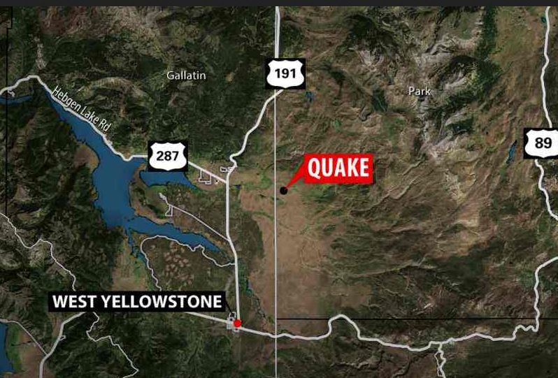
Shallow 4.5 magnitude earthquake and aftershocks rattle West Yellowstone area

West Yellowstone earthquake
© MTN News
A 4.5 Magnitude earthquake was recorded in Yellowstone National Park at 6:48 p.m. on Thursday.

It was followed by 4 small aftershocks ranging from 2.7 to 3.1 magnitude.

The main quake was centered about 5.8 miles underground.

The quake and aftershocks occurred just over 8 miles northeast from West Yellowstone, according to the U.S. Geological Service.

A witness reported that she felt the building she was in move.

Dozens of people reported that they felt it in and around West Yellowstone, Gardiner, Ennis, and Bozeman.

There have been no reports of any injuries or damage.

Seismograph

Shallow earthquake of Magnitude 5.9 hits Kermadec Islands

graph
Magnitude: 5.9

Region: Kermadec Islands, New Zealand

Date: 2017-06-15

Time: 00:26:14.8 UTC

Location: 30.66 S; 177.91 W

Depth: 20 km

Distances: 1090 km S of Nuku'alofa, Tonga / pop: 22,400 / local time: 13:26:14.8 2017-06-15
916 km NE of Whangarei, New Zealand / pop: 50,900 / local time: 12:26:14.8 2017-06-15

Source parameters reviewed by a seismologist

Bizarro Earth

Signs of past mega-quakes show wide-ranging implications of major rupture on California's San Andreas fault

San Andreas Fault
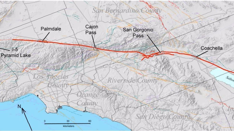
© U.S. Geological Survey)The San Andreas fault, in heavy red, slices through key mountain passes including the San Gorgonio Pass and the Cajon Pass.
As Interstate 10 snakes through the mountains and toward the golf courses, housing tracts and resorts of the Coachella Valley, it crosses the dusty slopes of the San Gorgonio Pass.

The pass is best known for the spinning wind turbines that line it. But for geologists, the narrow desert canyon is something of a canary in the coal mine for what they expect will be a major earthquake coming from the San Andreas fault.

The pass sits at a key geological point, separating the low desert from the Inland Empire, and, beyond that, the Los Angeles Basin.

Through it runs an essential aqueduct that feeds Southern California water from the Colorado River as well as vital transportation links. It's also the path for crucial power transmission lines.

California earthquake experts believe what happens at the San Gorgonio Pass during a major rupture of the San Andreas fault could have wide-ranging implications for the region and beyond.
Comment: New study finds that California's San Andreas Fault could actually rupture along its entire 800-mile length


Seismograph

Magnitude 7.0 earthquake strikes off Mexico coast

Richter magnitude scale
© AFP 2017/ Richter magnitude scale
A magnitude 7 earthquake took place off the coast of southern Mexico.

A magnitude 7 earthquake registered off the coast of southern Mexico at a depth of 61 miles does not present a tsunami threat, the US National Weather Service (NWS) said Wednesday.

"An earthquake with a preliminary magnitude of 7.0 occurred near the coast of Chiapas, Mexico at 0729 UTC on Wednesday June 14 2017," the NWS said.

It added, "based on all available data... there is no tsunami threat from this earthquake."

Seismograph

Shallow magnitude 6.3 earthquake strikes near İzmir, Turkey

The epicentre of the quake was located some 84 km (52 miles) northwest of the Aegean coastal province of Izmir
© US Geological SurveyThe epicentre of the quake was located some 84 km (52 miles) northwest of the Aegean coastal province of Izmir
A strong earthquake with a magnitude of 6.3 has struck near the coast of western Turkey and the Greek island of Lesbos, a European earthquake monitor said.

The epicentre of the quake was located some 84 km (52 miles) northwest of the Aegean coastal province of Izmir, the European-Mediterranean Seismological Centre (EMSC) said on its website.

The Greek island of Lesbos has also been rattled.


Comment: This quake occurred at a depth of just 10 kilometres according to Earthquake Track, although another source has it even shallower at only 5 kms.

Approximately 13 hours earlier: Shallow 6.3 magnitude earthquake hits off Indonesia's Java Island


Seismograph

Shallow 6.3 magnitude earthquake hits off Indonesia's Java Island

Java earthquake
© Google
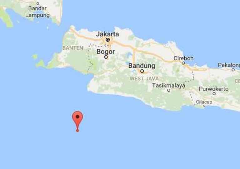
A strong earthquake (gempa) with a preliminary magnitude of 6.3 has struck off the Indonesian island of Java, centered southwest of Jakarta, Bogor, and Bandung. Only few details were immediately available.

The earthquake, which struck at 6:15 a.m. local time on Monday, was centered about 192 kilometers (119 miles) southwest of Bogor. It struck at a depth of about 10 kilometers (6.2 miles), making it a shallow earthquake.

Indonesia's seismological agency BMKG put the preliminary magnitude at 6.3, while the U.S. Geological Survey (USGS) put the magnitude at 5.6. Many people across the western end of Java said the earthquake was strong enough to wake them up.

"Just laying on bed and shook hard enough to wake me up," one resident in Bogor told EMSC. Someone else in the city told the agency: "While at hospital, bed shock hard enough to wake me up."