Storms
S


Cloud Lightning

Lightning sparks fresh wildfires across California

wilfires california lightning
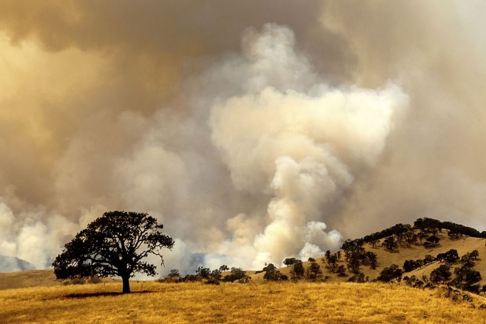
© AP Photo/Noah BergerSmoke from a wildfire, one of several that comprise the Deer Zone fires, billows over unincorporated Contra Costa County, Calif., on Sunday, Aug. 16, 2020
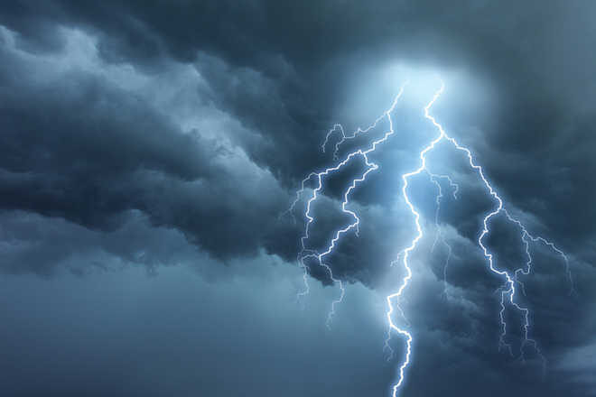
A rare summer thunderstorm brought lightning that sparked several small blazes in Northern California on Sunday and stoked a huge wildfire that has forced hundreds of people from their homes north of Los Angeles.

More than 4,500 buildings remained threatened by the fire burning toward thick, dry brush in the Angeles National Forest. Firefighters already battling the blaze in steep, rugged terrain with scorching heat faced more hurdles when hundreds of lightning strikes and winds up to 15 mph (24 kph) pushed the flames uphill.

"We set up a containment line at the top of the hills so the fire doesn't spill over to the other side and cause it to spread, but it was obviously difficult given the erratic wind and some other conditions," said fire spokesman Jake Miller.
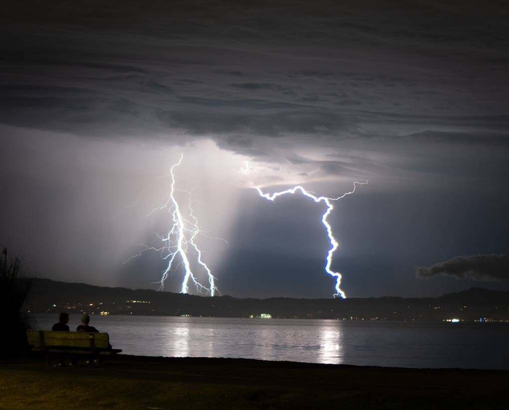
Comment: More spectacular clips from the crazy weather/fires in California:


Tornado2

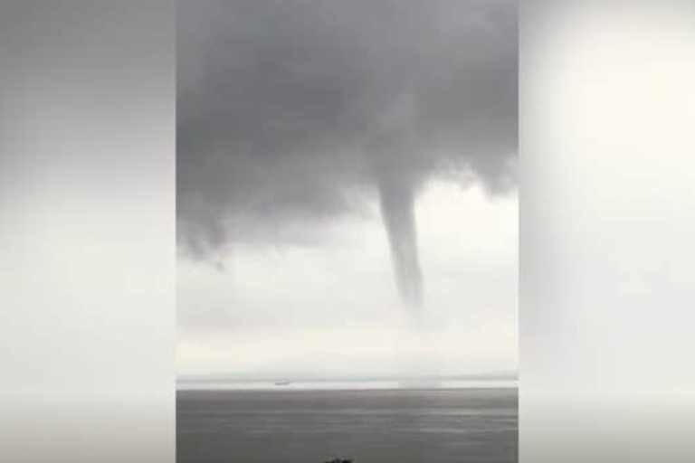
Massive tornado-like waterspout seen over Bristol Channel, UK

Bristol Channel waterspout
© Arthur RichardsThe rare weather event was spotted over the Bristol Channel at the weekend
An enormous tornado-like waterspout has been caught on camera swirling over the Bristol Channel.

The rare weather event, spotted near Portishead on Sunday afternoon, happens when strong gusts of wind rotate from the base of a cloud all the way down to the water below.

The phenomenon was spotted by a number of social media users, including Dr Arthur Richards, who tweeted footage from Somerset at around 4pm.

The spiralling cloud was visible for around 15 minutes, according to onlookers, and appeared to create a spray from the sea.


Comment: Also this month:


Cloud Lightning

Rare August thunderstorm gives intense lightning display across San Francisco's Bay Area

Lightning streaks across the Bay area
© Huxley Dunsany, Twitter: @Huxley_DLightning streaks across the Bay.
It's a rare sight for thunder and lighting to rock the Bay Area. As the skies sparked Saturday night and through Sunday morning, it's not a surprise that many of you got out your phones and cameras to capture the spectacle.

We've collected some submissions from KQED listeners, readers, and staff, as well as some great shots from around the Bay Area social media-sphere.

Enjoy the odd weather while you can: San Francisco, Oakland and San Jose are expected to get sunny by Sunday afternoon, though there is still a chance of thunderstorms Sunday night, according to the National Weather Service.


Attention

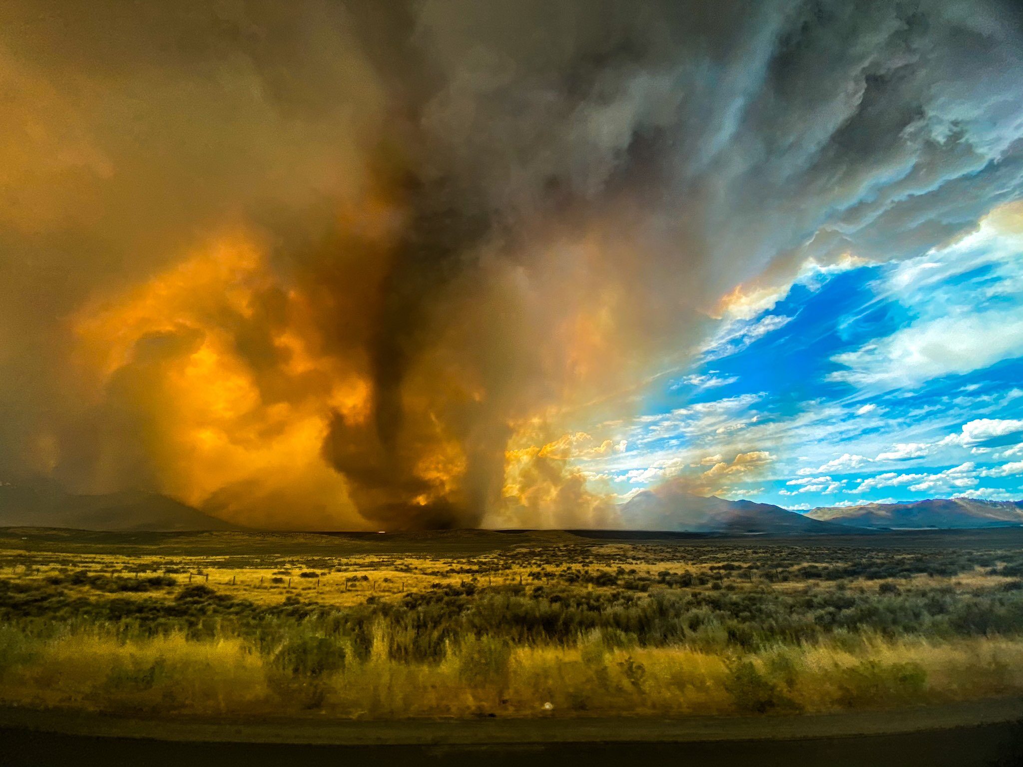
Best of the Web: First ever firenado warning in California as wildfires rage into third day

Firenado
© nevada_traveler/TwitterFirenado spotted in California on the 16th August 2020
The Loyalton Fire currently raging in California, as seen in this one-hour timelapse, produced a fiery vortex on Saturday, leading the National Weather Service to issue its first-ever tornado warning for a twister spawned by fire.

Apparently running out of cataclysmic events to throw at us this year, Mother Nature decided to reach deep into her bag of tricks and pull out a Biblical classic: swirling hellfire.

The National Weather Service issued its first-ever tornado warning for a twister spawned by fire early Saturday afternoon after a wildfire in Northern California produced a towering, flaming vortex. While not unheard of, fire tornadoes are some of the rarest weather phenomena on Earth, and meteorologists are saying this is the first time one's received an official tornado warning.

Comment: As the original title noted: You can mark firenado off of your 2020 apocalypse bingo card.

More footage has emerged on Twitter:


And this isn't the first firenado that's been spawned from this wildfire:


In Earth Changes and the Human-Cosmic Connection Pierre Lescaudron explicates the drivers behind wind vortices of all kinds:
The accumulation of cometary dust in the Earth's atmosphere plays an important role in the increase of tornadoes, cyclones, hurricanes and their associated rainfalls, snowfalls and lightning. To understand this mechanism we must first take into account the electric nature of hurricanes, tornadoes and cyclones, which are actually manifestations of the same electric phenomenon at different scales or levels of power. Because of this similarity, we will refer to these three phenomena collectively as 'air spirals' in the following discussion.

McCanney [in his book Planet-X, Comets and Earth Changes] describes the electric nature of hurricanes in these terms:
A simple model showed that these [tropical] storms formed when electrical currents connected between the ionosphere and the top of the clouds. [...] the reason hurricanes lost power when they approached land was that the powering electrical current from the ionosphere to the cloud tops and to the Earth's surface had no connection (anode) while over the ocean so it drew up vast surface areas of ionized air from the ocean surface and sucked them up a central column (the spinning vortex was caused by the moist air rising 'up the drain')  whereas the land provided a 'ground' for the current and therefore it shunted out the storm's power source. [...] I also calculated that the warm water theory for hurricane development lacked sufficient energy to account for the energy in these massive storms. We later witnessed hurricanes on Mars where there is no water at all. Clearly, the warm water concept did not work [...]1
From this perspective, air spirals are simply the manifestation of electric discharges between the ionosphere and the Earth's surface. The image above shows a waterspout and a lightning bolt occurring in the same place at the same time, suggesting that indeed electric potential difference between the clouds at the top of the picture and the ground at the bottom is what powers both the lightning and the tornado.This additional feature of dust particles - their ability to carry an electric charge - means that dust accumulation enables any given area of the atmosphere to carry potentially massive electric charges, which can differ from the charge of adjacent regions, from the charge of the ionosphere and from the charge of the Earth's surface.
See also: And check out SOTT radio's: Behind the Headlines: Earth changes in an electric universe: Is climate change really man-made?


Cloud Lightning

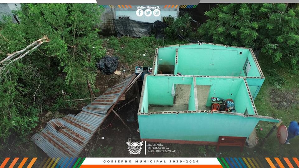
Hurricane slams Sipacate, Guatemala

Several homes completely lost their roofs in Sipacate due to the strong wind on Friday, August 14.
© Walter NájeraSeveral homes completely lost their roofs in Sipacate due to the strong wind on Friday, August 14.
High winds cause damage in Sipacate, Escuintla, Guatemala. August 15th 2020.


Cloud Lightning

Lightning strike kills 3 women, injures 4 others in Chhattisgarh, India

lightning
Three women were killed and four others were injured on Saturday in a lightning strike at a village in Chhattisgarh's Raigarh district, police said.

A group of women was working in a paddy field at Hardi village under Sarangarh police station when they were struck by the bolt from sky around 11 am, said Raigarh superintendent of police Santosh Singh.

The deceased are identified as Vinita Jangde (20), Sashi Mahant (30) and Nanki Tandan (50), he said, adding that four others sustained burn injuries.

A police team shifted the injured women to Sarangarh Civil Hospital, he said, adding that a case has been registered.

Source: PTI

Tornado2

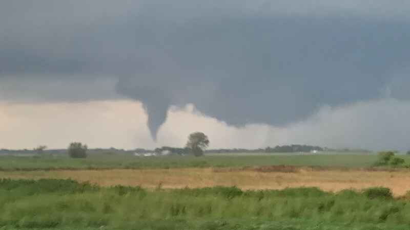
At least 10 tornadoes reported across Minnesota

Funnel cloud near Gaylord
© Rebecca Kolstad.Funnel cloud near Gaylord
The National Weather Service Storm Prediction Center received at least 10 reports of tornadoes Friday evening across Minnesota, although more reports are still coming in.

Storms producing tornadoes developed in western Minnesota and moved eastward across the state starting around 3:38 p.m., according to preliminary reports. The highest concentration of reports occurred in a line from northwest of Alexandria to south of Hutchinson, with other reports coming from southeast and northwest Minnesota.

The NWS also confirmed an EF-0 tornado touched down near Crystal around 7:55 p.m. Maximum winds were estimated to be around 75 mph, causing "significant" tree damage in Crystal, New Hope and Robbinsdale.


Cloud Lightning

Lightning bolt kills over 30 sheep in Sorogain, Spain

dead sheep
A lightning strike has killed over 30 sheep, a cow and a ram in Sorogain, in the Valley of Erro.

The macabre images released by the Guardia Civil look like something out of a gory, zombie-apocalypse film.

The Guardia Civil was alerted by a farmer from Sorogain, Navarra, that an electrical storm which lashed down on the area on Saturday night, had left a ghastly aftermath.

It had resulted in the death of 28 sheep and one ram on his property.

Several other sheep and a cow owned by a neighbouring farmer also died as a result of the electrical storm after being struck by lightning.


Comment: In addition, a strike killed 2 horses in Kent, UK on August 13.


Cloud Precipitation

22 people dead and almost 40,000 hectares of farmland damaged after 2 weeks of heavy rains and flooding in North Korea

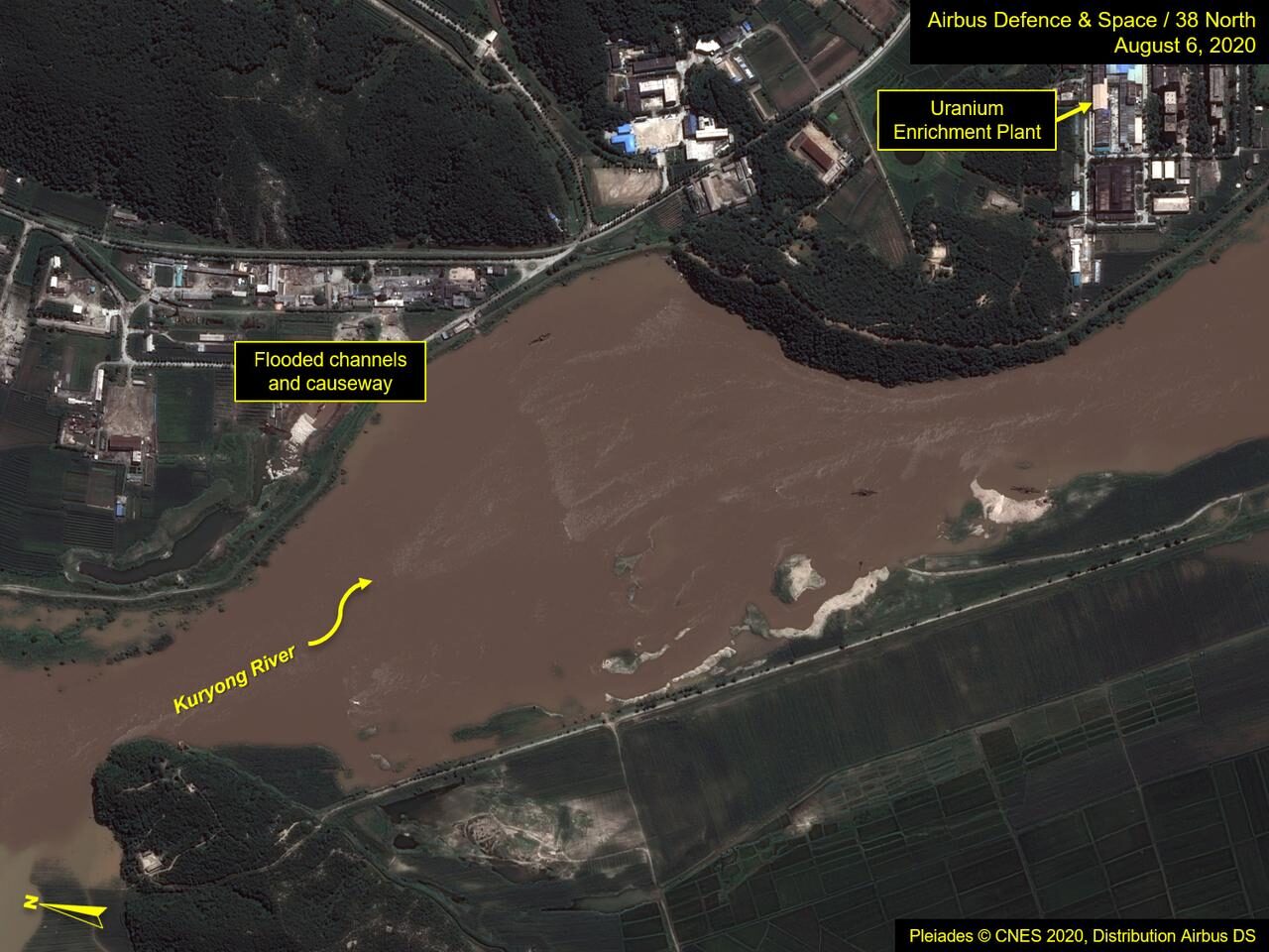
A view of the Yongbyon Nuclear Scientific Research Center shows flooding along the bank of the Kuryong River in Yongbyon, North Korea, August 6, 2020
© Airbus Defence & Space and 38 North/PleiadesA view of the Yongbyon Nuclear Scientific Research Center shows flooding along the bank of the Kuryong River in Yongbyon, North Korea, August 6, 2020
Over 20 people have died in North Korea after two weeks of heavy rains and flooding. Thousands of homes and wide areas of farmland have been damaged or destroyed.

In a press statement of 14 August, 2020, International Federation of Red Cross and Red Crescent Societies (IFRC) said that 22 people have died and 4 are missing after weeks of heavy rain and floods in North Korea.

The country's state-run Korean Central News Agency (KCNA) reported that floods had damaged or destroyed 39,296 hectares of farmland, 16,680 homes and 630 public buildings across the country.


Cloud Precipitation

Latest storms and hail in Spain caused severe damage to several crops - 360,000 hectares affected

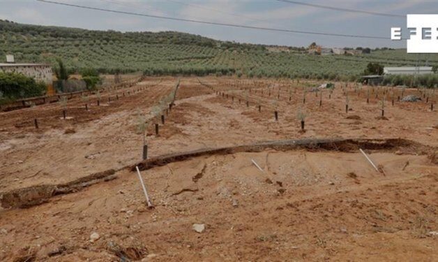
Damage to an olive grove in the Sevillian town of Gilena
© Efeagro / José Manuel VidalDamage to an olive grove in the Sevillian town of Gilena
According to estimates by the Spanish Group of Combined Agricultural Insurance Entities (Agroseguro), the storms and hail registered recently in various parts of Spain have damaged a total of 24,000 hectares of crops.

The region of Castile-La Mancha has been particularly hit by these meteorological events, with the greatest damage being recorded in Campo de Calatrava and Montiel, in Ciudad Real, and in Albacete.

In the province of Ciudad Real, hail has caused plenty of damage to almond trees (just at the beginning of their harvest season) and to summer vegetables (melon, watermelon, tomato and onion). In Albacete, the hail storms have hit similar crops, as well as other like corn or lettuce, as revealed by Agroseguro data.

In the case of Extremadura, a region also strongly affected, the greatest damage has been reported in the Las Vegas Altas region, in the province of Badajoz, especially in fruit trees (some plum and peach varieties) and in crops such as tomatoes.


Comment: View also: Summer flash floods hit Andalusia, Spain