Storms
S


Windsock

Satellite imagery shows devastation to US Midwest crops a week after derecho

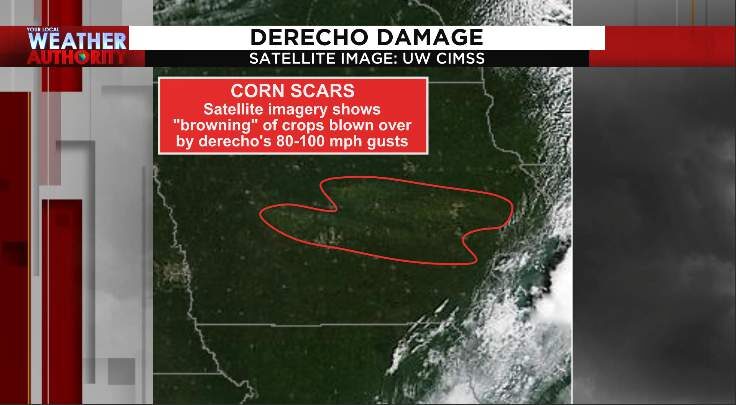
Satellite imagery shows devastation to corn, soy crop in Iowa
© University of Wisconsin's Cooperative Institute for Meteorological Satellite StudiesSatellite imagery shows devastation to corn, soy crop in Iowa

The storm leveled fields of corn, damaged agricultural buildings and had wind gusts of 80-100 mph in some places


Last Monday, a derecho (widespread windstorm) sped through parts of the upper Midwest. We first wrote about this last Tuesday, after wind gusts in parts of Iowa reached and exceeded 100 miles-per-hour. A week later, 75,000 Iowans are still without power.

The image at the top of the article shows brown scars, meaning that the blown-over crops are dying and are not coming back up. This is a devastating blow, partially because Iowa has led the U.S. in corn production for more than two decades in a row. For so many in the Midwest, this is their livelihood and with fall harvest not that far away.

Millions of acres of corn and soybeans were impacted by the storm, according to the Iowa Soybean Association. The damage is still being assessed, so it's not known exactly how much of the crop is destroyed.
Comment: Powerful derecho storm wreaks havoc across US Midwest leaving 1.1 million without power


Boat

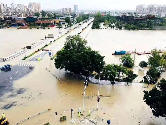
Sichuan Province in China braces for yet more severe flooding - likely worst for 70 years

floods
Three Gorges Dam braces for 'No. 5 Flood' days after 'No. 4 Flood' struck

Sichuan Province, which sits on the upper reaches of the Yangtze River, on Monday (Aug. 17) braced for some of the worst flooding seen in over 70 years, likely to bring the "No. 5 Flood" downstream to the beleaguered Three Gorges Dam.

After the "No. 4 Flood" of the year passed through the Three Gorges Dam on Saturday (Aug. 15), the Changjiang Water Resources Commission (CWRC) issued an orange flood warning for the Jialing River and its tributary Fu River on the upper reaches of the Yangtze in Sichuan Province on Sunday (Aug. 16). It predicted that the latest bout of flooding will likely form the "No. 5 Flood" of the year and could come only two or three days after the previous one.

The peak of the No. 4 flood on the Yangtze River passed through the Three Gorges Reservoir at around 8 a.m. on the 15th. The water inflow reached 62,000 cubic meters per second, which was higher than the previous three floods this year.


Umbrella

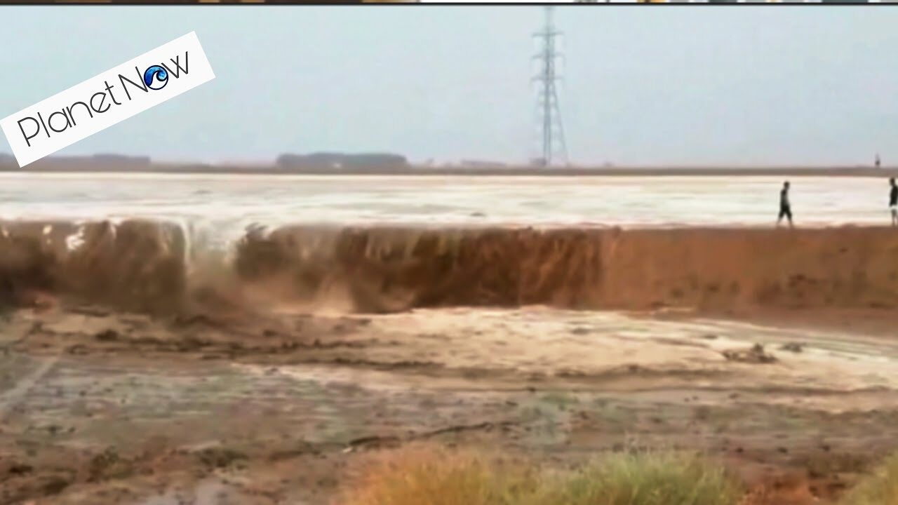
Summer storms hit Ibri, Oman

floods
High winds and flooding in the state of Ibri, Oman. August 16th, 2020.


Boat

Almost 15 million affected, around 850 dead due to this year's monsoon in India

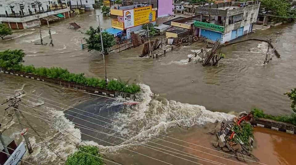
Flooded streets and submerged houses after heavy rainfall, in Warangal district on Sunday.
© PTIFlooded streets and submerged houses after heavy rainfall, in Warangal district on Sunday.
Flooding has worsened in Telangana state in southern India. Meanwhile the neighbouring state of Andhra Pradesh has also seen flooding over recent days.

Almost 15 million people have been affected and around 850 people have lost their lives as a result of this year's monsoon in India, according to figures from the Ministry of Home Affairs Disaster Management Division (DMD).

Telangana

Flooding that began in Telangana last week has now affected the districts of Jayashankar Bhupalpally , Hyderabad, Mulugu, Bhadradri Kothagudem, Warangal urban, Warangal rural, Karimnagar, Mancherial, Komaram Bheem, Nirmal and Peddapalli.

The Godavari river is still above the danger mark at Bhadrachalam and Dummugudem in Bhadradri Kothagudem district.


Windsock

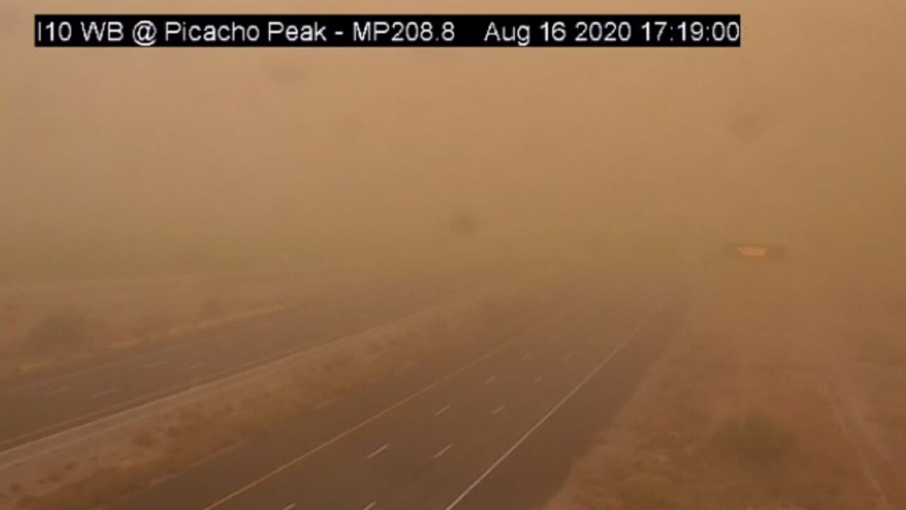
Huge dust storm sweeps through Arizona

A dust storm can be seen on Sunday, Aug. 16, 2020 on Interstate 10 near Picacho Peak, Arizona.
A massive dust storm engulfed homes and highways in Arizona on Sunday, as the temperature in Phoenix soared to a record 46C (115F). Bronze-coloured plumes blanketed Picacho Peak, causing low visibility on roads between Tucson and Casa Grande. The conditions brought traffic to a halt.


Cloud Lightning

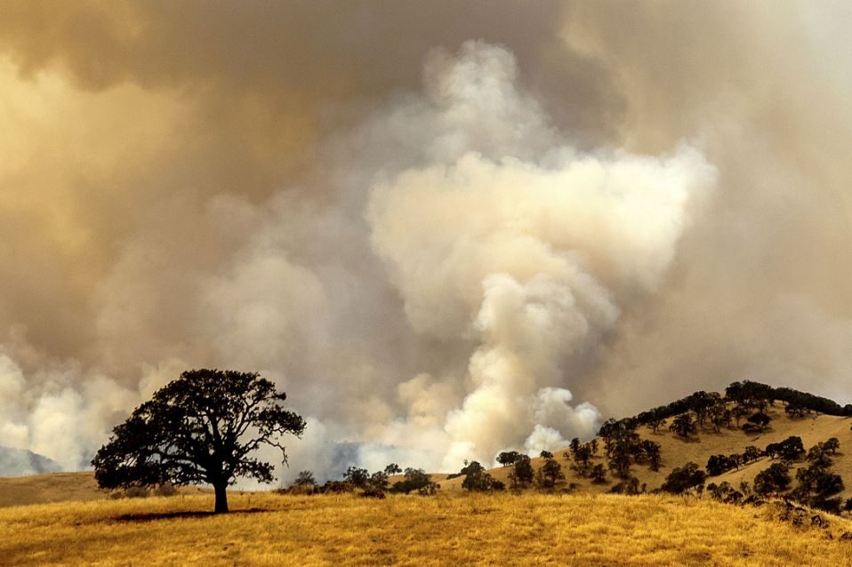
Lightning sparks fresh wildfires across California

wilfires california lightning
© AP Photo/Noah BergerSmoke from a wildfire, one of several that comprise the Deer Zone fires, billows over unincorporated Contra Costa County, Calif., on Sunday, Aug. 16, 2020
A rare summer thunderstorm brought lightning that sparked several small blazes in Northern California on Sunday and stoked a huge wildfire that has forced hundreds of people from their homes north of Los Angeles.

More than 4,500 buildings remained threatened by the fire burning toward thick, dry brush in the Angeles National Forest. Firefighters already battling the blaze in steep, rugged terrain with scorching heat faced more hurdles when hundreds of lightning strikes and winds up to 15 mph (24 kph) pushed the flames uphill.

"We set up a containment line at the top of the hills so the fire doesn't spill over to the other side and cause it to spread, but it was obviously difficult given the erratic wind and some other conditions," said fire spokesman Jake Miller.

Comment: More spectacular clips from the crazy weather/fires in California:


Tornado2

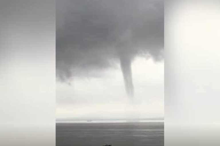
Massive tornado-like waterspout seen over Bristol Channel, UK

Bristol Channel waterspout
© Arthur RichardsThe rare weather event was spotted over the Bristol Channel at the weekend
An enormous tornado-like waterspout has been caught on camera swirling over the Bristol Channel.

The rare weather event, spotted near Portishead on Sunday afternoon, happens when strong gusts of wind rotate from the base of a cloud all the way down to the water below.

The phenomenon was spotted by a number of social media users, including Dr Arthur Richards, who tweeted footage from Somerset at around 4pm.

The spiralling cloud was visible for around 15 minutes, according to onlookers, and appeared to create a spray from the sea.


Comment: Also this month:


Cloud Lightning

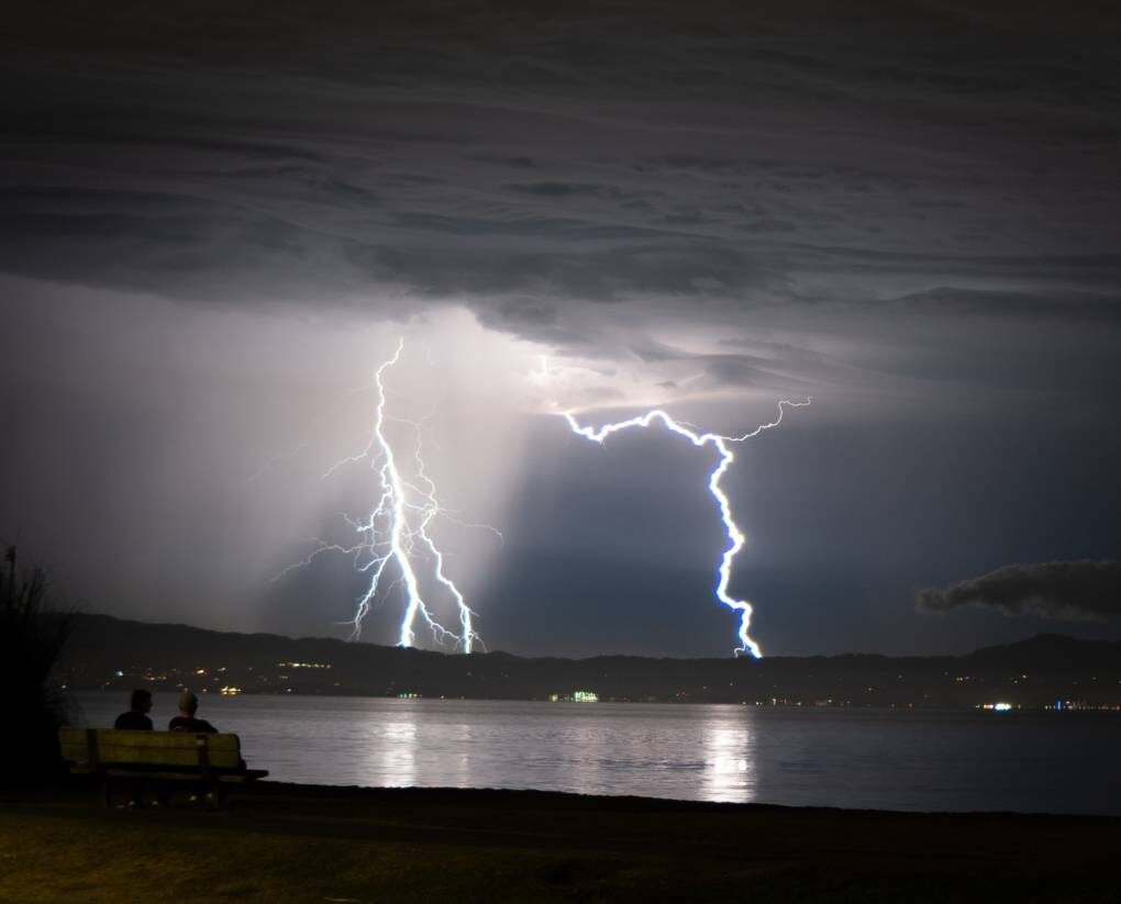
Rare August thunderstorm gives intense lightning display across San Francisco's Bay Area

Lightning streaks across the Bay area
© Huxley Dunsany, Twitter: @Huxley_DLightning streaks across the Bay.
It's a rare sight for thunder and lighting to rock the Bay Area. As the skies sparked Saturday night and through Sunday morning, it's not a surprise that many of you got out your phones and cameras to capture the spectacle.

We've collected some submissions from KQED listeners, readers, and staff, as well as some great shots from around the Bay Area social media-sphere.

Enjoy the odd weather while you can: San Francisco, Oakland and San Jose are expected to get sunny by Sunday afternoon, though there is still a chance of thunderstorms Sunday night, according to the National Weather Service.


Attention

Best of the Web: First ever firenado warning in California as wildfires rage into third day

Firenado
© nevada_traveler/TwitterFirenado spotted in California on the 16th August 2020
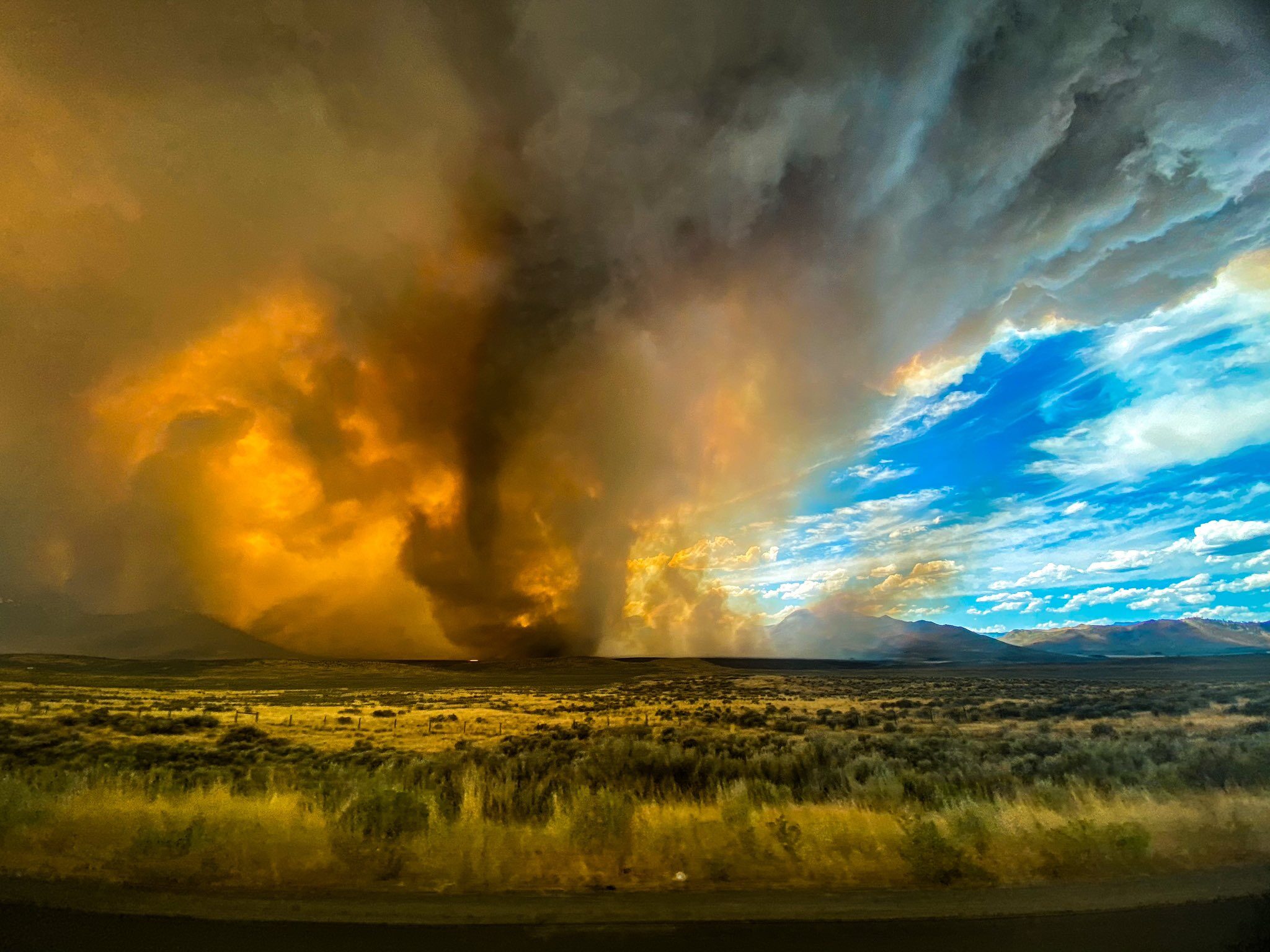
The Loyalton Fire currently raging in California, as seen in this one-hour timelapse, produced a fiery vortex on Saturday, leading the National Weather Service to issue its first-ever tornado warning for a twister spawned by fire.

Apparently running out of cataclysmic events to throw at us this year, Mother Nature decided to reach deep into her bag of tricks and pull out a Biblical classic: swirling hellfire.

The National Weather Service issued its first-ever tornado warning for a twister spawned by fire early Saturday afternoon after a wildfire in Northern California produced a towering, flaming vortex. While not unheard of, fire tornadoes are some of the rarest weather phenomena on Earth, and meteorologists are saying this is the first time one's received an official tornado warning.

Comment: As the original title noted: You can mark firenado off of your 2020 apocalypse bingo card.

More footage has emerged on Twitter:


And this isn't the first firenado that's been spawned from this wildfire:


In Earth Changes and the Human-Cosmic Connection Pierre Lescaudron explicates the drivers behind wind vortices of all kinds:
The accumulation of cometary dust in the Earth's atmosphere plays an important role in the increase of tornadoes, cyclones, hurricanes and their associated rainfalls, snowfalls and lightning. To understand this mechanism we must first take into account the electric nature of hurricanes, tornadoes and cyclones, which are actually manifestations of the same electric phenomenon at different scales or levels of power. Because of this similarity, we will refer to these three phenomena collectively as 'air spirals' in the following discussion.

McCanney [in his book Planet-X, Comets and Earth Changes] describes the electric nature of hurricanes in these terms:
A simple model showed that these [tropical] storms formed when electrical currents connected between the ionosphere and the top of the clouds. [...] the reason hurricanes lost power when they approached land was that the powering electrical current from the ionosphere to the cloud tops and to the Earth's surface had no connection (anode) while over the ocean so it drew up vast surface areas of ionized air from the ocean surface and sucked them up a central column (the spinning vortex was caused by the moist air rising 'up the drain')  whereas the land provided a 'ground' for the current and therefore it shunted out the storm's power source. [...] I also calculated that the warm water theory for hurricane development lacked sufficient energy to account for the energy in these massive storms. We later witnessed hurricanes on Mars where there is no water at all. Clearly, the warm water concept did not work [...]1
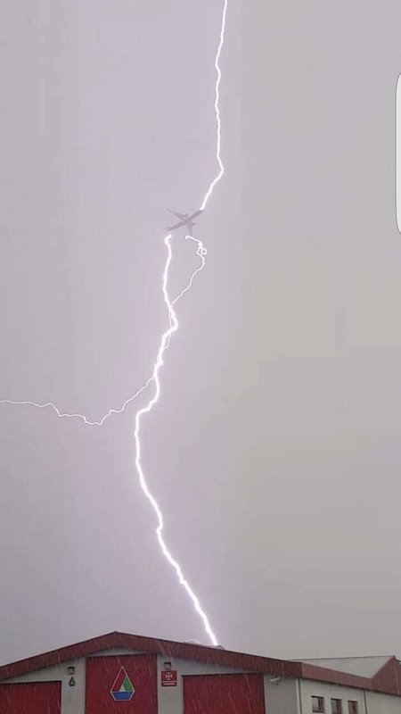
From this perspective, air spirals are simply the manifestation of electric discharges between the ionosphere and the Earth's surface. The image above shows a waterspout and a lightning bolt occurring in the same place at the same time, suggesting that indeed electric potential difference between the clouds at the top of the picture and the ground at the bottom is what powers both the lightning and the tornado.This additional feature of dust particles - their ability to carry an electric charge - means that dust accumulation enables any given area of the atmosphere to carry potentially massive electric charges, which can differ from the charge of adjacent regions, from the charge of the ionosphere and from the charge of the Earth's surface.
See also: And check out SOTT radio's: Behind the Headlines: Earth changes in an electric universe: Is climate change really man-made?


Cloud Lightning

Hurricane slams Sipacate, Guatemala

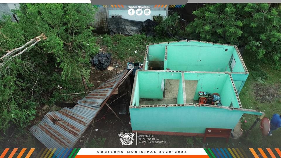
Several homes completely lost their roofs in Sipacate due to the strong wind on Friday, August 14.
© Walter NájeraSeveral homes completely lost their roofs in Sipacate due to the strong wind on Friday, August 14.
High winds cause damage in Sipacate, Escuintla, Guatemala. August 15th 2020.