Storms
S


Tornado2

3 tornadoes hit Delaware in a week, normally sees 1 a year - Philadelphia region rainfall nearly 1,000% of normal

Photo of barge that struck the Vine Street interchange over the Schuylkill River due to heavy rain and flooding last week.
© Alejandro A. AlverazPhoto of barge that struck the Vine Street interchange over the Schuylkill River due to heavy rain and flooding last week.
Once again downpours have developed across the Philadelphia region Wednesday, and the National Weather Service has issued fresh rounds of flood advisories and storm warnings.

Flood warnings covered areas from Chester County, through parts of Philadelphia, into South Jersey at mid-afternoon where up to 2 inches of rain already had fallen.

Three separate severe-thunderstorm warnings were in effect at mid-afternoon on both sides of the river, and a flash-flood watch for the entire region remains until 11 p.m., with rainfall rates of 1 and 2 inches an hour expected along the I-95 corridor, the weather service said.

And some of the region's streams are about up to here with all this rain and are primed for another slosh-over, the weather service says. Rainfall last week in some areas incredibly was close to 1,000% of normal, according to the Middle Atlantic River Forecast Center.

In its noon update the government's Weather Prediction center had the entire region under a "moderate risk" for "excessive rainfall," with isolated rates of 2 and 3 inches an hour possible.

Cloud Precipitation

Summer flash floods hit Andalusia, Spain

flood
Severe weather, including heavy rainfall, hail and strong winds, caused damage in parts of southern and central Spain on 11 August 2020.

In Andalusia, emergency services responded to over 130 calls for assistance in the provinces of Córdoba and Seville.

In Córdoba, homes and roads were flooded in the towns of Castro del Río, Puente Genil, Bélmez and Palma del Río , as well as parts of the provincial capital Córdoba, according to the regional government.

Emergency services responded to around 30 calls in the province of Seville. Several roads were cut by flood waters and a driver was rescued from a stranded vehicle. Storm damage interrupted power supply in Herrera.


Snowflake Cold

Adapt 2030 Ice Age Report: The Australia anomaly

Tasmanian devil in snow
© Inhabitat
Tasmania records coldest ever recorded temperature but it was colder that day in Tasmania than Antarctica, during winter. Third atmospheric river sweeps the continent bringing over topping dams, record cold and repeating snow cycles from 1882. In the Andes mountains 13 feet of snow fell which was beyond anything ever seen as South Africa piled on hundreds of new all time record cold events.


Comment: See also:


Tornado2

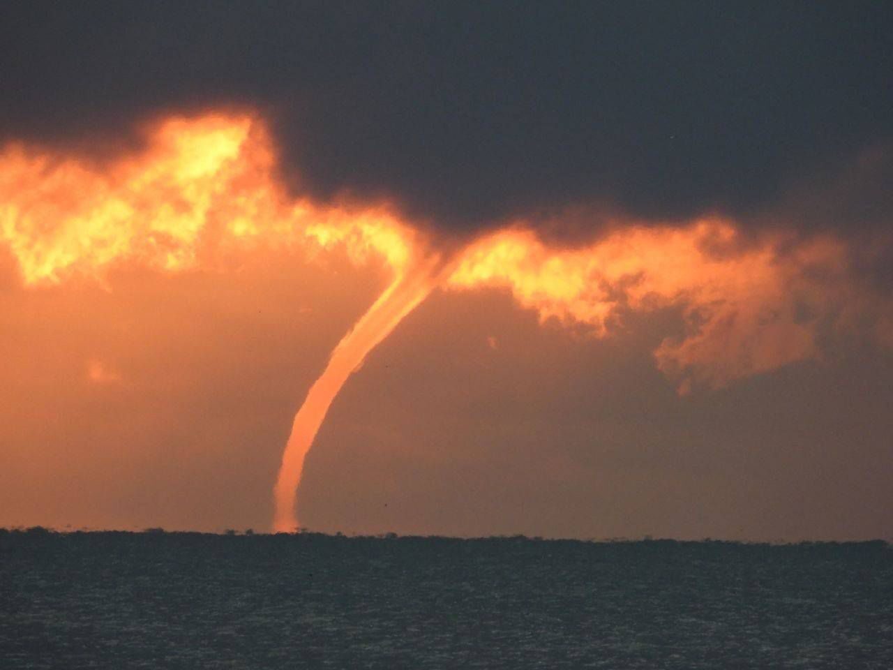
Record outbreak of 84 waterspouts last week over the Great Lakes

Waterspout over Lake Erie, off of Lorain, Ohio
© Jeffrey PaulWaterspout over Lake Erie, off of Lorain, Ohio on Wednesday, August 5, 2020.
In the Great Lakes region we can get set for what I call waterspout season. The summer weather leading up to today could lead us into a banner waterspout season. As of last week, we've already seen a record amount of waterspouts.

The waterspout set-up is pretty simple, and very similar to a lake-effect snow situation. Cold air aloft blowing over warm water surfaces, with some added switching of wind directions, and we have the makings of a waterspout outbreak.

This happened last week over the Great Lakes. The cold air aloft is heavy. The warm air rises off the Great Lakes surfaces. If a wind shift line blows through an area, some rotation is started. A waterspout is born.

The International Centre For Waterspout Research (ICWR) has reported seven days in a row of waterspouts on the Great Lakes. They have been calling this past week "the Great Waterspout Outbreak of 2020." Today the ICWR has declared a record number of waterspouts for last week. There were 84 waterspouts last week, with the old record being 67 waterspouts in 2013.


Cloud Precipitation

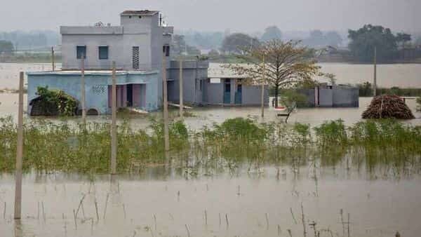
Flood situation in Bihar, India continues to be grim - 24 killed in 24 hours, over 7.5 million affected

flood
In Bihar, the flood situation continues to be grim in flood affected areas of the state. The flood water has entered new areas of Siwan and Madhepura. Surging water of Gandak and Kosi spread out in fresh areas after the river continues flowing at above danger mark in their courses.

Over 75 lakh people of 16 districts spread over 1,240 Panchayats are reeling under the impact of flood. The flood situation is particularly serious in Darbhanga, Muzaffarpur and Saran district. Flood water has entered into houses in urban areas of Darbhanga and Muzaffarpur.

In all, 24 people lost their lives and 66 animals were killed in flood related accidents during the last 24 hours. Most of the people in affected areas were rendered homeless. Life in affected areas has been crippled as flood-hit people are forced to take shelter either on the embankments, national highways or other higher places.


Umbrella

6 dead, 5 missing in China's Sichuan after storm dumps 17.6 inches of rain in 12 hours

landslide
Six people were killed while five others remain missing after heavy rain hit Ya'an City, southwest China's Sichuan Province, local authorities said Tuesday.

The province's flood control and drought relief headquarters reported the casualties after a fresh spell of downpour started Monday evening, triggering a flood in the local Qingyi River.

The heavy rainfall has waterlogged low-lying areas of the city, causing damages to houses, water conservancy and power facilities. The detailed losses are being reviewed.

Cloud Lightning

Ice Age Farmer Report: DERECHO - Corn crop catastrophe, grain stores destroyed, food prices

Derecho devastates corn crop
Massive "derecho" devastates US corn crop, with tens of millions of acres of corn affected. As well, many grain silos and elevators were destroyed, and with them tons of "on farm storage" -- what remains of the US Strategic Grain Reserve. Yields will be reduced for ALL of those acres, particularly where damage was severe or irrigation was destroyed.


Sources

Comment: Powerful derecho storm wreaks havoc across US Midwest leaving 1.1 million without power


Cloud Precipitation

At least 11 from same family killed by flash flood in Panama

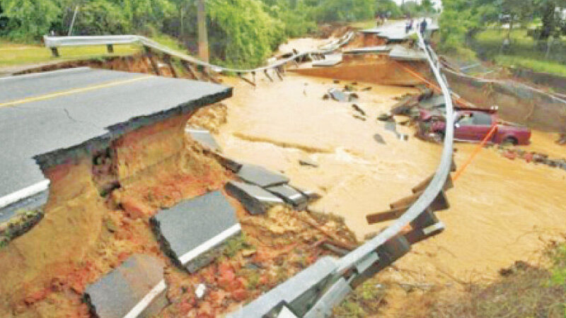
A road that was washed away by the recent floods in Panama.
At least 11 people have lost their lives after heavy rainfall caused flooding in several province of Panama over the last few days.

Panama's National Civil Protection System (Sinaproc) said 11 members of the same family, including 9 children, died after their home was swept away by flash flooding.

According to Sinaproc, flooding from the Bejuco River swept away their family home near Calovébora in Veraguas Province during the night of 08 to 09 August. Two others are thought to be still missing.


Tornado2

Tornado hits north China's Inner Mongolia injuring 33

Mongolia tornado
© YouTube/CGTN (screen capture)
A tornado hit Baotou City in north China's Inner Mongolia Autonomous Region, injuring 33 people on August 9. A local farmer at the tourist site of Tian'e Lake recorded the whole process with his phone. Rescue operations are underway as around 100 yurts, the traditional round-shaped dwelling in the area, were damaged. Three people were critically injured but are in stable condition, according to local authorities.


Windsock

Powerful derecho storm wreaks havoc across US Midwest leaving 1.1 million without power

Derecho damage in Illinois
© APA person surveys the damage from the roof of College Church in Wheaton, Illinois, after a severe storm toppled the church steeple on the campus of Wheaton College on Monday
A rare storm packing 100 mph winds has left more than 1.1 million Americans without power across the Midwest as it caused widespread destruction with blown over trees, flipped vehicles, property damage and several severe weather warnings as it turned toward embattled Chicago.

The derecho, a widespread weather system with a long line of storms packing high winds, descended upon the Central U.S. on Monday with wind speeds comparable to a major hurricane as it spent several hours tearing through parts of Iowa, Nebraska and Wisconsin.

The storm likely caused more widespread damage than a normal tornado, said Patrick Marsh, science support chief at the National Weather Service´s Storm Prediction Center in Norman, Oklahoma.

It´s not quite a hurricane. It has no eye and its winds come across in a line. But the damage it is likely to spread over such a large area is more like an inland hurricane than a quick more powerful tornado, Marsh said.

He compared it to a devastating Super Derecho of 2009, which was one of the strongest on record and traveled more than 1,000 miles in 24 hours, causing $500 million in damage, widespread power outages and several deaths.


Comment: Severe storms bring tennis ball-size hail, damaging winds, torrential rain to Minneapolis - Saint Paul