Earthquakes
S


Alarm Clock

5.8 magnitude earthquake strikes off Queensland, 'biggest in 20 years'

Queensland earthquake
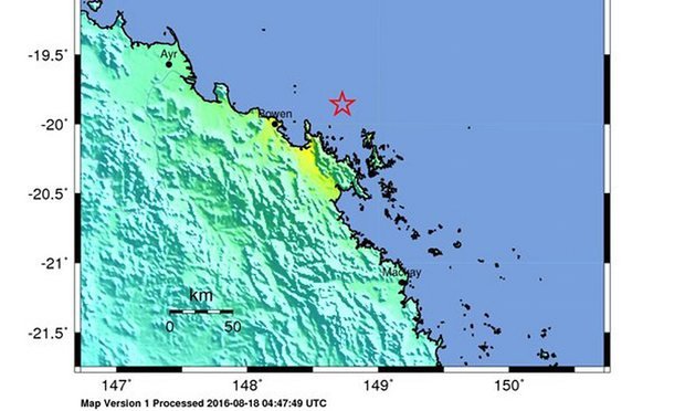
© USGS/EPAThe United States Geological Survey’s ‘shake map’ showed the 5.8 magnitude quake’s location off Bowen in north Queensland.

The 5.8 magnitude quake hit off Bowen in state's north triggering evacuations in Cairns and Townsville but no serious injuries or damage reported


One of the more powerful earthquakes to strike Australia in recent years sent tremors along more than 1,000 km of the Queensland coastline on Thursday.

The 5.8 magnitude quake struck off the coast of Bowen in north Queensland around 2.30pm, triggering evacuations of buildings in Cairns and Townsville but with no reports of serious injuries or damage.

An interview recorded with Greg Williamson, the mayor of Mackay, by the Daily Mercury newspaper captured the sound of a shaking floor when the quake struck, prompting Williamson to ask: "Is that an actual earthquake?"
Attention

Shallow magnitude 5.2 earthquake in southern Peru kills at least four

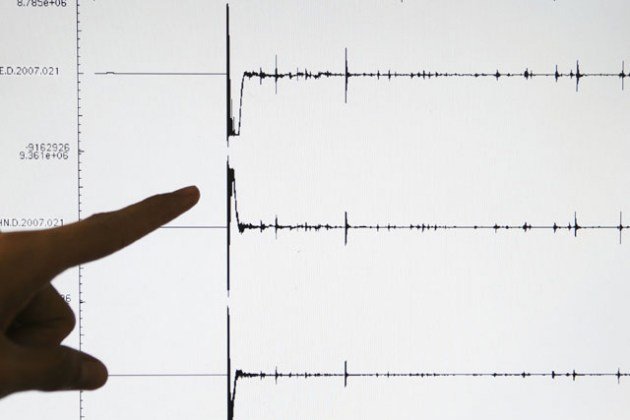
earthquake graph
A 5.2 magnitude earthquake in Peru has left at least four people dead and 40 injured, a civil defence official said.

The toll from Sunday night's quake in the southern Arequipa region might rise after about 50 homes collapsed and roads were cut off, the official told AFP.

Earthquakes are fairly common in Peru but this one hit at a shallow depth of eight kilometers so damage could be heavy near the epicenter.

The epicenter was 10 kilometers from the city of Chivay, capital of Caylloma province, according to the Geophysical Institute of Peru.

Two aftershocks hit Monday morning.

The quake caused damage throughout an area of Arequipa called the Colca Valley, and several villages have been cut off.

"We are asking for heavy machinery to gain access. There are fatalities," the mayor of Caylloma, Romulo Tinta, told RPP radio.

More than 80 homes have been left uninhabitable, but crews cannot reach the epicenter, said the governor of Arequipa region, Yamila Osorio.

Source: AFP

Attention

5.9 magnitude earthquake near Sakhalin, Russia

Graph
© Dimas Ardian, Getty Images
5.9 magnitude earthquake 52 km from Aleksandrovsk-Sakhalinskiy, Sakhalin, Russia

2016-08-14 11:15:14 UTC

UTC time: Sunday, August 14, 2016 11:15 AM

Your time: 2016-08-14T11:15:14Z

Magnitude Type: mb

USGS page: M 5.9 - 52km S of Aleksandrovsk-Sakhalinskiy, Russia

USGS status: Reviewed by a seismologist

Reports from the public: 9 people

Bizarro Earth

Magnitude 7.2 earthquake strikes East of Ile Hunter, New Caledonia

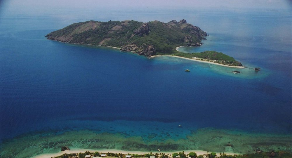
Kuata Island, Fiji
© Flickr/ireneKuata Island, Fiji.
Magnitude 7.2 earthquake has struck near Vanuatu, Fiji, a tsunami warning has been issued.

A strong earthquake with magnitude 7.2 has struck near Vanuatu and Fiji islands, the United States Geological Service reported. A local tsunami warning has been issued by the Pacific Tsunami Warning Center.

The earthquake has struck 122 kilometres east of Ile Hunter, New Caledonia, which is southwest of Fiji islands.

Attention

Magnitude 5.1 earthquake shakes Northern California

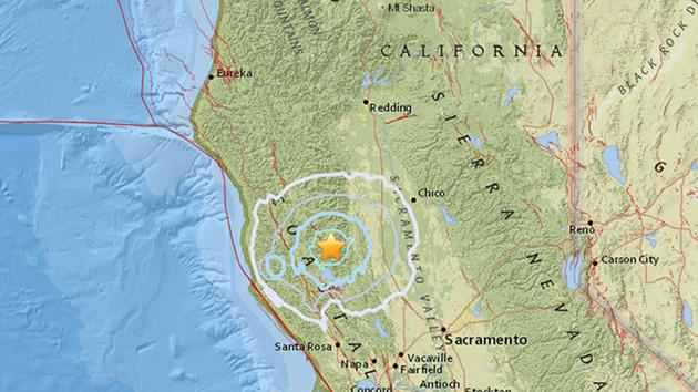
California earthquake map
© ABC7

A 5.1-magnitude earthquake struck in Upper Lake, California at 7:57 p.m., according to the USGS
A 5.1-magnitude earthquake struck north of the Bay Area on Tuesday, according to the United States Geological Survey.

The earthquake struck near Upper Lake, California, which is about 130 miles north of the Bay Area, at about 7:57 p.m.

The earthquake was originally reported as 5.0 magnitude by the USGS, but was later upgraded to 5.1-magnitude.

Shortly after the initial earthquake, the USGS reported aftershocks of 3.0 and 2.7 magnitude.

The Lake County Sheriff dispatch reported no damage or injuries and stated firefighters were battling a small wildfire nearby, according to ABC affiliate KGO-TV in San Francisco.

KGO-TV said residents and business owners in the region reported swaying light fixtures and scared pets, but no damage or injuries.

Comment: Last week a series of earthquakes rattled Northern California.


Alarm Clock

A dozen earthquakes registered overnight in Russia's Far Eastern Kamchatka

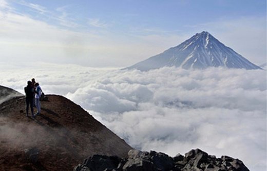
Kamchatka, Russia's land of volcanoes
© Kamchatka, Russia's land of volcanoes

The Russian Emergencies Ministry reports no casualties


About a dozen of earthquakes measuring from 2 to 5.2 points were registered in Russia's Far Eastern Kamchatka Territory overnight to Thursday, a spokesman for the Kamchatka branch of the Russian Academy of Sciences' Geophysical Service told TASS.

"All the quakes were registered during the night in the Avachinsky Bay near Petropavlovsk-Kamchatsky. The strongest earth tremor was registered at 00:17 local time (15:17 Moscow time). Its epicenter was located 85 kilometers away from Petropavlovsk-Kamchatsky at a depth of 50 kilometers," the spokesman said, adding that this tremor was felt as a magnitude 3 quake in the city.

Two more strong quakes of a magnitude 4.7 and 4.5 were registered at about 05:00 a.m. local time (20:00 Moscow time). These earth tremors were also felt in Petropavlovsk-Kamchatsky.

According to the Russian Emergencies Ministry, no casualties or damages were reported. No tsunami warning was issued.

Comment: Earlier this year Zhupanovsky volcano in Kamchatka erupted producing an ash plume 10km high.


Ice Cube

Earthquake 'swarm' near Pothole Glacier, Alaska probably not earthquakes at all

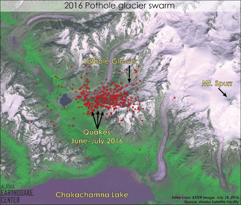
Pothole glacier swarm map
© Alaska Earthquake CenterHundreds of small seismic events have occurred in an area near Pothole Glacier.
Earlier this summer, the scientists at the Alaska Earthquake Center began monitoring a swarm of small earthquakes in an area about eight miles west of Mt. Spurr. According to State Seismologist Dr. Michael West, they probably aren't earthquakes at all.

Hundreds of small seismic events have been registered in the area since June 11, with almost 100 of the recordings exceeding magnitude 2.

"That catches our attention," says West, "because magnitude 2 is big enough that you're being recorded, you can see that signal a few hundred kilometers away."

The three possible sources of these seismic events, according to West, are standard earthquake activity, volcanic activity or glacial activity. "The patterns of all these little events didn't fit the pattern of a classic earthquake swarm driven by stresses, tectonic pressures in the region," says West. The Alaska Earthquake Center worked with the Alaska Volcano Observatory and largely ruled out volcanic activity. That left glaciers as the most likely explanation.

"I have to be clear, there is no smoking gun right now about exactly what these are," West says. "The hypothesis of least astonishment I think is that they are probably coming from one of the glaciers in that area."

Better Earth

4.8 magnitude earthquake shakes Eastern Ukraine, tremors felt as far away as Russia

earthquake
© David Moir / Reuters
An earthquake in the eastern Ukrainian port city of Mariupol caused a mild panic amongst the residents, with some believing the shaking was being caused by renewed shelling around the city.

The epicentre of the 4.8 magnitude earthquake, which had a depth of 10 kilometers, was around two kilometres west of the city, according to the US Geological Survey.

In videos released on social media, local residents discuss what really happened. They speculated if it was in fact powerful shelling or gunfire.

Bizarro Earth

Massive earthquakes affecting heavily populated areas of Pacific Northwest more frequent than previous estimates

cascadian subduction zone
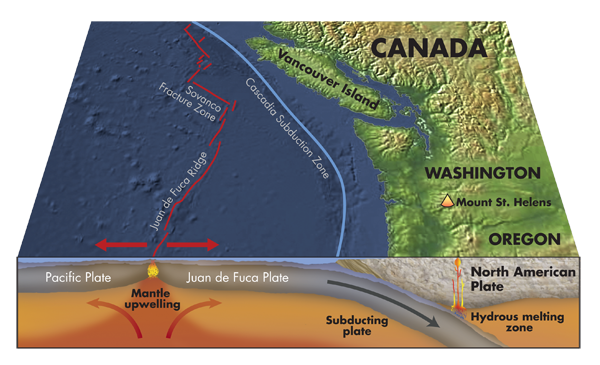
A new analysis suggests that massive earthquakes on northern sections of the Cascadia Subduction Zone, affecting areas of the Pacific Northwest that are more heavily populated, are somewhat more frequent than has been believed in the past.

The chance of one occurring within the next 50 years is also slightly higher than previously estimated.

The findings, published this week in the journal Marine Geology, are based on data that is far more detailed and comprehensive than anything prior to this. It used measurements from 195 core samples containing submarine landslide deposits caused by subduction zone earthquakes, instead of only about a dozen such samples in past research.

Attention

Cape Verde evacuates 300 people for fears of volcanic eruption following 'intensifying seismic activity'

Cape Verde evacuation
Cape Verde has evacuated 300 people from Brava in the south of the archipelago in the Atlantic Ocean for fear of a volcanic eruption after an earth tremor on Tuesday.

There were low intensity tremors on Tuesday morning on the coastal parts of Brava, which is the smallest island of the country, causing no injuries or damage, according to the weather service.

It was felt at Cova Joana where, as a precaution, authorities began the evacuation operation targeting some 300 people, the Interior Minister, Paulo Rocha announced at a press conference in Praia.

"Data from the National Institute of Meteorology and Geophysics demonstrate the intensifying seismic activity on the island of Brava. If this activity continues, we can possibly have a volcanic eruption in the coming hours," Rocha said.