Earthquakes
S


Attention

Nearly 20 micro-quakes hit near Salton Sea, California; second swarm in two months

The San Andreas Fault near the Salton Sea.
© Los Angeles TimesThe San Andreas Fault near the Salton Sea.
A series of small earthquakes struck near the Salton Sea area overnight.

Nearly 20 micro-quakes — the strongest measuring magnitude 3.3, with others much smaller — struck the town of Niland near the eastern shore of the Salton Sea, according to the U.S. Geological Survey. A magnitude 3.6 quake was recorded near Salton City on the west side of the Salton Sea.

In September, a series of more than 200 small quakes hit the area. That prompted scientists to say for several days that there was an elevated risk for a big San Andreas fault earthquake. Many of the minor quakes were located under the sea itself.

The Salton Sea is one of California's most seismically complex areas. It is located on a web of faults that scientists fear could one day wake up the nearby San Andreas from its long slumber.

Comment: Recent earthquake swarm under California's Salton Sea could lead to massive earthquake on San Andreas fault


Bizarro Earth

Magnitude 5.4 earthquake hits Colombia

Colombia Earthquake
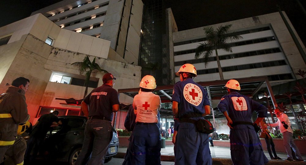
© Reuters/Jaime SaldarriagaRescue team members wait outside a clinic that was evacuated after tremors were felt resulting from an earthquake in Ecuador, in Cali, Colombia, April 16, 2016
An earthquake measuring 5.4 on the Richter scale occurred on Monday in the center of Colombia, the US Geological Survey (USGS) reported.

Moscow — The earthquake occurred at 00:20 GMT on Monday at a depth of 44 kilometers (about 27 miles) with the epicenter located in 25 miles of the small town of Colombia. The largest urban center relatively close to the earthquake at approximately 67 miles was Neiva with the population of 352,855.

There have been no reports yet of the damage inflicted by the earthquake.

Seismograph

6.6 earthquake devastates historic churches and buildings in Norcia, Italy

norica italy earthquake 2016
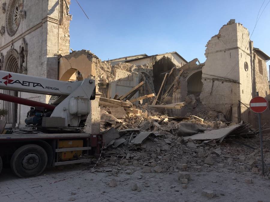
© The Monks of NorciaThe Basilica of St. Benedict is destroyed, flattened by most recent earthquake.
The ancient town of Norcia in central Italy is in ruins following the powerful earthquake which knocked its historical 13th century Basilica of St Benedict and other buildings to the ground.

Sunday's earthquake was the latest in a series of seismic events to strike central Italy, and comes just two months after another violent earthquake hit the same area of central and southern Italy, killing 300 people and destroying several towns.


There was widespread devastation, with many buildings, already compromised by earlier quakes, suffering severe damage.

Many of the town's residents had been evacuated after quakes on Wednesday, meaning they avoided the worst of the damage. The Civil Protection agency reported several injuries but no fatalities.

Seismograph

Strong 7.1 magnitude earthquake hits central Italy, tremors felt in Rome- USGS

Map of Italy
© usgs.gov
A powerful 7.1 magnitude earthquake has hit central Italy, Reuters reports citing the United States Geological Survey and local broadcasters. This comes only three days after two more tremors shook the region on Wednesday, leaving villages partly destroyed.

There were no immediate reports on damage or casualties caused by the quake.

However, local RAI TV reports that the tremor was powerful enough to wake the residents of the capital Rome, who reported walls of buildings shaking.

Initial reports on the magnitude of the tremors varied - while the USGS and Italian media talked of a 7.1 earthquake, the European-Mediterranean Seismological Center (EMSC) said the tremor was magnitude 6.5 or 6.6.

The USGS reports the quake was centered 68 km (42 miles) east-southeast of the city of Perugia and 132 kilometers northeast of Rome. The epicenter lay some 108 kilometers deep.


Seismograph

Shallow 5.8 magnitude earthquake recorded off False Pass, Alaska

Earthquake graph
5.8 magnitude earthquake 173 km from Akutan, Alaska, United States

2016-10-27 11:53:18 UTC

UTC time: Thursday, October 27, 2016 11:53 AM
Your time: 2016-10-27T11:53:18Z
Magnitude Type: mwp
USGS page: M 5.8 - 136km S of False Pass, Alaska
USGS status: Reviewed by a seismologist
Reports from the public: 0 people

2016-10-27 11:53:18 UTC 5.8 magnitude, 17 km depth

Seismograph

Shallow 2.3 magnitude earthquake hits Cornwall, UK

Cornwall earthquake
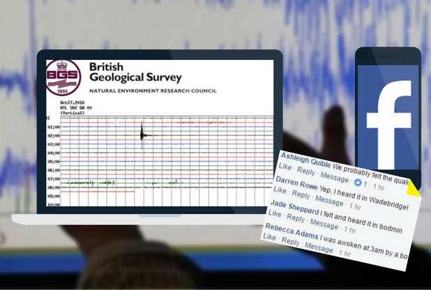
Here's how the quake looked to scientists.
Cornwall has been struck by a 2.3 magnitude earthquake, with the centre of the quake at Liskeard.

There are no reports of any damage this morning.

Kirstin Lemon, of the British Geological Survey, said the quake of this size was unusual for Cornwall adding that scientists hoped to have more details soon.

Dozens of people are now comparing their experience of the earthquake on our Facebook pages. Nanny Kay wrote: "Heard the rumble in Newquay but didn't feel any movement although things in the kitchen started making noises just after."

Sarah Pascoe of Wadebridge said there was "a rumbling sound like thunder and the ground was shaking for around 30 seconds".

Lisa Grainger added: "Definitely heard the rumble then the house vibrate here in Polperro."
Arrow Up

Series of powerful earthquakes including 6.0 magnitude strikes central Italy

Italy earthquake damage
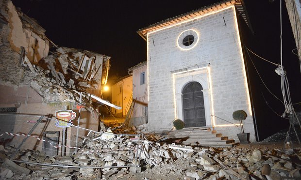
© Sandro Perozzi/AP The Church of San Sebastiano stands amid rubble in Castelsantangelo sul Nera following an earthquake.
A 6.0 magnitude earthquake hit the Marche region in central Italy, just hours after a 5.4-magnitude tremor damaged buildings and cut power lines across the area. Buildings in the region have been damaged, but there have been no reports of fatalities.

A series of powerful aftershocks between magnitude 4 and 4.9 struck the area about five hours after the first tremor.

The strongest earthquake occurred 9.18 p.m. on Wednesday, 71 km (44 miles) east of Perugia. The United States Geological Survey reported it as a 6.0 magnitude temblor, while Italy's National Institute of Geophysics and Volcanology said it was a 5.9.

"It was a very strong, apocalyptic earthquake - people were screaming in the street, and now the lights are cut off," said Marco Rinaldi, the mayor of Ussita, a community of 400 that was also affected by the initial earthquake. "Many houses have collapsed. Our area is devastated."


Comment: Shallow 5.4 magnitude earthquake rattles central Italy; shakes buildings in Rome


Seismograph

Shallow 5.4 magnitude earthquake rattles central Italy; shakes buildings in Rome

Italy quake map
© USGSMap of the earthquake's epicenter
An earthquake with a preliminary magnitude of 5.4 rattled a broad swath of central Italy, including Rome, on Wednesday (Thursday NZT), just two months after a powerful temblor toppled villages, killing nearly 300 people.

There were no immediate reports of damage.

Italy's National Vulcanology Center said the epicenter was near Macerata, near Perugia. The US Geological Survey said it had a depth of some 10 kilometres, which is relatively shallow.

The quake was felt across a broad swath of central and southern Italy, shaking centuries-old palazzi in Rome's historic centre.

The Aug. 24 quake destroyed hilltop village of Amatrice and other nearby towns.

Seismograph

USGS: 5.6 magnitude earthquake strikes off Tonga

Earthquake hits Tonga
© earthquake.usgs.gov
A 5.6 magnitude undersea earthquake struck 130 kms (80 miles) northwest of the South Pacific island nation of Tonga on Wednesday, the U.S. Geological Survey (USGS) said.

The quake was originally reported as 6.1 magnitude but was later downgraded by the USGS.

There were no immediate reports of damage or injuries and there was no tsunami warning issued after the quake, which struck at a shallow depth of 42 kms (26 miles). Its location was also recorded as 392 km (243 miles) west southwest of Samoa.

Seismograph

Shallow 5.8 magnitude earthquake hits near the Kuril Islands, Russia

Earthquake graph
An earthquake measuring 5.8 on the Richter scale occurred on Sunday near the Kuril Islands, the US Geological Survey reported.

The earthquake occurred at 20:25 GMT on Sunday at a depth of 29,7 kilometers (about 18 miles) with the epicenter located in 117 kilometers to the east of the Shikotan island.

There appeared to be no tsunami threat following the earthquake and there were no immediate reports of any damages or casualties. The Geological Survey appointed the green level of the earthquake consequences, indicating low probability of casualties and economic damage.

The so-called Kuril-Kamchatka Arc, which extends some 2,100 km from Hokkaido, Japan along the Kuril Islands and the Pacific coast of Russia's Kamchatka Peninsula, is one of the most seismically active regions in the world.