Earthquakes
S

Map

'Scars' from ancient geologic events may be linked to earthquakes says study

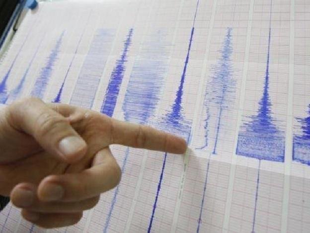
Earthquake image
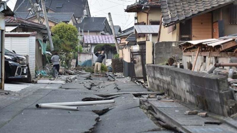
© Deccan Chronicle Ancient geologic events may have left deep 'scars' that can come to life and play a role in earthquakes. (Representational image)
Ancient geologic events may have left deep 'scars' that can come to life and play a role in earthquakes, mountain formation and other ongoing processes on our planet, a new study which involved super-computer modelling of Earth's crust and upper-mantle has found. This changes the widespread view that only interactions at the boundaries between continent-sized tectonic plates could be responsible for such events, researchers said.

Scientists from University of Toronto (U of T) in Canada and the University of Aberdeen in the UK have created models indicating that former plate boundaries may stay hidden deep beneath the Earth's surface. These multi-million-year-old structures, situated at sites away from existing plate boundaries, may trigger changes in the structure and properties at the surface in the interior regions of continents, researchers said.

"This is a potentially major revision to the fundamental idea of plate tectonics," said Philip Heron from U of T. Researchers have proposed a 'perennial plate tectonic map' of the Earth to help illustrate how ancient processes may have present-day implications.

"It is based on the familiar global tectonic map that is taught starting in elementary school. What our models redefine and show on the map are dormant, hidden, ancient plate boundaries that could also be enduring or "perennial" sites of past and active plate tectonic activity," said Russell Pysklywec from U of T.

Comment: See also: Researchers believe earthquakes in SE US caused by chunks of Earth's mantle breaking off and sinking into the Earth


Better Earth

Unusual seismic activity continues around Yellowstone and California

earthquake map
Over the past few days the mainstream media has been fixated on the largest mass shooting in U.S. history, but meanwhile there has been highly unusual seismic activity along major fault lines in California and near the Yellowstone supervolcano. Let's talk about Yellowstone first. In recent months, the big geysers have been behaving very strangely and this is something that my wife and I covered on our television show. And now, just over the past week there have been three very significant earthquakes in the region. On June 9th, there was a magnitude 3.7 earthquake, on June 13th there was a magnitude 4.3 earthquake and earlier today there was a magnitude 4.0 earthquake. Yes, the area around Yellowstone is hit by earthquakes all the time, but most of them are extremely small. For earthquakes of this size to be striking right around Yellowstone is highly unusual and more than just a little bit alarming.

The map below comes directly from the USGS, and it shows all of the earthquakes of magnitude 2.5 or greater that have hit the western portion of the United States over the last week. The three big earthquakes that struck southwestern Montana are visible on the map, although they are hard to see because the dots all overlap. But the main reason why I am showing you this map is because I want you to see all of the earthquakes that have been happening along the major fault lines in southern California in recent days...

Map

Magnitude 3.6 earthquake strikes near Brawley, California

Brawley California
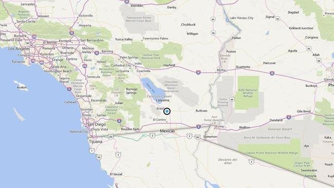
© Bing MapsA map showing the epicenter of Tuesday afternoon's quake near Brawley.
A shallow magnitude 3.6 earthquake was reported Tuesday afternoon 1 mile from Brawley, according to the U.S. Geological Survey. The temblor occurred at 2:23 p.m. PDT at a depth of 6.8 miles.

According to the USGS, the epicenter was 8 miles from Imperial, 12 miles from El Centro and 20 miles from Calexico.

In the last 10 days, there have been 10 earthquakes of magnitude 3.0 or greater centered nearby.

Moon

Magnitude 5.6 earthquake strikes off Indonesia coast

Indonesia earthquake
© USGS
A 5.6-magnitude earthquake occurred off the coast of Indonesia, the US Geological Survey (USGS) said on Wednesday.

The epicenter of the quake was located 194 kilometers (120.5 miles) southeast of the city Enarotali, Papua province, on the island of New Guinea, at a depth of 10 kilometers (6.2 miles), according to the agency.

There have been neither immediate reports of damages or casualties, nor a tsunami threat.

Arrow Up

USGS: 6.2 magnitude earthquake hits Pacific island of Vanuatu

Vanuatu quake map
There are no immediate reports of damage.

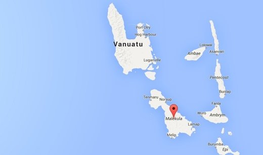
A 6.2-magnitude earthquake hit the Pacific island nation of Vanuatu on Tuesday (Jun 14), the United States Geological Survey (USGS) said.

There were no immediate reports of damage or casualties, and no tsunami warning was issued.

Vanuatu is part of the "Ring of Fire", a zone of tectonic activity around the Pacific that is subject to frequent earthquakes and volcanic eruptions.

The quake struck at a depth of 131 kilometres (81 miles), 92 kilometres northwest of the town of Isangel on Tanna island, USGS said.

Vanuatu has been rocked by a series of quakes this year, including some that prompted tsunami warnings.

Source: AFP/hs

Attention

Sizable 4.3 magnitude earthquake hits west of Yellowstone

Graph
© Dimas Ardian, Getty Images
A sizable quake rattled the mountains west of Yellowstone Park Monday morning, registering a 4.3 magnitude.

The U.S. Geological Survey says the quake hit at 6:14 a.m. Monday with the epicenter about 32 miles west of West Yellowstone.

That would put the quake's location north of the Continental Divide, in the Centennial Valley.

The area is sparsely populated, and even an hour after the quake only a couple of people had reported feeling the quake to U.S.G.S.

The region on the west side of Yellowstone frequently has several small quakes per month, but Monday's quake was larger than usual.

Attention

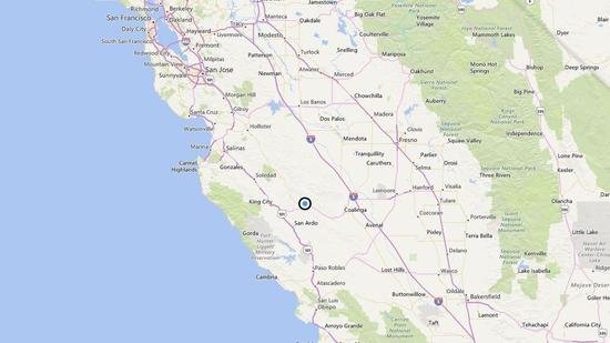
Shallow magnitude 3.3 earthquake strikes near King City, California

 quake
© El Comercio/AP
A shallow magnitude 3.3 earthquake was reported Saturday afternoon 18 miles from King City, Calif., according to the U.S. Geological Survey. The temblor occurred at 1:32 p.m. Pacific time at a depth of 3.1 miles.

According to the USGS, the epicenter was 24 miles from Coalinga, 26 miles from Greenfield and 32 miles from Soledad.

In the last 10 days, there have been no earthquakes of magnitude 3.0 or greater centered nearby.

This information comes from the USGS Earthquake Notification Service and this post was created by an algorithm written by the author.

A map showing the location of the epicenter of Saturday afternoon's quake near King City
© Bing MapsA map showing the location of the epicenter of Saturday afternoon's quake near King City, California

Attention

Hundreds of aftershocks following magnitude 5.2 earthquake in Borrego Springs, California

 quake
© El Comercio/AP
There have been hundreds of aftershocks from the magnitude 5.2 earthquake that rattled Southern California on Friday.

Aftershocks are common after significant quakes, and Friday's temblor - which was felt from San Diego to Los Angeles and beyond - produced a few larger than 3.0. Most were much smaller.

The quake occurred in a sparsely populated area near Borrego Springs in San Diego County but the 1:04 a.m. quake was felt across a wide area.

"It's the biggest one for a while," said Egill Hauksson, a research professor of geophysics at Caltech.

Friday's temblor occurred on the San Jacinto fault, the most active in the region, Hauksson said. As of Saturday, the U.S. Geological Service listed more than 200 aftershocks in the Borrego Springs area, and there were others nearby.

Small boxes on a U.S. Geological Survey map represent the epicenters of aftershocks from Friday's magnitude 5.2 earthquake, signified by the larger yellow box.
© U.S. Geological SurveySmall boxes on a U.S. Geological Survey map represent the epicenters of aftershocks from Friday's magnitude 5.2 earthquake, signified by the larger yellow box.

Comment: See also: Southern California shaken by 5.2 earthquake


Attention

4.9 magnitude earthquake strikes central Japan, tremors felt in Tokyo

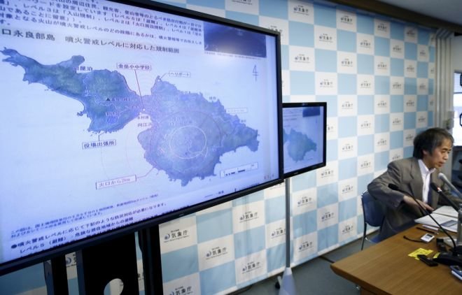
Senior member of Japan Meteorological Agency in a meeting
© ReutersSenior member of Japan Meteorological Agency in a meeting
A 4.9-magnitude earthquake hit central Japan on Sunday morning, according to the US Geological Survey (USGS).

The epicenter of the tremor was 6km east of Noda and at a depth of 45km. The local media reported that the quake struck at 7.54am (local time) in the southern part of Ibaraki Prefecture at a depth of 40km.

The Japan Meteorological Agency said the earthquake struck the Kanto region, but there was no tsunami alert. Tremors were felt in Tokyo, the capital of Japan.

However, there were no immediate reports of damage or injuries.

Info

Ancient plate tectonic boundaries may reactivate

Ancient Fault Lines
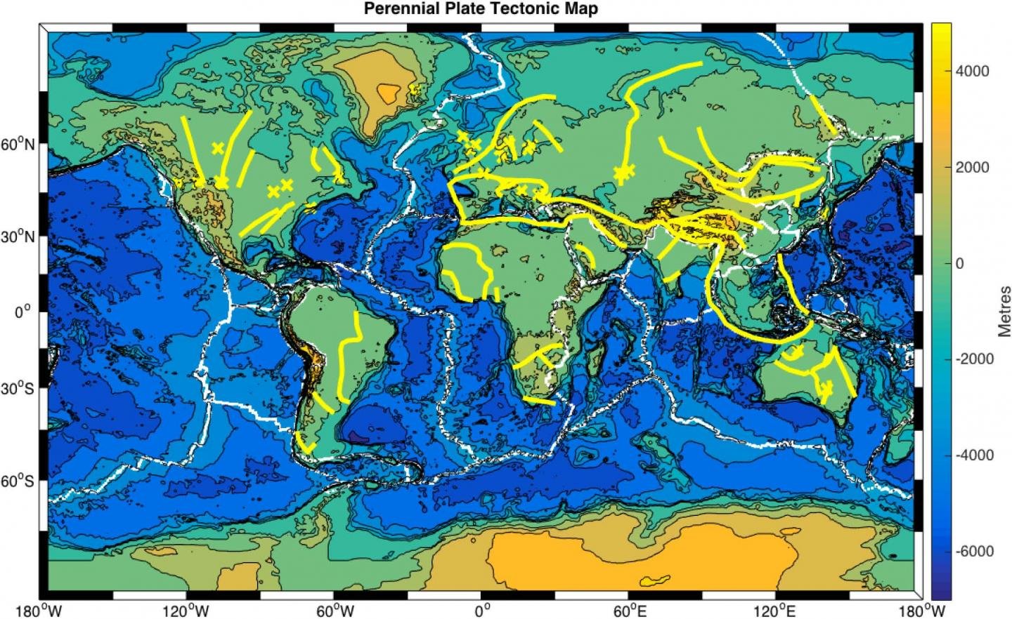
© Russell Pysklywec, Philip Heron, Randell StephensonA proposed perennial plate tectonic map. Present-day plate boundaries (white lines), with hidden ancient plate boundaries that may reactivate to control plate tectonics (yellow lines). Regions where mantle lithosphere heterogeneities have been located are given by yellow crosses.
Super-computer modelling of Earth's crust and upper-mantle suggests that ancient geologic events may have left deep 'scars' that can come to life to play a role in earthquakes, mountain formation, and other ongoing processes on our planet. This changes the widespread view that only interactions at the boundaries between continent-sized tectonic plates could be responsible for such events.

A team of researchers from the University of Toronto and the University of Aberdeen have created models indicating that former plate boundaries may stay hidden deep beneath the Earth's surface. These multi-million-year-old structures, situated at sites away from existing plate boundaries, may trigger changes in the structure and properties at the surface in the interior regions of continents.

"This is a potentially major revision to the fundamental idea of plate tectonics," says lead author Philip Heron, a postdoctoral fellow in Russell Pysklywec's research group in U of T's Department of Earth Sciences. Their paper, "Lasting mantle scars lead to perennial plate tectonics," appears in the June 10, 2016 edition of Nature Communications.

Heron and Pysklywec, together with University of Aberdeen geologist Randell Stephenson have even proposed a 'perennial plate tectonic map' of the Earth to help illustrate how ancient processes may have present-day implications.

"It's based on the familiar global tectonic map that is taught starting in elementary school," says Pysklywec, who is also chair of U of T's Department of Earth Sciences. "What our models redefine and show on the map are dormant, hidden, ancient plate boundaries that could also be enduring or "perennial" sites of past and active plate tectonic activity."