Earthquakes
S

Arrow Down

'Boom - it would drop': Earthquake could cause California land to sink rapidly, up to 3 feet

Scientists looking for charcoal
© fullerton.eduScientists look for microscopic charcoal to radiocarbon date mud samples collected from the Seal Beach wetlands.
Land within major California seismic faults could sink by between 1.5 and 3 feet in a matter of seconds, causing catastrophic devastation, says a new study. It also shows that the Newport-Inglewood fault is more active than previously thought.

"It's not just a gradual sinking. This is boom โ€” it would drop. It's very rapid sinking," Robert Leeper, lead author of a new study published in Nature, carried out with the help of the US Geological Survey, told the LA Times.

Leeper's team took 55 samples at the Seal Beach National Wildlife Refuge in southern Los Angeles, by submerging 20-feet pipes that collected samples of the sediment, initially looking for evidence for a prehistoric tsunami.

Instead, the team from Cal State Fullerton found an identical pattern, of living vegetation suddenly dropping and being buried underneath the ground. "We identified three of these buried layers composed of vegetation or sediment that used to be at the surface," said Leeper.
Seismograph

5.5 magnitude earthquake shakes Bali, Indonesia

Bali earthquake March 2017
© USGS
An earthquake has hit Indonesia's resort island of Bali, causing some panic among residents, but there were no immediate reports of damage or casualties.

The United States Geological Survey said the magnitude 5.5 earthquake that struck at 7:10 a.m. Wednesday was centred two kilometres northeast of Banjar Pasekan, a town in the southeastern part of Bali, at a depth of 118 kilometres.

Witnesses said many residents and tourists ran out of their homes and hotels toward higher ground, but the situation returned to normal after they received text messages saying the quake had no potential to trigger a tsunami.

The Indonesian Meteorology, Climatology and Geophysics Agency measured the earthquake at 6.4 magnitude but said it would not cause a tsunami because the epicenter was so deep.

Indonesia is prone to the seismic upheaval due to its location on the so-called Pacific Ring of Fire. In December 2004, a massive earthquake off Sumatra island triggered a tsunami that killed 230,000 people in a dozen countries.

Seismograph

Shallow 4.0-magnitude earthquake jolts Islamabad, Pakistan

GRAPH
A 4.0-magnitude earthquake jolted Islamabad, Rawalpindi and surrounding areas on Tuesday, Pakistan Meteorological Department reported.

"The epicentre of the quake was near Hazro, Punjab and occurred at a depth of 12km," PMD said on Twitter.
An Earth Quake Originated on 10:57PST
Magnitude: 4.0
Depth: 12 Km
Lat: 33.89N
Lon: 72.54E
Epicenter: Near Hazro Punjab #Earthquake

โ€” Pak Met Department (@pmdgov) March 21, 2017

Seismograph

Trinidad jolted by strong shallow tremor of magnitude 4.9

GRAPH
An earthquake with a magnitude of 4.9 jolted Trinidad and Tobago on Monday but there were no immediate reports of injuries or damage.

The Seismic Research centre (SRC) of the University of the West Indies (UWI), said that the quake, which occurred at 3:01 pm (local time) had a depth of 10 kilometres.

It said felt in Port of Spain and Arima as well as in Scarborough, the capital of Tobago.

The location of the quake was given as Latitude 11.26N and Longitude: 60.92W.

Seismograph

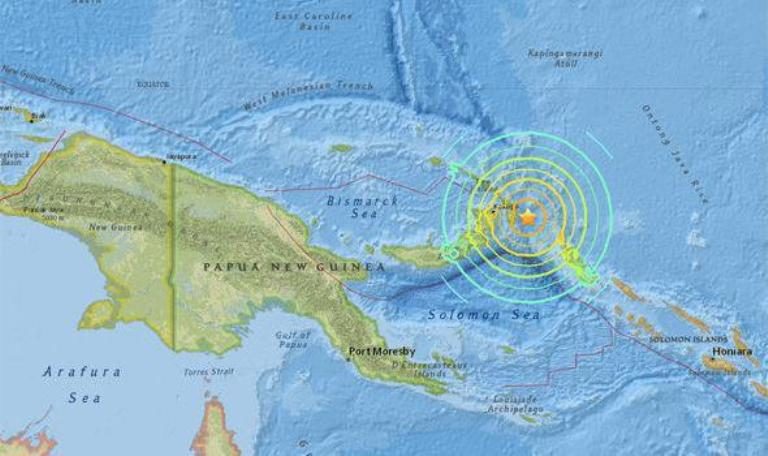
Shallow magnitude 6.0 quake strikes off the Solomon Islands

An earthquake of magnitude 6.0 hit off the Solomon Islands in the early hours of Monday.(Representative image)
A 6.0-magnitude earthquake hit off the Solomon Islands in the early hours of Monday, the US Geological Survey said.

The quake struck at 02:43 am local time at a depth of 4.0 kilometres (2.5 miles), some 170 kilometres north-northeast of the capital city Honiara, the USGS said. No tsunami warning was issued.

The Solomon Islands are part of the Pacific "Ring of Fire," a zone of tectonic activity known for frequent quakes and volcanic eruptions.

UTS Geotechnical and Earthquake Engineering senior lecturer Behzad Fatahi said the Ring of Fire "looks like broken eggshells".

Seismograph

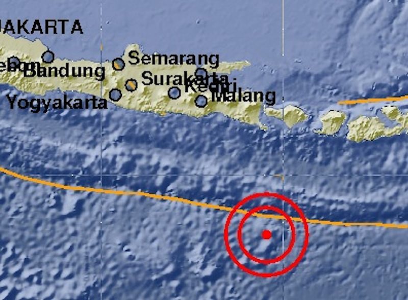
Shallow 5.4 earthquake shakes Bali, Indonesia

A map showing the epicenter of a 5.4 earthquake recorded off the south coast of Bali on March 17, 2017.
© BMKGA map showing the epicenter of a 5.4 earthquake recorded off the south coast of Bali on March 17, 2017.
An earthquake measuring 5.4 on the Richter scale reportedly shook South Bali on Friday morning, around 1:39 am.

Bali's Meteorology, Climatology and Geophysics Agency (BMKG) recorded the quake's epicenter as 334 kilometers southwest of Denpasar, at a depth of 10 kilometers. Most people likely slept through the small shakes, but the quake was reportedly felt in the Denpasar area.

The earthquake was not flagged for tsunami potential and there have been no reports so far of major damage or victims following the earthquake.

Comment: Other shallow earthquakes (10 kilometre depth) recently reported were a 4.8-magnitude quake in western Sudan and a 4.2 near the island of Rhodes in Greece


Seismograph

Three shallow earthquakes strike same California spot just hours apart

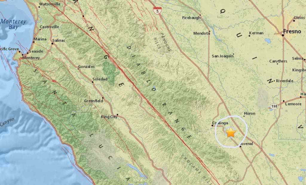
earthquake map of Avenal, California
© USGS
Three earthquakes struck just a kilometer or two apart in Central California on Thursday, according to the USGS, two of them within two minutes of each other, near the town of Avenal in Kings County.

The first was a magnitude 3.6 quake that struck at 7:50 a.m., 12 kilometers northwest of Avenal at a depth of 7 kilometers. Two minutes later, a 2.6-magnitude quake struck 11 kilometers of Avenal at a depth of 4 kilometers.

At 2:46 p.m., another 2.6-magnitude earthquake hit. This one was reported 12 kilometers northwest of Avenal, at a depth of 8.7 kilometers. There were no reports of injuries or damage from any of the quakes.

There was also an earthquake in Northern California on Thursday. At 8:15 a.m., a 3.0 quake struck 8 kilometers northeast of Watsonville at a depth of 10 kilometers. No injuries or damage were reported from this quake as well.

Seismograph

Shallow M6.0 earthquake hits Nicobar Islands region

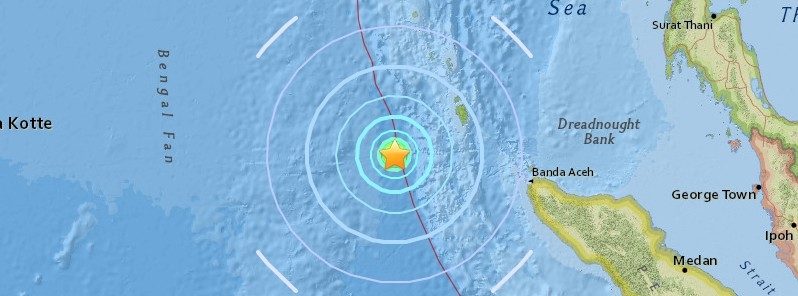
Nicobar Islands earthquake map
© USGS

A strong and shallow earthquake registered by the USGS as M6.0 hit Nicobar Islands region, India at 02:51 UTC on March 14, 2017. The agency is reporting a depth of 10 km (6.2 miles). EMSC is reporting the same magnitude and depth. India's National Center for Seismology reports M5.9 at a depth of 10 km.

According to the USGS, the epicenter was located 316.1 km (196.4 miles) W of Lampuyang (population 0), 333.2 km (207 miles) W of Sabang (population 24 519) and 338.8 km (210.5 miles) W of Banda Aceh (population 250 747), Indonesia.

There are no people living within 100 km (62 miles).

This earthquake did not produce a tsunami.

Seismograph

Loud boom 'like thunder' accompanies 2.3 earthquake in central Virginia

Seismograph
© fotoalia.com
A earthquake rumbled parts of Goochland and nearby portions of Central Virginia Sunday night.

The United States Geological Survey reported the magnitude-2.3 earthquake struck at about 10:11 p.m. (The quake was first reported as 2.1-magnitude, but was later revised as is often the case.)

It was centered about three miles northeast of Goochland Courthouse and not far from Oilville.

Earthquakes with magnitudes less than 2.5 are often not felt, but will be picked up by seismograph.

People from Hanover and Powhatan counties, as well as folks in Short Pump and other nearby locations, reported feeling the quake.

"No reports of injuries or damages resulting from the earthquake have been reported as of 8:30 a.m. on Monday," Goochland Administrative Services Manager Paul Drumwright said. "Goochland County and VDEM request citizens check over their homes and property for any visual or hidden damages. Attention should be paid to foundations, chimneys, and sheetrock of homes and businesses.

Dig

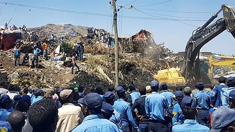
Garbage landslide kills at least 30 in Addis Ababa, Ethiopia

landslide
© APAbout 150 people were at the site when the landslide struck on Sunday
Dozens missing after huge landslide at decades-old landfill site near the capital buries squatters' makeshift homes.

At least 30 people have been killed and dozens are missing after a landslide struck at a massive garbage dump on the outskirts of Ethiopia's capital.

The landslide late on Saturday levelled more than 30 makeshift homes of squatters living inside the Koshe landfill on the outskirts of Addis Ababa, said Dagmawit Moges, head of the city's communications bureau.

Moges said most of the dead were women and children, and more bodies were expected to be found in the coming hours.

It was not immediately clear what caused Saturday night's disaster. "We expect the number of victims to increase because the landslide covered a relatively large area," he said.