Extreme Temperatures
S


Snowflake Cold

Record cold hits southern Brazil

Dawn in Urupema was marked by record-cold and hard-frosts
© Marleno Muniz FariasDawn in Urupema was marked by record-cold and hard-frosts.
A cold, recording-breaking past few nights have been suffered across the Rio Grande do Sul and Santa Catarina regions of Brazil, reports noticias.uol.com.br and g1.globo.com.

Thermometers hit double digits BELOW-ZERO.

A bone-chilling -10C (14F) was observed in the mountain settlements of Santa Catarina. Even regions in the lower-lying state of Rio Grande do Sul suffered negative temperatures into the early hours of Tuesday morning.

One reading of -10C (14F) occurred in the rural town of Bom Jardim da Serra, and, after checking the record books, that observation has tied with August 2, 1991 for the areas all-time coldest temperature on record.

With regards to the more urban areas, the lowest minimum on the same day appears to be the -8.8C (16F) in the town of São Joaquim — a further example of the Urban Heat Island effect, if we needed it.

Snowflake

Big snow totals across the Snowy Mountains, Australia - nearly 40 inches in 24 hours

The freshies in Thredbo were best yesterday morning, the snow getting heavier as the day went on.
© ThredboThe freshies in Thredbo were best yesterday morning, the snow getting heavier as the day went on.
Well, that was an incredible 24 hours for the NSW resorts with 70-100cms of snow in a 24-hour period, the higher totals falling above 1800 metres, but there was also snow all the way down to Jindabyne and beyond.

The first snow fall came through on Sunday with a few centimetres during the day before things kicked in overnight, leaving 17cms on the deck outside my place in Thredbo Village and 40+cms on the mountain by yesterday morning.

The snow kept falling all day, dumping at times, before it finally eased at around 8pm last night and there's a few lingering snow showers today. The result is 100% of the terrain in the NSW resorts now has a good base and more lifts will open this week.


Snowflake Cold

Incredible rare peek at Patagonia in winter, high pressure area bringing unusually cold temperatures

June 26, 2020
Patagonia, June 26, 2020.
In southern South America, clouds often rule the skies. But in June 2020, just the right weather patterns were in place to provide a rare, clear view of Patagonia in winter.

On June 26, when the Moderate Resolution Imaging Spectroradiometer (MODIS) on NASA's Aqua satellite acquired these images, skies were clear over nearly all of Patagonia, which spans more than 1 million square kilometers of the continent's southern end. Snow cover is visible from the western slopes of the Andes Mountains in Chile to the coastal lowlands in Argentina.

According to René Darío Garreaud, a professor at the University of Chile, it's unusual to see such a widespread cloud-free area over Patagonia. "The last time that I saw a completely clear image was in February 2019," he said. At that time, during the Southern Hemisphere's summer, the warm seasonal temperatures meant snow and ice were mostly limited to the spine of the Andes and the Patagonian icefields.

Comment: Related: Incredible snowfalls in the Andes - snow lying almost 5 metre (17 FEET) deep


Snowflake

Hundreds flock to see the snow in Matroosberg, South Africa, many for the first time

An intense cold front turned parts of the Western Cape highlands into a winter wonderland
© Amy Gibbings, News24An intense cold front turned parts of the Western Cape highlands into a winter wonderland.
People waited in a long queue to enter the Matroosberg Nature Reserve on Saturday to get a first-hand glimpse of the snow that fell over the Western Cape highlands on the weekend.

The intense cold front that hit South Africa on Thursday created the perfect winter wonderland thanks to widespread snowfall in the Eastern Cape, Lesotho and areas across the Western Cape.

The muddy and ice-cold conditions didn't deter people from hiking the short distance into the mountains to play in the snow - many for the first time.

"This is breathtaking," said TEFL teacher Donito Adonis who got to hold snow for the first time. "I never thought I'd see snow like this in South Africa," he told News24.


Snowflake

Incredible snowfalls in the Andes - snow lying almost 5 metre (17 FEET) deep

snow
Corralco
Snow has been falling almost constantly for more than a month now in the Andes mountains of South America and ski areas area reporting the snow lying almost five metre (17 feet) deep.

It should be one of the best ski seasons of the century - but no resorts are able to open so far because of lockdown measures in Argentina and Chile to fight the coronavirus pandemic.

Ski areas are none-the-less posting pictures of the snow are reporting how deep it has got, Chile's Corralco (pictured) say 4.9 metres (16 feet), Portillo (pictured bottom) an inch less with 4.87 metres. There are similar stats at other ski areas in the region where they've measured depth.


Snowflake

New record for snow in Norway: 10 meters (over 32 feet) remains in summer

snow norway
Snowfall in Norway, 2020.
Never seen so much snow in July," reads the headline on the Norwegian website nrk/no.

We have not had such snowfall as this year, says Knut Kinne, watercourse technical manager at the energy company BKK.

With ten meters (more than 32 feet) of packed snow, it may not have melted in the summer and fall if we had not removed it, says communications adviser Jarle Hodne at BKK.

Snowflake

The Andes - "Experts say it has never snowed that much" - Over 13 FEET deep

snow
Las Leñas, Argentina
The Andes continue accumulating snow, up to 4 meters (more than 13 feet).

Unfortunately for skiers, time does not understand pandemics. The Andes are receiving perhaps record-breaking snowfall just when ski centers are closed due to Covid-19. There are few clues as to whether they will finally be able to open. (I say 'perhaps record-breaking' because my translator said it was 'anthological' snowfall. I'm not sure what that means.)

Nonetheless, Cerro Catedral Alta Patagonia has detected groups of people who skipped the ban and went skiing anyway.


SOTT Logo Media

SOTT Focus: SOTT Earth Changes Summary - June 2020: Extreme Weather, Planetary Upheaval, Meteor Fireballs

secsjune2020
Sheets of rain, floods and hail left a path of destruction all over the world, and the northern hemisphere still got snow in June.

The unbelievable amount of precipitation during the past months can be explained with the increasing amount of charged particles in upper layers of the atmosphere.

When meteors and meteorites pass through our lower atmosphere, or when our planet goes trough a comet dust stream, charged particles accumulate between the ionosphere and the surface of the earth causing storms to intensify, clouds to grow and more rain to fall. Wildfires and volcanic eruptions, for example, also contribute to this accumulation of particles.

At the same time, rain can conduct the accumulated electrical charge of the ionosphere to the ground, which increases the occurrence of other electrical phenomena, as tornadoes, hurricanes and plasma formations.

The accumulation of charged aerosols and increasingly colder temperatures in upper layers of the atmosphere - caused by the current solar minimum - can also be responsible of the increasing amount of hail and unseasonable snow around the world.

Charged particles influence weather much more than has been appreciated.

Heavy rain and raging floods took the life of hundreds and affected millions in south China, and destroyed 1,470 houses and 3 bridges in Gorontalo Province, Indonesia. Heavy floods also hit Assam, India leaving 16 dead and over 253,000 affected.

While Romania got its second coldest day in June, Montana got more than 1 foot of snow and southeast Wyoming got 6 inches... just at the beginning of summer.

Siberia got a share of extreme weather this month, from tornadoes to floods and extreme temperature swings.

A 7.5-magnitude earthquake rattled large swaths of southern and central Mexico, killing at least five people. No major damage was reported.

Locusts continued to ravage Africa, India, Brazil, Argentina and the Middle East, with no sign that they'll be gone soon.

All that and more in our SOTT Earth Changes Summary for June 2020:

Snowflake

Temperature extremes: Pole of Cold district that recently recorded desert-like heat of +38C now sees snow in Verkhoyansk, Russia

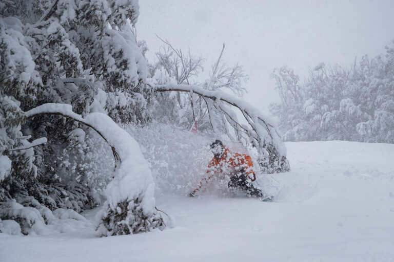
As the pictures show, Verkhoyansk was hit by summer snow, which is not unknown but hardly common.
Topsy-turvy summer swings from Saudi-heat to freezer in Arctic north of Russia's largest region of Yakutia.

Abnormally cold weather has been recorded in the north of Yakutia with residents of Verkhoyansk district waking up to fresh snow on 5 July.

Just days before that, locals were complaining about the hot and dry beginning of July, with air temperature heating up to +27C on 1 July, and wildfires raging.


Earlier, on 17 June this district saw a world record for the Arctic of 38C.

Snowflake

Summer suddenly turned chilly in southern Norway - FOOT of snow with -7.2C temperatures

snow Norway
After an unusually warm June, Norway's July summer holidays got off to an extremely chilly start over the weekend. Strong winds, heavy rain, hail and even some snow caught many tourists by surprise.

Slippery roads and as much as 30 centimeters of snow in the mountains prompted warnings from state highway officials that motorists shouldn't drive over mountain passes without snow tires on their vehicles. One mountain lodge, Sognefjellshytta, reported a new record low temperature for July of minus-7.2C late Saturday night, and so did several other weather stations in the mountains of Southern Norway.


Comment: Also recently: Big July snowstorm at ski resort in southern Norway - at least 14 inches dumped