Earthquakes
S


Attention

Magnitude 5.3 earthquake hits eastern Taiwan

earthquake
A magnitude 5.3 earthquake jolted eastern Taiwan at 12:52 p.m. Monday, according to the Central Weather Bureau.

The quake's epicenter was located at sea about 66.2 kilometers south of Hualien County Hall at a depth of 28.6 km, the bureau's data shows.

The quake's intensity, which gauges the actual effect of a temblor, was highest in Changbin Township in Taitung County, where it measured 4 on Taiwan's 7-tier intensity scale.

It was felt at an intensity of 3 in some areas of Hualien. No immediate injuries or damage were reported.

Attention

Magnitude 4 earthquake felt in El Salvador

earthquake
A four-magnitude earthquake in Richter's scale was felt in some regions in El Salvador on Sunday, especially in the department of Usulutan, 117 kilometers from this capital.

The earth tremor was reported at 03:52 hours, local time, on Sunday, and its epicenter was located 10 kilometers deep, off the coast of that region. No material damage or human victims were reported.

El Salvador is in a highly-seismic region due to the volcanic chain that is part of the Pacific fire belt, which runs along the country's territory.

Another earthquake-generating source is a system of geological faults that run from northwest to southeast on Salvadorian territory.

Attention

4.4 magnitude tremor hits eastern Nepal

earthquake
A fresh tremor of local magnitude 4.4 was felt in eastern Nepal on Saturday midnight.

According to the National Seismological Centre, the light tremor was recorded at around 11:23:28 pm and it has been listed as an aftershock of the April 25 earthquake.

The epicentre of the aftershock was in Ramechhap district, with the coordinates of the location 27.48°N, 86.01°E. The location lies around 15 kilometres northwest of the district headquarters, Manthali.

With this, the NSC records show that as many as 424 significant aftershocks (of local magnitude 4.0 or above) have followed the devastating earthquake on April 25. Around 9,000 people were killed in the earthquake and its powerful May 12 aftershock in Nepal.

Earlier on January 4 morning, tremors of the powerful earthquake that struck northeast India were felt in the eastern Nepal also.

Arrow Up

Earthquake swarm rattles northwest Oklahoma

oklahoma earthquake swarm
More than two dozen earthquakes have been recorded in northwest Oklahoma since Wednesday night.

Four of the temblors measured magnitude 4.0 or stronger, and one was the strongest quake recorded in Oklahoma so far this year, according to U.S. Geological Survey records.

Despite all the shaking, there have been no immediate reports of injuries or damage.

The earthquake swarm began at 10:27 p.m. Wednesday with the strongest quakes — measuring magnitude 4.4 and 4.8 — 30 seconds apart at Waynoka, in Woods County. Over the next hour, those were followed by two quakes measuring 3.4 magnitude at Waynoka, and one 3.3 magnitude temblor in the Major County town of Cleo Springs.

According to USGS, the 4.4 magnitude quake was 3 miles deep. It was originally reported to be 4.3 magnitude, but it was later upgraded to 4.7 before being downgraded again to 4.4 magnitude. The 4.8 magnitude quake was 3.7 miles deep. The other temblors were all about 3 miles deep.

In the hours that followed, there were 12 magnitude 3.0 or greater temblors, and 11 measuring below magnitude 3.0.

The two strongest quakes since Wednesday night both measured magnitude 4.0, and both were about 3 miles deep. The first, at 2:37 a.m. Thursday was recorded at Aline, in Alfalfa County. The second occurred at 1:59 p.m. Thursday in Waynoka.

There were two other quakes less than 30 seconds apart in the swarm. A 3.0 magnitude temblor was recorded at 4:48 a.m. Thursday at Waynoka. It was 2 miles deep. A 3.5 magnitude quake followed 24 seconds later, within the same minute, at Waynoka. It was 3 miles deep.
Comment: See also:


Alarm Clock

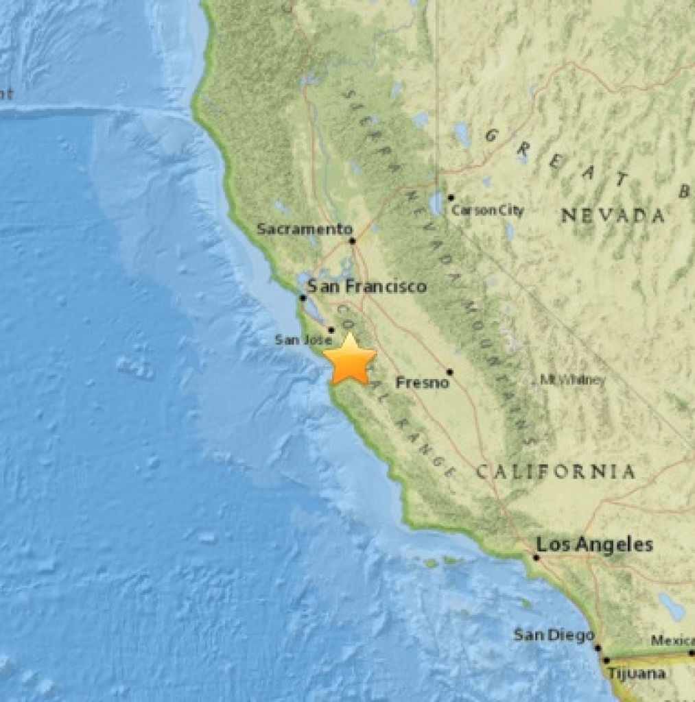
Cluster of three small earthquakes hit Hollister, California in a six-minute span

Holister earthquake cluster epicenter
© USGSThe Holister area had a series of three quakes on Saturday, Jan. 09, 2016. The first of three quakes had a magnitude of 3.2. The epicenter of that quake is shown here
A cluster of three small earthquakes with a 3.2, 2.9 and 2.6 preliminary magnitude shook the Hollister area early Saturday within a span of six minutes.

The United States Geological Survey recorded the largest tremor at 2.5 miles from San Juan Bautista at a depth of 3.5 miles. It struck at 9:43 a.m. and was followed by a 2.9-magnitude quake at 9:46 a.m. and the 2.6-magnitude jolt at 9:49 a.m.

Attention

4.6 magnitude tremor shakes Zambia

Earthquake information
Zambia experienced a 4.6 magnitude on the richter scale an earthquake/earth tremour at 03;05, (05:05 Zambian time) 74km South of Lusaka and 38km from Kafue on January 9, 2015.

This comes a day after a heavy downpour following a dry spell claimed nearly seven lives in the capital Lusaka. A building on the outskirts of the city's Central Business District also collapsed, but there were no casualties.

Attention

4.2 magnitude earthquake strikes Southern Fars province, Iran

earthquake
An Earthquake measuring 4.2 on the Richter scale jolted the town of Bairam in Fars province, Southern Iran, on Saturday morning, IRNA reported.

The Seismological center of Fars province affiliated to the Geophysics Institute of Tehran University registered the quake at 00:14 hours local time.

The epicenter of the quake was registered at 53.5 in longitude and 27.4 in latitude.

There has yet been no report on the possible number of casualties or damage to properties by the quake.

Iran sits astride several major faults in the earth's crust, and is prone to frequent earthquakes, many of which have been devastating.

Attention

Magnitude 5.0 earthquake hits Southern Chile

A closeup of a seismograph machine needle drawing a red line on graph paper depicting seismic and eartquake activity
Moderate mag. 5.0 earthquake - Southern Chile on Thursday, 7 January 2016

Hypocenter depth recalculated from 33.0 to 37.0 km.

Date & time: Thu, 7 Jan 15:40:46 UTC

Magnitude: 5.0

Depth: 37.0 km

Epicenter latitude / longitude: 41.59°S / 73.79°W [Map]

Nearest volcano: Calbuco (99 km)

Primary data source: GFZ

Attention

5.9 magnitude earthquake strikes Pakistan

Epicentre
This was the third quake to hit Pakistan since the beginning of 2016.

A strong earthquake measuring 5.9 on the Richter Scale hit Pakistan on Friday, the country's Meteorological Department said.

The epicentre of the quake was detected at Afghanistan-Tajikistan border region, Dawn online reported.

However, the United States Geological Survey (USGS) reported the magnitude of the earthquake was 5.0 and traced its origin to the Jarm region in Afghanistan.

Attention

Magnitude 5.2 earthquake hits Kuril Islands, Russia

Kuril Islands
Kuril Islands
A 5.2-magnitude earthquake has occurred off the Kuril Islands, the US Geological Survey (USGS) reports.

The quake struck at 20:23 GMT on Thursday, its epicenter was located 93 miles (150 kilometers) southwest of Severo-Kurilsk, a Russian town in the northern part of the Kuril Islands.

There have been no reports of damages or tsunami warnings in the area.

According to the Richter scale, earthquakes with a magnitude of 5.0-5.9 are considered to be moderate and can lead to casualties and cause damage to buildings and infrastructure.

The Kuril Islands separate the Sea of Okhotsk from the North Pacific Ocean. Russia and Japan are engaged in a territorial dispute over the South Kuril Islands, called the Northern Territories in Japan.