Earth ChangesS

Heart

Four killer whales saved in rescue operation in Russia's Far East

Russians rescue whales
A challenging rescue operation in Russia's Far East was declared a success after four orcas, including a pup, were freed from an ice trap in the Sea of Okhotsk off Sakhalin Island.

The killer whales' plight triggered a unique eight-hour rescue mission, which was carried out by the Russian Emergencies Ministry with the help of a local fishing company. As the bay where the orcas got stuck was shallow and filled with ice and rocks, a traditional fishing boat was enlisted for the job, in place of a rescue vessel.

Rescuers used hooks to move pieces of ice out of the way of the animals, but they turned out to be no match for the largest chunks. Undeterred by the obstacle, however, they used some ingenuity and attached a thick rope to a vehicle on the shore that towed the bigger slabs of ice out of the path of the whales.


Bizarro Earth

Geologists concerned over unusual string of large earthquakes spanning a vast area in southern Japan

landslide minamiaso earthquake
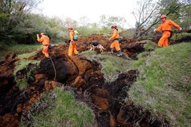
© APRescuers and a search dog check the damage around a landslide area caused by earthquakes in Minamiaso, Kumamoto prefecture on April 17
Seismic activity in southern Japan is mystifying geologists and keeping the nation on edge.

The island of Kyushu has been struck by a series of significant earthquakes, with the epicenters moving progressively further inland. The cluster started with the deadly quakes that hit Kumamoto Prefecture last Thursday and Saturday. Temblors subsequently rocked the Mount Aso region and neighboring Oita Prefecture.

There is a known concentration of faults in the area. Still, experts say it is highly unusual to have a string of quakes measuring around magnitude 6 and stretching over such a vast area. The epicenter of the Oita jolt was about 100km away from the first Kumamoto quake.

"I don't quite understand what is happening with the recent earthquakes, because it's an unfamiliar phenomenon," said Yoshihisa Iio, a professor at Kyoto University's Research Center for Earthquake Prediction.

The Japan Meteorological Agency said it is unprecedented to have a group of large quakes in these three parts of Kyushu. Experts are divided over how far the shaking will spread and whether it could prompt more quakes centered elsewhere.

Comment:


Bizarro Earth

Subduction process similar to one causing Ecuadorean quake could cause megathrust in India at any time

earthquake in Imphal, Manipur
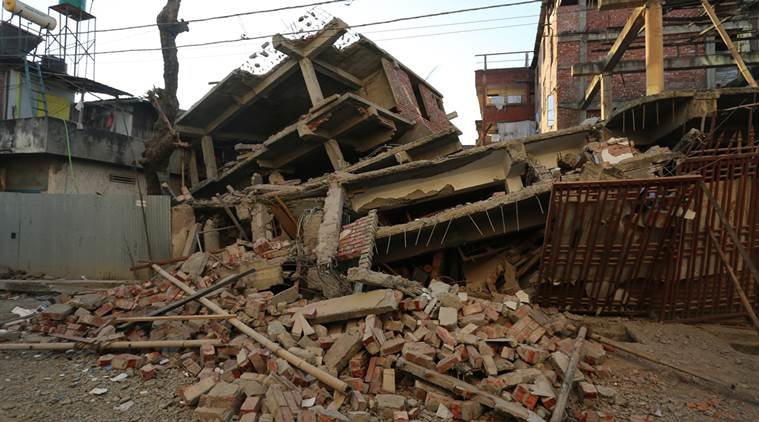
© xpress /Deepak Shijagurumayum.An under construction building that got damaged in the earthquake in Imphal, Manipur in January 2016
A subduction process similar to the one that caused the Ecuadorean quake is happening under the Himalayan region as well, where the Indian plate is getting inside the Chinese landmass.

This northward push has been creating a huge amount of tectonic strain in the region, making it particularly prone to earthquakes.

Scientists believe there is so much energy stored in the area that an earthquake of magnitude greater than 8, possibly even 9, would be needed to release it. This earthquake can come at any time.

The Nepal earthquake was a result of this same process, but it was relatively weak in magnitude.

Comment: Multiple recent powerful earthquakes reflect a planet in deep transition


Map

Japan: Seismic activity from magnitude-7.3 earthquake stretched 100 kilometers

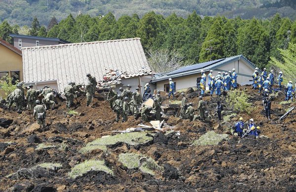
Rescue workers
© Yomiuri ShimbunSelf-Defense Forces personnel and other rescue workers search for missing people in a residential area of Minami-Aso, Kumamoto Prefecture, on Sunday.
The magnitude-7.3 earthquake that pounded Kumamoto Prefecture early Saturday was more powerful than a foreshock that struck two days earlier.

The seismic activity then moved northeast to reach areas in Oita Prefecture about 100 kilometers away from the focus of the magnitude-7.3 quake. Experts are concerned that quake activities could spread to a major active fault that lies further ahead in that direction.

On Saturday morning, Yomiuri Shimbun reporters entered the town of Mashiki, Kumamoto Prefecture, where aftershocks continue to rattle the area. Many houses in the town's Dozono district have collapsed. A large crack ran through a field, leaving a line of what looked like overturned earth. A road crossing the field was buckled out of alignment.

According to a calculation by Masashi Omata of the Japanese Society for Active Fault Studies, the ground here moved about 20 centimeters vertically, and about two meters horizontally. This measurement was taken in a northeastern section of the Futagawa fault zone, which extends for at least about 64 kilometers. "Part of the Futagawa fault zone shifted and caused the magnitude-7.3 temblor," Omata said.

Comment: Seismic activity increasing: Scientist warns up to 4 quakes over 8.0 possible under 'current conditions'


Cloud Precipitation

At least 1,000 displaced following floods in Uganda

Following torrential rains, fresh floods have started hitting Kasese destroying roads
Many people in parts of Western and Southern Uganda faced severe flood conditions as a result of a result of heavy rainfall that began on 13 April 2016. Further heavy rainfall on 17 April has hit flood-affected areas in the west, in particular Kasese, once again.

Kampala

In Kampala and its suburbs, houses were inundated by flood waters forcing people to evacuate to higher grounds for safety. Some of the buildings were reported to have collapsed. Flooding rendered roads impassable. According to the Uganda Radio Network (URN), floods on Wednesday, 13 April, affected several suburbs including Kyebando, Bwaise, Kamwokya, Mulago and Kalerwe. There were also some reports of flooded farmland and damaged crops.

Over the years Kampala and areas around Lake Victoria have experienced severe floods. In September 2013 for example, the streets of numerous suburbs were badly affected.

The locals of these suburbs believe these floods, which occur on a regular basis, are very much man made and mostly caused by building and development on flood plains and swamp areas. Flooding like this occurs on a regular basis in Kampala - mostly in the suburbs - during the rainy season. Two people died in floods in September 2011. Further floods occurred in November that year, as discussed in this report from Uganda's New Vision.


Kyebando road flooded leaving business at a standstill
© ALEX OTTO Kyebando road flooded leaving business at a standstill

Ambulance

Power cut, copper mine shut, 4 million with no fresh water as massive flood hits Santiago, Chile

Flooded Santiago street
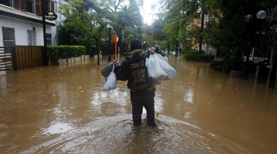
© Ivan Alvarado/ReutersA man walks along a flooded street in Santiago, April 17, 2016.
Chile's capital, Santiago, has been inundated by rains that caused the Mapocho River to breach its banks and flow into one of the city's upbeat neighborhoods. The calamity has killed at least two people and left four million more short of water.

The intense rains that have been pouring down since Friday caused the Mapocho River to overflow for the first time in 30 years, mostly into the wealthy neighborhood of Providencia, with water streaming into cafes, shops, and underground car parking.

The local government blames the incident on the poorly designed roads that led a canal built to hold 80 cubic meters of water to exceed its capacity. Sacyr SA and Costanera Norte SA, the companies in charge of the road construction, which was part of a $197 million project designed to enhance the city's highway system, have been put under investigation.
Man next to river in Santiago
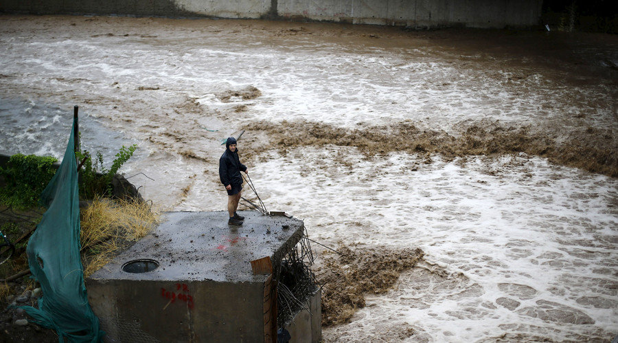
© Ivan Alvarado/ReutersA man is seen next to a river during floods in Santiago, April 17, 2016.
The flooding triggered landslides into the Maipo and Mapocho Rivers, killing at least two people and cutting more than four million residents off from the fresh water.
Comment: There is an extraordinary amount of flooding going on right now affecting millions of people all over. See our topic on Floods.


Attention

GPS data indicates shifting land surface by nearly one meter in Japan

Kumamoto Prefecture
Geological officials say the magnitude-7.3 quake early on Saturday in Kumamoto Prefecture shifted observation points horizontally by nearly one meter.

The Geospatial Information Authority says GPS data shows that an observation point in Minami Aso Village moved southwest by 97 centimeters, and rose by 23 centimeters.

Comment: See also: Update: 32 killed, 70,000 evacuated as Japan hit by 2 powerful earthquakes & devastating landslides (photos & videos)


Cloud Precipitation

Houston record floods: Disaster zone declared after 'historic' rainfall

Houston flooding
© Houston ChronicleWaters in one spot were 12m higher than the record.
Meteorologists said some 17.6in (44.7cm) of rain fell on the city on Monday alone, levels that national officials said were "historic".

Texas Governor Greg Abbott has declared a state of emergency in Houston, where 70,000 people were left without power.

Rivers burst their banks in the fourth-largest US city and 1,200 people were rescued from rising floodwaters.

At least 1,000 homes have flooded, with the number likely to rise. City officials have turned a large shopping centre into an evacuation centre.

Comment: This is not a one-off event for the United States - Houston flooding is the 8th historic flood to hit America since the end of September.


Jet2

Russia deploys Su-34 aircraft to bomb ice jam in flooded territories

melting earth
© Flickr/ PhOtOnQuAnTiQuE
Russian military aviation has been deployed to the Vologda region, after powerful snowmelt floods hit vast territories across the country.

Local authorities initiated efforts to destroy a 40-km ice jam on the Sukhona river near Veliky Ustyug, in the Vologda region. As Monday's demolition work didn't bring the expected result, bombing missions from the air are being implemented.

Several Russian Su-34 bomber aircraft launched airstrikes on the border area between the Archangelsk and Vologda regions. These modern multipurpose planes were most recently bombing Daesh positions in Syria.

The task isn't easy. The Vologda region is in the grip of the worst flooding in 20 years, and the consequences have required a special operation by the military and emergency response groups.


Attention

Magnitude 5.9 earthquake rocks South Georgia

earthquake
A magnitude 5.9 earthquake recently struck north of South Georgia on Tuesday (April 19, 2016), as reported by the United States Geological Survey (USGS) earthquake bulletin.

The earthquake's epicenter was recorded at 119 kilometers north of Visokoi Island, South Georgia and the South Sandwich Islands at 1:25 pm of Tuesday (Philippine time).

A slight tremor has also affected nearby areas such as areas of Argentina - Ushuaia, Rio Gallegos, Puerto Deseado - and Stanley in Falkland Islands.
No casualties were reported as of this posting.

A 5.9-magnitude quake struck Visokoi Island on  Tuesday afternoon (Philippine time). The epicenter was located 119 km of South Georgia.
© USGSA 5.9-magnitude quake struck Visokoi Island on Tuesday afternoon (Philippine time). The epicenter was located 119 km of South Georgia.