OF THE
TIMES
Briefly stated, the Gell-Mann Amnesia effect is as follows. You open the newspaper to an article on some subject you know well... You read the article and see the journalist has absolutely no understanding of either the facts or the issues. Often, the article is so wrong it actually presents the story backward—reversing cause and effect...
In any case, you read with exasperation or amusement the multiple errors in a story, and then turn the page to national or international affairs, and read as if the rest of the newspaper was somehow more accurate about Palestine than the baloney you just read. You turn the page, and forget what you know.
Trump Forced To Wear Hannibal Lecter Muzzle For Gag Order Violations ·May 6, 2024 [Link]
Back to the topic, I think Xi's intention here is to drive a wedge between the US and Europe. France is historically more independant than other...
Or this video of a Russian soldier: "Guy casually shrugs off 3 FPV strikes, drops a grenade into a dugout before jumping in, just in time to be...
I don't know any details of this case, but to offer this as being acceptable legal procedure is as absurd, irrational, and quite frankly...
The Biden administration has halted a shipment of ammunition previously approved to aid Israel in its war efforts with Hamas. What shipment did...
To submit an article for publication, see our Submission Guidelines
Reader comments do not necessarily reflect the views of the volunteers, editors, and directors of SOTT.net or the Quantum Future Group.
Some icons on this site were created by: Afterglow, Aha-Soft, AntialiasFactory, artdesigner.lv, Artura, DailyOverview, Everaldo, GraphicsFuel, IconFactory, Iconka, IconShock, Icons-Land, i-love-icons, KDE-look.org, Klukeart, mugenb16, Map Icons Collection, PetshopBoxStudio, VisualPharm, wbeiruti, WebIconset
Powered by PikaJS 🐁 and In·Site
Original content © 2002-2024 by Sott.net/Signs of the Times. See: FAIR USE NOTICE

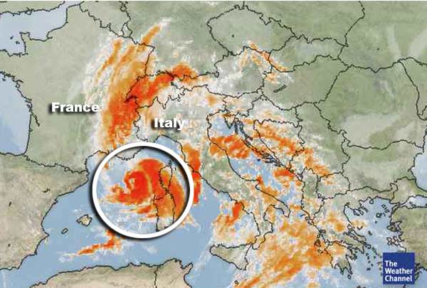
Could the warming of the ocean due to El Hierro be the cause? The warm waters must be circulating into the Mediterranean.