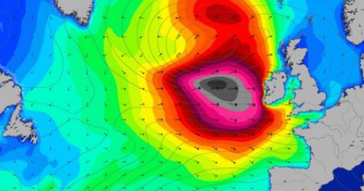
The fifth named storm of the season will bring a "very windy" spell to the UK from this evening and into Wednesday, forecasters said.
The Met Office has issued several national severe weather warnings due to the potential for travel disruption.
Comment: A few days earlier Britain was facing Storm Dylan: Britain warned of Storm Dylan dangers as extreme cold hits US
Coastal roads and properties along Britain's western and southern coasts are vulnerable to high waves throwing beach material onto sea fronts, forecasters warned.
Met Office chief forecaster Paul Gundersen said: "The unsettled theme continues throughout this week, with further spells of rain moving across the UK from the west as many return to work on Tuesday and there will again be some snow over the high ground in Scotland.
"The wind will pick up again later on Tuesday and Wednesday as developing Storm Eleanor heads towards the UK and Ireland."
The Environment Agency warned earlier that strong winds and high tides could bring coastal flooding from Tuesday until Thursday.
Carol Holt, the Environment Agency's flood duty manager, said: "We urge people to stay safe on the coast - take extreme care on coastal paths and promenades, and don't put yourself in unnecessary danger trying to take 'storm selfies'.
"If you're travelling, please check your route before setting off and don't drive through flood water."
A yellow weather warning has been issued for between 6pm on Tuesday and 8am on Wednesday for north east and west England, northern Ireland and parts of Scotland.
The warning predicts gales with gusts of 60mph to 70mph are likely while some western coastal areas have a chance of seeing gusts of up to 80mph.
Deputy chief forecaster Dan Harris added that next weekend could bring a return of colder conditions with a risk of frost, ice and wintry conditions, particularly in the north.
He added: "It could remain more unsettled in the south.
"The details of the forecast later this week and into the weekend are extremely uncertain at this stage, so my advice is to keep up to date with the latest forecasts as confidence will increase later in the week."
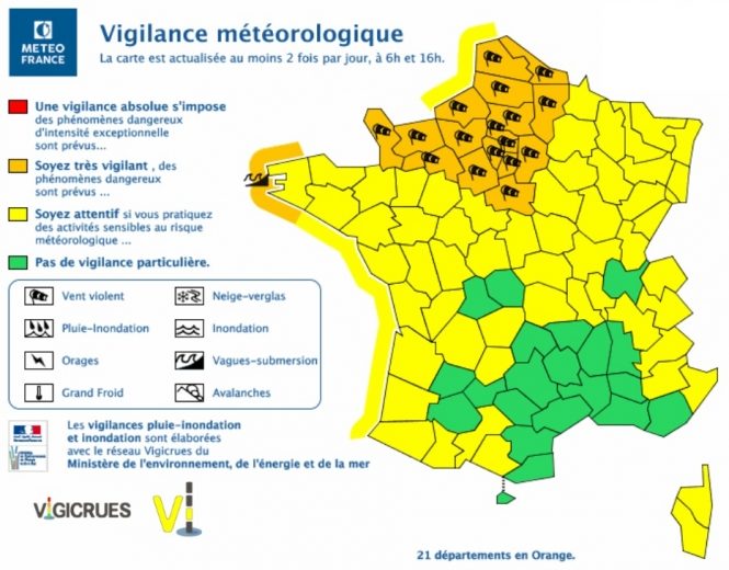
UPDATE: France, like the UK, were recovering from a storm which hit just 24 hours ago, are now on alert for Storm Eleanor:
Orange alert extended to 48 departments all along Channel coast and down western France to Saône-et-Loire and Jura for strong winds
The Finistère coastline (29) is also on alert for high waves that are expected to be "particularly intense" and may breach beach walls and other coastline barriers, and cause flooding, according to Météo France.
The wind expected in the alert regions will be comparable to that of Storm Carmen - which swept through the country on January 1 - the forecaster said, with the strongest gusts expected on Wednesday morning (January 3).
Wind speeds could reach up to 120kph on the coast, and 100-110kph closer inland, and could even soar higher in the event of thunder and rain.
Météo France also warns that the wind level and subsequent damage risks affecting electricity and telephone lines.
Notice of Storm Eleanor comes just 24 hours after Storm Carmen hit (and after Storm Dylan, which did not reach France), leaving at least one person in France dead and tens of thousands of homes without power.
Comment: This winter is proving to be particularly brutal:
- Adapt 2030 Ice Age Report: Arctic cold grips the US, Asia and Europe - Record snows in Erie, Pennsylvania smash old record by 3x (VIDEO)
- 2018 to start off with piercing cold temps in central and northeastern US
- Extreme cold spell breaks 57 year old record in Toronto
- Heavy snow strands 4 thousand, kills skier in French Alps
- Niagara Falls 'freezes' as Arctic conditions grip North America (VIDEO)


Storm Eleanor to BATTER UK coast with 80mph WINDS and MONSTER waves!!!!!!