
Storms
S


Cloud Precipitation

Wild weather slams New South Wales, Australia: Flash-floods, towns evacuated, dams on the brink

floods
A rain bomb is slowly pushing down the NSW coastline, leaving a trail of flash floods and destruction in its wake.

Multiple warnings and evacuation orders are still in place for the NSW mid-north coast amid fears of record flood levels and overflowing levees, with authorities warning the situation could be life-threatening.

Sydney is next in line with some areas predicted to cop more than 150 millimetres of rain on Saturday.

Sydney's waterways are set to become danger zones, with up to four times as much rain from today predicted to fall in the next 24 hours.

Warragamba dam is expected to overflow at the weekend, as the deluge of rain expands from the worst-hit NSW Mid North Coast, to further south including the Hunter Region, Sydney and Illawarra.


Snowflake Cold

Snowstorm hits Murmansk, Russia

SNOW
Snow piles buried cars and streets! Snow storm hits Murmansk, Russia.


Snowflake

Snow accumulates as blizzard conditions hit Texas Panhandle in mid-March

blizzard
Blizzard conditions arrived in the Texas Panhandle on Wednesday, March 17, bringing wind gusts up to 60 mph and greatly reduced visibility.

Footage shared by Amarillo-based meteorologist Corbin A Voges shows the snowy conditions on Wednesday morning.

"Crazy weather! We made it to 76° yesterday afternoon and we are accumulating snow just 15 hours later!" Voges wrote in a tweet.

The NWS reported downed power lines and stranded cars on highways as near-whiteout conditions struck some areas.


Tornado1

Tornado damages homes in Choctaw County, Alabama

tornado
A tornado touched down in Choctaw County in the town of Silas, Alabama.

Around 4 pm Wednesday, the tornado hit causing damage to the area. Choctaw County Sheriff Scott Lolley reported there are no deaths or injuries from the tornado but there are a lot of trees and roof damage on the South end of the city.

Medford Taylor a resident of Silas talked about when the storm came through his back yard.

"The wind got pretty strong," Taylor said. "I was in the house by myself watching out the back window and saw it come through the backyard. It didn't hurt the house that much, but it tore all my trees down."

Five homes in the Silas area have reported damage so far.


Windsock

Tuesday's 200-mile-wide dust storm brought 64 mph winds to El Paso, Texas

dust
The sky turned beige and the wind roared Tuesday as a dust storm roughly 200 miles wide engulfed El Paso and neighboring regions as it lumbered toward northeastern New Mexico and other parts of Texas.

The storm's winds reached upwards of 60 mph in East-Central El Paso, where the weather station at the El Paso International Airport recorded a high of 64 mph gusts, according to Joe Delizio, a meteorologist with National Weather Service El Paso.

"Inside the city, but a little bit to the east, we had stronger winds," Delizio said, explaining there were wind gusts "in the 60s and 70s east of the mountain range."


Cloud Lightning

Lighting bolt kills three, injures one in Zimbabwe

lightning
A lightning bolt struck and killed three men and seriously injured one at Mhembwechena business centre in Makonde district last week.

Tongai Gandiwa (32), Stewart Phiri (23) and Shadreck Bvudzijena (age unknown) struck while sitting under a tree and where pronounced dead on arrival at Kenzamba clinic.

Tongai's brother, Shine (30) who sustained serious burns was taken to the same clinic where he was treated.

Snowflake

Blizzard drops up to 4 feet of snow across the Front Range, Colorado

snow
The blizzard that hit Colorado over the weekend was a historic storm that brought Denver's biggest snow in 18 years. Snow totals ranged from a foot to 4 feet across the Front Range. With Buckhorn Mountain in Larimer County, coming in just a bit over 48 inches.

The weekend storm officially brought 27.1 inches of snow to Denver as measured at the airport (DIA). It was a rare storm where DIA got more snow than virtually anywhere else in the Denver metro area.


Cloud Precipitation

15 dead, thousands affected after weeks of severe weather in Colombia

Landslide Antioquia, Colombia, March 2021
© DAGRAN AntioquiaLandslide Antioquia, Colombia, March 2021
Colombia's National Unit for Disaster Risk Management (UNGRD) reported that 15 people have lost their lives due to severe weather so far this year (01 January to 12 March 2021).

UNGRD added that a further 16 people have been injured and 2 are still missing. A total of 5,854 families have been directly affected. During this period there have been 289 severe weather events, including 146 landslides, 45 floods and 32 flash floods.

Severe weather events have been registered in 176 municipalities in 23 departments, in particular in Nariño, Huila, Cauca, Cundinamarca, Antioquia and Valle del Cauca.

Parts of Valle del Cauca have seen heavy rain resulting in floods and landslides since around 08 March, 2021. The heavy rain caused flooding in parts of Santiago de Cali, capital of Valle del Cauca Department, on 10 March. Two people died in a landslide in the Siloé district of the city.
Snowflake

Major snowstorm hits the Alps in mid-March - up to 4 feet of snow measured

Lech in Austria is pictured above this morning
Most of us can't get there, except those lucky enough to live near to an open ski area, but some of us still like to know what's happening in the Alps whilst we dream of returning. The news today, as we reach a year since most of Europe went in to lockdown (a week after Italy and a week before the UK), is that it's dumping down.

"The return of winter" comes with less than a week until the start of springtime and after several months when fresh snowfall has been quite rare, although most areas report good cover on their runs.

The snowfall is widespread but has so far been heaviest in the French and Swiss Alps where many resorts have posted >30-60cm (1-2 feet) of snowfall so far, some as much as 1.2 metres (4 feet) already, and the snowfall is expected to continue through this week.


Snowflake

Best of the Web: Late winter storm buries parts of Wyoming, Nebraska and Colorado under several feet of snow, including record-breaking snowfall in Cheyenne

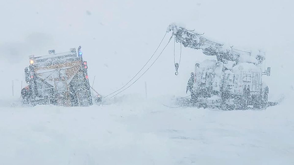
Wyoming Highway Patrol continues to respond to calls for stranded motorists during the March 13-14 storm.
© WHPWyoming Highway Patrol continues to respond to calls for stranded motorists during the March 13-14 storm.
Nearly twenty-six inches fell in Cheyenne by noon, Sunday March 14th. The massive snow storm, a low pressure system fed by gulf moisture dumped, and dumped and dumped some more. By the time this article is being written Sunday afternoon, the snow continues to fall in Cheyenne.


And you read that right - the last time we had this much snow was the same year Cheyenne was hit by the famous tornado of '79. This storm broke records by noon, and it's still not done.


Comment: The storm has since heavily impacted neighboring states. According to USA Today:
More than 2,000 flights were canceled in and out of Denver alone over the weekend. Runways were closed for Sunday night, the Denver International Airport tweeted, as it marked nearly two inches of snow.

Many highways and local roads were closed, including a few with "no alternate route advised."

In Colorado, some areas already had almost 30 inches of snow by noon Sunday. A foot of snow had fallen in Denver, and more was on the way.

"Total snow accumulations of 12-24 inches for the Interstate 25 corridor and up to 3-4 feet in the northern foothills," the National Weather Service warned. "Wind gusts of 30-40 mph will cause some blowing and drifting snow."

The Colorado Department of Transportation reported a slew of highway closures, including swaths of Interstate 70 that runs east to west across the state. The Colorado Avalanche Information Center set the avalanche risk as high, warning of "very dangerous avalanche conditions."

"Slow to ramp up Saturday, storm makes itself known on Sunday," the state Transportation Department tweeted Sunday afternoon. "Return travel from the mountains into #Denver will be extremely challenging Sunday. Motorists please make plans to postpone travel until Monday." [...]

Nebraska's State Patrol tweeted asking people across the western part of the state to stay home to avoid strong winds and blizzard conditions. The Department of Transportation urged people across the state to avoid travel if at all possible, reported the Omaha World-Herald.