Earthquakes
S


Bizarro Earth

Major earthquakes can be triggered by system of small faults linked along a keystone fault

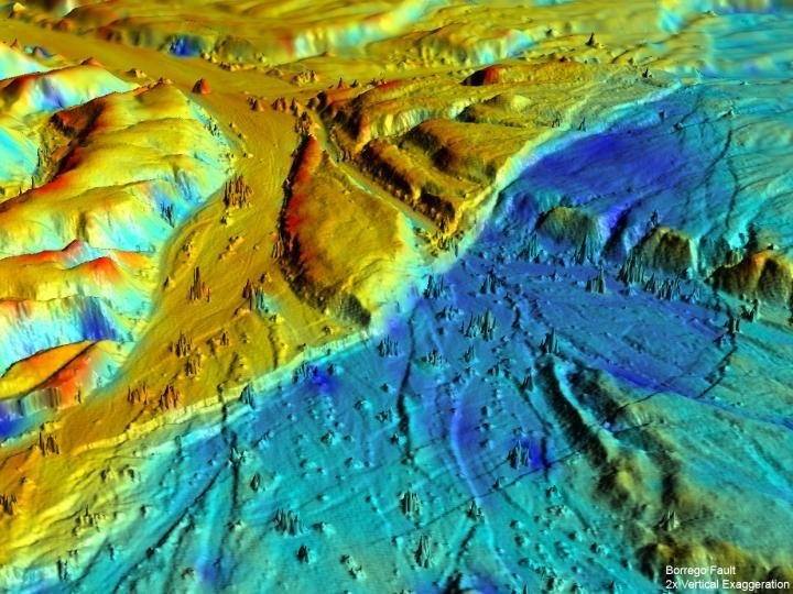
Borrego Fault Baja CA
© UC DavisThis 3-D LiDAR imaging of the Borrego Fault, ruptured during the 2010 El Mayor-Cucapah earthquake in Baja California, Mexico shows numerous small faults. The various colors represent elevation changes during the earthquake.
A spate of major earthquakes on small faults could overturn traditional views about how earthquakes start, according to a study from researchers at the Centro de Investigación Científica y de Educación Superior in Ensenada, Mexico, and the University of California, Davis.

The study, published Feb. 15 in the journal Nature Geoscience, highlights the role of smaller faults in forecasting California's risk of large earthquakes.

In the past 25 years, many of California's biggest earthquakes struck on small faults, away from the San Andreas Fault plate boundary. These events include the Landers, Hector Mine and Napa earthquakes. Several of the quakes were unexpected, rattling areas thought seismically quiet.

A closer look at one of the surprise events, the magnitude-7.2 El Mayor-Cucapah earthquake, showed that small faults may often link together along a "keystone" fault. A keystone is the central stone that holds a masonry structure together. During the El Mayor-Cucapah earthquake, the keystone fault broke first, unlocking seven smaller faults, the study found.

However, the research team discovered that of all the faults unzipped during the El Mayor-Cucapah earthquake, the keystone fault was not the one closest to breaking.
Attention

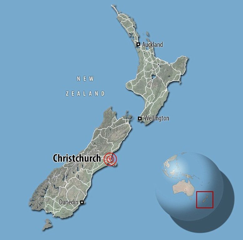
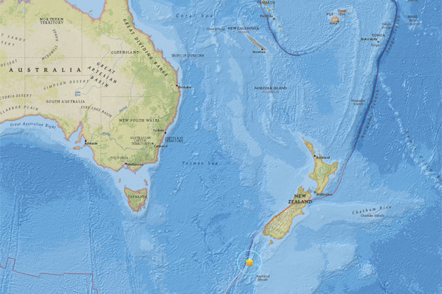
6.2 magnitude earthquake hits Auckland Islands off New Zealand

EPICENTRE: The earthquake was just 258 miles away from mainland New Zealand
© USGSEPICENTRE: The earthquake was just 258 miles away from mainland New Zealand
A 6.2 magnitude earthquake has hit the Auckland Islands off the south coast of New Zealand, according to the U.S. Geological Survey.

Earthquakes 6.0 to 6.9 can cause a lot of damage in very populated areas. News of this earthquake comes just days after a 6.4 magnitude earthquake killed at least 11 people in Taiwan.

The epicentre of the quake is said to have been just 258 miles away from mainland New Zealand.

The earthquake follows a 5.7 magnitude quake hit Christchurch yesterday, causing cliffs to collapse.

The U.S. Geological Survey says the quake struck shortly before 1930 GMT on Monday and was centered 136 miles northwest of Auckland Island. It was at a depth of 6.2 miles.

There was no immediate tsunami alert from the Pacific Tsunami Warning Center.

Minutes later, reports emerged that another earthquake hit Zacharo Town along Greece's west coast.

Attention

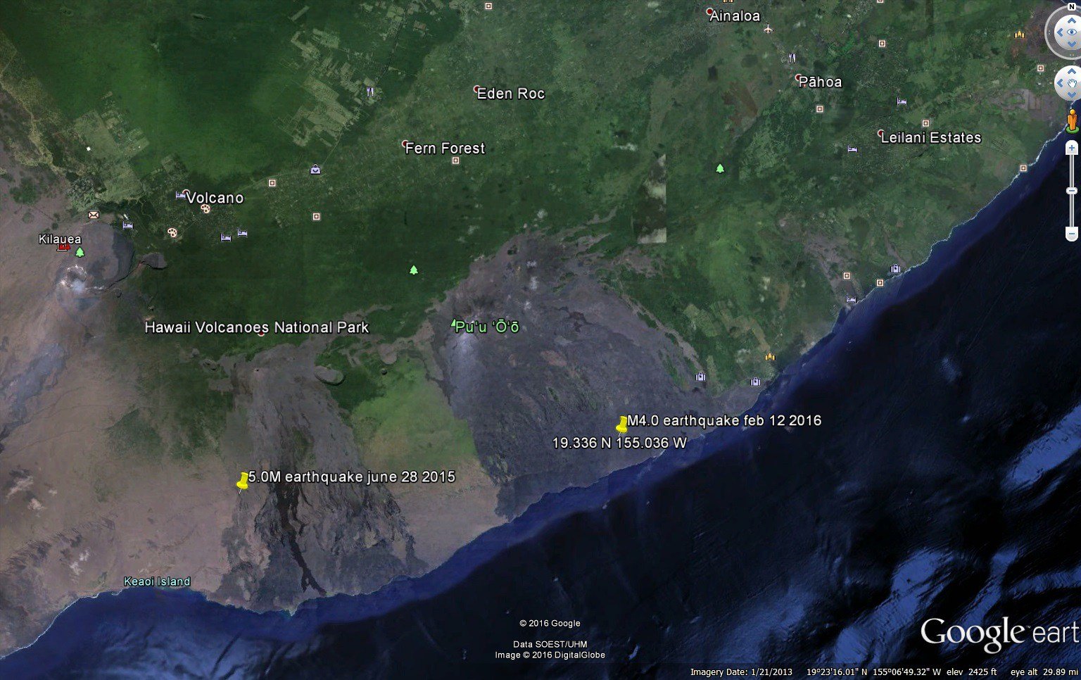
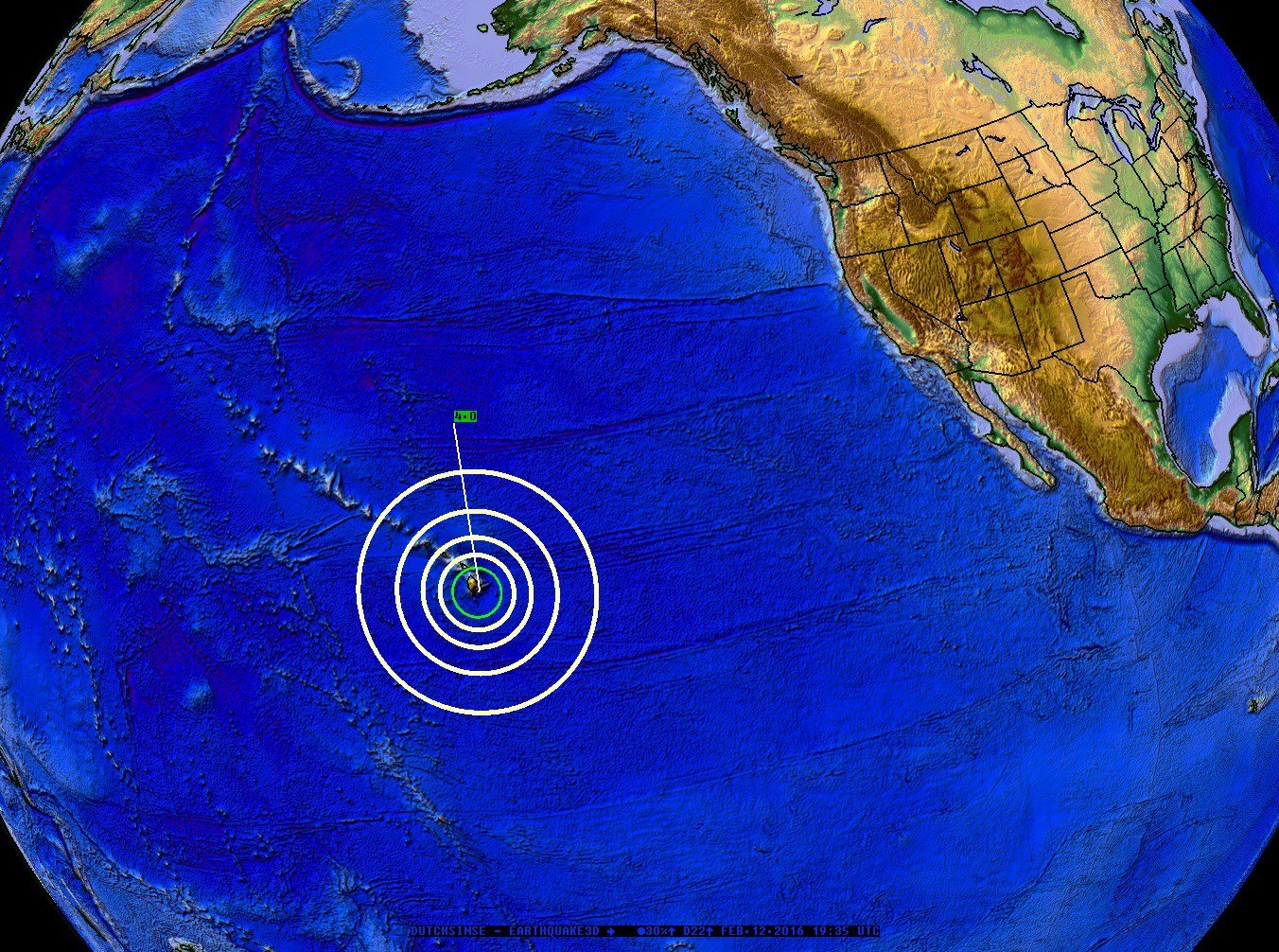
Magnitude 4.1 earthquake strikes Pu'u O'o volcano in Hawaii

Epicentre
A magnitude 4.1 (+/- 0.1) earthquake has struck on the Southern flank of Pu'u O'o Volcano in Hawaii, part of the greater Kilauea volcanic complex located on the "Big Island".

The earthquake struck in the middle of the Southern lava fields off the Pu'u O'o caldera which reaches all the way from the peak of the Volcano into the ocean (several miles away).

The earthquake may be a byproduct of large volumes of moving lava (magma) from the large flow which was observed coming from Pu'u O'o a several weeks ago.

Pu’u O’o caldera

Bizarro Earth

'Severe' magnitude 5.9 earthquake hits Christchurch, New Zealand

Christchurch earthquake
The quake hit the suburb of Sumner, about 15 kilometres east of Christchurch's city centre

Paramedics responding to calls for help after 5.9 magnitude earthquake hits New Zealand's South Island, which is still recovering from a fatal quake in 2011


Several people have been injured and a cliff has collapsed into the sea on New Zealand's South Island after a "severe" magnitude 5.9 earthquake struck close to Christchurch, which is still rebuilding following a devastating tremor in 2011.

The earthquake hit shortly after 1pm (11am AEDT) on Sunday, according to GeoNet, which monitors seismic activity in New Zealand.

It was centred 15km east of Christchurch and was 31km deep.

Paramedics were responding to a number of calls from people who fell over during the tremor. One building in the city was evacuated after items tumbled down and computer monitors smashed.


Alarm Clock

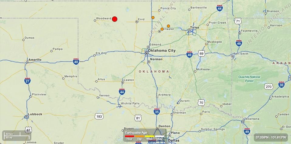
5.1 magnitude earthquake rattles Oklahoma; third largest in state's history

Oklahoma earthquake
© USGS
The third largest earthquake in recorded state history rocked parts of western Oklahoma on Saturday morning near the site of other large, recent temblors.

The quake registered a 5.1 magnitude and was recorded northwest of Fairview just after 11 a.m., according to preliminary estimates from the U.S. Geological Survey.

A 3.9 aftershock followed the earthquake, according to the USGS.

At 5.1, the temblor will be the state's third largest earthquake, according to Oklahoma Geological Survey data.

The state's largest earthquake is a 5.6 recorded out of Prague in 2011.

Saturday's quake surpassed a 4.8 recorded on Jan. 6 as this year's largest earthquake. Both the 4.8 and Saturday's 5.1 were centered near Fairview, according to USGS data.

Comment: Hundreds more earthquakes shake Oklahoma in 2015 setting new state record


Attention

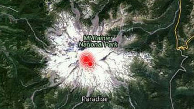
Series of earthquakes reported under Mount Rainier, Washington

Mount Rainier
A series of earthquakes were recorded under Mount Rainier Thursday morning.

The Pacific Northwest Seismic Network reports a "little swarm of quakes" shook under the mountain for about 20 minutes.
Yesterday morning, there was a little swarm of quakes under #MountRainier for 20 mins or so. https://t.co/IfDLt2iZye pic.twitter.com/vrxQgLLuwp — PNSN (@PNSN1) February 12, 2016
Don't read into the quakes too much. Earthquakes like that are fairly common, according to John Vidale of the Seismic Network. They don't signify much, he says.

"Those swarms probably appear several times a year," he added.

The stronger shaking occurred at 3:41 a.m. when a 1.45-magnitude quake was recorded.

Attention

USGS: Powerful 6.5 earthquake strikes Indonesia

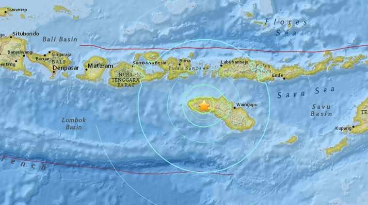
Indonesia earthquake map
© USGSScreenshot of Impact map.
A powerful 6.5-magnitude earthquake struck eastern Indonesia late Friday (Feb 12), but no tsunami warning was immediately issued, US seismologists said.

The earthquake hit at 5:02 pm local time (1002 GMT Friday), the US Geological Survey said, and was centred three kilometres (two miles) east-southeast of Andekanter in the Sumba region at a depth of 30 kilometres.

The Indonesian disaster mitigation agency said there were no immediate reports of damage or casualties.

AFP/yt

Bizarro Earth

Earthquake 'swarm' rattles village in New Brunswick, Canada

McAdam earthquake swarm
© CBCA window was cracked at Lindsey Wilson's McAdam home during a recent earthquake.

McAdam again hit by dozens of small quakes as seismologists search for answers


A swarm of small earthquakes is again rattling residents in the southwestern New Brunswick village of McAdam.

Officially, nine earthquakes hit the area on Monday night alone, coming on the heels of more than 23 temblors recorded since Feb. 1.

Mayor Frank Carroll estimates there were 20 to 30 small quakes on Monday night, with many of them not picked up by monitoring equipment located about 95 kilometres away in St. George. One of them registered 3.3 in magnitude.

No injuries have been reported and damage has been minor.

"Some people kind of describe it as a bomb going off," said Carroll.

"The community was really on edge on Monday," he said. "It was a horrific day in the world of earthquakes for us."

The village is giving all residents an "earthquake safety action plan," advising them on what to do if the quakes worsen.

Lindsey Wilson says a quake rattled her windows hard enough to break one of them.

"We've had some damage to our house. We've actually had a window get cracked on Sunday night," Wilson said.

A seismologist with Natural Resources Canada says it isn't known whether the small quakes are a precursor to a larger one.

"Magnitude 3.3 was quite a bit bigger than they had before," said John Adams. "But the pattern of activity is unpredictable."

Document

Scientists find new cause of strong earthquakes

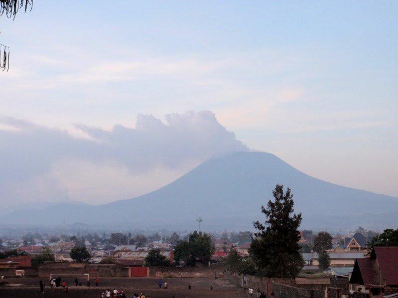
Nyiragongo volcano
© Christelle Wauthier/Penn StateNyiragongo volcano (2002)
A geologic event known as diking can cause strong earthquakes -- with a magnitude between 6 and 7, according to an international research team.

Diking can occur all over the world but most often occurs in areas where the Earth's tectonic plates are moving apart, such as Iceland, Hawaii and parts of Africa in the East African Rift System. As plates spread apart, magma from beneath the Earth's surface rises into the space, forming vertical magma intrusions, known as dikes. The dike pushes on the surrounding rocks, creating strain.

"Diking is a known phenomenon, but it has not been observed by geophysical techniques often," said Christelle Wauthier, assistant professor of geosciences, Penn State who led the study. "We know it's linked with rift opening and it has implications on plate tectonics. Here, we see that it also could pose hazards to nearby communities."

The team investigated ties between two natural disasters from 2002 in the Democratic Republic of the Congo, East African Rift System. On Jan. 17, the Nyiragongo volcano erupted, killing more than 100 people and leaving more than 100,000 people homeless. Eight months later a magnitude 6.2 earthquake struck the town of Kalehe, which is 12 miles from the Nyiragongo volcano. Several people died during the Oct. 24 earthquake, and Kalehe was inundated with water from nearby Lake Kivu.

"The Kalehe earthquake was the largest recorded in the Lake Kivu area, and we wanted to find out whether it was coincidence that, eight months before the earthquake, Nyiragongo erupted," said Wauthier.

The researchers used a remote sensing technique, Interferometric Synthetic Aperture Radar, to measure changes to the Earth's surface before and after both natural disasters.

Bizarro Earth

Strong 6.3 magnitude earthquake strikes Chile

las serena chile earthquake
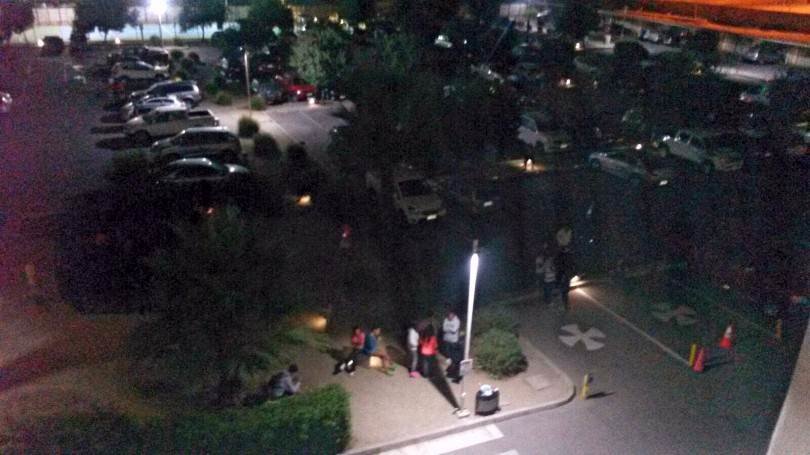
Citizens on the streets of La Serena. In some localities power outages were reported , but no major damage has been reported so far
A strong earthquake with a preliminary magnitude of 6.3 has struck off the coast of central Chile, centered off Tongoy and La Serena, seismologists say. No tsunami warnings have been issued.

Chile Earthquake
© USGS
The earthquake, which struck at 9:33 p.m. local time on Tuesday, was centered in the ocean about 48 kilometers southwest of the coastal town of Tongoy, or 89 kilometers southwest of La Serena. It struck about 19 kilometers deep, making it a shallow earthquake, according to Chile's national seismological agency.

Moderate shaking was felt in the Coquimbo Region, according to Chile's National Office of Emergency of the Interior Ministry (ONEMI). "The characteristics of the earthquake do not meet the conditions necessary to generate a tsunami off the coast of Chile," ONEMI said in an alert. No tsunami warnings have been issued.

Other details were not yet available, but there were no immediate reports of damage or casualties.

Chile and the wider region are on the so-called 'Pacific Ring of Fire' which is regularly struck by large earthquakes, including the Great Chilean earthquake that struck the coast of central Chile on May 22, 1960. The 9.5-magnitude earthquake, the largest earthquake ever instrumentally recorded, left between 490 and 5,700 people killed.