Earthquakes
S


Seismograph

Large earthquakes can trigger aftershocks on separate faults within moments causing greater damage

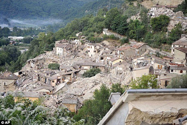
A large earthquake on one fault can trigger large aftershocks on separate faults within just a few minutes, scientists have found. The town of Pescara del Tronto was one of the worst hit with buildings flattened (pictured) by the magnitude 6.2 earthquake
A large earthquake on one fault can trigger large aftershocks on separate faults within just a few minutes, scientists have found. The town of Pescara del Tronto was one of the worst hit with buildings flattened (pictured) by the magnitude 6.2 earthquake that occurred last month
It is well known that earthquakes can cause widespread destruction to buildings and settlements close to the fault lines they occur on.

But according to a new study, the damage can be spread far further by triggering a tidal wave of aftershocks on other faults elsewhere.

A large earthquake on one fault can trigger large aftershocks on separate faults within just a few seconds, scientists discovered.

Scientists at Scripps Institution of Oceanography at the University of California San Diego discovered previously unidentified aftershocks that happened within minutes of big earthquakes.

The discovery is important for the safety of earthquake-prone regions like California - where ruptures on complex fault systems like the San Andreas fault may lead to mega-earthquakes.

In the study, published in the journal Science, geophysicist Professor Peter Shearer and graduate student Wenyuan Fan discovered 48 previously unidentified large aftershocks that occurred between 2004 and 2015.
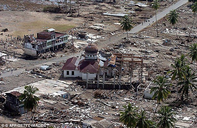
In one instance along the Sundra arc subduction zone, where the magnitude 9 Sumatra-Andaman mega-earthquake occurred off the coast of Indonesia in 2004 (aftermath pictured), a magnitude 7 quake triggered two large aftershocks over 124 miles (200 kilometre
In one instance along the Sundra arc subduction zone, where the magnitude 9 Sumatra-Andaman mega-earthquake occurred off the coast of Indonesia in 2004 (aftermath pictured), a magnitude 7 quake triggered two large aftershocks over 124 miles (200 kilometres) away

Seismograph

Severe 6.7 earthquake hits Australia's Macquarie Islands

Macquarie Island earthquake
© Google Maps
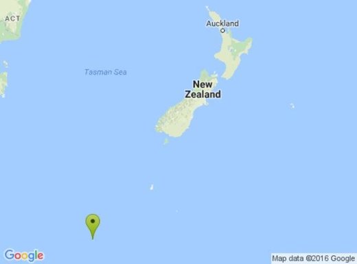
A severe quake initially believed to have hit Central Otago this morning actually struck south of New Zealand.

GeoNet initially reported a magnitude 5.3 quake had struck 30km southeast of Roxburgh, at a depth of 12km, at 9.48am.

GeoNet classified the quake as severe.

However, GeoNet later revised the strength and location of the quake.

It said the magnitude 6.7 quake actually struck west of the Macquarie Islands at a depth of 10km.

Attention

5.6 magnitude earthquake, strongest in state history, rattles Oklahoma early Saturday - revised to 5.8! (UPDATE)

Graph
© Dimas Ardian, Getty Images
An earthquake that initially has been reported as matching the strongest quake in Oklahoma's history was felt across Oklahoma early Saturday, rattling windows and waking residents.

The 5.6 quake was centered northwest of Pawnee and occurred at 7:02 a.m., according to the U.S. Geological survey.

Initial indications on social media were that the quake could be felt across the state, from central Oklahoma to northeast Oklahoma. Reports of feeling the quake also came from Texas and Kansas.

The temblor's initial measurement indicates it matches the strongest quake in state history, a 5.6 magnitude earthquake on Nov. Nov. 6, 2011, in the Lincoln County town of Prague.

Hundreds of earthquakes have shaken Oklahoma annually in recent years, but rarely have they been felt in northeast Oklahoma. Often the quakes are below 4.0 magnitude.


Comment: From USGS: "The U.S. Geological Survey is updating the official magnitude of the September 3, 2016 Pawnee, Oklahoma earthquake to Mw 5.8 (from 5.6), making it Oklahoma's largest recorded earthquake to date."


Attention

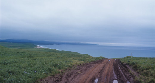
Three consecutive earthquakes strike off Russia's Bering Island

Bering Island
© RIA Novosti. Yury Abramotchkin
A magnitude 5.5 earthquake has occurred off Russia's Bering Island, followed by three more quakes of a lesser magnitude, the US Geological Survey (USGS) reports.

The quake hit at 20:07 GMT on Wednesday, about 182 kilometers (113 miles) southeast of Nikolskoye, USGS said. The epicenter of the earthquake was located at a depth of 10 kilometers (about 6 miles). There were no immediate reports of damages or casualties.

Three more quakes, with a magnitude of 4.8, 5.2, and 4.6 struck off the coast of Bering Island within three hours from the initial earthquake, according to USGS.

The depth of the aftershocks was the same as that of the initial earthquake (10km). The Bering Island is located off Russia's Kamchatka Peninsula in the Bering Sea.

Comment: A couple of days ago a shallow 6.2 magnitude earthquake struck in the same area.


Seismograph

Seismic activity recorded in Mýrdalsjökull Glacier, Iceland

Graph
© Dimas Ardian, Getty Images
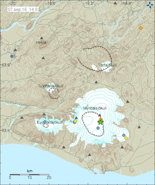
A tremor of magnitude 3.5 hit Mýrdalsjökull glacier just before 9 am today, mbl.is reports. A few aftershocks have registered since. The area is closely monitored around the clock by the Icelandic Met Office.

Close to 600 tremors were registered by the SIL monitoring network of the Icelandic Met Office last week.

A series of quakes began in Mýrdalsjökull glacier on August 29, the strongest of which measured 4.5 in the northern part of the caldera of Katla volcano. Those were the largest quakes in Katla since 1977.

The green star shows the location of today's tremor.
© Icelandic Met Office.The green star shows the location of today's tremor.

Seismograph

Three earthquakes recorded in Grant County, Oklahoma

Graph
© Dimas Ardian, Getty Images
Three earthquakes were recorded in Grant County, Oklahoma, Tuesday afternoon.

A 3.9 magnitude was recorded at 12:48 p.m, 11 miles northwest of the town of Medford, Okla. at a depth of approximately 3.3 miles. The USGS originally rated this earthquake 4.1 in magnitude. It was later downgraded to a 3.9.

A minute later, at 12:49 p.m., a 3.7 magnitude earthquake struck 12 miles northwest of Medford at a depth of about 7.5 miles.

At 1:33 p.m. another 3.5 magnitude earthquake was recorded 12 miles northwest of Medford. It was about two and a half miles deep.

Comment: See also: 5.6 magnitude earthquake, strongest in state history, rattles Oklahoma early Saturday


Seismograph

Tokyo rocked by 4.9 magnitude earthquake

Graph
© Dimas Ardian, Getty Images
An earthquake with a preliminary magnitude of 4.9 shook buildings in Tokyo on Wednesday, but no tsunami warning was issued and there were no immediate reports of damage or injuries.

Earthquakes are common in Japan, one of the world's most seismically active areas. Japan accounts for about 20 percent of the world's earthquakes of magnitude 6 or greater.

On March 11, 2011, Japan's northeast coast was struck by a magnitude 9 earthquake and a massive tsunami, triggering the Fukushima nuclear disaster.

Source: Reuters

Attention

Shallow 4.0 magnitude earthquake underneath summit of Mauna Loa volcano, Hawaii

Map Mauna Loa
© Hawaiian Volcano Observatory
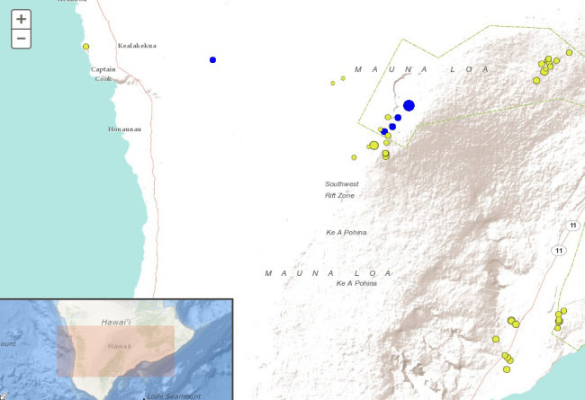
The Hawaiian Volcano Observatory recorded a magnitude-4.0 earthquake beneath Hawaii Island at 4:25 a.m. Tuesday.

The earthquake occurred underneath Moku'aweoweo, Mauna Loa's summit caldera, at a depth of 1.2 km (0.74 mi).

The USGS "Did you feel it?" website received only one felt report within an hour of the earthquake. This report described light shaking (Intensity III). The lack of felt reports is consistent with the remote location and shallow depth of the earthquake.

The earthquake appears to be isolated. As of 6:30 a.m., no aftershocks have been observed.

Magnitude-4 or greater earthquakes occurred in the summit of Mauna Loa six to seven months prior to the volcano's two most recent eruptions in 1975 and 1984. Tuesday's isolated earthquake, however, does not represent a significant departure from the seismic activity rate for the past year, so the Volcano Alert Level for Mauna Loa will remain at Advisory.

According to HVO's Scientist-in-Charge, Christina Neal, the earthquake had no apparent effect on Kilauea Volcano's ongoing eruptions.

Seismograph

Shallow 6.2 magnitude earthquake hits off Russia's Kamchatka Peninsula

Russia quake
© USGS
A strong 6.2 magnitude earthquake has rocked Russian islands in the volatile "Ring of Fire".

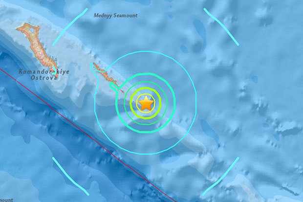
The earthquake struck in the Pacific Ocean near the Commander Islands, just off Russia's Kamchatka Peninsula, on Tuesday.

The epicenter was shallow - just 8 miles below the surface.

It was just over 100 miles south east of Bering Island, in the Commander Islands chain.

No tsunami warning has been issued yet.

But the quake is situated right on the "Ring of Fire" - which is known for it's fearsome volcanoes.

The epicentre is not far from Japan or Alaska.

Seismograph

Shallow 4.6 magnitude earthquake hits Quito, Ecuador

Graph
© Dimas Ardian, Getty Images
The Geophysical Institute of Ecuador registered it as another earthquake and not an aftershock from the 7.8 magnitude earthquake on April 16.

Another earthquake hit Ecuador's capital Quito at 7.22 p.m., local time. While only a 4.6 magnitude earthquake, the fact that it struck the capital again is alarming.

The Geophysical Institute of Ecuador registered it as an earthquake and not an aftershock from the 7.8-magnitude earthquake on April 16.

It added that the epicenter was 11.8 kilometers from Quito and its depth was at only 4.7 kilometers. Many across the city left their buildings and ran to the streets as they feared a major aftershock.