Earthquakes
S


Seismograph

The swarm won't stop: 62 earthquakes strike southeast Idaho in one day

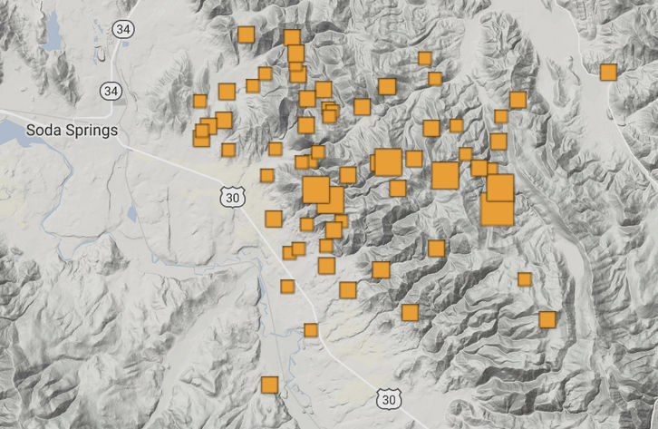
earthquake map
© University of Utah Seismograph StationsThe orange areas show the epicenters of the 62 earthquakes that occurred Saturday night through early Sunday evening in Southeast Idaho.
The strongest earthquake to hit the region in years as well as 61 smaller quakes occurred Saturday night to Sunday night in Southeast Idaho, startling tens of thousands of residents.

Authorities said it does not appear that the quakes have caused any injuries to people or damage to structures (ADVICE ON WHAT TO DO IF AN EARTHQUAKE HITS YOUR TOWN IS AT THE END OF THIS ARTICLE).

The quakes were felt in Caribou County, where all 62 occurred, as well as in cities in northern Utah and throughout Southeast Idaho. It's unknown when the earthquake swarm will end. Earthquake swarms have been known to continue for weeks or even months.

In recent decades Southeast Idaho has seen infrequent instances in which one to three weak earthquakes occur near the Western Wyoming border. Local authorities say they cannot ever remember any earthquake swarm in Southeast Idaho that comes even close to the current series of temblors shaking the region.
Seismograph

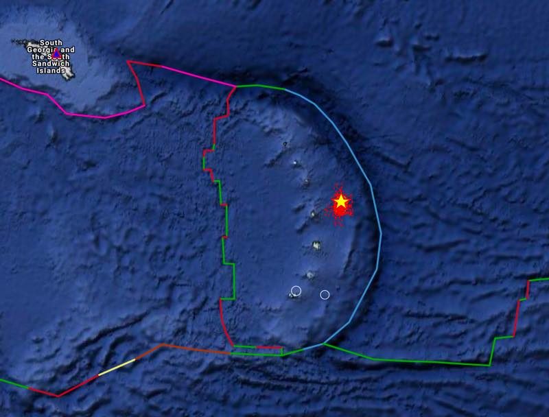
Magnitude 6 earthquake in the unpopulated South Sandwich Islands Region

Map courtesy Alomax.free.net - Star: calculated epicenter - Small red dots: possible error margin for the epicenter, the more dense, the higher probability that the epicenter will be in that area. Orange circle: epicenter location error zone
© Alomax.free.netStar: calculated epicenter - Small red dots: possible error margin for the epicenter, the more dense, the higher probability that the epicenter will be in that area. Orange circle: epicenter location error zone
Most important Earthquake Data:

Magnitude : 6

Local Time (conversion only below land) : 2017-09-04 06:07:39

GMT/UTC Time : 2017-09-04 08:07:39

Depth (Hypocenter) : 65 km

Update 09:25 UTC: earthquake in the subantarctic penguin volcanic islands region. This is an unpopulated area of the world, so no impact at all on human beings :)

Attention

Idaho is rocked by shallow 5.3 magnitude earthquake with tremors felt as far away as Salt Lake City

Idaho earthquake
An 5.3 earthquake followed by half a dozen aftershocks have struck Idaho near the state border with Wyoming, some 28 km east of Soda Springs which has a population of roughly 3,000 people, the USGS announced.

The earthquake which struck just before 6pm was registered at a preliminary 10 kilometers (6.2 mi ) depth.

Several aftershocks measuring from 3.1 to 4.1 magnitude have been recorded following the initial quake.

It is not yet known if the earthquake caused any damage or injuries, but Fox 13 local news reports that it received several calls and messages from people who felt tremors as far as the state of Utah.

Seismograph

Yellowstone earthquake swarm now one of largest on record, with over 2,300 tremors since start of June

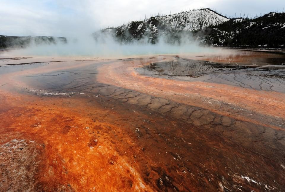
View of the Grand Prismatic hot spring in Yellowstone National Park.
© Mark RalstonView of the Grand Prismatic hot spring in Yellowstone National Park
An ongoing earthquake swarm at Yellowstone volcano is now one of the biggest ever recorded, with over 2,300 tremors since it began in June.

As of August 30, 2,357 earthquakes had been recorded. The most powerful in recent weeks was magnitude 3.3; it took place on August 21.

The most powerful in the current swarm was a magnitude 4.4, which was recorded on June 15. Most of the earthquakes were in the magnitude 0 or 1 range, with a further 181 recorded at magnitude 2 and 11 at magnitude 3. Another 53 were less than 0, meaning they were very small events that could be detected only with sensitive earthquake-monitoring instruments.

Jamie Farrell, a research professor at the University of Utah, which is involved in monitoring seismic activity at Yellowstone, told Newsweek that the swarm was "nothing out of the ordinary" and that it had "slowed down significantly but does occasionally have little bursts of activity that lasts for a few hours."

Seismograph

Magnitude 5.2 earthquake shakes Greek island of Rhodes

Rhodes earthquake
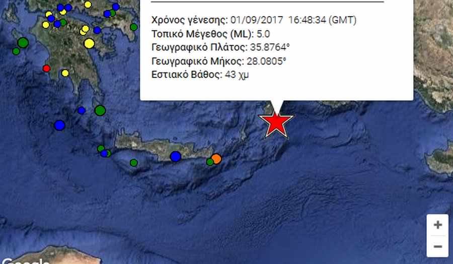
A magnitude 5.2 earthquake hit south east off the coast of the island of Rhodes at 19:48 (local) on Friday, according to the Greek Department of Geophysics at the University of Athens.

The quake's epicenter was located in the Aegean Sea at a depth of 43km below the seabed. There are no reports of injuries, or damages.

Earthquakes have historically caused widespread damage across central and southern Greece, Cyprus, Sicily and other neighboring regions.

Seismograph

BREAKING: Huge 6.2 magnitude earthquake strikes off coast rocking Indonesia

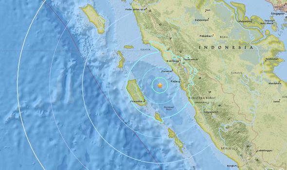
A huge earthquake has struck Indonesia
© USGSA huge earthquake has struck Indonesia
The quake registered 6.2 magnitude on the richter scale and happened just off the coast of Padang.

Witnesses have reported feeling the impact of the quake on the mainland as it shook homes.

The quake strike at around midnight local time.

One witness said: "Enough to wake me from sleep and long enough to make me panicked"

Another said: "This tremor feels quite strong. Lamp shaking, and you can felt it when you are standing."

Seismograph

Shallow magnitude 5.2 earthquake hits off the coast of Guam

chart
A magnitude 5.2 earthquake struck Wednesday to the southeast of the island of Guam.

The quake hit a little after 6 p.m. local time, about 4 a.m. ET, according to the U.S. Geological Survey. Its epicenter was about 50 miles southeast of Inarajan, a community of 2,300 people, at a depth of about 6 miles.

The area, about 20 miles south of Guam's capital of Hagåtña, had no reports of damage or injuries, according to emergency dispatchers, said Jenna Gaminde, Guam Homeland Security spokeswoman.

The National Weather Service issued no tsunami watches or warnings. The intensity of the quake is considered moderate: Nearly everyone feels it, but damage is slight.

Seismograph

26,290 earthquakes recorded for Turkey in first 7 months of 2017; most seismic activity for 15 years

eARTHQUAKE WATCHERS
A total of 26,290 earthquakes have rocked Turkey over the first seven months of the year, marking the most seismic activity the country has experienced in 15 years, according to data from the Disaster and Emergency Management Authority (AFAD).

The earthquake distribution map at the AFAD earthquake department in the capital Ankara showed that the country's western regions had been particularly badly shaken by a series of earthquakes.

According to the map, a total of 20,143 earthquakes were recorded across Turkey last year, contrasting with the 26,290 earthquakes recorded between Jan. 1 and Aug. 16.

The quakes were particularly intensified in the Marmara and Aegean regions, which had an average of five earthquakes of varying sizes per day. The map revealed that earthquakes were most commonly observed in the Istanbul-Çanakkale-İzmir-Muğla fault line.

Seismograph

Shallow 6.6 magnitude earthquake strikes off Papua New Guinea's north-east coast

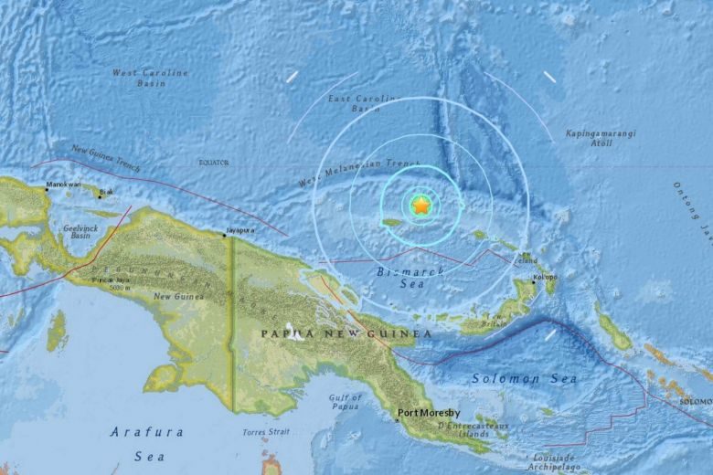
An undersea earthquake measuring 6.6 magnitude struck off Papua New Guinea's north-east coast on Sunday
© USGSAn undersea earthquake measuring 6.6 magnitude struck off Papua New Guinea's north-east coast on Sunday
An undersea earthquake measuring 6.6 magnitude struck off Papua New Guinea's north-east coast on Sunday (Aug 27), but there was no tsunami threat, said the Hawaii-based Pacific Tsunami Warning Centre.

The quake struck at a shallow depth of 10km just off Papua New Guinea's Manus Island, said the centre.

Source: Reuters

Bizarro Earth

Predictions of earthquakes following last eclipse

Predictions
© Sunday Guardian Live
Shakeel Ahmad, a well known cloud reader from Varanasi, has predicted powerful to medium earthquakes and strong tidal waves in several countries, including North and South America, Turkey Japan, China, Taiwan, Philippines, Indonesia, Australia and New Zealand. This, he says, will be in the aftermath of the solar eclipse that took place on Monday night.

Shakeel Ahmad, who has predicted several earthquakes by studying formations and patterns of clouds, says that on Monday he observed cloud patterns that are known to signify earthquakes on land and in sea.

"I have, once again, observed the earthquake predicting clouds indicating the first warning signal. A disturbance was noticed in the ionosphere which was due to the condensation of clouds in S E-140 to E N-45 direction. By the magnetic compass from Varanasi, these clouds began to move towards this direction EN-45 to NW-310 and SE-150 to SW-240 and SE-140 to EN-45 direction too," he says.

Ahmad says that on this basis, he predicts powerful and medium earthquakes, tsunami and tidal waves.