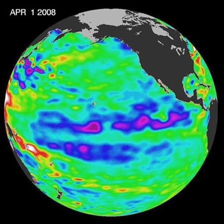
The La Nina weather anomaly will persist into the spring of 2009 but should gradually weaken during that period, the U.S. Climate Prediction Center said on Thursday.
In a monthly update, the CPC said "a majority of the model forecasts ... indicate a gradual weakening of La Nina through February-April 2009, with an eventual transition to neutral conditions."
CPC is an office under the National Oceanic and Atmospheric Administration (NOAA). The body said La Nina will last into spring of this year.
La Nina literally means "little girl" in Spanish. It results in cooler-than-normal waters in the Pacific Ocean. The more famous El Nino weather phenomenon has the opposite effect.
Scientists believe La Nina spurs hurricane formation in the Atlantic basin by hindering wind shear that breaks up storms as they form.
CPC said the potential impact of La Nina during February to April 2009 include above average precipitation in the Ohio and Tennessee valleys and below average rainfall in the southwestern and southeastern United States.
It said the other impacts are below average temperatures in the Pacific Northwest and above average temperatures in much of the southern United States.
Indonesia, the most populous country in Southeast Asia and a major producer of coffee, cocoa, palm oil and other agricultural products, could get above average precipitation, the CPC added.
El Nino -- which means ' little boy' in Spanish -- wreaks havoc in weather patterns across the Asia-Pacific regions. The most devastating struck in 1997/98 when it caused withering drought in Australia and Indonesia while spawning floods in Peru and Ecuador.
It was named after the Christ child by Latin American anchovy fishermen in the 19th century who first took note of the weather anomaly.


Reader Comments
to our Newsletter