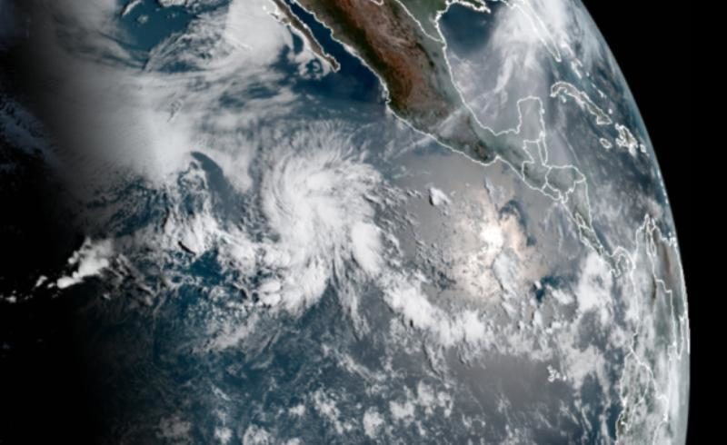
Tropical Depression One-E formed three weeks before the official May 15 start of the eastern Pacific hurricane season. No storm on record has formed this early in the year in the basin, with reliable records here stretching back to the beginning of the satellite era in 1966, according to the National Hurricane Center.
Forecasters expect the tropical depression to maintain its strength before dissipating in the next day or two; however, if it does manage to strengthen into a tropical storm, its name will be Amanda.
This tropical depression took advantage of a perfect window of opportunity. A tropical wave developed broad rotation within an area of lower wind shear and sea surface temperatures around 80°F. A persistent cluster of thunderstorms within the wave allowed a closed center of circulation to take root at the surface and organize the system into a tropical depression.
Hurricane season in the eastern Pacific Ocean doesn't begin until May 15. But the dates that start and end a hurricane season aren't hard cutoffs. These seasonal windows are driven by climatology; the vast majority of storms form within the six-month hurricane season, but some can and do form outside of those dates.
While preseason storms are rare in the eastern Pacific, it's not terribly uncommon to see early storms over in the Atlantic Ocean. The basin's hurricane season officially begins on June 1, but the last five hurricane seasons — 2019, 2018, 2017, 2016, and 2015 — all saw their first named storms before June 1. That was an unprecedented stretch for early-season formation in the Atlantic, and it remains to be seen if the basin will continue this streak next month.


Reader Comments
to our Newsletter