
The storm lasted around 3 days and affected areas from Sacramento County to Los Angeles County. The worst of the storm is now thought to be over and many of the flood warnings have been cancelled.
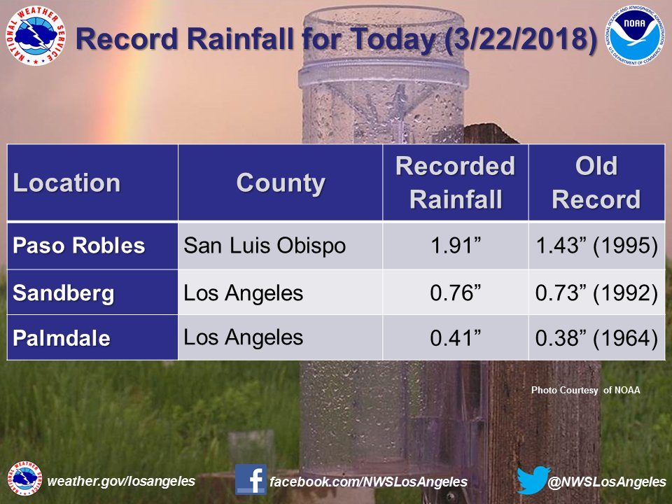
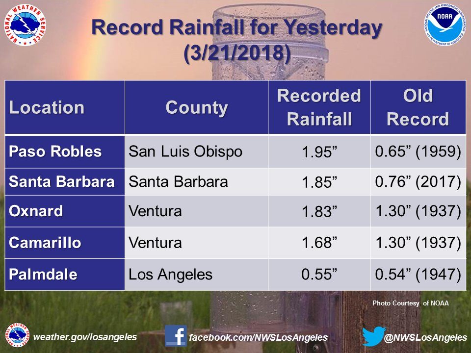
Paso Robles in San Luis Obispo County recorded 1.91 inches (48.54 mm) of rain in 24 hours to 22 March. Storm total rainfall for Paso Robles was 4.26 inches (108.2 mm) as of 17:00 on 22 March.
National Weather Service said that an automated gauge at El Rio (near Oxnard) in Ventura County reported 0.64 inches (16.25 mm) of rain in 1 hour during the evening of 22 March.
Flood rescues
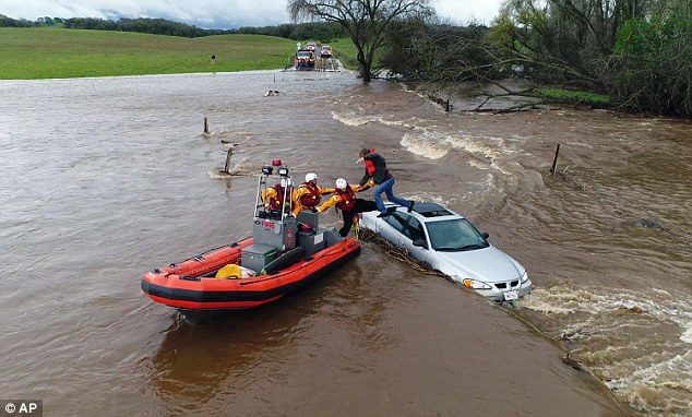
According to Associated Press reports, at least 16 people were rescued from flood waters during the storm. No fatalities were reported.
Two people were rescued by passers-by after their vehicle was swept away by flood water in Canyon Country in the city of Santa Clarita.
Emergency teams were called on to carry out rescues in the Salinas River in San Luis Obispo County (10), Los Angeles River in the Sepulveda Basin (1), Tuolumne County (2) and in Folsom, Sacramento County (1).
Evacuations
On Tuesday, 20 March, authorities issued evacuation orders for around 30,000 people in Santa Barbara County, including Montecito, the location of the catastrophic mudslides in January this year.
Areas of the county suffered major burns scars in the forest fires last year making them particularly vulnerable to mudslides. This is the fifth time some residents of the county have evacuated since the fires.
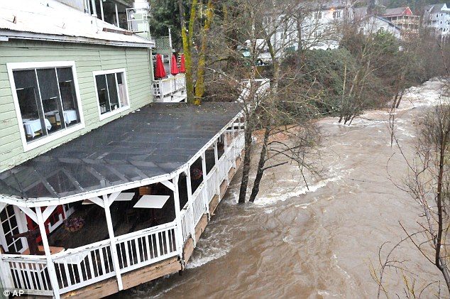
Some flooding and debris flows affected some areas, closing roads. Overall Santa Barbara County escaped the worst of the storm this time around. Evacuation orders were lifted on Thursday.
Mark Johnson, National Weather Service meteorologist, said that the debris basins and creek clearings had done their job.
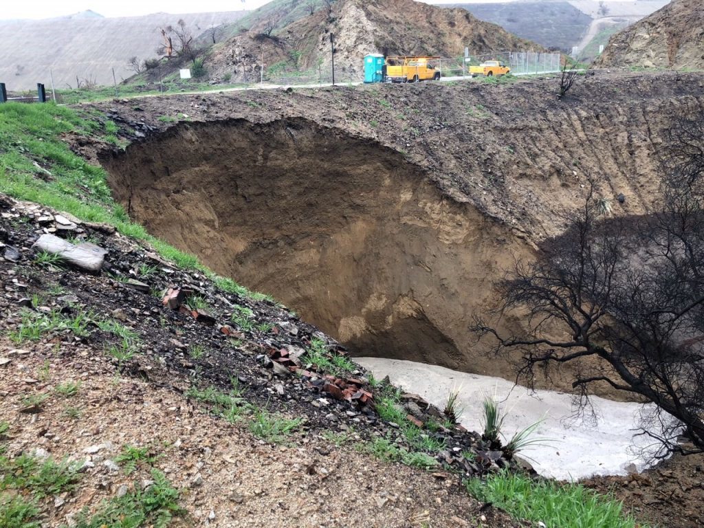
Los Angeles County also cancelled evacuation orders for Kagel Canyon, Lopez Canyon, and Little Tujunga. However, as of 22 March, evacuation orders La Tuna Canyon area remained in place due to a landslide in the area.
Pineapple express
The storm was described as the "Pineapple Express", a type of atmospheric river (a long, narrow regions in the atmosphere that transport large amounts of the water vapour from the tropics) which brings in vapour from waters around the Hawaiian Islands to the US West Coast.
Previous examples of the Pineapple Express in California can be found here for February 2017, January 2017, February 2014 and December 2014.


Reader Comments
to our Newsletter