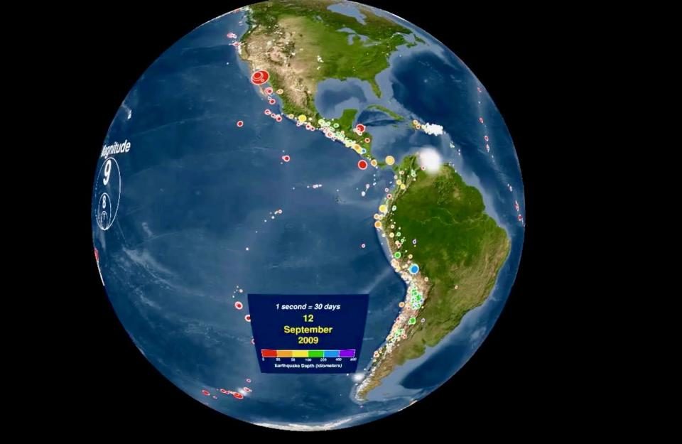
© NOAACompilation of every earthquake around the world
The National Ocean and Atmospheric Administration (NOAA)
released an animation last year that displays every recorded earthquake between January 1, 2001, and December 31, 2015. Despite the fact that this video was released several months ago, it's a remarkable way to visualize Earth's plate boundaries and the dynamic changes in Earth's crust.
Can you pick out the Pacific Ring of Fire, the Mid-Atlantic Ridge, the collision of India with Eurasia, the building of the Andes? So much information is packed into one animation it's worth discussing what earthquakes tell us about global plate tectonics and mountain building.
The video is both color coded by earthquake depth and sized dependent on the magnitude. Hotter colors represent shallower earthquakes whereas cooler colors represent deeper earthquakes up to 800 km. The circles are sized based on magnitude but then shrink as to not obscure subsequent earthquakes. At the end of the video, there is a compilation of every earthquake in that 15-year time frame, earthquakes with magnitude larger than 6.5 and those with a magnitude larger than 8.
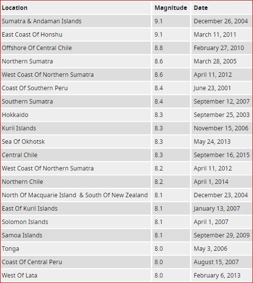
Some of the most notable earthquakes in this time period include the 9.1 magnitude earthquake in Sumatra in 2004, the 8.1 M in Samoa in 2009, the 8.8 M in Chile in 2010 and the 9.0 M off Japan in 2011. In the 15 year window, there were 20 earthquakes larger than 8.0 M and two larger than 9.0 M (see table below).
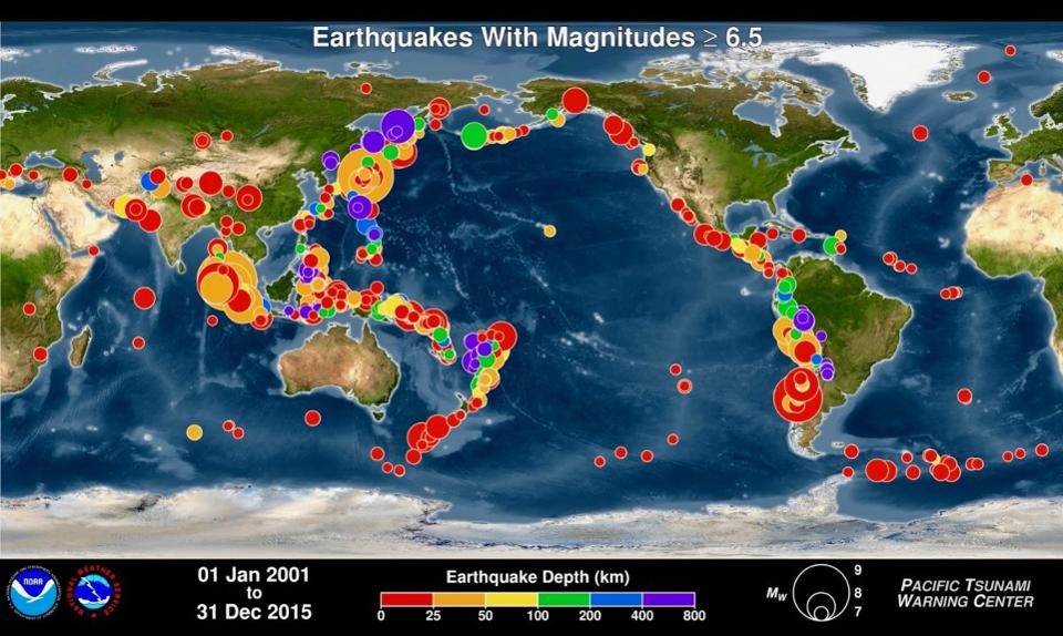
© Pacific Tsunami Warning CenterEarthquakes larger than 6.5 M
© Unknown
If you look at a map of every earthquake in the past 15 years side by side with a map of plate tectonics you can immediately see the similarities. This is because most earthquakes on Earth are triggered by movement of plates, specifically at plate boundaries.
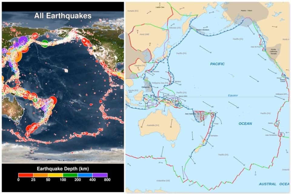
© NOAA & WikipediaComparison of global earthquakes with plate tectonics map
After watching the video you will notice that there is a circular ring of earthquakes along the edges of the Pacific Ocean. This is called the Pacific Ring of Fire and is due to the subsidence of the Pacific plate underneath continental plates to the East, North, and West.
You can pick out small earthquakes on the big island of Hawaii as the hot spot continues to erupt in the middle of the Pacific Ocean. Also, notice the increasing number of earthquakes in Oklahoma associated with oil and gas industry's salt water injection wells.
You will notice that the largest earthquakes are typically associated with convergent plate boundaries like the Himalayas. Whereas earthquakes along strike-slip boundaries like the San Andreas fault in California or divergent plate boundaries are typically limited to earthquakes less than 8.0M.
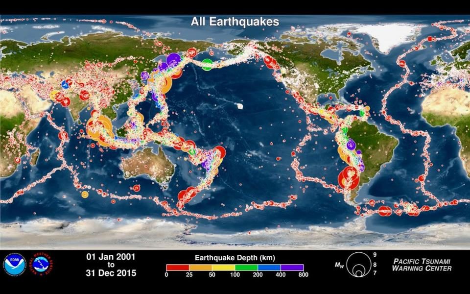
© Pacific Tsunami Warning CenterAll earthquakes globally from 2001 to 2015
There is an incredible amount of information displayed in this video, allowing you to further understand the geology of your home town, state, or country. Take some time to watch the video and post any questions you may have below.


Reader Comments
to our Newsletter