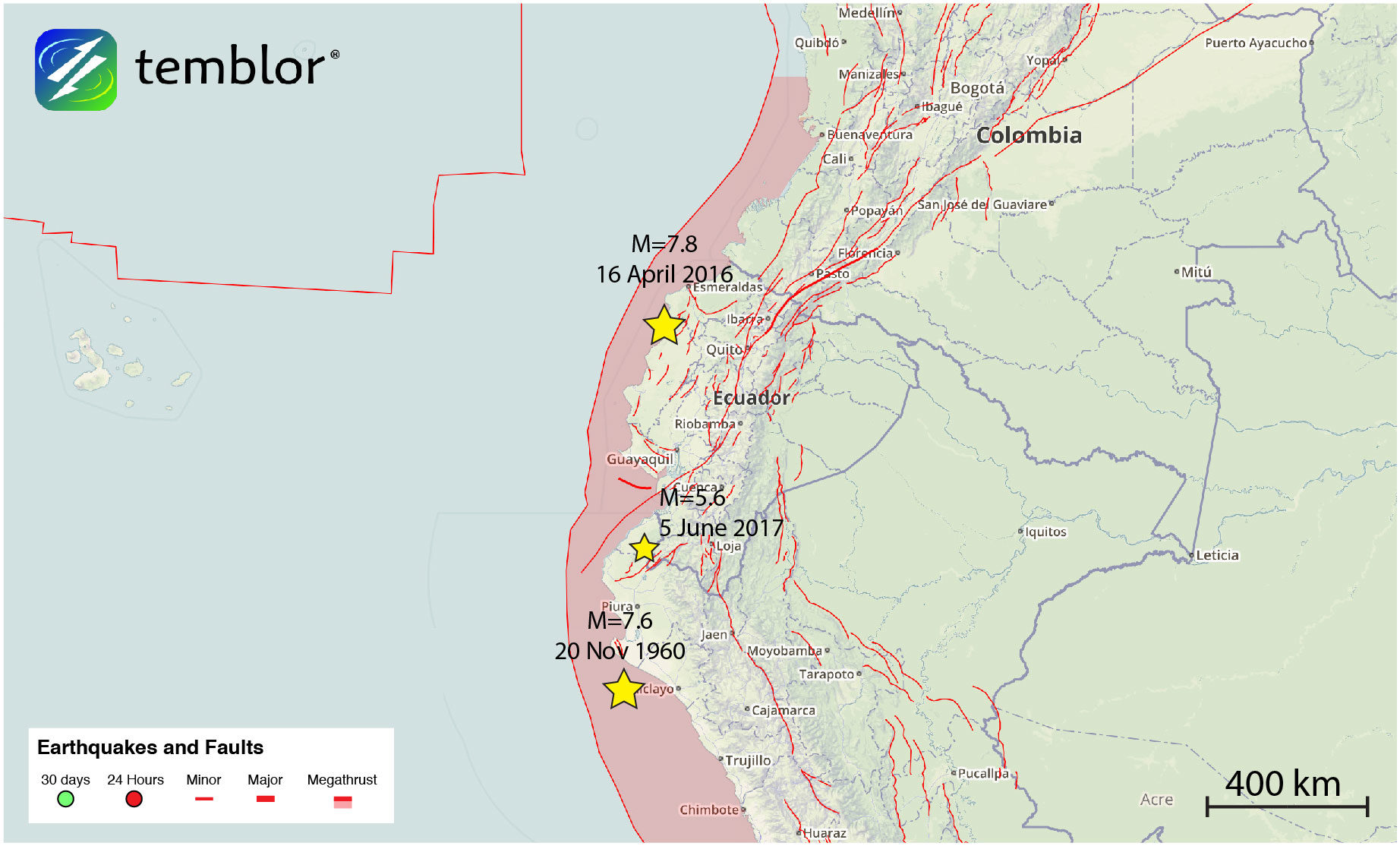
Based on the reported depth from both the USGS (52 km) and the EMSC (60 km), and the thrust focal mechanism, this earthquake likely occurred on the subducting slab where the Nazca Plate slides beneath the South American. By examining the Slab 1.0 model from the USGS' Gavin Hayes (which is also visible in Temblor as 'Megathrust Zones'), the subducting slab should be between 50 and 60 km depth in the location of today's earthquake. Therefore, a minor slip event on the subduction zone is the likely cause of the quake.
While this was a small earthquake, this location, and nearly the entire western margin of South America is prone to large, damaging earthquakes. The Peru-Chile Trench, which marks where the Nazca Plate begins subducting beneath the South American Plate, lies only 20-60 km offshore. It should also be pointed out that even though western South America is at risk of large earthquakes, the behavior of the subducting slab varies greatly. In much of southern Peru, northern Chile, and southern Chile, the slab dips at angles of 25° to 30°. However, in southern Ecuador, and central Chile, the slab dips at 10° or less. In these areas of "flat-slab" subduction, crustal earthquakes within the overlying South American Plate are common. In fact, in 1970, a M=7.2 earthquake just to the west of today's quake killed at least 80 people and caused liquefaction. This quake occurred at a depth of 25 km, suggesting it was likely an upper crustal event.
Based on the Global Earthquake Activity Rate (GEAR) model, which is available in Temblor, today's M=5.6 earthquake should not be considered surprising. This model uses global strain rates and seismicity since 1977 to forecast what the likely earthquake magnitude is in your lifetime anywhere on earth. From the Temblor map below, one can see that around the location of today's event, a M=6.75+ is likely. Therefore, while the moderate event today may not have caused damage or loss of life, this region of South America, like the rest of the continent is prone to experiencing large and damaging earthquakes.
References
USGS
European Mediterranean Seismological Centre


Reader Comments
to our Newsletter