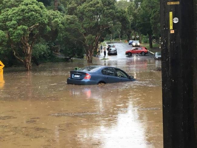
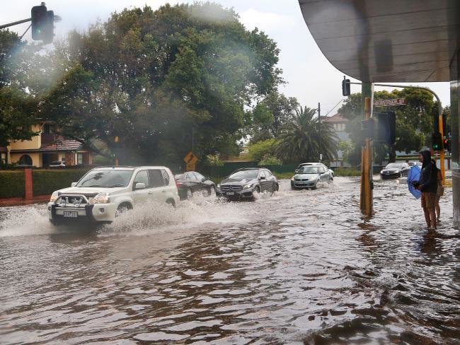
Torrential rain hammered Melbourne from about 3pm as roads turned into rivers and flash flooding wreaked havoc.
Major arterials were closed, leaving drivers stranded. The Western Ring Road at Plenty Rd — and dozens of other Victorian roads — remained closed in both directions as of 11.15pm on Thursday, according to VicRoads' website, while the SES had received more than 1500 calls for assistance
Metro Trains was still reporting delays across most of the network, with sections of Sandringham, Hurstbridge and Belgrave lines still suspended as of 11.15pm.
The reason for the traffic on the ring road...more a river than a puddle #victraffic #melbweather @VicTraffic pic.twitter.com/2akzyCZaTC
— Sharnel Amber (@sharnelc) December 29, 2016
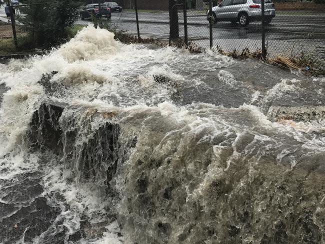
The reason for the traffic on the ring road...more a river than a puddle #victraffic #melbweather @VicTraffic pic.twitter.com/2akzyCZaTCA moderate flood warning was issued to Coburg and Northcote residents as Merri Creek's water level rose. The creek is expected to peak at 3.2 metres on Friday.
— Sharnel Amber (@sharnelc) December 29, 2016
A minor flood warning has been issued for the Yarra River at Heidelberg, Fairfield and Abbotsford, while an earlier flood warning issued for Elsternwick Canal has been downgraded to minor.
Dozens of flights were delayed at Melbourne airport, with planes forced to circle for more than an hour with visibility of only 100m and wind gusts of 95kmh.
Airfield staff were forced to retreat from the tarmac as the risk of lightning strikes heightened just before 3pm.
"We've had a few gaps in the weather where we've been able to get some flights out," an airport spokesman said.
Bureau of Meteorology forecaster Michael Efron said the highest rainfall was recorded just north of Sunbury, with 84mm. But while some suburbs were saturated, others were almost dry.
"The outer western suburbs escaped the worst of it. St Albans only had 7mm but Melbourne airport had 54mm, so it just shows how thunderstorms can be hit-and-miss," he said.
VicRoads urged motorists to drive with caution with dozen of roads across the state closed due to flooding.
Severe flooding has been reported in dozens of suburbs.
The Sandringham line shut down due to flooding near Prahran railway station. A passenger tweeted footage of a train on the line inching forward through water:
Hey @metrotrains - good to see you do boat services now #sandringham #melbweather #metrotrains pic.twitter.com/Zq19PnqiabAnd a car tried to drive through floodwaters under the Montague St bridge, but came unstuck while a man tried a spot of fishing in the background:
— Matt LaPorta (@mattylp) December 29, 2016
Montague street underpass... No, no, don't do it!! Too late... (complete with a bloke fishing at the end) @9NewsMelb pic.twitter.com/DqiB2DChVE
— Kieran Jones (@kieranjones_9) December 29, 2016
Montague street underpass... No, no, don't do it!! Too late... (complete with a bloke fishing at the end) @9NewsMelb pic.twitter.com/DqiB2DChVE
— Kieran Jones (@kieranjones_9) December 29, 2016
Elwood Canal full to the point of bursting, warning messages from the SES in phone, be safe out there #melbourneweather pic.twitter.com/6uj9qGT0Xg
— Mathew Langdon (@mnlangdon) December 29, 2016
Elwood Canal full to the point of bursting, warning messages from the SES in phone, be safe out there #melbourneweather pic.twitter.com/6uj9qGT0XgMr Efron said the thunderstorm drenching the capital city was the "remnants" of the system in Central Australia earlier this week.
— Mathew Langdon (@mnlangdon) December 29, 2016
He said revellers planning on hitting the city tonight, may want to change their plans, with showers and storms expected into the evening.
"We've got severe thunderstorm activity across the melbourne area extending into northern victoria as well as west Gippsland," he said.
"With that thunderstorm activity we have seen flash flooding across much of southern Melbourne, around St Kilda, Elwood and Elsternwick.
"Some of the rainfall totals we have seen have been in excess of 50mm.
"In the Seymour area we have had 68mm since 9am."
He said the heaviest falls across the state were recorded in St Kilda, with 26mm falling in the 30 minutes up to 3.30pm, while 40mm dumped on Mt Macedon in the half-hour to 4pm.
Mr Efron said the conditions were like what you would see in Darwin in the NT, with another humid night ahead.
"It's as a result of northerly winds transporting very moist air across southeastern Australia from the tropics," he said.
"Conditions in Melbourne today are very similar to what you would see in Darwin at this time of year. A combination of high temperatures and humidity as well.
"The humidity won't drop until tomorrow morning."



First we had the summer that never was at the start of December, then we have tropical conditions at the end of the month. If there was someone in charge of weather 'up there', they've pretty much lost the plot! Even my plants are getting confused.