It's the study of prehistoric storms. The word pops up near the end of the new paper in Nature describing "Grey swan tropical cyclones" (Nature, as always, favors the British spelling of "gray"). My colleague Chris Mooney describes this new research on the E&E blog.
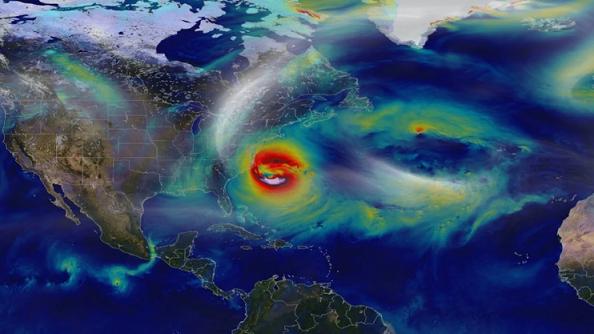
The paper has some jaw-dropping calculations, most notably that it is not inconceivable that in the hotter climate at the end of this century, a mega-storm could ride up along the shallow waters of Florida's Gulf Coast, take a sharp turn into Tampa Bay and (boosted by something called "Kelvin Waves"*) produce as much as a 36-foot storm surge at the head of the bay.
That would be, to say the least, a sub-optimal situation. Put it in 72-point type: Megastorm Threatens Bern's Steak House.
Of course, such a Tampa-blasting mega-storm isn't likely to happen. Nor is it likely that a monster storm will careen into the Persian Gulf and clobber Dubai -- another scenario entertained by the authors of the new paper. They are using computer models and the historical record to try to get an estimate of how frequently three vulnerable cities (the third is Cairns, Australia) could be hit by anomalously huge storms in the coming decades. These are places where the geography and bathymetry (lots of shallow water in particular) could amplify the devastation. In the case of Tampa, the authors can envision a low-probability, high-consequence event in which the bay essentially dumps its contents on the city and surrounding areas like a tipping bathtub.
Climate change is factored in, and that obviously amplifies the uncertainty. But there's a deeper point here: The future might include events with which we are totally unfamiliar.
The past is prologue, but it's not a fetter. You know how we are: We think certain things don't happen here. But don't be so sure about that.
The possibility of "gray swan" storms is not merely the result of climate change, but also the result of our short memories and limited historical record (which is why we need help from the paleotempestologists!).
There are natural phenomena out there that have long return times -- which gets us to the earthquake discussion. Earthquakes have a bad habit of violating our expectations. We wrote about this a few years ago after the huge tsunami-generating earthquake off the Tohoku coast of Japan. There may be earthquakes with "return" times of several thousand years or more:
Humans can be gifted at perceiving patterns in nature. We can also imagine patterns that do not exist. We can focus our attention on too narrow a frame. It is the special challenge of earthquake scientists that they must contend with terrestrial forces that exist outside the frame of human lifetimes, or even the lifetimes of entire civilizations. Some geologic faults may endure thousands of years of strain before a catastrophic rupture.The point here is not that we're insufficiently afraid of disasters. Only that we should be humble about our understanding of the natural world and what might be coming our way. Heed the uncertainties.
That also means avoiding simplistic metrics. There have numerous reports in recent months about the nearly decade-long drought in "major" hurricanes making landfall in the U.S. Here's one from weather.com. The problem is that "major" is defined very narrowly as a storm that at landfall is a Category 3 on the Saffir-Simpson scale. That scale needs to be put out to pasture. Storms have many ways of being damaging. Sandy wasn't even a hurricane and you saw what it did to New York City. Hurricane Ike was right on the cusp of a 3 when it hit Galveston (sure seemed like a major hurricane to me!).
My colleague Jason Samenow of the globally famous Capital Weather Gang tells me:
Sandy was "only" a category 1-equivalent hurricane (or technically a "post tropical cyclone") when it made landfall near Atlantic City, but was one the costliest natural disasters on record in the U.S.And this morning, Kerry Emanuel, co-author of the new Nature paper, chimes in by e-mail:
The Saffir-Simpson scale - on which hurricanes are rated from 1-5 - is only an indicator of the storm's maximum sustained winds. The Saffir-Simpson scale does not provide information about a hurricane's rainfall, which often results in life-threatening flash flooding. Nor does it tell how you the size of the storm surge, the rapid rise in water accompanying a landfalling storm that can inundate low lying coastal areas, frequently the most destructive and deadly hazard in a hurricane.
Meteorologists are increasingly de-emphasizing this number in favor of an all-hazards approach to communicating the risks of hurricanes.
"I and many of my colleagues agree ... that it is time to retire the Saffir-Simpson Scale. The question is what (if anything) to replace it with. Perhaps something simple, like three colors, that indicate the overall magnitude of the risk."
Question: What's the color equivalent of "This one goes to 11"? (Code Purple?)
[*"These waves form when the storm travels along the west Florida coast and propagate northwards along the Florida shelf, enhancing the coastal surges, especially when the storm moves parallel to the shelf and at comparable speed to the wave phase speed. This geophysical feature makes Tampa Bay even more susceptible to storm surge."]


Comment: The uncertainties aren't as uncertain as we might think (or hope) them to be. While modern record keeping of meteorological events only go so far, our history is rich with examples of megastorms that when read with a discerning eye indicate that we may very well see these types of events again during this time loop.
See also: Future forecast? Hurricanes 'unlike anything you've seen in history'