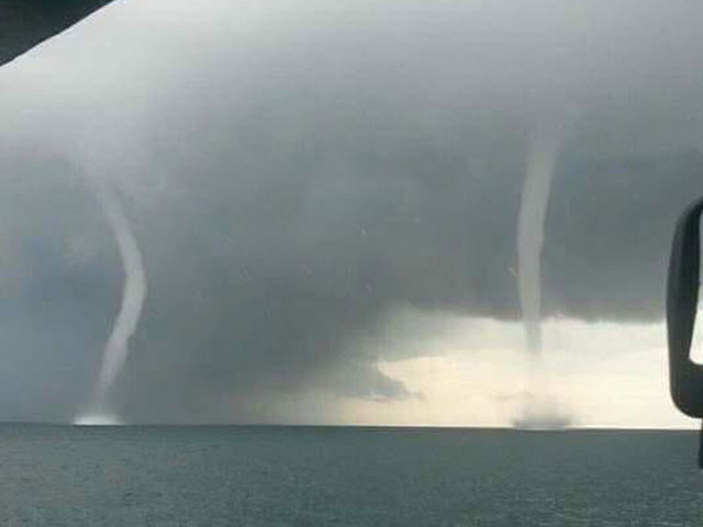
The moment was captured by Twitter user @FullGrd_FgtGear.
The picture was taken over the Caloosahatchee River off the coast of Cape Coral at about 10:45 a.m.
@ericfisher hey man. Cape coral Florida is a mess right now. pic.twitter.com/GFih6OrvDX
— Full Guard (@FullGrd_FgtGear) August 27, 2015Read below as Storm Team 5 Meteorologist Tyler Mauldin explains how waterspouts form.
Waterspouts feed off a temperature contrast between the atmosphere and ocean; air rises when the ocean temperatures are warmer than the air above the water.
When the air rises, it starts to condense into water droplets, and at times, the wind lines up just so that these water droplets start to spin. ...this is when a waterspout starts to form.
There are exactly 5 stages of waterspout formation:
1. Dark spot forms on the surface of the water (low pressure forming).
2. Wind shifts and starts to spiral (low pressure has formed).
3.Sea spray begins to spiral upward - also known as the spray vortex (condensing air).
4. Funnel cloud stretches from the cloud all the way to the water (most mature stage).
5. Sea spray and funnel cloud become disconnected (waterspout begins to decay). It's thought to believe rain from the parent cloud causes the waterspout to dissipate, and this makes complete sense. When rain falls, it cools the air through evaporational cooling.
This causes the temperature contrast between the ocean and atmosphere to lessen; thus removing the energy for the waterspout.
Waterspouts are most prevalent during the hours of 4 p.m. to 7 p.m. and normally form around 20,000 feet in the air.


Reader Comments
to our Newsletter