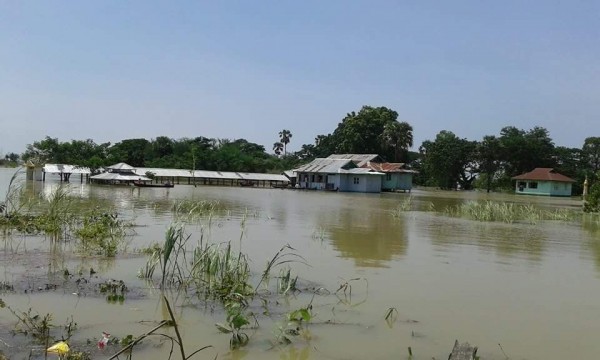
© Medical Teams InternationalFloodwater in Myanmar
The UN Office for the Coordination of Humanitarian Affairs (OCHA) in Myanmar have confirmed that the death toll of the flood disaster now stands at 103.
Heavy monsoon rainfall, combined with rain brought in the wake of Cyclone Komen, resulted in widespread flooding during early August 2015, affecting all but a few regions or states of the country.More heavy rain has fallen since then, and river levels are still high, posing a risk for communities living along river banks. WMO report that Kyaukpyu in Rakhine State saw 86.9 mm of rain in 24 hours to 17 August 2015.
OCHA figures also say that 1,152,490 people have been critically affected by the floods, which have left 15,239 houses destroyed.During a meeting on relief and resettlement for flood victims of 14 August 2015, United Nations Resident and Humanitarian Coordinator in Myanmar, Ms. Renata Dessallien said that a precise picture of the flood damage is yet to be determined.
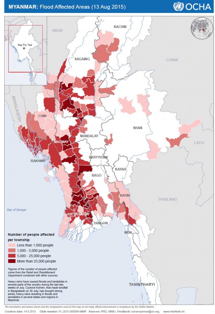
"We know that the impact of the heavy rains, floods and landslides are extensive but we are yet to fully determine the extent. Immediate needs are nation-wide with a particular focus on the hardest hit areas of Chin, Magway, Sagaing and Rakhine. But we also know that the flood waters have moved south and evacuations have occurred in Bago and Ayeyarwaddy."

© Medical Teams International

Medical Teams International
Renata Dessallien said, "
I know that Myanmar farmers are at a critical phase in the cropping calendar where rice must be planted in less than two weeks, at the absolute maximum, in order to make the next harvest. Failure to do so will result in extensive food insecurity, extended economic hardship, and loss of rural livelihoods in large parts of the flood affected areas. We are dependent on government for this critical time-sensitive action."
Map of flood affected areas in Myanmar, August 2015
© OCHAMap of flood affected areas of Myanmar, August 2015.
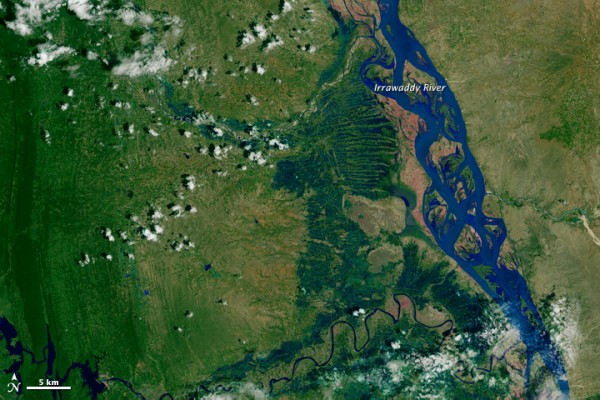
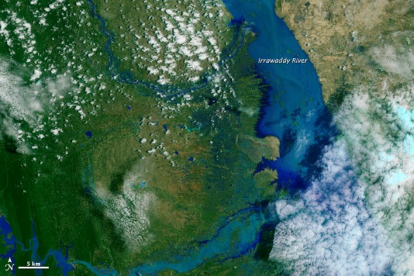
Before and after the floods. The two images below, courtesy of NASA, show the Irrawaddy River in Myanmar. The first image shows the river at normal levels, taken during August 2013. The second image shows the river during the current floods of August 2015. The composites above were made from images acquired by the Operational Land Imager (OLI) on the Landsat 8 satellite.

© NASA

© NASA


Reader Comments
to our Newsletter