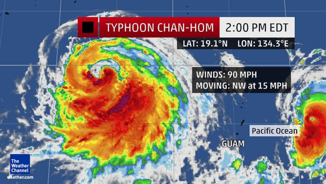
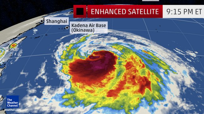
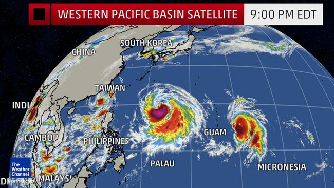
Chan-hom's center is now about 657 miles southeast of Kadena Air Base on Okinawa and moving west-northwest around 15 mph.
Chan-hom is expected to continue to track west-northwest around the southwest side of high-pressure aloft.
Like Super Typhoon Dolphin in May, Chan-hom may undergo a period of rapid intensification in this zone of the Philippine Sea.
With the upper-level ridge extending rather far to the west over or near southwest Honshu Island, Japan, and the jet stream remaining well to the north, Chan-hom will be a threat to the southwest Japanese islands (including Okinawa), Taiwan and eastern China late this week, possibly as a strong typhoon.

Details on the exact track at this time are still uncertain, therefore, it is not yet known where the worst of Chan-hom will be experienced. Average forecast track errors three days out in eastern Pacific tropical cyclones were about 95 statute miles.
Here is our best estimate of the potential timing of the closest approach of Chan-hom (all times local):
- Okinawa, Miyako, Yaeyama: Thursday night/early Friday
- Taiwan: Friday/Friday night
- Eastern China: Saturday
Sunday, Chan-hom soaked Guam with up to 16 inches of rain, according to the National Weather Service.
Andersen Air Force Base, Guam, reported a peak wind gust to 62 mph Sunday afternoon. Guam International Airport just east of Hagatna, Guam, clocked a peak gust to 43 mph, while Rota Island measured a peak gust to 37 mph.
Chan-hom isn't the only system we are tracking in the western Pacific.
Typhoon Nangka has intensified to a Category 4 equivalent storm well east of Chan-hom. Nangka will pass well north of Guam late Thursday. Nangka may then curl toward Iwo Jima (Iwo To) this weekend, possibly as a strong typhoon. It remains too soon to tell whether Nangka may eventually pose a threat to mainland Japan next week.
Tropical Storm Linfa has defied previous forecasts of its demise after dumping locally heavy rainfall over the northern Philippines, and will now curl northwest, then west into far southeast China, with a threat of heavy rain and flash flooding for areas not far from Hong Kong later this week.
Meteorologist Chris Dolce contributed to this report.


Reader Comments
to our Newsletter