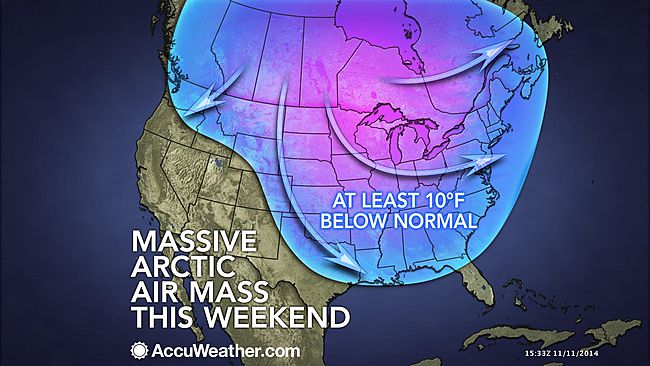
Cold air building over the Central states will expand toward the East during the balance of the week and will be accompanied by snow in some locations.
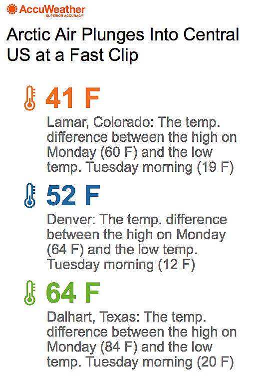
Temperatures will be slashed by 20 to 30 degrees compared to the start of this week.
High temperatures mainly in the 40s during the later part of this week will replace highs in the 60s in New York City, Philadelphia and Washington, D.C. AccuWeather RealFeel® Temperatures will plunge into the 20s and 30s at times during the daylight hours.
However, the temperature drops will not be as extreme in the East as they were over the Central states.
The air will get cold enough at night to bring the first freeze to portions of the South, including Atlanta, and the Interstate-95 corridor.
Unlike chilly air episodes thus far this season, this particular cold outbreak will have staying power and is likely to last well into next week.
In much of the Appalachians and many areas on the western slopes of the mountains, high temperatures most days will be no better than the 30s.
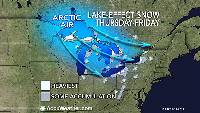
Bands of snow and flurries will set up downwind of the Great Lakes.
The first areas to experience the lake-effect snow will be across parts of Michigan and northern Wisconsin beginning at midweek in the wake of the Upper Midwest snowstorm.
According to AccuWeather Chief Meteorologist Elliot Abrams, "Some areas around the lower Great Lakes that have escaped lake-effect snowfall thus far this season will have their first accumulation later this week."
Abrams expects enough snow to fall on parts of northeastern Ohio, northwestern Pennsylvania and western New York to make roads slippery.
From Cleveland to Erie, Pennsylvania, and Syracuse and Rochester, New York, lie within this swath of potential rounds of snowfall and slippery travel beginning on Thursday and lasting through the weekend.
While a storm offshore is not expected to develop fast enough to bring accumulating snow Thursday night into Friday in the I-95 corridor of the Northeast, it may bring a touch of rain and wet snow to Cape Cod, Massachusetts, and eastern Long Island.
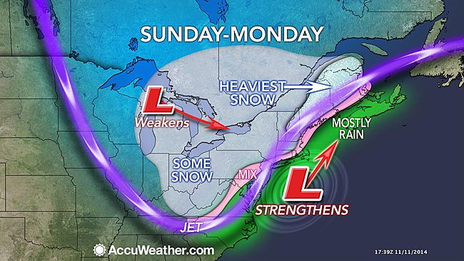
During Sunday into early Monday, another wave of cold air will approach with a storm tagging along.
This storm system has the potential to bring a swath of light to moderate snow over the Appalachians. There is a chance it could turn cold fast enough to bring some wet snow to the northern and western suburbs of the I-95 corridor in the mid-Atlantic and New England and possibly rain ending as wet snow in some of the major cities.
The amount and extent of that snow will depend on the strength of the storm and the speed of the reinforcing surge of cold air. A very weak storm and fast-moving front may translate to only spotty showers of rain and non-accumulating snow for much of the region.
More details on the cold air, lake-effect snow and potential storms will continue to unfold on AccuWeather.com.


Reader Comments
to our Newsletter