- Bertha is expected to develop into a hurricane this evening
- Storm likely to head north offshore and along the east coast of the US
- It will then swing out and travel across the Atlantic
- At the moment the storm looks like it will head in the direction of the UK
- Meanwhile Wednesday is likely to be the wettest day of the week
- Heavy showers are expected across most of the UK
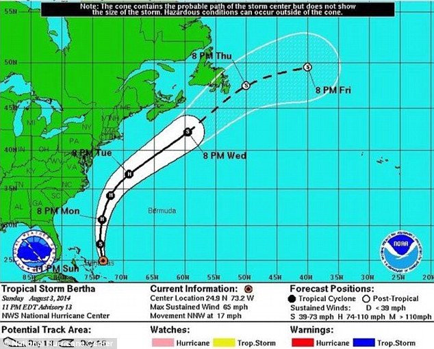
At the moment the storm looks like it will head in the direction of the UK and continental Europe. If the storm continues the way it is going, it likely Britain will experience a summer storm from the start of next week including heavy rain and strong winds.
'One certainty is that as the storm heads north away from the very warm seas which drive its power, it will lose strength and become what's known as an extra-tropical storm - so we won't be seeing a 'hurricane in Europe', but there is a chance we could see a fairly active summer storm.
'The development of extra tropical storms can present complexities for meteorologists, and Bertha is a good example of that.
'In the case of Bertha each of the models we use gives a very different picture of what the storm will do.'This ranges from Bertha heading towards France as a weak feature which will completely miss the UK, to it arriving as a fairly active summer storm.'In terms of timing, there's also a spread of possibilities - but it looks likely that the earliest Bertha would affect the UK would be on Sunday or into the start of next week.'
The Met Office will be keeping an eye on the storm and will be offering advice on what Bertha is likely to do over the coming days.
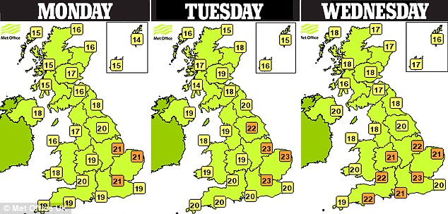
Meanwhile, today and tomorrow is set to remain sunny with temperatures in their mid-20s.
According to the Met Office most parts of the UK will enjoy some good sunny spells today but scattered showers are likely to develop in the afternoon, perhaps heavy and thundery in places, especially over Kent.It will be feeling warm in the sunshine with a maximum temperature of about 24C. Tomorrow will also be sunny at first but cloud tending to increase by the afternoon.It will be dry for most of the day but a few showers are likely later with a maximum temperature of 24C.However, most parts of the UK will experience showers on Wednesday with heavy rain in the south of England.The band of rain should pass quickly with sunshine appearing again on Thursday.
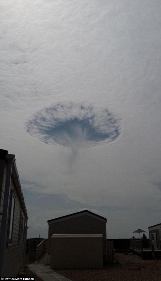
Did someone punch a hole in the clouds?
Bizarre phenomenon seen over Britain - and experts say it was probably caused by ice crystals forming round an aeroplane.
Experts at the Met Office have said this is a holepunch or fallstreak cloud.It forms when part of the cloud layer forms ice crystals which are large enough to fall.Aircraft punching through this cloud layer can cause air to expand and cool as it passes over the aircraft wings or propeller.This change in temperature can be enough to make the supercooled droplets to freeze and fall from the cloud layer in this distinctive pattern.The photograph was taken by Marc Eilbeck and posted on Twitter.
Girl rescued from muddy fate at beauty spot near Mersey
A teenage girl had to be rescued by firemen after getting stuck up to her waist in mud at a beauty spot.The 15-year-old was with friends in Urmston Meadows, close to the River Mersey, when she sank and became trapped.Two fire crews and a water incident unit were called to the scene after the group dialed 999.
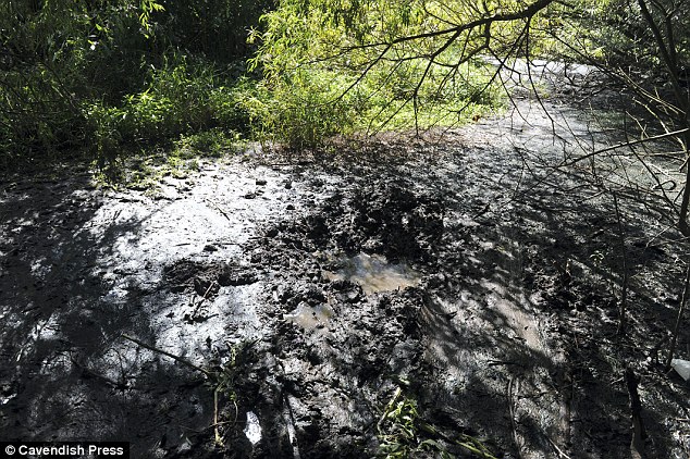
Crew manager Dave Price, from Stretford fire station, said: 'She has had an incredibly lucky escape. I have seen the water rise in this area by 10ft in an hour when it rains. The water rises so quickly it is scary.' Greater Manchester Fire and Rescue Service has renewed its warning to youngsters camping at the site, off Meadow Road, following the incident.


Reader Comments
to our Newsletter