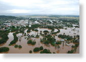
At least 9,000 Grafton residents have been told to leave, with the town predicted to flood tonight.
However, there are differing reports about the number of residents being asked to evacuate, with the SES putting the figure at about 20,000.
Ken Boys from the Roads and Traffic Authority says the Pacific Highway has flooded and is cut off between Grafton and Maclean.
He says residents who must go north are advised to take the New England Highway.
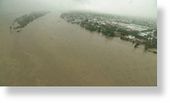
"With the Clarence out there we've had to close the Pacific Highway from Grafton right through to Maclean.
"We are now telling traffic unfortunately you can't get past Grafton on the Pacific Highway. If you must go north the New England is still open."
Residents in towns north of Grafton around the Lower Clarence River, including Ulmarra, Brushgrove and Cowper, have also been told to leave.
Cowper residents who have their own cars have been advised to head to the Richmond Room in Ballina.
Earlier, more than 5,000 people left the city of Lismore over concerns the Wilsons River would peak.
'Evacuate ASAP'
SES spokesman Dave Mackey says the Clarence River in Grafton could reach 7.8 metres about midnight.
"Given the fact that we've had so much rainfall and it doesn't seem to be letting up too much, that prediction of 7.8 is very close to [the] levee overtopping," he said.
"At this stage we do not believe it is worth waiting until dark to make a call for an evacuation.
"This height water is below the levee but the following areas will be inundated: the town of Grafton and low-lying areas of South Grafton, except for Bent Street Hill and the high ground to the Armidale Road.
"Residents and business owners in Grafton and the lower parts of South Grafton are to activate their personal and business flood plans and evacuate as soon as possible."
Mr Mackey says an evacuation coordination centre has been established at the Coffs Harbour Showground.
He says residents in Grafton can expect the worst if the towns get flooded.
"Power supplies will need to be shut down. Telephone services will fail, which means people will not be able to call for help," he said.
"Sewerage facilities will fail with raw sewage possibly entering houses. Roads will become flooded and vehicle movement will be restricted."
Macleay River
Further south council staff and emergency services workers are keeping a close eye on river heights on the Macleay.
Kempsey Council operations manager Wayne Butler says he expects three floodgates at Kinchela and Belmore will be opened some time during the evening.
Mr Butler says rain has continued to fall upstream and the Macleay River is currently rising about 200 millimetres per hour.
He says if that continues, the river may exceed moderate flood level by 9:00pm AEST.
"When the level of the river gets to 4.5 metres at the Kempsey traffic bridge, we will go down to the floodgates at Kinchela and Belmore and wait until the river level there gets almost to the top of the levee banks and then we will proceed to open the gates there," he said.
"That will alleviate the water there and let it flush out down river."
Lismore reprieve
Meanwhile, Lismore residents are breathing a sigh of relief with flood waters starting to recede.
Low-lying parts of city were evacuated as authorities waited for Wilsons River to peak earlier this afternoon.
SES spokeswoman Libby Spash says the danger has passed for south Lismore and the CBD, but an evacuation order remains in place in other parts of the city.
"SES reconnaissance and Lismore SES units have given the all clear for south Lismore and CBD," she said.
"The danger for that area has passed. They can return to their residences and their businesses.
"The evacuation order is still in place for north Lismore."
Disaster areas
Six local government areas have today been declared natural disaster areas.
They include the Tweed, Byron Bay, Ballina, Lismore, Kyogle and the Clarence Valley.
Premier Nathan Rees says the declarations provide for a range of assistance to cover personal hardship and the costs to councils of rebuilding.
"In a previous life as an emergency services minister I've been here for floods, but this is worse than that occasion," he said.
"Those with a local knowledge tell me it's about a one in 10 to 20-year event."
State Opposition environment spokeswoman Catherine Cusack, a north coast resident, says the Government is going to have to start preparing for a greater frequency of these sorts of events.
"We've been having a substantial number of these severe storm events," she said.
"I'm calling on the State Government to step in with some practical climate change policies that recognises our area is going through change in climate."


Reader Comments
to our Newsletter