What they found, surprisingly, was little damage, but an abundance of water in the streets along with trash cans.
"Lot of rain," said Lynn Enslinger, who retrieved a trash cart from the middle of the street. "We avoided the big disaster. We were lucky."
Fire trucks canvassed the city, driving up and down every street, checking for damage.
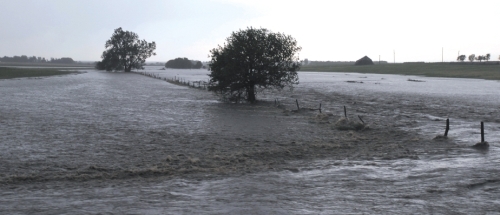
Rainfall amounts varied, but Rush County Emergency Management Director Jim Fisher suspected they were in the 4- to 5-inch range, all of it falling within an hour's time.
"I have not heard of any property damage other than county roads," he said.
Tuesday's storm brought an abrupt halt to an otherwise serene year as far as severe weather in northwest Kansas.
Tornado reports in both the Dodge City and Goodland National Weather Service forecast areas have been lacking this year -- uncommon, but not unheard of, meteorologists said.
Rainfall was reported elsewhere in northwest Kansas, with reports of 2 to 3 inches in Sherman County, and almost 3 inches in Decatur and Smith counties. Eastern Russell County again had reports of 3 to 4 inches, rain falling on top of last week's heavy rains. Hays reported 0.87 of an inch of rainfall.
Tuesday's storms were something of an anomaly as forecasters had been predicting an outbreak in southeast Kansas and in Oklahoma.
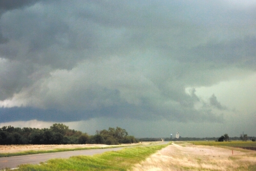
The storms did develop in Oklahoma, but in Kansas, the storms started developing in southwest Kansas, moving almost straight north into Ness County.
There, it gathered steam and started heading almost due east, dumping heavy rain, high winds and hail -- in some cases as big as softballs -- along the way.
By nightfall, 15 tornadoes in Kansas were reported to the Storm Prediction Center in Norman, Okla.
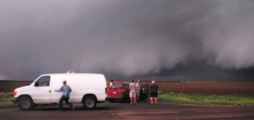
Four of those tornadoes were reported in Rush County, even though Fisher said anywhere from five to six were spotted on Doppler radar.
A Rush County rural firefighter, who was out at the height of the storm, said he personally saw three of the tornadoes.
"We only had one that did any damage that I can see," Fisher said of the tornadoes in the county.
Between Bison and Otis, he said, a tornado took aim at an abandoned farmstead, toppling a grain bin and damaging several old outbuildings.
There were no injuries in Rush County, with Fisher noting the advance warning sent people scurrying for cover.

Timken, however, had softball sized hail, "and there is a lot of property damage there."
Hail as big as baseballs was reported at several locations along Kansas Highway 96.
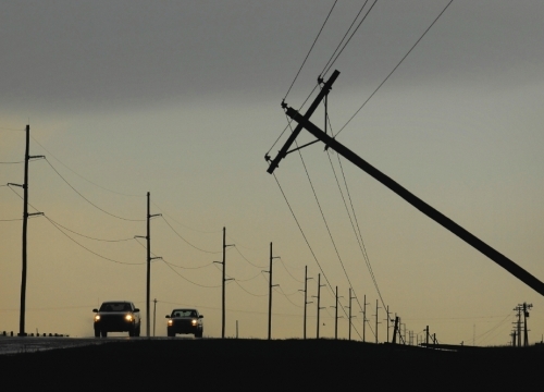
Winds -- although it's uncertain if it was straight-line winds or a tornado -- toppled power poles immediately south of La Crosse.
Three of the poles were snapped off, while a fourth leaned precariously toward U.S. Highway 183.
Electrical power to the south half of La Crosse was shut off for a time.
Rush Center lost power at the height of the storm.
Watershed dams were unable to hold all of the water, with more spilling into draws heading toward the Smoky Hill River and into Walnut Creek. Neither one had any flooding, although water levels were rising this morning.
"I think we have enough road damage that we'll make a disaster declaration this morning," Fisher said. "We've got a hell of a lot of water. We had a lot of rain. And it came fast."


Reader Comments
to our Newsletter