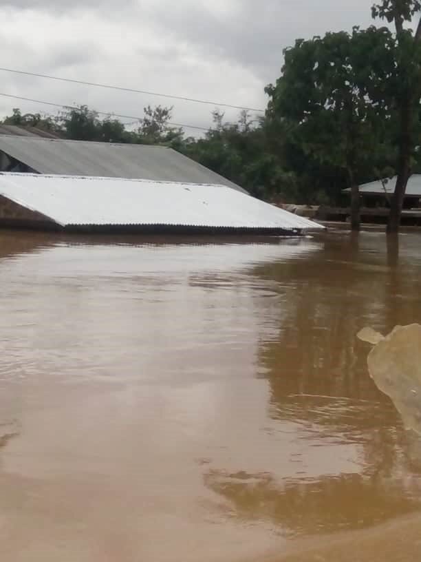
Myanmar state media reported on 30 July that the Ayeyarwady (also Ayeyawady and Irrawaddy) River burst its banks in Sagaing Region, prompting the evacuation of 6,516 people from 1,451 households.
In a report of 29 July, UN Office for the Coordination of Humanitarian Affairs said nearly 7,750 people in nine townships were displaced between 11 and 27 July by flooding in Kachin state. As of 29 July, some of those displaced had been able to return homes, although 46 temporary shelters were still hosting around 6,650 people.
Floods in #Myanmar #Burma
— TibetoBurman (@TibetoBurman) July 21, 2020
Monsoon 2020#Mandalay
On Sunday night, water from the swelling Irrawaddy leaked through a hole near the pipelines of the Shwe Ge pumping station, causing a flood that destroyed the road along the embankment and affected lowland areas.
video credit pic.twitter.com/v6W2x6U0Jl
Original report, 29 July 2020:
The Ayeyarwady River burst its banks, and 6,516 locals from 1,451 households in some areas of Sagaing Region were evacuated from their homes, state media reported.
Around 20,000 people have affected by flooding along the Ayeyarwady River in Myanmar, according to Red Cross reports.
An embankment along the river near the Sagaing-Mandalay Highway collapsed on 19 July 2020. About 200 households in areas near Amarapura Township were immediately evacuated, with flooding affecting a total of 4,000 households or around 20,000 people.
Myanmar Red Cross Society reported on 23 July that thousands of people had to evacuate when heavy rains in Kachin caused floods, affecting around 800 families.
Over 160 people died after a massive landslide in a jade mine in Kachin State on 02 July this year.
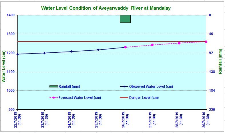
Meanwhile, Myanmar's Department of Meteorology and Hydrology has warned that levels of the Ayeyarwady rivers are approaching the danger mark and are advising residents in low-lying areas of Mandalay, Sagaing, Myinmu and Myitnge to take precautionary measures.
Social Media
A damaged embarkment near Amarapura caused flooding in the nearby villages on 19 July. But thanks to the swift and coordinated response of the government, engineers, and volunteers, the damage was successfully repaired within one day. pic.twitter.com/zkIxpWgynW
— Yadanar-myay (@MyayYadanar) July 21, 2020


Reader Comments
to our Newsletter