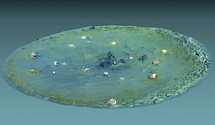
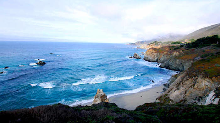
A team led by Eve Lundsten from the Monterey Bay Aquarium Research Institute (MBARI) discovered the so-called "micro-depressions" during a survey of North America's largest pockmark field.
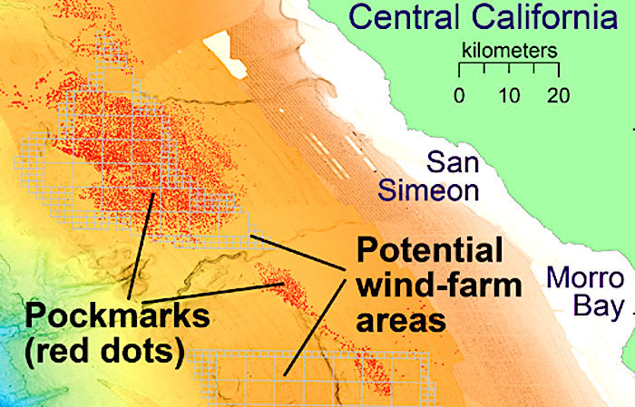
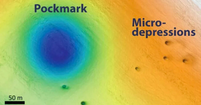
Pockmarks are similar to micro-depressions albeit much larger, measuring around 600 feet across on average and 16 feet deep in this particular field. Since 1999, MBARI scientists have uncovered more than 5,200 of these almost-circular and evenly-spaced pockmarks across an area of around 500 square miles off Big Sur.
For their latest survey, the Lundsten and colleagues wanted to investigate this pockmark field because there are proposals to build a wind-energy farm in the area.
It was during this survey that the team identified the never-before-seen micro depressions (MDs) using autonomous underwater vehicles. They identified roughly 15,000 MDs scattered throughout the area, some of which are found inside the pockmarks themselves. The sides of the micro-depressions tend to be steeper than those of the pockmarks and they are often elongated in one direction.
In research presented at the Fall 2019 meeting of the American Geophysical Union in San Francisco, the researchers say it is unclear how the pockmarks and MDs were formed.
Pockmarks have been found in other locations around the world and scientists have linked them to the release of methane gas or other fluids from the seafloor. The release of the these gases could make the seafloor unstable, which has implications for the construction of offshore infrastructure.
However, Lundsten and her team found no evidence that they were created by fluid or gas venting in the recent past. Investigations with sonar revealed that these pockmarks formed long ago and have likely been inactive for the past 50,000 years — although the origin of the holes remains a mystery, according to the researchers.

"The presence of these objects provides micro habitats for fish, that were commonly observed in ROV [remotely operated vehicle] dives stirring up the fine-grained sediment, which is then carried away by sea-bottom currents, further contributing to carving out the eroded hole(s) left behind," the authors wrote in the presentation abstract.Nevertheless, Lundsten said that much more research is needed to fully understand how the micro depressions and pockmarks were formed.
"These observations imply that marine trash is at least partly responsible for approximately 4,500 of the 15,000 MDs and provide some clues as to how the MDs are created."
According to Reidulv Bøe, a marine geologist at the Geological Survey of Norway, who was not involved in the study, seafloor surveys like the one the MBARI team conducted can shed light on how humans are affecting the ocean environment.
"In a way, you can map garbage by counting micro-depressions," Bøe told Science magazine.
Pockmarks were first discovered in the late 1960s off the coast of Nova Scotia in Canada, although they have since been found around the world. In 2013, researchers announced the discovery of particularly large ones on an area of ocean floor east of New Zealand know as the Chatham Rise.
The largest of these measure around seven by four miles in diameter, and up to around 330 feet in depth. They lie at water depths of 3,300 feet and form part of a much larger pockmark field — which contains thousands of smaller pockmarks. This field covers an estimated area of 7,700 square miles.


Reader Comments