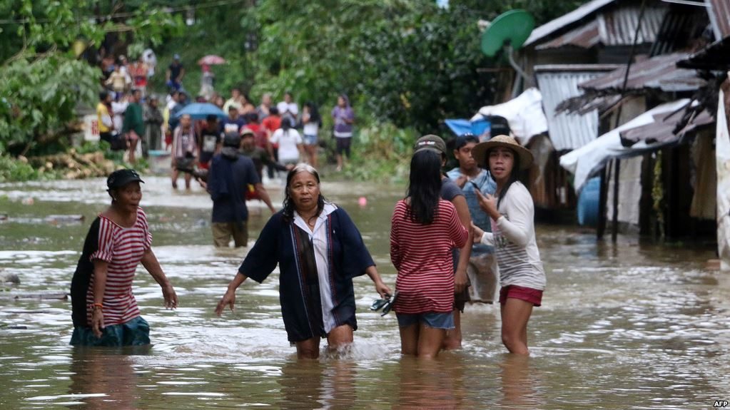
Urduja, known globally as Kai-tak, will fail to strengthen into a typhoon. However, lives and property remain in peril as the tropical storm is unleashing a catastrophic amount of rainfall.
More than 1067 mm (42 inches) of rain has inundated Guiuan on the island of Samar in the Eastern Visayas since midweek. In 24 hours alone, 780 mm (nearly 31 inches) poured down.
To the north, Borongan City Airport has recorded 813 mm (32 inches) since Urduja began lashing the Philippines.
There are unconfirmed reports of 3 deaths due to Urduja, including a child, according to GMA News Online.
As of Dec. 16, The Philippine National Disaster Risk Reducation and Management Council (NDRRMC) reports that a total of 4,327 families have been evacuated from portions of Samar Island. In total, 8,832 families are being served at evacuation centers.
Two people were reportedly injured in a landslide in Tacloban City on Friday, The Freeman reported.
"The slow movement of Urduja is leading to the excessive rainfall," AccuWeather Meteorologist Adam Douty said.
Urduja is crawling across the central Philippines from the Eastern Visayas to Mimaropa this into Monday.
Outside of the Eastern Visayas where localized totals may top 1,000 mm (40 inches), amounts around 300 mm (12 inches) will be common along Urduja's path.
Other residents across the central Philippines should prepare for possible evacuations as the torrential rain threatens to inundate more communities, force rivers out of their banks and damage bridges. Additional landslides may be triggered.
The combination of flooding and mudslides can lead to road closures and flight cancellations. The downpours and gusty winds accompanying Urduja can prevent rescue crews from reaching some communities.
The threat from the tropical storm led to the suspension of classes late last week, according to a report from NDRRMC.
Luzon will escape the heaviest rainfall from Urduja. However, localized flooding and mudslides may still unfold across eastern and southern Luzon.
"Periods of rain may dampen Manila at times this weekend, but flooding should remain a relatively small threat in the city," AccuWeather Meteorologist Rob Richards said.
Urduja is also expected to kick up wind gusts of 70-105 km/h (45-65 mph) across southern Luzon, the Visayas and northern Mimaropa.
The strongest gusts and highest risk for localized damage are expected in coastal areas along the Philippine Sea. The persistent strong winds can lead to coastal flooding in the Bicol and Calabarzon regions.
Dangerous seas will also be stirred around the Philippines, creating hazards for shipping interests.
The NDRRMC reports that 670 rolling cargoes and 7,500 passengers are stranded in the ports across the central Philippines. This includes in the National Capital Region.
After impacting the Philippines, Urduja may regain strength across the South China Sea this week as it heads toward the Malay Peninsula.
If Urduja tracks far enough to the north, heavy rain may spread across southern Vietnam later in the week.
Meanwhile, attention in the Philippines will turn toward a new tropical threat brewing in the southern Philippine Sea.
The scenarios for this budding system include a turn northward away from the Philippines or potential impacts in late-December.
This storm has the potential to become stronger than Urduja, meaning a greater risk for wind damage if it takes aim at the Philippines.
The risk for flooding and mudslides would also be exacerbated across the Philippines with the ground left oversaturated and rivers high from Urduja.


Reader Comments
to our Newsletter