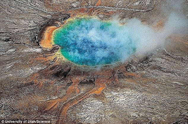
A new map from the US Geological Survey shows how the ground around the Yellowstone caldera has deformed over the span of two years, as the quakes release uplift-causing pressure, allowing the ground to sink back down.
This activity is typically linked to changes in magma and gases deep below the surface - but for now, the experts say there's no cause for worry.
The map, created by USGS geophysicist Chuck Wicks uses data from June 2015 and July 2017 to show how the region around Yellowstone has changed.
In the map, the colourful rings show the changes in the ground's elevation as seen by a radar satellite, according to USGS.
A bulls-eye shaped section of uplift can be seen at the Norris Geyser Basin, where the ground has risen roughly 3 inches.
And, an elliptical subsidence can be seen in the Yellowstone caldera, with the ground dropping about 1.2 inches.
Just 12-18 miles away, the summer 2017 earthquake storm is still underway, to the west of the Norris uplift.
And, it's likely playing a role in the changes observed at the site.
'The uplift and subsidence is usually interpreted as due to addition or withdrawal of deep magma and related gases and water at depths 5 to 15 km (3 to 9 mi) beneath the ground,' USGS explains.
'This cycle of uplift and subsidence is common and seems tied to earthquake swarms; that is, swarms appear to release the pressure that caused the initial uplift, thus allowing the region to return to a period of subsidence.'
While it may seem alarming, the experts say this behaviour is common, and the locations are so far exhibiting minimal changes this month.
'Behavior is similar to the past several months,' USGS notes in a monthly update released last week.
'Current deformation patterns at Yellowstone remain within historical norms.'
The earthquake storm has steadily persisted throughout the summer.
By August 2, the area had seen 1,562 events, with the largest magnitude of ML 4.4
Yellowstone National Park was hit by more than 1,200 earthquakes in the span of just a month, seismologists revealed earlier this summer.
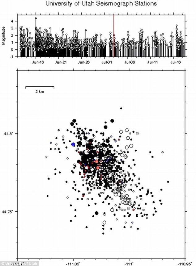
In an update on the ongoing earthquake storm, which scientists have been monitoring since June 12, the researchers said they'd recorded 1,284 events by mid-July, with the largest being a magnitude 4.4
While the activity has spurred fears that the supervolcano could be gearing up to an eruption, the experts say the risk of such an event is low, and the alert level remains at 'normal.'
The experts at the University of Utah Seismograph Stations (UUSS) have been tracking the current swarm on the western edge of Yellowstone since June 12.
Swarms of this kind are common in the area, they say, and make up roughly 50 percent of the seismic activity in the Yellowstone region.
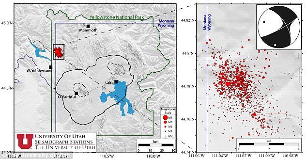
'These events have depths from ~0.0 km to ~14.0 km, relative to sea level.
'At the time of this report, there were 125 felt reports for the M4.4 event that occurred on June 16, 2017 at 00:48:46.94 UTC (June 15, 2017 at 18:48:46.94 MDT).'
As the swarm continues, they will continue to monitor its activity, and provide updates as seen fit.
For now, though, experts have left the alert level in the green zone, meaning activity is still considered normal.
'Yellowstone hasn't erupted for 70,000 years, so it's going to take some impressive earthquakes and ground uplift to get these things started,' the US Geological Survey explains.
'Besides intense earthquake swarms (with many earthquakes above M4 or M5) we expect rapid and notable uplift around the caldera (possible tens of inches per year).
'Finally, rising magma will cause explosions from the boiling-temperature geothermal reservoirs.
'Even with explosions, earthquakes, and notable ground uplift, the most likely volcanic eruptions would be the type that would have minimal affect outside the park itself.'
The swarm has steadily persisted over the last few weeks.
In a previous update, experts revealed the swarm had reached nearly 900 quakes by June 28.
And, when the earthquakes started on 12 June, USGS said it was the highest number of earthquakes at the park within a single week in the past five years.

Reader Comments
It is interesting to look at the gas graphs and the earthquake recording graphs, but who knows what they mean.? DEFINITELY not Mary Greeley. She can barely even read. After five years she is getting better, but trust me. Mary Greeley has no idea what she is talking about at all.