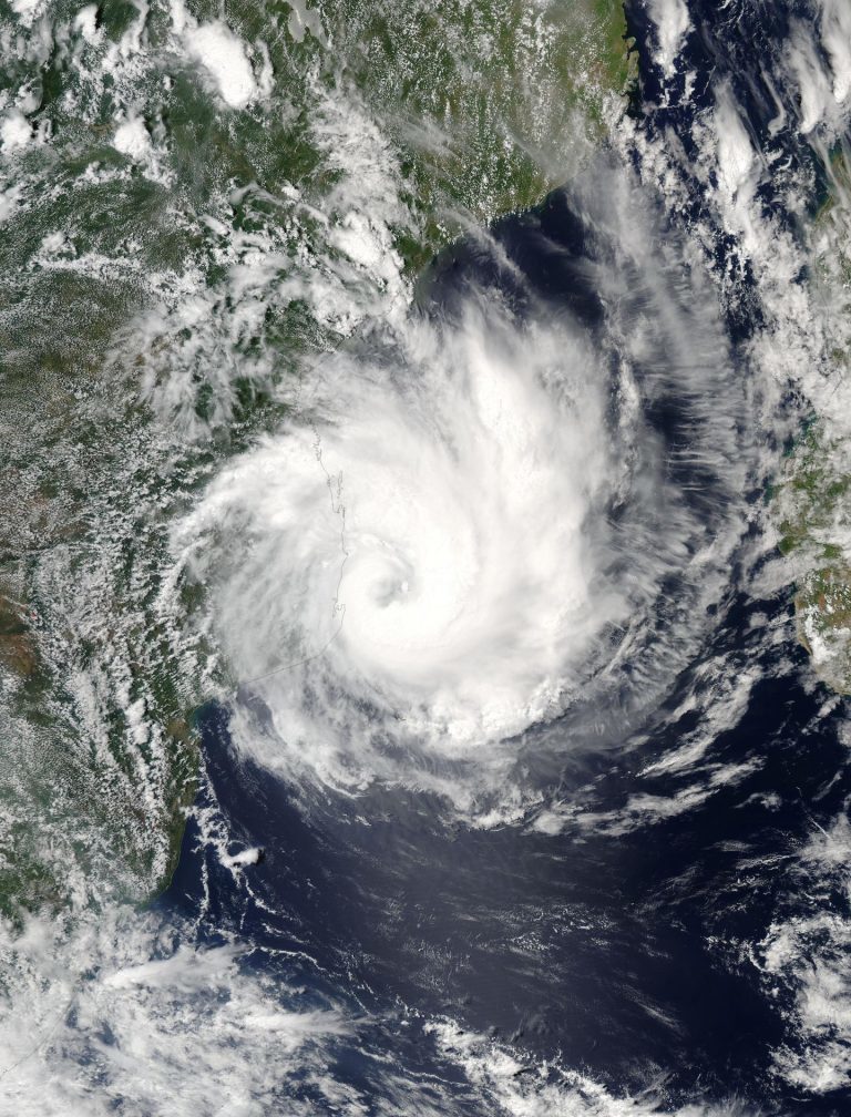
The equivalent of a category 1 hurricane on the Saffir-Simpson scale, Dineo is the first tropical cyclone to hit the province of Inhambane since Favio in February 2007, according to WMO.
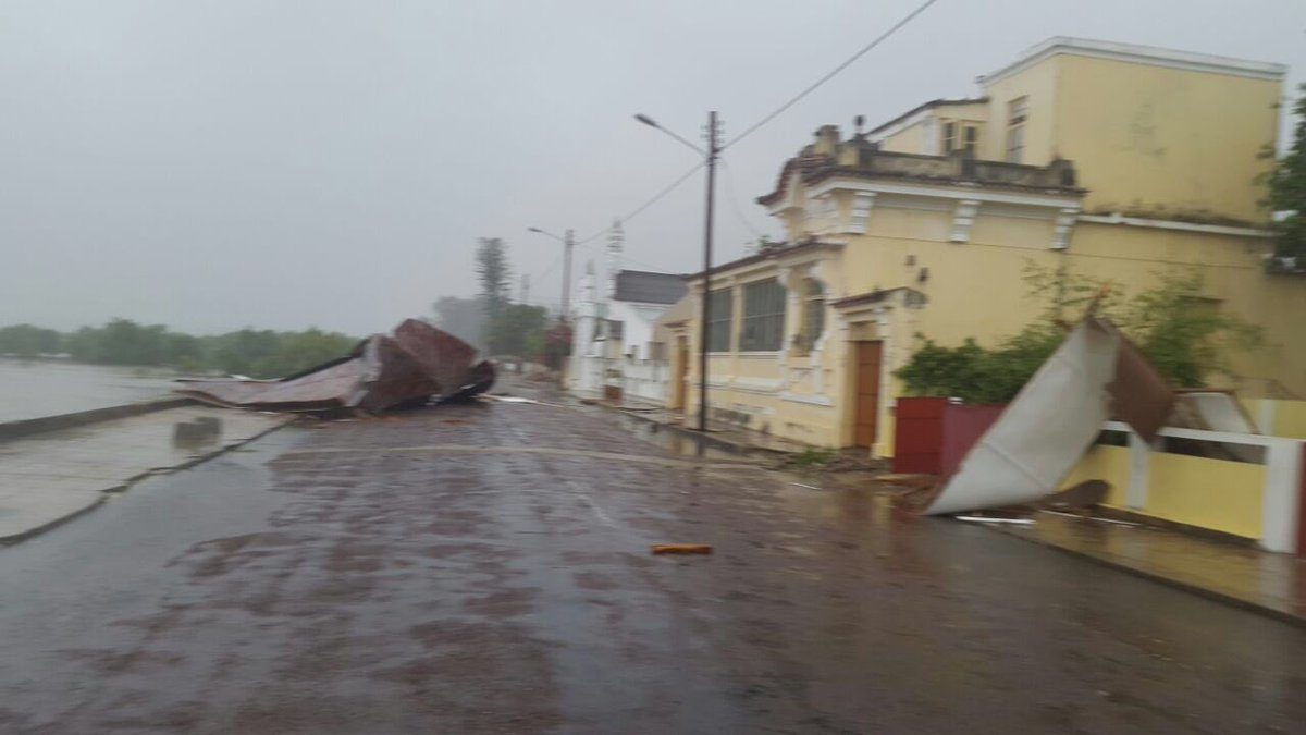
Its landfall was accompanied by winds of approximately 130km/h (70 knots), breaking and uprooting trees and ripping roofs off a number of buildings, as well as disrupting power supplies.
The UN in Mozambique reported that hundreds of thousands could be affected. In a report from earlier today the UN Resident Coordinator for Mozambique said "Although it is too premature to indicate the population to be affected, the estimations done by provincial authorities in Inhambane indicates that about 750,000 people might be affected by cyclone. These figure is based on the total population living in the risk area and will be updated in the next days."
National Institute of meteorology (INAM) forecast further strong winds and heavy rains possibly until 18 February 2017 in areas of Gaza province (Mandlakazi, Xai-Xai, Chibuto, Guija, Massingir, Mabalane) and several districts in Inhambane (Morrumbene, Jangamo, Inharime, Panda, Homoine, Vilankulos, Maxixe, Massinga, Zavala, and Inhambane city).
For more details on potentially affected populations, see the report from UNITAR-UNOSAT here (pdf).
Rainfall
Local media in Mozambique say that rainfall of 150mm (6 inches) was measured in the area during the 24 hour period to midnight on Wednesday. NASA's Aqua satellite measured 132 mm of rain per hour yesterday while Dineo was in the Mozambique Channel.
Some roofs of houses are being blown away by hwavy winds in Inhambane, Mozambique - Thomas Keating pic.twitter.com/Cxh55wlC09
— Storm Report SA (@StormReportSA1) February 15, 2017
Fatalities
According to SABC News reporter Mweli Masilela, Mozambique's Director of National Disasters Joao Machatine, reported on Thursday morning that 4 people had been killed by Tropical Cyclone Dineo in Inhambane province, including a child in Massinga near the capital city of Maxixe, and 720,000 people in the province had been affected by the cyclone.
Director of National Disasters in Mozambique Joao Machatine says 4 people have died and 720 thousand affected in Inhambane #Dineo #sabcnews
— Mweli Masilela (@mwelimasilela) February 16, 2017
Cyclone #Dineo in pictures, courtesy of TV Mozambique. #sabcnews pic.twitter.com/Vt7q8Ajgvq
— Mweli Masilela (@mwelimasilela) February 16, 2017
The trail of destruction left by cyclone #Dineo in Inhambane Mozambique. Pictures courtesy of TV Mozambique. #sabcnews pic.twitter.com/f5yjIKfHkeRSMC La Reunion forecast a storm surge of 2 to 3 metres (6 to 9 ft) in Inhambane Bay, co-inciding with high tide.
— Mweli Masilela (@mwelimasilela) February 16, 2017
Sixteen dolphins were reportedly stranded on Inhassoro beach in the north of Inhambane province by the heavy seas in the early hours of Thursday morning. Eight were rescued and returned to the sea, but the other 8 could not be saved.
16 dolphins stranded on Inhassoro beach this morning, after cyclone #Dineo landfall. Rescuers managed to save 8. Unfortunately 8 died. pic.twitter.com/M68vaKuiF9Dineo heads to South Africa and Southern Zimbabwe
— Zenaida Machado (@zenaidamz) February 16, 2017
Dineo has dissipated slightly as it moves westwards and is now classified as an overland depression. Gale force winds and heavy rains can still be expected into the northeastern parts of South Africa and southern Zimbabwe through Thursday and Friday. Flood warnings are in place and Mozambican, South African and Zimbabwean disaster management services are on high alert.
Jan Vermeleun of the South African Weather Service said, "Dineo has now been downgraded to a depression. It still has winds of 50-60 kilometers per hour. It is expected to move towards the Punda Maria area of the Kruger National Park later today, still giving heavy rainfalls of 200mm per day in places."
The storm is expected to move towards the eastern parts of Botswana by Friday and heavy rainfall of more than 100mm is expected in that area and over northern Limpopo province of South Africa.


Reader Comments
to our Newsletter