At least 23 U.S. states are under winter weather alerts, and a tornado watch has been issued for parts of the Southeast as most of the country braces for severe weather this week.
"We are in a very active weather pattern all across the country, from California to New York," ABC News senior meteorologist Max Golembo said.
An atmospheric river, which draws massive amounts of water vapor from the Pacific Ocean, has taken aim at California, where the National Weather Service has issued flash flood and flood watches through Friday. 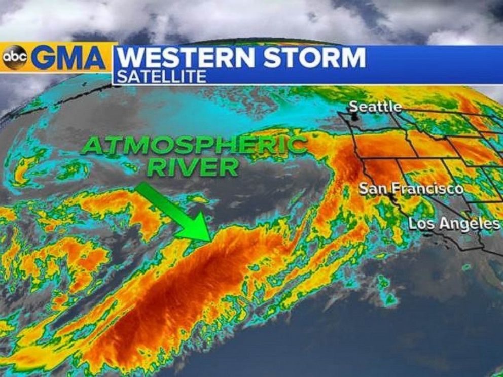
© ABC NewsThe Atmospheric River was aimed straight at California as of 7 a.m. ET on Feb. 7, 2017.
. ABC News' weather team predicts more than a half a foot of rain in Central to Northern California over the next several days. Additional rain is expected for Portland, Oregon, and Seattle.
"California will see waves of moisture on and off through Friday," Golembo said.
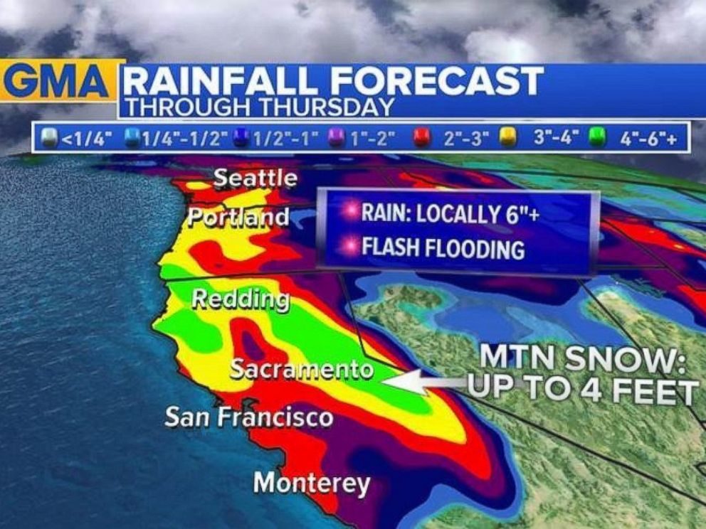
© ABC NewsCopious amounts of rain are in the forecast for the west coast through the end of the week.
Meanwhile, thunderstorms and damaging winds are expected to rattle Southern states, from the Gulf Coast to the Ohio Valley. The National Weather System has issued a tornado watch for portions of southern Louisiana, southern Mississippi and other parts of the region's coast until 2 p.m. local time.
"Severe storms are firing up already in Louisiana and Mississippi," Golembo said. "Damaging winds are the biggest threat this morning."
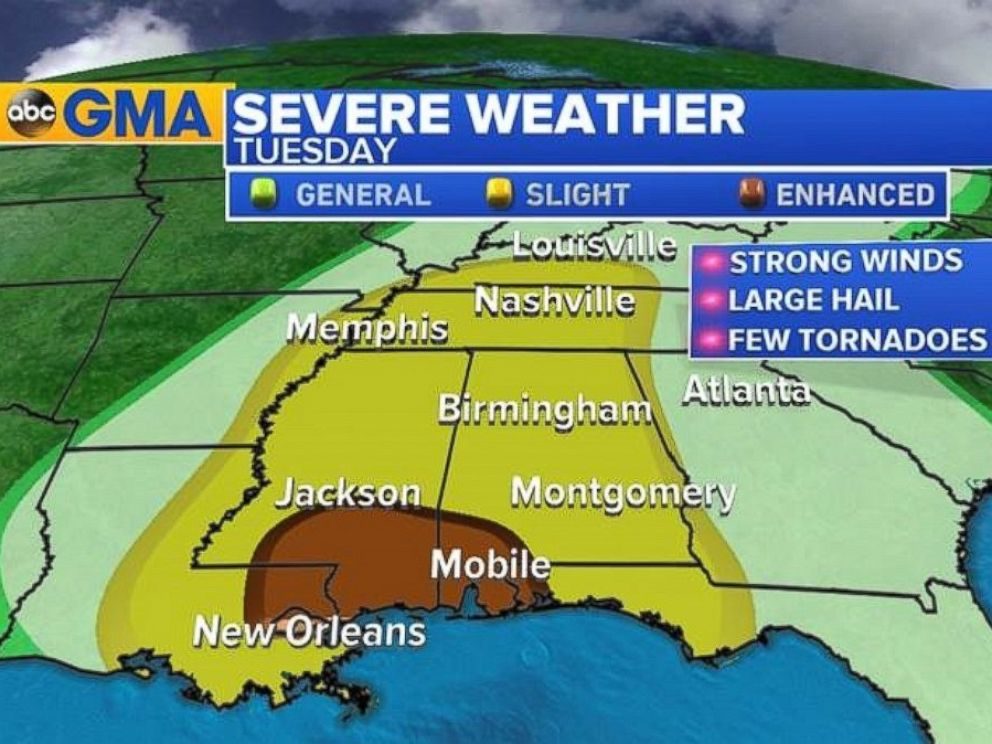
© ABC NewsThe National Weather Service upgraded the risk for severe weather along the Gulf Coast for Feb. 7, 2017.
Northeastern states can expect to see rain, snow and ice this week, according to ABC News meteorologists. The first of two storms arrives today, bringing rain and ice for much of the region, with potential snowfall in Boston and other parts of New England.
The icy weather moved through the Hudson Valley into southern New England this morning. By this afternoon, the snow and ice in Boston will transition to heavy rain, with some snow and ice lingering in New England and the upper Hudson Valley near Albany, New York.
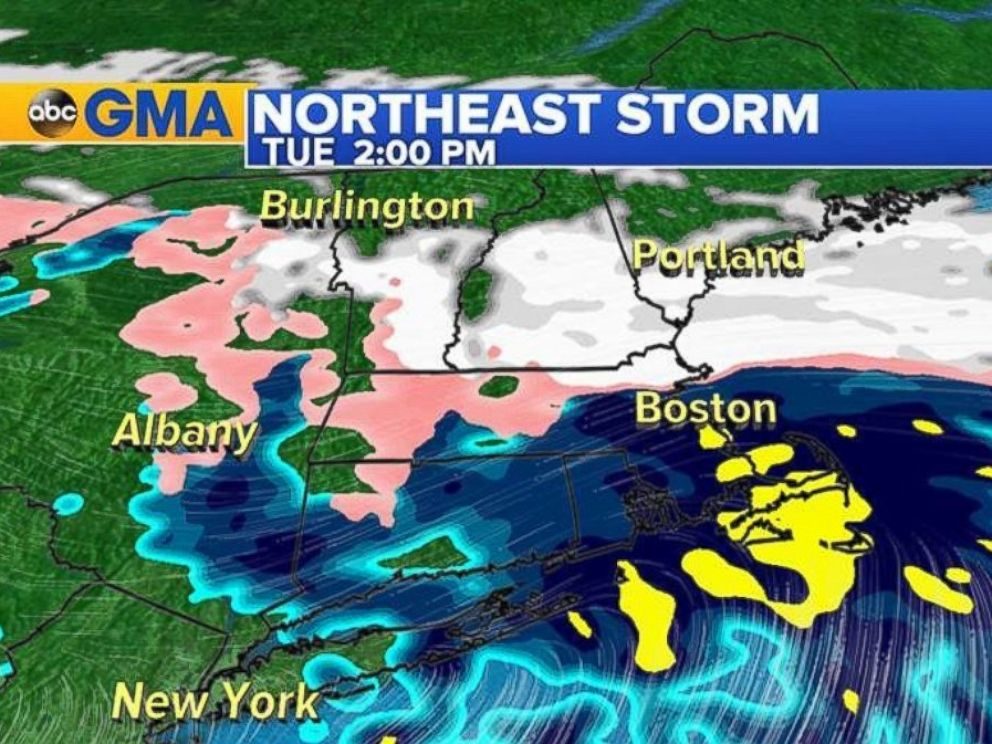
© ABC NewsIce and snow will be moving through the Hudson Valley into southern New England before changing to heavy rain
ABC News meteorologists said a second storm will move into the Northeast on Thursday morning, bringing mostly snow to New York City and Boston. Heavy snowfall is in the forecast until Thursday afternoon. Some weather models are showing snow farther south in Philadelphia and Washington, D.C.
"This could be a plowed event for major Northeast cities," Golembo said. "Stay tuned. This is a changing forecast."
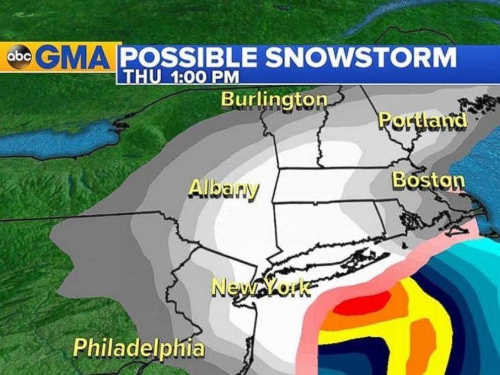
© ABC NewsMajor northeast cities could see heavy snowfall on Feb. 9, 2017.




Comment: See also: Apocalyptic scenes in Louisiana and New Orleans after four huge tornadoes flip cars and trash homes