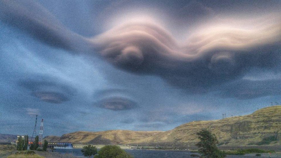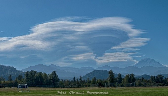
But no, it wasn't an alien invasion, just an invasion of cooler air from the Pacific Ocean that put a surreal visual stamp on the end of the recent hot weather. The spooky looking clouds are "lenticular" clouds -- so named for their lens-like shape, and while they might look ominous, the clouds themselves are fairly benign.
Lenticular clouds are created when the atmosphere is moist and almost -- but not quite -- to the point of condensation. They are most commonly seen in the Pacific Northwest near the large mountaintops, especially over and around Mt. Rainier.
As air flows over the summit, the mountain creates just enough lift that the air cools the few degrees it needs to condense into a cloud. Then when the air sinks down the windward side of the mountain, it warms and dries out, and essentially goes back to being invisible.
Depending on the horizontal air flow, you can get secondary and tertiary lenticular clouds downstream as the air propagates in the Rainier-caused turbulence where the air rises enough again to condense into a cloud, then sinks down again. And depending on how the air stacks up vertically, you can get several layers of clouds stacked like thin pancakes that give way to unusual shapes.
Watch this time lapse video from Saturday showing how the clouds form and appear to float in place:
(Video courtesy: Luke Meyers)
And here's another showing a lenticular display Saturday morning at sunrise:
(Video courtesy: Mike Reid Photography)
But this past weekend, the lenticular clouds were not just relegated to Mt. Rainier. Instead, we had strong westerly flow aloft in the wake of the heat wave breaking and incoming charge of cool, moist air from the ocean. That rush of westerly winds interacted with much of the spine of the Cascade Mountains, creating turbulence and just enough lift for a series of lenticular clouds downstream in central and Eastern Washington.
Conditions even persisted into Sunday, with more lenticular clouds popping up over Mt. Rainier again:
Northwesterners know seeing the "hat" or "umbrella" on the mountain is commonly a sign of approaching rain -- that's because conditions where the atmosphere is right on the edge of cloud development is usually as moisture moves in ahead of an approaching storm. It's not 100% foolproof, but I'd say just from personal experience it bats about 70% -- and lo and behold it was raining in parts of Western Washington on Sunday.
Watch them form:
Local photographer Don Jensen has been been filming lenticular clouds for years and has compiled this time lapse video that shows how they ebb and form. Enjoy!
(Courtesy of Donald Jensen)


Comment: More pictures from a photographer at Mt. Rainer: