OF THE
TIMES
We'll know our disinformation program is complete when everything the American public believes is false.
Mars-Saturn conjunction: Artworks uncovered in Pompeii excavation [Link] #astrology
At about 1:33:00 Joe is talking about Kate and cancer. On GlobalResearch Dr. Makis regularly publishes the results of vaxes. In yesterday's...
Another airhead on the airwaves...
"...it is very likely that during this catastrophe cycle reset the next age of Earth will begin with such a Thunder Bolt from the gods sometime in...
'Cosmic Thunderbolt Will Strike The Earth - Thunderbolt of the Gods' [Link]
To submit an article for publication, see our Submission Guidelines
Reader comments do not necessarily reflect the views of the volunteers, editors, and directors of SOTT.net or the Quantum Future Group.
Some icons on this site were created by: Afterglow, Aha-Soft, AntialiasFactory, artdesigner.lv, Artura, DailyOverview, Everaldo, GraphicsFuel, IconFactory, Iconka, IconShock, Icons-Land, i-love-icons, KDE-look.org, Klukeart, mugenb16, Map Icons Collection, PetshopBoxStudio, VisualPharm, wbeiruti, WebIconset
Powered by PikaJS 🐁 and In·Site
Original content © 2002-2024 by Sott.net/Signs of the Times. See: FAIR USE NOTICE

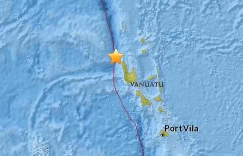
Comment: This latest quake is the FIFTH + 6.0 magnitude earthquake to have struck this region in the past several days. See also:
- 6.0 earthquake strikes off Vanuatu coast; 4th quake in a week
- Magnitude 6.7 earthquake strikes Vanuatu; THIRD large quake in region this week
- Magnitude 6.9 earthquake strikes northwest of Vanuatu
- 7.2 magnitude quake strikes off Vanuatu islands
All around the world seismic and volcanic activity appears to have increased recently.