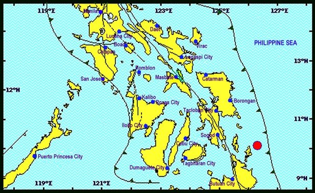
The strong quake occurred at 6:11 a.m. with its epicenter traced at 29 kilometers (km) northeast of San Isidro town, Siargao Island, Surigao del Norte, the Philippine Institute of Volcanology and Seismology (Phivolcs), said in its bulletin.
The tremor was tectonic in origin, with a depth of 51 km. The quake was also felt in the cities of Surigao and Butuan.
It was caused by movements along a local fault in Surigao Island, Phivolcs said.
No aftershock was registered and no tsunami alert was raised by the state agency.
The action center of the Provincial Disaster Risk Reduction and Management Council (PDRRMC) in Surigao del Norte said there were no casualties or damages reported when the earthquake hit the tourist island.
Personnel and rescue teams of PDRRMC were immediately mobilized by Surigao del Norte Gov. Sol F. Matugas to go to Siargao Island and conduct on-ground assessment and verification.
"I already called up the attention of our nine island mayors there to personally verify on the ground the situation of our residents including tourists, both foreign and domestic, but thanks God no one was reported hurt as of this time," Matugas said.
Earlier, on the same day and town, a 3.2 magnitude quake was also registered at 4:04 a.m. with an epicenter plotted just 7 km southwest of San Isidro town, with only a depth of 10 km., Philvocs said.
The tremor was also tectonic in origin.


Reader Comments
to our Newsletter