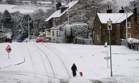
The cold snap gripping Europe shows no sign of letting up as the UK braces for snow next week.
Overnight frosts will continue throughout next week, with increasingly wintry showers turning from sleet into snow.
A few centimetres of snow could fall in the east and hilly parts of the south-east on Friday.
Snow is continuing to fall on higher ground across Scotland, but will struggle to settle after sleet showers.
The rain and sleet will move southwards over the country while other parts will stay dry after clear spells. A cold wind is expected to sweep the entire country as temperatures struggle to rise above 4C or 5C.
Alexi Boothman, forecaster at MeteoGroup, said showers and sleet are likely to continue throughout the day. "Down south will experience mostly rain but some snow is likely to fall on higher ground in areas such as Derbyshire and Lincolnshire. This band is moving south quickly, with clear skies behind this," she said.
"It will be a mostly dry day for most parts apart from the east and southeastern parts, where sleet showers will be falling until lunchtime. Kent and the far south-east look set to stay fairly damp following a fair amount of rain, and the eastern coast and parts of Wales are also set for showers."
Weather warnings have been issued for Scotland, northern England and parts of the Midlands and East Anglia as ice is likely to form on untreated surfaces following rainfall.
Overnight the wind will ease and skies will clear, and temperatures will be close to freezing in most places. A cold and frosty start is expected for the weekend, with plenty of sunshine before wet and windy weather returns on Saturday.


Reader Comments
to our Newsletter