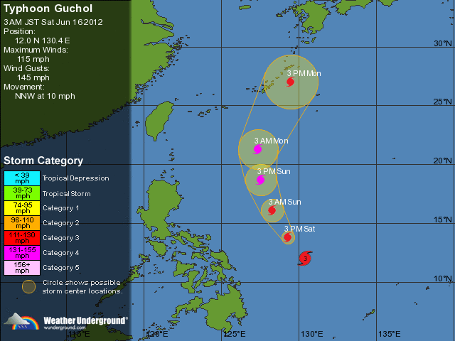
Wind gusts in the area may be considerably higher. There is also the potential for flooding further inland due to heavy rain. This is an extremely dangerous storm and people in low-lying areas or regions at risk should heed all emergency bulletins.
According to the Saffir-Simpson damage scale the potential property damage and flooding from a storm ofGuchol'sstrength (category 1)at landfall includes:
- Storm surge generally 1.2-1.5 metres (4-5 feet) above normal.
- No real damage to building structures.
- Damage primarily to unanchored mobile homes, shrubbery, and trees.
- Some damage to poorly constructed signs.
- Some coastal road flooding and minor pier damage.
The information above is provided for guidance only and should not be used to make life or death decisions or decisions relating to property. Anyone in the region who is concerned for their personal safety or property should contact their official national weather agency or warning centre for advice.
This alert is provided by TropicalStorm Risk (TSR) which is sponsored by Benfield, Royal & SunAlliance,Crawford & Company and University College London (UCL). TSR acknowledges thesupport of the UK Met Office.


Reader Comments
to our Newsletter