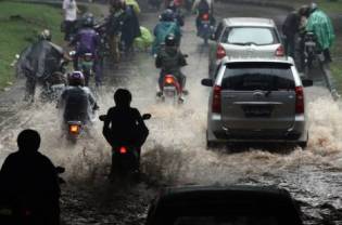
All regions across the archipelago have been experiencing abnormal and often catastrophic weather, an official from the Meteorology, Climatology and Geophysics Agency (BMKG) said.
"We have reached a super-extreme level of weather this year, the first time in our history, and this is much worse than what we experienced back in 1998, when the La Nina caused extreme weather in the country," Edvin Aldrian warned.
Edvin, who leads the climate change and air quality division at the agency, told the Jakarta Globe that a combination of a heating planet and the La Nina climate cycle were behind the unseasonable downpours.
"The combination of global warming and the La Nina phenomenon makes everything exceed normalcy," he said, adding that global warming causes higher temperature in sea waters, and La Nina boosts humidity and the likeliness of rains.
Sea temperatures, Edvin said, were also at a level considered normal for Indonesia's rainy season, not for the dry season. "It is about 28 to 29 [degrees] Celsius now. Normally, for August it should have been around 24 to 26 degrees."
Generally at this time of year, Indonesia is supposed to be in the midst of the dry season and entering the transition to wetter months. "In conditions like this, tornadoes are likely to occur," Edvin warned.
"It can happen in any region in the country, starting from the western part of Indonesia to the east."
He also said the extreme conditions were causing high waves, posing a threat to ships in Indonesian waters. "At the least, the waves will reach 3.5 meters and can reach up to more than five meters. And strong winds can make the waves even higher.
"The Southern part of Sumatra and Java are the most affected areas so far," he said. "This condition is forecast to start to reach the eastern part of Indonesia within one to two weeks."
Based on a BMKG forecast, the provinces of Aceh, North Sumatra, West Sumatra, West Java, West Kalimantan, East Kalimantan, Maluku, West Papua and Papua would see prolonged high rains, with more than 400 millimeters falling from now through October. More than 100 mm of rain is categorized as high intensity.
The rest of the country is expected to begin entering the rainy season again in November.
The extreme weather has already affected the country's agricultural output, especially in Java where there are many farms, said Winny Dian Wibawa, the Agriculture Ministry's director for horticulture.
"Crops like melon, mango and mushrooms are experiencing delayed harvests.
"It puts the farmers at a disadvantage as they now cannot produce many good quality crops," he said, adding that the excess rains made fruit softer and less sweet.
Izzul Waro, an analyst from the Transportation Study Institute (Instran), told the Globe that the extreme weather would also cause headaches for commuters and truckers, especially in big cities like Jakarta.
"The conditions become worse because the drainage system in the city's roads is bad. Puddles of water will occur with just a bit of rain," he said, adding that traffic would only worsen during the extended rainy season.
The capital has seen heavy downpours in the past two days, causing deep inundations and burst river banks. On Tuesday, at least five neighborhoods in South Jakarta reported flooding.


They don't seem to extend back very far.