|
|
Signs Supplement: Climate
and Earth Changes
May 2005
FREDERICTON - Flooding is easing in the
upper reaches of New Brunswick's St. John River valley, but the
water is still rising downstream, the province's Emergency Measures
Organization and River Watch 2005 said on Sunday.
"Persons living or working along the lower St. John River
and in low-lying areas should remain on the alert and take steps
to protect their property," a news release said.
In some areas, the only way to get around is on canoe.
From Jemseg, roughly halfway between Fredericton and Saint John,
down to salt water, the river is still rising. But upriver from
the town, it has peaked and is beginning to drop.
Even so, for Fredericton and nearby areas, "flooding is
expected to continue for the next few days as the water levels
slowly decrease," EMO said. [...] |
BIRMINGHAM, Ala. -- April made a stormy exit
in Alabama.
Thunderstorms this weekend brought a flood threat to coastal retreats
along the Styx and Fish rivers, and downed some trees and knocked
out power in the Birmingham metro area.
The National Weather Service warned residents along the rivers
in south Baldwin County to brace for high water caused by the
downpour.
The Styx River near Elsanor was expected to crest near 17.7
feet early Sunday and fall back below flood stage Sunday evening.
Moderate flooding was forecast for the Fish River near Silverhill.
The river was expected to crest near 14.7 feet early Sunday and
fall back below flood stage early Monday.
The thunderstorms, packing high winds and lightning, also moved
across north-central Alabama early today. The storms caused nearly
16,000 temporary power outages in the Birmingham-Hoover metro
area. [...] |
Experts at the Climate Modeling Group at
the Lamont-Doherty Earth Observatory (LDEO), part of The Earth
Institute at Columbia University, expect drought to worsen in
the Plains and the West over the next several years due to La
Niña-like conditions. LDEO's "Persistent Drought in
North America" Web site provides an in-depth examination
of drought in this region.
Using observations and models, LDEO scientists learned that
all the major dry and wet events in the American West in the last
century and a half were forced by slowing varying tropical Pacific
sea surface temperatures (SSTs). On the Web site, Climate Modeling
Group scientists show that decadal variations of these SSTs are
predictable to a modest degree a few years in advance.
The group’s research on whether rising greenhouse gases
will induce an El Niño-like (causing increased precipitation
over the American West) or La Niña-like (causing less precipitation
over the American West) response in the tropical Pacific Ocean
provides additional insight on whether the American West is entering
a more drought-prone period than any seen since European settlement.
[...] |
MADRID: Spain has suffered its driest winter
and early spring since records began almost 60 years ago, data
from meteorologists showed on Friday.
Rainfall from November to the end of March this year was 37 per
cent below the average for the period and the lowest since records
started in 1947, the National Meteorological Office said.
With water reserves in Spain at just 60 per cent of full capacity,
farmers fearing water rationing say they are planting fewer crops.
Neighbouring Portugal is suffering its worst drought for 25
years and authorities there have imposed irrigation restrictions
in the south, a popular tourist destination. |
Using ocean data collected by diving floats,
U.S. climate scientists released a study Thursday that they said
provides the "smoking gun" that ties manmade greenhouse
gas emissions to global warming.
The researchers, some of them working for NASA and the Energy
Department, went a step further, implicitly criticizing President
Bush for not taking stronger action to curb emissions of carbon
dioxide and other heat-trapping gases.
They said the findings confirm that computer models of climate
change are on target and that global temperatures will rise 1
degree Fahrenheit this century, even if greenhouse gases are capped
tomorrow.
If emissions instead continue to grow,
as expected, things could spin "out of our control,"
especially as ocean levels rise from melting Greenland and Antarctic
ice sheets, the NASA-led scientists said. "The climate system
could reach a point where large sea level change is practically
impossible to avoid."
The study, published Thursday in the journal Science, is the
latest to report growing certainty about global warming projections.
Floats and satellites used
More than 1,800 technology-packed floats, deployed in oceans
worldwide beginning in 2000, are regularly diving as much as a
mile undersea to take temperature and other readings. Their precise
measurements are supplemented by better satellite gauging of ocean
levels, which rise both from meltwater and as the sea warms and
expands.
Researchers led by NASA's James Hansen used the improved data
to calculate the oceans' heat content and the global "energy
imbalance." They found that for every
square meter of surface area, the planet is absorbing almost one
watt more of the sun's energy than it is radiating back to space
as heat - a historically large imbalance. Such absorbed
energy will steadily warm the atmosphere. [...]
'Can no longer be genuine doubt'
Significantly, those emissions have increased at a rate consistent
with the detected energy imbalance, the researchers said.
"There can no longer be genuine doubt that humanmade gases
are the dominant cause of observed warming," said Hansen,
director of NASA's Goddard Institute for Space Studies. "This
energy imbalance is the 'smoking gun' that we have been looking
for." [...] |
| Springtime on the Columbia River
usually means hordes of Chinook salmon swimming up the river, nourishing
on their way centuries-old Indian traditions and a voracious commercial
fishery.
This year, however, thousands of salmon seem to have gone missing
- and no one knows why.
"We’ve got a big mystery on our hands, a run of salmon
that seems to have disappeared," said Stuart Ellis, a harvest
management biologist with the Columbia River Inter-Tribal Fish Commission.
Scientists had initially expected this year’s salmon run
to number about 225,000 fish swimming past the Bonneville Dam where
they’re counted. But, as of last Thursday, scientists had
only counted about 26,000 since the beginning of the year.
A group of fish managers and tribal representatives met Monday
to revise their estimate, knocking the number of fish they expect
to pass from the original estimate of 225,000 to an unofficial guess
of between 70,000 and 100,000.
Harsh consequences
For the first time the Indian tribes - who have for centuries
relied on the salmon for their cultural and economic well-being
- have been forced to get the fish used in their springtime
ceremonies from other sources, some donated from sympathetic fishermen
downstream and others from freezers storing last year’s catch.
Charles Hudson, the manager of the Columbia River Inter-Tribal
Fish Commission, said that the effects of the dearth of Chinook
this year run deep, deeper than just having to rely on frozen fish
for the annual ceremonies.
The tribes also depends on the fish for much of their daily food,
and were initially given a seasonal allotment of 25,000 fish to
feed about 20,000 people this year. So far, tribal fishermen have
caught under 5,000 fish, according to the commission's statistics.
The tribes are also dependent on salmon for much of their economic
sustenance, but it looks as though that will also be jeopardized
this year.
"It looks very likely that there will be no - zero -
commercial fishery this year," said Hudson.
Significant drop in tourism
On April 20, federal fish managers shut down the entire Columbia
River above the Bonneville dam to all commercial and sport fishing.
This has resulted in commercial fisherman losing one quarter to
one third of their profits for the entire year, according to Oliver
Waldman, the executive director of Salmon for All, a fisherman’s
advocacy organization.
"They’re broke," he said. The Chinook are their
most important catch, the most valuable fish on the West Coast,
netting the fishermen $5-6 per pound.
Now, however, "the fishery is sitting at the dock," Waldman
said.
Bill Witt, who owns a fishing guide company that runs frequent
trips on the Columbia, estimates that if the river is closed until
June, his business will lose at least $25,000, about one-tenth of
its income for the season.
Within four days of the fishery shutting down, Gimme-A-Go Fishing
Adventures lost about $3,000, according to its owner, Jon Ball.
"I’ve been sitting at home. I had the last three days
off," he said on Tuesday. He had to cancel all of the river
tours he had booked for the weekend, as well as a television feature
that was to be filmed from his boat.
Ball noted that it’s not only sportsmen like himself who
depend on the sport fishing industry, but also the riverside towns
who rely on tourists and fishermen to rent hotel rooms and visit
stores and restaurants. Now none of those businesses are getting
the expected seasonal rush.
"Everybody’s screwed," said Ball.
Unsolved mystery
So what happened to the fish?
Were they victimized by the wily sea lions that have discovered
how to climb fish ladders at the Bonneville Dam, sitting there all
day and devouring the unfortunate fish that try to swim past? Has
there been some significant change in ocean conditions that have
killed thousands of fish? Or is there some secret black market downriver
that’s catching all the fish as they try to swim up the river?
Sea lions are easy targets of the public and the government fish
managers, who have begun to blast fireworks on the Bonneville Dam
fish ladders where many lions have taken up residence. But even
the hundreds of sea lions that now live around the dam couldn’t
eat nearly enough fish to account for the tiny run.
The fish market is also closely monitored by government regulatory
agencies, so a massive black market is highly unlikely.
Scientists say they haven’t seen any evidence of a dramatic
change in ocean conditions that could cause so many fish to die,
but that could be a likely problem, according to Steve Williams,
the assistant director of the fish program at the Oregon Department
of Fish and Wildlife.
Such changes could include increased predation of the fish, or
a change in water temperatures. Williams said scientists have not
been able to pinpoint what changes have occurred that have hurt
fish populations.
Williams noted that the annual springtime smelt fish run up the
river was also nearly nonexistent this season. Smelt runs have not
in years past been accurate predictors of salmon runs up the river,
but both fish would be susceptible to altered ocean conditions,
so the same problem could be to blame for reduced populations of
both fish.
Most people involved have established their own theories. Ball,
the fisherman, said he suspects the salmon have been tricked by
lower water levels caused by last summer’s drought into delaying
their run up the river. He said he also thinks the sea lions may
have quite a bit to do with it.
Ellis and Williams both agree that none of these problems individually
should take all the blame. If anything, the low numbers of salmon
are the result of a number of factors influencing their ability
to swim past the Bonneville Dam to their upstream spawning grounds.
Room for optimism
Williams said that despite the dismal numbers and initial panic,
he and others are now looking at the salmon run with "slight
optimism."
"Last week we were definitely in crisis mode," he said.
But the increase in the number of fish making their way upstream
is cause for optimism, he said, and he expects the run this year
to at least hit the minimum expectation of 70,000 fish.
Williams also said that the commercial and sport fisheries might,
if the count continues to trend upward, be opened again soon. He
said fish managers are evaluating the necessity of the closure on
a weekly basis, and could decide as soon as next week that salmon
numbers are sufficient to warrant it reopening.
Even if the fishery were to reopen soon, however, it would be too
late for many of those people dependent on the fish. Most of the
Indian celebrations are done for the season, and most of the commercial
fishermen have departed the salmon fishery, looking for greener
pastures in other Pacific Northwest regions.
"They’re hoping, with a great, fervent hope, that the
Alaska season will bring some revenues to them and their families,"
said Waldman, of Salmon for All. Even if the river were reopened
to the fishermen next week, they’ve already departed north
and couldn’t be repositioned for the Chinook catch.
Scientists are careful to note that the fish count continues through
early June, but say that even if it turned out that the run was
simply delayed this year, or even if daily counts jumped into the
thousands, this year’s run still won’t come close to
the numbers initially predicted. |
BIG FLATS, Wis. - A fast-moving forest fire
destroyed 30 homes and forced dozens to flee as it spread to almost
4,000 acres before being contained overnight, officials said Friday.
No major injuries were reported.
The wind-whipped fire - described as the
largest wildfire in Wisconsin in 25 years - swept across
nearly 3,900 acres, destroying 30 permanent and seasonal homes,
at least 30 camper trailers and about 60 sheds or similar structures,
Big Flats Fire Chief Dick Meyers said. About 125 families were
evacuated, and about two dozen spent the night at an elementary
school.
The total loss will be in the millions of dollars, said David
Weitz, a spokesman for the state Department of Natural Resources.
More than 200 homes and businesses lost electricity as the flames
consumed utility poles, damaged transformers and burned at least
25 miles of power lines.
The blaze in rural Adams County began Thursday when a landowner
started a small fire to clear grass before building a campfire,
said Steve Courtney, a Natural Resources incident commander.
Along with the homes, the fire destroyed camper-trailers and
other outbuildings, Fire Chief Dick Meyers said. Gov. Jim Doyle,
who surveyed the damage by helicopter, said he saw many houses
still standing. [...]
Some people reported seeing flames shooting 120 feet into the
air, said Trent Marty, head of the state's forest protection bureau.
[...] |
| WASHINGTON - The Earth has been
getting brighter since 1990, reversing a trend called global dimming,
scientists reported on Friday in the journal Science.
A brighter Earth means more sunlight is reaching the ground. The
scientists wrote that there appeared to be fewer particles in the
air to reflect light back into space before it hits the ground.
The planet has become about four per cent brighter, the researchers
said, although they could not pinpoint exactly why.
The scientists, led by Martin Wild of the Institute of Atmospheric
and Climate Science in Switzerland, suggested the reason could be
less pollution.
"This may be ... due to more effective clean air regulations
and the decline in the economy with the political transition in
Eastern European countries in the late 1980s," Wild and his
co-authors wrote.
The trend could explain why higher temperatures as forecast by
global warming did not occur until the late 1990s.
The study said the dimming effect found by other scientists between
the 1960s and the 1980s, perhaps due to cloud composition and pollution,
masked the greenhouse effect.
But the atmosphere began to change from the mid-1980s, Wild's team
wrote, with less carbon dioxide and other gases that trap heat in
the atmosphere.
"This masking of the greenhouse effect and related impacts
may no longer have been effective thereafter, enabling the greenhouse
signals to become more evident during the 1990s," they wrote.
Wild's study also found the dimming trend continues in some areas,
such as China and India, where pollution remains largely unabated.
The scientists behind another study published in the same issue
of Science supported Wild and his colleagues.
Bruce Wielicki of the NASA Langley Research Center in Virginia
and his team used satellites to show the Earth has increased its
reflectivity.
They also discounted the suggestion that changing cloud patterns
could be responsible for the Earth's new glow. |
| There's a myth about the sun.
Teachers teach it. Astronomers repeat it. NASA mission planners
are mindful of it.
Every 11 years solar activity surges. Sunspots pepper the sun;
they explode; massive clouds of gas known as "CMEs" hurtle
through the solar system. Earth gets hit with X-rays and protons
and knots of magnetism. This is called solar maximum.
There's nothing mythical about "Solar Max." During the
most recent episode in 2000 and 2001, sky watchers saw auroras as
far south as Mexico and Florida; astronomers marveled at the huge
sunspots; satellite operators and power companies struggled with
outages.
Now the sun is approaching the opposite extreme of its activity
cycle, solar minimum, due in 2006. We can relax because, around
solar minimum, the sun is quiet. Right?
"That's the myth," says solar physicist David Hathaway
of the NASA Marshall Space Flight Center. The truth is, solar activity
never stops, "not even during solar minimum."
To show that this is so, Hathaway counted the number of X-class
solar flares each month during the last three solar cycles, a period
spanning 1970 to the present. X-flares are the most powerful kind
of solar explosions; they're associated with bright auroras and
intense radiation storms. "There was at least one X-flare during
each of the last three solar minima," says Hathaway.
This means astronauts traveling through the solar system, far from
the protection of Earth's atmosphere and magnetic field, can't drop
their guard--ever.
Recent events bear this out: Rewind to January 10, 2005. It's four
years since solar maximum and the sun is almost blank--only two
tiny sunspots are visible from Earth. The sun is quiet.
The next day, with stunning rapidity, everything changes. On January
11th, a new 'spot appears. At first no more than a speck, it quickly
blossoms into a giant almost as big as the planet Jupiter. "It
happened so quickly," recalls Hathaway. "People were asking
me if they should be alarmed."
Between January 15th and 20th, the sunspot unleashed two X-class
solar flares, sparked auroras as far south as Arizona in the United
States, and peppered the Moon with high-energy protons. Lunar astronauts
caught outdoors, had there been any, would've likely gotten sick.
So much for the quiet sun.
It almost happened again last month. On April 25, 2005, small sunspot
emerged and--déjà vu--it grew many times wider than
Earth in only 48 hours. This time, however, there were no eruptions.
Why not? No one knows.
Sunspots are devilishly unpredictable. They're made of magnetic
fields poking up through the surface of the sun. Electrical currents
deep inside our star drag these fields around, causing them to twist
and tangle until they become unstable and explode. Solar flares
and CMEs are by-products of the blast. The process is hard to forecast
because the underlying currents are hidden from view. Sometimes
sunspots explode, sometimes they don't. Weather forecasting on Earth
was about this good ... 50 years ago.
Researchers like Hathaway study sunspots and their magnetic fields,
hoping to improve the woeful situation. "We're making progress,"
he says.
Good thing. Predicting solar activity is more important than ever.
Not only do we depend increasingly on sun-sensitive technologies
like cell phones and GPS, but also NASA plans to send people back
to the Moon and then on to Mars. Astronauts will be "out there"
during solar maximum, solar minimum and all times in between.
Will the sun be quiet when it's supposed to be? Don't count on
it. |
BEIJING - China is facing an "apocalyptic"
summer of severe drought and floods, a leading weather expert
has warned, with water supplies and grain production under threat.
"China may face a grim situation
from seasonal floods or drought this year with potential damage
worse than that of last year," said Qin Dahe, a top
official at the China Meteorological Administration.
"There will be much fear of a bad harvest this year."
Qin was speaking during a national televised conference on summer
weather forecasting and services, said the China Daily, which
reported him as saying China faced an "apocalyptic"
situation.
He warned the probabilities of weather-related disasters were
high with the rainy season already underway in parts of south
China while the national flood season was imminent.
Thousands of people die every year from floods, landslides and
mudflows in China, with millions left homeless.
While some parts of the huge country suffer massive rainfall,
other parts are ravaged by drought, with drinking water and grain
yields hit.
Qin said most of western and northeast China as well as parts
of south China are in the midst of their worst drought in 50 years
and no end was in sight, while huge rain belts were forecast for
other areas. |
TAIPEI - Torrential rain in Taiwan has caused
mass flooding and landslides that have claimed the lives of four
people and left another four missing, fire agency and government
officials said Sunday.
"The bodies of the four victims have been found,"
said an official from the National Fire Agency, which coordinates
rescue operations in Taiwan.
A 60-year-old man was drowned in northern Hsinchu city.
Two agricultural officials were found dead after they were washed
away by rising floodwater outside the city in Hsinchu county.
The fourth victim was working on a riverbed in southeastern
Taitung county when he was engulfed by floodwaters, the agency
said.
Hundreds of residents were evacuated from Hsinchu county and
central Nantou, where at least 500 millimeters (20 inches) of
rain had fallen in three days, it said. |
Nebraska Gov. Dave Heineman declared a state
of emergency in Adams and Hall counties late Thursday after touring
hard-hit central Nebraska, which is recovering from heavy rain
and pounding storms.
Heineman also sent 20 soldiers from the Nebraska National Guard
to help with sandbagging in the Grand Island area, as requested
by city officials.
It may take days or even weeks before the state can provide
an estimate of damage to the region's buildings, infrastructures
and crops, Heineman said.
Heineman said officials would continue to assess damage, which
could lead to more disaster declarations in other counties. |
The damage is done and now its time to pick
up the pieces. Thursday was a rough day for residents across the
South Plains. The storms produced 10 tornadoes across the area.
A tornado tore through a house just two miles west of Ralls.
Harley Reese, 77, wasn't home at the time. The 2,500 square-foot
house was ripped off its foundation and contents were found a
mile-and-a-half away. [...]
Softball sized hail broke several windows, sky lights and car
windshields. The most damage was done on the south side of Lake
Ransom Canyon and just to the east. The storm damaged several
roofs, but there were no reports of damage to any homes. [...] |
Atlantic Ocean ripe for two more decades
of fostering strong storms
TAMPA, Fla. - With the onset of the 2005 hurricane season little
more than two weeks away, meteorologists on Friday warned that
conditions in the Atlantic Ocean again were ripe for spawning
tropical storms that could slam into Florida or other parts of
the Eastern U.S. or Gulf coast with potentially devastating and
deadly consequences.
Last season, Florida was hit by four hurricanes in six weeks,
an unprecedented succession of natural disasters in the state
that was blamed for 123 deaths and more than $42 billion in property
damage. Although predicting where and when storms will make landfall
is impossible, forecasters attending Florida's 19th annual Governor's
Hurricane Conference agreed that the Atlantic Ocean was in the
throes of an active period that could last another two decades
or more.
"We're in a new era now, and we're going to see a lot more
major storms," said William Gray, a professor in Colorado
State University's department of atmospheric science, who issues
a much-awaited yearly prediction of hurricane activity. [...] |
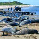 |
| A
new study finds whale beachings coincide with changes in
solar activity. (Mavis Burgess) |
Surges of solar activity may cause whales to run aground, possibly
by disrupting the creatures' internal compasses, according to
German scientists.
University of Kiel researchers Klaus Vaneslow and Klaus Ricklefs
looked at sightings of sperm whales found beached in the North
Sea between 1712 and 2003.
They compared the record with another set of historical data
- astronomers' observations of sunspots, an indicator of solar
radiation.
They found that more whale strandings occurred when the sun's
activity was high.
The sun experiences cycles of activity which range from eight
to 17 years, with 11 years being the average.
Short cycles are linked with periods of high energy output,
while long cycles are believed to be low energy.
Changes in levels of solar radiation have a big effect on earth's
magnetic field.
The most notable events are solar flares that cause shimmering
lights, called aurorae, in the magnetic fields in polar regions.
Big solar flares can also disrupt telecommunications and power
lines and knock out delicate electronic circuitry on satellites.
The researchers found that of the 97 stranding events reported
around the coastal countries of the North Sea over the 291 years,
90 per cent occurred when the sun cycles were below average in
duration. [...] |
'Dead zones',
where pollution has starved the sea of life-giving oxygen, are
increasing at a devastating rate
It has arrived early; it's bigger than ever and it promises
a summer of death and destruction. The annual "dead zone"
in the Gulf of Mexico - starved of oxygen, and thus killing fish
and underwater vegetation - has appeared earlier than usual this
year.
This is just one sign of a rapidly growing crisis. The number
of similar dead zones in the world's seas has doubled every decade
since 1960, as a result of increasing pollution. The United Nations
Environment Programme says that there are now 146 of them worldwide,
mainly around the coasts of rich countries.
Its executive director, Klaus Töpfer, calls their growth
"a gigantic, global experiment ... triggering alarming, and
sometimes irreversible, effects".
The Gulf of Mexico dead zone - which can cover more than 7,000
square miles - is mainly caused by fertilisers, flowing down rivers
to the sea. Every year the Mississippi river - which drains 41
per cent of the United States - dumps 1.6 million tons of nitrogen
in the gulf, three times as much as 40 years ago. Most comes from
the highly productive corn belt, which helps to feed the world.
The nutrients feed blooms of algae and phytoplankton. The algae
drain oxygen from the water, as do the decomposing bodies of the
plankton, when they fall to the seabed and die.
It hits a fishery that provides one-fifth of the country's entire
harvest from the sea. As a result, catches of brown shrimp, the
gulf's most important species, have dropped since 1990. The worst
years match those with biggest dead zones, which appear to block
juveniles from reaching their offshore spawning grounds. Last
year, the dead zone was even blamed for a tripling in shark attacks
on Texas bathers. Fish and swimming crabs flee the pollution for
cleaner water, followed by the sharks.
Scientists recently found 19 locations with
severely depleted oxygen in the gulf, where they expected to find
none at this time of year. "It usually doesn't start until
June," said Steven DiMarco, a researcher at Texas A&M
University, one of several groups involved in the testing. "It
was larger at that time than it was at any time in 2004. During
January and February of this year, the flow of the Mississippi
river was larger than at any time in 2004."
The stratification levels between the fresh river water and heavier
salt water of the sea created the dead zone, which usually is
at its most severe between 30 and 60 feet below the surface. The
zone was first recorded in the early 1970s. It originally occurred
every two to three years, but now returns each summer.
The world's biggest dead zone is in the Baltic, where sewage
and nitrogen fallout from burning fossil fuels combine with fertilisers
to over-enrich the sea. Fish farming can also exacerbate the problem.
Nearly a third of the world's dead zones are
off the United States - including a notorious one in Chesapeake
Bay - but they also cluster round the coasts of Europe and Japan,
and have reached China, Brazil, Australia and New Zealand. [...] |
 |
|
Image
of the sun from the SOHO spacecraft of the intense solar
activity taken May 15, 2005, at 7:50 a.m. |
Forecasters at the NOAA Space Environment Center in Boulder, Colo.,
observed a geomagnetic storm on Sunday, May 15, which they classified
as an extreme event, measuring G-5-the highest level-on
the NOAA Space Weather Scales.
"This event registered a 9 on the K-Index, which measures
the maximum deviation of the Earth's magnetic field in a given
three-hour period," said Gayle Nelson, lead operations specialist
at NOAA Space Environment Center. "The scale ranges from
0 to 9, with 9 being the highest. This was a significant event."
Possible impacts from such a geomagnetic storm include widespread
power system voltage control problems; some grid systems may experience
complete collapse or blackouts. Transformers may experience damage.
Spacecraft operations may experience extensive surface charging;
problems with orientation; uplink/downlink and tracking satellites.
Satellite navigation may be degraded for days, and low-frequency
radio navigation can be out for hours. Reports received by the
NOAA Space Environment Center indicate that such impacts have
been observed in the United States.
NOAA forecasters said the probability of another major event
of this type is unlikely, however, other minor level (G-1) geomagnetic
storms are possible within the next 24 hours.
This event was forecast by NOAA as the result of a solar flare
that occurred on Friday, May 13.
The NOAA Space Environment Center, one of the NOAA National Centers
for Environmental Prediction, is home to the nation's early warning
system for solar activities that directly affect people and equipment
on Earth and in space. The NOAA Space Environment Center’s
24/7 around-the-clock operations are critical in protecting space
and ground-based assets. Through the SEC, NOAA and the U.S. Air
Force jointly operate the space weather operations center that
continuously monitors, analyzes and forecasts the environment
between the sun and Earth. In addition to the data gathered from
NOAA and NASA satellites, the center receives real-time solar
and geophysical information from ground-based observatories around
the world. NOAA space weather forecasters use the data to predict
solar and geomagnetic activity and issue worldwide alerts of extreme
events.
NOAA, an agency of the U.S. Department of Commerce, is dedicated
to enhancing economic security and national safety through the
prediction and research of weather and climate-related events
and providing environmental stewardship of the nation's coastal
and marine resources.
|
PERTH - Severe winds and torrential rain
have ripped through the southwest of Western Australia, blocking
roads, damaging buildings, felling trees, bringing down power
lines and closing schools.
Hundreds of State Emergency Service volunteers were called to
incidents across Perth and further south.
The town of Bunbury, 180km south of Perth, appears to have been
the worst affected by the line of severe thunderstorms yesterday.
Staff at the town's ABC radio station were lucky to escape with
their lives after a 38m crane collapsed on their building.
Some schools in the town were forced to close, the roof of the
town's cathedral was damaged and numerous businesses and homes
also lost roofs.
At the ABC station, journalist Alisha O'Flaherty said she had
stepped out of her office and was walking towards a printer as
she prepared her 6.30am bulletin when the crane collapsed, crushing
the newsroom.
"I heard a sound like a train coming towards me and basically
this enormous crash behind me, and the whole office was destroyed,"
said Ms O'Flaherty.
"I was shocked for a second, and then we all gathered together
and left the building because we didn't think it was stable."
Bicton, 15km south of Perth, was also battered, and the suburb's
primary school was badly affected.
State Emergency Service spokeswoman Nita Gill said there had
been calls to 500 incidents across the city, and 150 volunteers
had been asked to help. [...] |
NANCHANG, May 15 (Xinhuanet) -- The Yangtze
River areas will receive more rain this year than last year and
will be under threat in the coming June-August flood season.
Cloudy and rainy weather has lingered at the middle and lower
reaches of the river since the beginning of spring, and several
hydrological stations have reported record high levels of water,
said Cai Qihua, director of the Yangtze River Water Resources
Committee.
He made the remarks at a meeting on flood control of the Yangtze
River Sunday in Nanchang, capital of east China's Jiangxi Province.
The Yangtze River, historically rampant with flooding, was spared
slightly last year. But typhoons, mud-rock flows and landslides
still occurred in some flooded areas. [...] |
HANOI - A Vietnamese oil tanker sank after
colliding with another vessel, spilling tonnes of diesel off the
country's southern coast, state media reported on Friday.
The tanker, operated by state oil monopoly Petrovietnam, went
down on Thursday near Dai Hung oilfield with a cargo of 100 tonnes
of diesel oil after crashing into a Liberian-flagged oil tanker,
the Nhan Dan newspaper reported.
An oil spill appeared near the crash site, around 135 nautical
miles southeast of the southern oil hub Vung Tau City, which is
125 km (75 miles) northeast of Ho Chi Minh City, the report said.
All 16 crew of the Vietnamese ship were rescued. There was no
damage to the Liberian vessel. |
ST. JOHN'S - Warming waters in the North
Sea have pushed dozens of species of fish farther north, according
to British researchers.
Reporting in the latest issue of the journal Science, the researchers
found water temperatures in the North Sea climbed about one degree
Celsuis during their investigation period, 1977 to 2001.
"We've seen that nearly two-thirds of the species have
shifted their geographic centre in response to warming, and most
of those shifts have been northward," says principal researcher
Allison Perry, a doctoral student at the University of East Anglia.
In all, 36 species were considered, including cod and other
commercially sought species, such as whiting.
The study pointed to a range of troubles, because while some
species have moved significantly northwards, other species –
including traditional food sources for other fish – have
not.
"It's not so simple as just all of the fish moving together,"
Perry says.
"What we're seeing is a whole range of different responses
... so there are some fish that are shifting and among those some
are shifting more quickly, and others are shifting more slowly,
and there are some fish that don't seem to be responding at all."
The researchers attributed the rise in temperature to global
warming. [...] |
DHAKA : At least 17 people died and more
than 1,000 homes were destroyed Tuesday in pre-monsoon storms
in northwestern Bangladesh, police officials told AFP.
The storms uprooted trees and flattened hundreds of bamboo and
tin roofed dwellings, killing 13 people in Natore district, said
district additional superintendent of police Mustafizur Reza.
Four others died in adjoining Rajshahi district, about 160 kilometres
(100 miles) from the capital Dhaka, added a district police spokesman.
The victims died when they were hit by falling trees and other
objects, the officials said.
Phone lines to some of the areas had been cut, they added.
In another storm in central Bangladesh Tuesday, a ferry carrying
more than 100 people capsized.
At least one person has been confirmed dead and a salvage operation
to recover bodies thought to be trapped in the sunken vessel was
due to begin early Wednesday. |
YELLOWKNIFE – People living in a wilderness
camp downriver from Fort Good Hope narrowly escaped the floodwaters
of the Mackenzie River late last week.
The 14 Sahtu Dene at Charlie Tobac's camp on the Tida River,
60 kilometres down river from the community, had to be evacuated
when waters swept through the camp.
The group had been in contact with Fort Good Hope and had heard
about the flooding in the community, so knew they were next to
face the rising waters.
Tobac says they placed as much of their equipment and supplies
as they could on stilts, and started hauling the remainder of
their goods up a slope away from the river.
But the speed of the rising waters still caught them off guard,
and Tobac says the flood waters were terrifying.
"All that water was just going over the cliff and it was
just like rapids. I heard trees breaking like sticks and sounds
like shots of rifles. It was really loud," he says.
Tobac says they had a radio, but the had to save the radio's
one remaining battery to start their outboard in case they had
to make a fast escape by water.
By Wednesday, the Fort Good Hope band became alarmed by their
radio silence, and sent out a helicopter.
The helicopter relayed a total of eight people from Tobac's
camp that day and the next.
But the camp was flooded out before the chopper could return
for the last six on Friday.
The remainder had to take to their boat in search of higher
ground. |
CLIMATE change researchers have
detected the first signs of a slowdown in the Gulf Stream -
the mighty ocean current that keeps Britain and Europe from freezing.
They have found that one of the “engines” driving
the Gulf Stream - the sinking of supercooled water in the
Greenland Sea - has weakened to less than a quarter of its
former strength.
The weakening, apparently caused by global warming, could herald
big changes in the current over the next
few years or decades. Paradoxically,
it could lead to Britain and northwestern and Europe undergoing
a sharp drop in temperatures.
Such a change has long been predicted by scientists but the new
research is among the first to show clear experimental evidence
of the phenomenon.
Peter Wadhams, professor of ocean physics at Cambridge University,
hitched rides under the Arctic ice cap in Royal Navy submarines
and used ships to take measurements across the Greenland Sea.
“Until recently we would find giant ‘chimneys’
in the sea where columns of cold, dense water were sinking from
the surface to the seabed 3,000 metres below, but now they have
almost disappeared,” he said.
“As the water sank it was replaced by warm water flowing
in from the south, which kept the circulation going. If that mechanism
is slowing, it will mean less heat reaching Europe.”
Such a change could have a severe impact on
Britain, which lies on the same latitude as Siberia and ought
to be much colder. The Gulf Stream transports 27,000 times more
heat to British shores than all the nation’s power supplies
could provide, warming Britain by 5-8C.
Wadhams and his colleagues believe, however, that just such changes
could be well under way. They predict that the slowing of the
Gulf Stream is likely to be accompanied by other effects, such
as the complete summer melting of the Arctic ice cap by as early
as 2020 and almost certainly by 2080. This would spell disaster
for Arctic wildlife such as the polar bear, which could face extinction.
Wadhams’s submarine journeys took him under the North Polar
ice cap, using sonar to survey the ice from underneath. He has
measured how the ice has become 46% thinner over the past 20 years.
The results from these surveys prompted him to focus on a feature
called the Odden ice shelf, which should grow out into the Greenland
Sea every winter and recede in summer.
The growth of this shelf should trigger the annual formation
of the sinking water columns. As sea water freezes to form the
shelf, the ice crystals expel their salt into the surrounding
water, making it heavier than the water below.
However, the Odden ice shelf has stopped forming. It last appeared
in full in 1997. “In the past we could see nine to 12 giant
columns forming under the shelf each year. In our latest cruise,
we found only two and they were so weak that the sinking water
could not reach the seabed,” said Wadhams, who disclosed
the findings at a meeting of the European Geosciences Union in
Vienna.
The exact effect of such changes is hard to predict because currents
and weather systems take years to respond and because there are
two other areas around the north Atlantic where water sinks, helping
to maintain circulation. Less is known about how climate change
is affecting these.
However, Wadhams suggests the effect could be dramatic. “One
of the frightening things in the film The Day After Tomorrow showed
how the circulation in the Atlantic Ocean is upset because the
sinking of cold water in the north Atlantic suddenly stops,”
he said.
“The sinking is stopping, albeit much more slowly than
in the film - over years rather than a few days. If it continues,
the effect will be to cool the climate of northern Europe.”
One possibility is that Europe will freeze; another is that the
slowing of the Gulf Stream may keep Europe cool as global warming
heats the rest of the world - but with more extremes of
weather.
|
BEIJING- Global warming is shrinking glaciers
on the Tibet side of Mount Everest faster than ever, putting world
water supplies at risk, Xinhua news agency said on Tuesday.Chinese
scientists researching the world's tallest peak, which China refers
to by its Tibetan name, "Qomolangma", had found clear
evidence of increasing glacial melting, Xinhua said.
"Global warming has resulted in glaciers melting fast in
the Mount Qomolangma area ... threatening the balance of global
water resources," it said.
Around 75 percent of the world's fresh water is stored in glacial
ice, much of it in mountain areas, allowing for heavy winter rain
and snowfall to be released gradually into river networks throughout
the summer or dry months.
"The growing melting area means less fresh water reserves
for the world in the future," Xinhua said.
The Chinese scientists had found the melting point of one Everest
glacier had risen around 50 metres (165 ft) in just two years,
more than twice as fast as normal, while a huge, high-altitude
ice cliff seen in 2002 had apparently disappeared, it said.
Similar melting has been reported on Nepal's side of the mountain.
The United Nations warned in 2002 that more than 40 Himalayan
glacial lakes were dangerously close to bursting, endangering
thousands of people, because of global warming.
Scientists say global warming could drive the average global
temperature up by 1.4-5.8 degrees Celsius over the next 100 years,
which would cause glaciers to retreat and oceans to rise and swamp
low-lying areas around the world. |
BRASILIA, Brazil (AP) - Deforestation in
the Amazon rain forest in 2004 was the second-worst ever, figures
released by the Brazilian government showed Wednesday.
Satellite photos and data showed ranchers, soybean farmers and
loggers burned and cut down a near-record area of 26,130 square
kilometres of rain forest in the 12 months ending in August 2004,
the Brazilian Environmental Ministry said.
The destruction was nearly six per cent higher than in the same
period the year before, when 24,600 square kilometres were destroyed.
The deforestation hit record numbers in 1995, when the Amazon
shrank by a record 29,000 square kilometres, an area roughly the
size of Belgium.
Environmentalists were shocked with the new figures, which were
announced nearly a year after the Brazilian government announced
a multimillion-dollar package to curtail destruction.
"It's a tragedy, a demonstration that more needs to be
done by the government," said Paulo Adario, head of Greenpeace's
Amazon program. [...] |
(New Zealand) - Record rainfall has turned
parts of the Bay of Plenty into a disaster zone, with a state
of emergency being declared in Tauranga on Wednesday afternoon.
Around 230 millimetres of rain fell in and around Tauranga,
stretching emergency services and bringing the city to a standstill.
A state of emergency has also been declared in the small township
of Matata near Whakatane due to serious flooding.
The Whakatane District Council says it has received reports
that a number of homes are underwater or have been hit by mudslides.
Emergency services are in the township to assess the damage
and assist where needed. A number of people are being evacuated
to Whakatane.
In one of Tauranga's worst hit suburbs, Otumoetai, several streets
have been blocked and houses are teetering on a cliff edge. Elsewhere
emergency services have called in the Army to help get people
to safety.
Homes have collapsed and many are on the verge of destruction
as mud slides and floods sweep through the suburbs of Tauranga.
Eight houses have already been seriously damaged by flooding and
slips, and 200 people have been evacuated.
Tauranga Mayor Stuart Crosbie says the forecast for more rain
could bring further flooding to the city. Up to 120 millimetres
is forecast for Wednesday night. [...] |
SEWAGE PLANT A SUSPECT BUT EVIDENCE IS LACKING
MORRO BAY - Known for its fishing port, sandy beaches and hulking
Morro Rock, a granite monolith that has guided sailors since the
1600s, Morro Bay has gained another distinction lately: It's a
place where California sea otters appear to be dying in unusual
numbers.
Two years ago, a toxic algae bloom off the quiet San Luis Obispo
County town was to blame. Last year, dozens of otters there died
of a brain parasite found in opossums. And in a 2002 study, otters
in Morro Bay were found to suffer the highest rate of infection
of Toxoplasma gondii, a potentially fatal parasite found in cat
feces, of any coastal area in California.
Marine biologists -- who are working the mystery like sleuths
in the TV series "CSI'' -- say they don't know for sure what
the culprit is. They offer a range of theories: polluted storm
runoff, the geography of the area, even toxic chemicals used in
boat paint that might weaken otter immunity or -- most likely
-- a combination of things.
But as the detective work continues, one landmark is making
environmentalists uneasy: the town's sewage plant.
Built in 1954, the oceanfront plant discharges 1 million gallons
a day of partially treated sewage into the ocean, half a mile
off the beach. [...] |
SANTIAGO, Chile (AP) - Five Chilean soldiers
died and 95 others were missing after a snow storm trapped an
army battalion in the Andes mountains, an army commander said
Thursday.
The battalion was returning from a mountain drill Wednesday
when the storm hit, reducing visibility to near zero with driving
snow, Gen. Emilio Cheyre said.
By early Thursday, 333 members of the 433-soldier battalion
were safe at military installations in the area, some 500 kilometres
south of Santiago, Cheyre told Radio Cooperativa.
The five soldiers who died were victims of hypothermia, the
army said. [...] |
The first storm of the Pacific hurricane
season spiraled toward Central America's Pacific coast on Thursday,
killing two and forcing thousands of others from their homes as
it gashed the terrain and soaked the region with rain. The National
Hurricane Center upgraded "Adrian" from a tropical storm
to a Hurricane on Thursday afternoon.
Guatemalan officials declared a "maximum alert" ahead
of Adrian and Salvadoran officials closed schools and began evacuations
Thursday as the hurricane began to threaten the impoverished Central
American nation and its neighbor Guatemala. Many schools and offices
were closed on Thursday, and some stores were crowded with people
stocking up on water and food.
Both countries declared emergencies as the storm gained strength,
carrying heavy rains that forecasters warned would likely cause
flooding.
A Category I hurricane, Adrian was expected to pick up pace and
the eye of the storm was expected to hit land late Thursday or
early Friday along El Salvador's northern coast, near the country's
capital, San Salvador.
At last report Adrian was about 120 miles southwest of San Salvador
with winds approaching 75 mph with higher gusts, the National
Hurricane Center in Miami reported. The hurricane center notes
that "The biggest threat from Adrian is the potential for
torrential rainfall, which will likely produce flash flooding
and potentially devastating mud slides over the mountainous terrain
of Central America." [...] |
Powerful thunderstorms had unleashed ten
twisters in Iowa and Minnesota by late Wednesday. Three of the
ten were in Minnesota, where debris was reported by two law enforcement
officials on Highway 29 near Benson in the west-central section
of the state.Farther south, a tornado was on the ground at least
10 minutes in western Iowa near Fort Dodge. [...] |
QINGYUAN - It's rice-planting season in China's
southern province of Guangdong, but despite the landscape of flooded
fields dotted with green seedlings, Lian is worried."There
is not enough water. There's rain now, but it's still not enough.
There's not enough water in the reservoir," she says squatting
by the edge of a field, her trousers rolled to the knee and a
broad straw hat hiding her eyes.
The province is recovering from its worst drought in 50 years,
allowing farmers to begin sowing.
The drought in southern China has affected everything from crops
and livelihoods to hydropower.
"Throughout history droughts have happened, but the frequency
and level of severity are increasing because of climate change,"
said Yang Ailun, a Greenpeace climate and energy specialist based
in the provincial capital of Guangzhou.
Even as the rainfall diminishes, consumption is growing ever
higher.
A few kilometres (miles) outside of Guangzhou, smokestacks give
way to fields and stylish city people are replaced by barefoot
farmers.
But the lack of water is affecting both.
Crops are dying and fish farms drying up, while grid overloads
last year forced factories to tap power only overnight, and led
the government to ask restaurants and hotels to limit use of electric
lights.
"In this part of Guangdong and the Pearl River Delta area,
the population is increasing very fast. Through the 1990s, the
economic boom has also driven up water consumption," said
Ma Jun, an environmentalist and the author of "China's Water
Crisis".
"The water consumption rise is staggering," he said.
[...] |
| MOSCOW (Reuters) - A Russian
village was left baffled Thursday after its lake disappeared overnight.
NTV television showed pictures of a giant muddy hole bathed in
summer sun, while fishermen from the village of Bolotnikovo looked
on disconsolately.
"It is very dangerous. If a person had been in this disaster,
he would have had almost no chance of survival. The trees flew
downwards, under the ground," said Dmitry Zaitsev, a local
Emergencies Ministry official interviewed by the channel.
Officials in Nizhegorodskaya region, on the Volga river east
of Moscow, said water in the lake might have been sucked down
into an underground water-course or cave system, but some villagers
had more sinister explanations.
"I am thinking, well, America has finally got to us,"
said one old woman, as she sat on the ground outside her house.
|
WASHINGTON - Eleven states sued the Bush
administration on Wednesday to block new rules allowing coal-burning
utilities to trade rights to emit toxic mercury, adding to a flurry
of lawsuits challenging the regulations.The core issue in all
the lawsuits is whether the Environmental Protection Agency went
far enough with its March regulations to protect public health.
Mercury contaminates fish and water and has been linked to neurological
disorders in young children.
The EPA regulations rolled out in March ordered US utilities
to cut their emissions of mercury by 70 percent by 2018 through
a cap-and-trade system.
On Wednesday, New Jersey and 10 other states filed a federal
lawsuit in Washington, D.C., saying the cap-and-trade rules will
lead to "hot spots" with concentrated mercury levels
near power plants. That's because polluting utilities will be
able to buy rights to emit the toxin rather than reduce levels
outright.
"These laws are deeply flawed and contrary both to science
and law," said New Jersey Attorney General Peter Harvey.
EPA officials have downplayed the possibility of hot spots and
the agency said it will "vigorously defend" the rules
against court challenges from states and environmental groups.
The other states in the lawsuit are California, Connecticut,
Maine, Massachusetts, New Hampshire, New Mexico, New York, Pennsylvania,
Vermont, and Wisconsin.
The nation's 1,100 coal-burning power plants emit about 48 tons
of mercury each year, the largest unregulated US source. [...] |
Aside from views of cattails and blackbirds,
the marshes in the lower Hudson Valley near New York City offer
an amazingly detailed history of the area's climate. Sediment
layers from a tidal marsh in the Hudson River Estuary have preserved
pollen from plants, seeds, and other materials. These past remnants
allowed researchers from Columbia University, New York, N.Y. and
NASA to see evidence of a 500 year drought from 800 A.D. to 1300
A.D., the passing of the Little Ice Age and the impacts of European
settlers.
Plants provide an indicator of climate because the well-being
of a species is controlled by the temperature and moisture of
a region, and whether those conditions suit a type of plant. That's
why if you draw latitudinal or horizontal lines around the world
you'll find very similar species growing along those lines, like
tropical plants around the equator, or tundra and northern or
boreal forest species in a circumference south of the North Pole.
From the pollen record found in sediments in Piermont Marsh
of the lower Hudson Valley, a Medieval Warm period was evident
from 800 to 1300 A.D. Researchers know this from the striking
increases in both charcoal, a sign of dry vegetation and fires,
and pollen from pine and hickory trees. Prior to this warming
spell, there were more oaks, which prefer a wetter climate. [...]
During this drought period, a core drilled into the marsh bed
showed large influxes of inorganic soil particles, a sign of erosion.
Plant roots hold soil in place, but with drought and plant deaths,
more erosion occurs.
Droughts like this also make the bay saltier, and evidence of
this was found by an increase in salty marsh plants, like saltmarsh
cordgrass. The changing salinity of the marshes and estuaries
could present future water quality issues in the event of a drought.
For example, heading north up the Hudson River, the city of Poughkeepsie
draws its municipal water directly from the river. Because the
salinity of the river changes with drought, causing saltier water
to move further north, salinity changes have the potential to
affect the water supply of the city.
During the Little Ice Age from the early
1400s to late 1800s, the vegetation changed again to plants that
favored cooler and wetter climates. The core records revealed
increases in spruce and hemlock that prefer cooler and wetter
climates.
Similarly, when Europeans settled the area they cleared the
forests for agriculture. The pollen record reflects this with
a vast decline in tree pollen and an increase in pollen from weedy
plants like ragweed, plantain, sorrel and dock. Inorganic soil
particles also went up following European settlement.
Peteet points out that researchers could use these methods to
similarly learn about climate in other parts of the world. |
| WILDWOOD, Mo. - To folks around
Wildwood, it is nothing but freaky: an entire 23-acre lake vanished
in a matter of days, as if someone pulled the plug on a bathtub.
Lake Chesterfield went down a sinkhole this week, leaving homeowners
in this affluent St. Louis suburb wondering if their property values
disappeared along with their lakeside views.
"It's real creepy," said Donna Ripp, who lives near what
had been Lake Chesterfield. "That lake was 23 acres - no small
lake. And to wake up one morning, drive by and it's gone?"
What once was an oasis for waterfowl and sailboats was nothing
but a muddy, cracked pit outlined by rotting fish.
The sight had 74-year-old George English scratching his head.
"It's disheartening, getting out on your deck and seeing this,"
he said as he stood next to wife, Betty, and the "lakeside"
condominium they bought in 1996 for its view. "One day it's
a beautiful lake, and now, bingo, it's gone."
Some residents said they noticed that the lake, after being swelled
by torrential rains weeks earlier, began falling last weekend. The
Englishes said they noticed the drop-off Monday.
By Wednesday, the manmade lake - normally seven to 10 feet deep
in spots - had been reduced to a mucky, stinky mess.
David Taylor, a geologist who inspected the lakebed Wednesday,
told the St. Louis Post-Dispatch that the sinkhole was formed when
water eroded the limestone deep underground and created pockets
in the rock. The sinkhole was "like a ticking time bomb."
The lake and surrounding housing development date to the late 1980s.
The development now includes more than 670 condominiums and houses,
about one-tenth of them bordering the lake.
Because the lake is private property, the subdivision's residents
will have to cover the cost of fixing it, probably through special
property assessments. George English expects it to cost $1,000 a
household.
It is a price English said he is willing to pay. He just wants
the unsightly pit gone, either by refilling it with water or dumping
enormous amounts of dirt into it to create green space or usable
land.
"I think it'll come back again," he said. "You have
to hope they can fix it." |
| Icelanders are accustomed to
their land being stretched, split, and torn by violent earthquakes
and haphazardly rebuilt by exploding volcanoes. But everyone was
surprised when a large lake began to disappear into a long fissure
created by one of last summer's earthquakes.
The draining lake is an oddity even by Icelandic standards, and
has lured hordes of curious onlookers to it barren shores.
"If you put your ear to the ground, you can hear the lake
draining," said geologist Amy Clifton of the Nordic Volcanological
Institute in Reykjavik, Iceland. "It sounds like water going
down the sink."
Last year, during a leisurely Sunday drive, a geologist noticed
a large gash in the landscape about 20 kilometers (13 miles) from
Reykjavik and reported it to Clifton. When she arrived she found
a fissure-about a foot wide and 400 meters (1,280 feet) long-that
led directly into Lake Kleifarvatn and disappeared beneath the water.
Lake Kleifarvatn, which measured about six kilometers (3.7 miles)
long and 2.3 kilometers (1.4 miles) wide last year, has shrunk dramatically.
Now it is only 3.5 kilometers long and roughly 1.8 kilometers wide,
said Clifton.
Kleifarvatn is draining at about one centimeter (one-third of an
inch) a day, according to Clifton. "You can almost see the
lake level drop," she said.
Summerhouses that were once mere steps from waterfront are now
more than a kilometer away from the water's edge. The placid waters
have dropped more than four meters in the last year. In their place
is a barren lake bed speckled with sulphur-rimmed thermal springs
that spit boiling water and mud.
Clifton spends much of her time mapping and measuring "rips,
gashes, and holes" in the Icelandic landscape. Describing herself
as a "walking pencil," because her treks are all mapped
by global positioning system (GPS) technology, she investigates
open cracks, torn vegetation, rock falls, sinkholes, and other disturbances
and tries to determine what caused them.
But what phenomenon created the large fissure at Lake Kleifarvatn
is an enigma. "I couldn't find an earthquake in our database
that was big enough to cause such a huge rupture in the surface,"
said Clifton.
She and some of her colleagues think a "quiet earthquake"
may be responsible. Explaining such a scenario, Clifton said the
water may have "lubricated the fault lines, allowing them to
slide quietly and slowly, preventing the shock waves that would
normally accompany an earthquake."
The earthquake thought to be responsible for the fissure at Lake
Kleifarvatn occurred last year on June 17, about 80 kilometers (49
miles) east in the South Icelandic seismic zone. "No one ever
expected earthquakes in this region to affect the surface in the
Reykjanes Peninsula, where Lake Kleifarvatn is located," said
Clifton.
Clifton hopes to eventually understand the relationship between
the movement of faults deep within Earth and their surface effects
in the region. Such knowledge is important for mapping areas that
may be subject to future hazards, especially in regions where the
population is growing.
While the Lake's dramatic disappearance is, for Clifton, "alarming,
interesting, and unusual," she and her colleagues assume the
waters will return. The last time a similar event happened was in
1912, after a magnitude 7 earthquake, and it took about three decades
for the water level to normalize, she said.
Iceland experiences violent geological events because it sits at
the Mid-Atlantic ridge-the boundary of the North American and European
continental plates. The North American plate is shifting westward
and the European plate is moving eastward. In the middle is a "hot
spot," which spews the magma that has created the island of
Iceland. Iceland grows by two centimeters (three-fourths of an inch)
every year because of stretching and building caused by the combination
of plate movements and volcanic activity.
Clifton said: "Iceland is a natural laboratory for studying
this stretching and understanding the time scale on which these
events occur." |
| When Lake Jackson "disappeared,"
governmental agencies jumped in. The Northwest Florida Water Management
District, along with state and local governments, were prepared
to implement a massive clean-up plan to restore the lake to its
previous ecological health and to its renown trophy largemouth bass
days. [...]
On September 16, 1999, most of the water remaining in the southern
portion of Lake Jackson drained through Porter Hole Sink, an eight-foot
wide sinkhole, leaving only isolated pools. The largest pool in
the northwest portion of the lake drained slowly into Lime Sink
over the next six months and in May 2000, this portion of the lake
was completely dry.
The first documented disappearance of the lake's water was in May
of 1907. The lake also disappeared in 1909, 1932, 1935, 1936, 1957
and 1982. Today, water managers call this process a natural drawdown,
dewatering, draining or drydown. |
 |
|
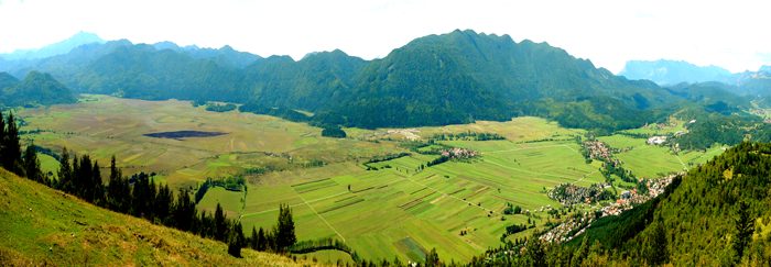
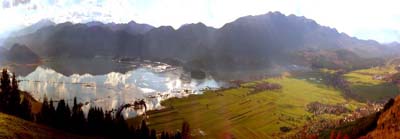
Cerknisko
jezero is an intermittent lake and covers 26 km2 when
is full - even up to 38 km2!. It is 10 km long and 5 km wide.
That makes it the largest lake in Slovenia. |
 |
|
YELLOWSTONE NATIONAL PARK, Wyo. (AP) - A
flash flood warning was issued for Yellowstone National Park and
northern Teton County last night after heavy rains drenched northwest
Wyoming.
No damage was immediately reported.
The National Weather Service said that a half inch to an inch
fell in a short time, and more was possible.
The heavy rain, combined with mountain snowmelt, caused rising
waters across the Teton Range and southern portions of Yellowstone
National Park from the south entrance to West Thumb Junction.
|
Utah rivers and streams continued their
march to flood stage. Peak snowmelt flows could arrive as early
as Sunday.
In eastern Utah, officials say the Ashley River threatens to
swamp as many as 40 houses in Vernal. West of Salt Lake City,
a mudslide blocked the intake to a culinary water system for Stockton.
Stockton is asking its 529 residents to limit their use of water
until the city can push boulders from the intake.
In southern Utah, record flows continued to swamp the Sevier
River, flooding agriculture lands.
A flood watch remained in effect for other parts of southern
Utah. [...] |
Clean up continues after a tornado touches
down in Eastern Kentucky.
The twister hit a community near Campton in Wolfe County.
The National Weather Service rates the tornado F-0, the lowest
on its scale, packing winds near 70 miles an hour.
The tornado blew over roofs and tree limbs and sent one woman,
Orinne Spencer, to the hospital.
Spencer is in stable condition. [...] |
| BHUBANESHWAR, India : At least 35 people
have died from sunstroke and dehydration in India over the past
two weeks with soaring temperatures gripping vast tracts of the
country, officials said Saturday.
Twenty-four people have died in the eastern Indian state of
Orissa because of a heat wave, said state revenue minister Manmohan
Samal.
He said authorities were investigating whether far more people
had been killed in the extreme temperatures.
"The government has heard reports that 113 people have
died due to heat-related reasons but we can only confirm 24 deaths
right now. We are still investigating the reports," Samal
told AFP. [...] |
| LOS ANGELES – Record temperatures
left Southern Californians sweltering on Saturday as thousands
flocked to parks, beaches and malls to beat the heat.
After a record-setting wet winter, scorching temperatures have
fire officials on guard. Several brush fires ignited during the
week, including a 120-acre blaze that threatened 40 homes near
the Cajon Pass in San Bernardino County on Saturday. It was expected
to be fully surrounded early Sunday. [...]
|
DHAKA - Flash floods caused by heavy pre-monsoon
rains killed at least one person and left more than 50,000 marooned
in villages in northeastern Bangladesh, officials said.
About 100 villages across Maulvibazar district, 160 kilometres
(100 miles) from the capital Dhaka, were inundated Tuesday after
five river embankments were breached, said district flood relief
chief Azadur Rahman Mallick.
One man was swept away when a river burst its bank and at least
100 houses were completely washed away, he said on Wednesday.
[...] |
Any astronomer will tell you
that the Sun is unpredictable. But on Jan. 20, 2005 it was dangerously
so, leaving scientists to rework theories of how space storms
operate and showing that interplanetary space travel will be a
deadly serious business.
In new studies presented today, researchers detailed a solar
outburst that shocked Earth with the highest dose of radiation
measured in five decades.
The tempest arrived frighteningly fast.
Other solar outbursts have provided more dramatic
pictures, more threatening X-ray flares, and tremendous coronal
mass ejections of hot gas that arrive several hours later. But
the solar event at 2 a.m. ET on that January morning created an
intense burst of energetic protons that, surprisingly, tripped
radiation monitors all over the planet within moments.
"This flare produced the largest
solar radiation signal on the ground in nearly 50 years,"
said Richard Mewaldt of the California Institute of Technology.
"But we were really surprised when we saw how fast the particles
reached their peak intensity and arrived at Earth."
Mewaldt is a co-investigator on NASA's Advanced Composition Explorer
(ACE) spacecraft, which monitored the event. Several studies on
the flare are being presented this week at a meeting of the American
Geophysical Union (AGU) New Orleans.
The raging proton storm peaked in 15 minutes.
Normally, the most intense part of a proton event takes two hours
or longer to build up.
"That's important because it's too fast to respond with
much warning to astronauts or spacecraft that might be outside
Earth's protective magnetosphere," Mewaldt said. "In
addition to monitoring the Sun, we need to develop the ability
to predict flares in advance if we are going to send humans to
explore our solar system." [...]
Flares emanate from sunspot groups, regions of the Sun where
intense magnetic energy caps upwelling solar material, creating
cooler, darker spots. The surprising January flare came on the
heels of a series of other very large but otherwise normal flares
from the same sunspot group. Scientists can't say why the fifth
event was so unusual.
"It means we really don't understand
how the Sun works," Lin said.
|
| Moscow sweltered in record heat
for a second day Tuesday, as emergency officials said four people
drowned as they sought refuge in rivers and ponds and 10 police
officers collapsed from heat exhaustion outside the courthouse
where Mikhail Khodorkovsky's verdict is being read.
Tuesday's air temperature peaked at 30.8 degrees Celsius at 5
p.m. -- breaking the record of 29.7 degrees set on May 24, 1983,
said Nadezhda Satina, spokeswoman for the Moscow weather bureau.
On Monday, the air temperature rose to 29.5 degrees, also topping
the previous record for the day -- 29 degrees -- from 1939, Satina
said.
But relief is in sight. A cold front is expected to blow across
Moscow on Wednesday and Thursday, pushing daytime temperatures
down to 21 to 26 degrees for the rest of the month, she said.
[...] |
It's Texas, and it's supposed
to get hot - but this early?
Spring 2005 was cooler than normal until summer-like weather
hit North Texas with a vengeance this weekend.
Temperatures reached 98 degrees on Sunday at Dallas/Fort Worth
International Airport, breaking the record of 96 set in 1939;
Saturday's high of 97 topped the record for that date by a single
degree.
Though the average high for this time of year is 85, 90-degree
temperatures in May are not unusual. However, Sunday marked the
second day in a row that saw a record high set and the third consecutive
day of above-average temperatures.
At Richardson's Wildflower Arts and Music Festival, water and
even sunblock on ice wasn't enough.
"It comes on all of a sudden, and they're not ready for
it," said Richardson Fire Department battalion chief Tim
Mock.
Eight people at the festival were overcome by the heat streaming
down via sunlight.
"People are getting overheated, and with the sunlight they're
not used to it," Mock said. "Wednesday was 85 degrees,
and today it's 100." |
PHOENIX (AP) -- Record breaking
temperatures again Sunday, across the state.
It was 109 degrees Saturday and Sunday in Phoenix.
Sunday's high ties the old record of 109 degrees last set in 2000.
The old Phoenix record of 107 degrees was set on Saturday's date
in 2000 and tied in 2003. That record was shattered shortly after
2:30 p-m.
The rest of the state wasn't any better today.
Record high temperatures were set or tied in south-central and
southwest Arizona this afternoon.
Monday's forecast isn't expected to be any cooler.
|
| More than one million Mozambicans
are reeling from a drought that has hit the south of the country
and only little more than a tenth are getting food aid, an official
said late Tuesday.
"The drought is now affecting more than one million people
in the south of the country," Silvano Langa, head of the National
Disaster Management Institute, said at a meeting with officials
from the UN World Food Programme and the Food and Agriculture Organisation.
"Only 150,000 people have got food assistance in June,"
Langa said, adding that the "target is being revised"
for the affected population in the regions of Maputo, Gaza and Inhambane.
Langa said he hoped the shortage would not be as "acute as
in past years when we had to ward off the combined effects of drought
and war."
He said he was not launching an "urgent international appeal"
for help, but was counting more on "bilateral aid."
A former Portuguese colony, Mozambique gained independence on June
25, 1975, only to plunge into war a year later that was to last
until 1992, claiming up to one million lives.
More than half of the population of 17 million lives on less than
a dollar a day. |
BOSTON -- A spring nor'easter
brought driving rain and strong winds to the region Wednesday
morning, as damp, frigid weather continued to plague New England
with the unofficial start to summer just days away.
Officials at the National Weather Service in Taunton said the
nor'easter, which reached New England on Tuesday night, would
bring winds of up to 60 mph along the coast. The storm could also
drop 1 to 2 inches of rain and bring coastal flooding with the
early morning high tide on Wednesday.
|
| BOMBAY (Reuters) - India's
monsoon appears to have set in over the southern Andaman Sea,
the first entry point for the subcontinent, after a delay of about
10 days, weather officials said on Wednesday.
The monsoon, closely watched in India because two-thirds of the
population earns a living from farms, was expected to arrive over
the southern coast around June 7, about a week later than normal,
officials said.
|
| "Unprecedented" effort
is required to slow biodiversity loss
If we continue with current rates of species extinction, we will
have no chance of rolling back poverty and the lives of all humans
will be diminished.
That is the stark warning to come out of the Millennium Ecosystem
Assessment (MA), the most comprehensive audit of the health of our
planet to date.
Organisms are disappearing at something like 100 to 1,000 times
the "background levels" seen in the fossil record.
Scientists warn that removing so many species puts our own existence
at risk.
It will certainly make it much harder to lift the world's poor
out of hardship given that these people are often the most vulnerable
to ecosystem degradation, the researchers say.
The message is written large in Ecosystems and Human Well-being:
the Biodiversity Synthesis Report.
It is the latest in a series of detailed documents to come out
of the MA, a remarkable tome drawn up by 1,300 researchers from
95 nations over four years.
The MA pulls together the current state of knowledge and in its
latest release this week focuses specifically on biodiversity and
the likely impacts its continued loss will have on human society.
Even faster
In one sense, and precisely because it is a synthesis, the new
document contains few surprises. It is, nonetheless, a startling
- and depressing - read.
A third of all amphibians, a fifth of mammals and an eighth of
all birds are now threatened with extinction. It is thought 90%
of the large predatory fish in the oceans have gone since the beginning
of industrial trawling.
And these are just the vertebrates - the species we know most about.
Ninety percent of species, maybe more, have not even been catalogued
by science yet.
"Changes in biodiversity were more rapid in the last 50 years
than at any time in human history," said Dr Georgina Mace,
the director of science at the Institute of Zoology, in London,
UK, and an MA synthesis team member.
"And when you look to the future, to various projections and
scenarios, we expect those changes to continue and in some circumstances
to accelerate.
"Future models are very uncertain but all of them tell us
that as we move into the next 100 years, we'll be seeing extinction
rates that are a thousand to 10,000 times those in the fossil record."
'Invisible services'
One feature that sets the MA apart from previous projects of its
kind is the way it defines ecosystems in terms of the "services",
or benefits, that people get from them.
Some of these services are obvious - they are "provisional":
timber for building; fish for food; fibres to make clothes.
At another level, these services are largely unseen - the recycling
of nutrients, pollination and seed dispersal, climate control, the
purification of water and air - but without these "support"
and "regulating" systems, life on Earth would soon collapse.
And although we may be some distance away from an "end scenario",
there is no doubt the rapid expansion of the human population and
its high consumption of natural resources have taken a heavy toll
on ecosystems and the organisms that inhabit them.
"Biodiversity and human well-being just cannot be separated,"
said Dr Kaveh Zahedi, the officer in charge of the Unep World Conservation
Monitoring Centre in Cambridge, UK.
"We are befitting from a whole range of services that up until
now have almost been invisible; we haven't considered them. And
then they suddenly pop up on our radar screens - we have a tragedy
in Asia with a tsunami and we realise that those mangroves that
were cut down had a value; they provided a service in terms of coastal
protection."
Similar picture
Land-use (habitat) changes, climate change, pollution and over-exploitation
- they are all pushing down on biodiversity and the pressure shows
little sign of easing.
"The magnitude of the challenge of slowing the rate of biodiversity
loss is demonstrated by the fact that most of the direct drivers
of biodiversity loss are projected to either remain constant or
increase in the near future," the MA biodiversity synthesis
report says.
Removing huge swathes of forest has a blunt and clear impact on
biodiversity by taking out the habitat formerly occupied by plants
and animals. But there are subtle changes taking place, too.
The distribution of species around the globe is becoming more homogenous,
as invasive creatures hitch a ride on fast human transport and trade
routes.
Genetic diversity, also, is declining rapidly.
This is most obvious in domesticated plants and animals where the
pursuit of high yields and the pressures of global markets have
pushed farmers towards a limited range of cultivars and breeds.
And so it is not simply that species are fewer in number, their
changed circumstances may also have reduced their resilience and
their ability to cope with future change.
Possible tensions
In 2002, world governments, through the Convention on Biological
Diversity, set themselves the target of making a "substantial
reduction in the rate of loss of biological diversity" by 2010.
The MA illustrates just how tough it will be to meet that target.
What is more, there may even be occasions when progress towards
that target conflicts with the even loftier 2015 Millennium Development
Goals of cutting into world hunger and poverty, and improving healthcare.
A classic example is the development of rural road networks -
a common feature of hunger reduction strategies - which are likely
also to accelerate rates of biodiversity loss by fragmenting habitats
and by opening up new areas to unsustainable harvests.
This sort of thing has been well documented in Africa where the
bushmeat trade that endangers many species follows the development
of transport infrastructure.
"This is a very important issue," said Dr Mace. "It's
clear there are going to have to be trade-offs and compromises but
it's not a simple relationship. It's not a case that you can have
20% poverty and 80% biodiversity.
"If you do things the right way, if you chose the right options
for poverty alleviation, you can also maximise biodiversity and
sustainability."
And Dr Neville Ash, another MA synthesis team member, added: "The
bottom line is that you cannot achieve long-term poverty alleviation
without sustainability.
"In order to reduce hunger and poverty and increase access
to clean water and sanitation, we need to have a strong base of
environmental sustainability which is providing these services on
which people rely for their well-being."
Little time
It is very evident, too, that we need to get a move on.
The wheels of global governance turn slowly, as was seen with the
Kyoto Protocol on climate change which finally entered into force
in February after many years of negotiation.
The MA has identified possible solutions - from significant shifts
in consumption patterns and better education, to the adoption of
new technologies and a large increase in the areas enjoying protection.
And if some of the ideas sound "old hat", such as the
abolition of farming subsidies that drive crop production to the
detriment of field biodiversity - that is because they are.
"Most of the approaches to achieving more sympathetic management
of the natural environment and the conservation of biodiversity
- I think we and governments know them already," commented
Graham Wynne, the chief executive of the UK bird conservation group,
the RSPB.
"The real challenge is to deploy them more extensively and
more intelligently.
"And you can't get away from the fact that we simply need
more money.
"The sums of money we throw at the environment in the West
are relatively modest; and the sums of money the West is prepared
to devote to developing countries is pitiful." |
HESPERUS, Colo. - A river in southwestern
Colorado spilled over its banks Wednesday, sending fast-moving
water into a trailer park and forcing families to scramble through
thigh-deep water to protect their belongings.
"It was scary. It sounded like we were sleeping in the river,"
Louise Suazo said as water from the swollen La Plata River rushed
under her home.
Several rivers in southwestern Colorado are cresting this week
after days of hot weather and melting snow. Water levels are expected
to remain high through the Memorial Day weekend,
National Weather Service hydrologist Brian Avery said.
"It's not over and it won't be over until at least next
week," he said.
In neighboring Utah, a missing elderly woman was found dead Wednesday
in an ordinarily moderate creek sent rushing by melting snowpack.
Cynthia Lark, 76, has dementia and was thought to have wandered
away.
In Hesperus, 240 miles southwest of Denver, dead trees and other
debris forced the La Plata over its banks and into the Pinewind
Trailer Park. Residents slogged through the water to dig diversion
ditches, hoping to steer the water away from propane tanks and
electrical wiring.
Six of the homes either were surrounded by water or had water
flowing beneath them. Gas service was turned off, and most residents
had lost phone service.
Avery said most major flooding has been in southwestern
Colorado, where the water is reportedly the highest it has been
since the regional drought began about six years ago.
Avery said authorities were concerned boaters, rafters and kayakers
would be drawn to high rivers, despite dangerous and icy conditions.
"We're trying to encourage people to be very safe or just
avoid the water altogether," Avery said.
Rescue workers have pulled 18 people from the Animas River in
the past five days and county officials planned to monitor popular
bridges after a 23-year-old man was rescued - and arrested - after
jumping into the torrent from a bridge Tuesday. He was dared by
friends to leap. |
SEATTLE - Make that an iced coffee. While
the Northeast was bidding farewell to unseasonable temperatures
in the 40s, residents of the northwest corner of the nation dusted
off the sunscreen and shorts Friday as the National Weather Service
issued its first-ever heat advisory for Seattle.
The advisory covering the urban corridor from Tacoma north to
Everett was prompted by a second day of record temperatures. Friday's
high of 89 degrees at Seattle-Tacoma International Airport broke
a 33-year-old record for the date. Thursday's high - also 89 degrees
- broke a 58-year-old record.
Phyllis Cameron, 92, planned to keep cool with lots of iced tea
and a few gin-and-tonics. "I'm just going to enjoy it on
the chaise on my deck," said the lifelong Seattle resident.
The weather service, however, was advising that people should
drink lots of water, stay indoors and out of the sun, and check
on relatives and neighbors.
The advice didn't seem to be taking. Winter-pale flesh was on
display in the city's parks, and the streets were packed with
people drinking iced coffee.
Seattle is among the cities added this year to the weather service's
excessive heat program. A heat advisory means conditions could
lead to heat stress in some people and a warning indicates a higher
possibility that people will get sick or die.
The organizers of the annual Northwest Folklife music festival
welcomed the heat, which boosted attendance for the normally slow
first day. Concertgoers crowded into Seattle Center, enjoying
the music, the sun and a giant fountain shooting cool water 120
feet into the air.
Last year it rained, said Rafael Maslan, 20, a festival board
member.
Seattle-area temperatures were expected to cool over the weekend,
and Weather Service meteorologist Dustin Guy said the heat advisory
would not be renewed for Saturday. |
NIJMEGEN, The Netherlands - Dikes and dams
will not be enough to stop the deluge. With climate change, people
will have to learn to live with floods and tidal waves, scientists
at an international conference said.
"We have gone from the point of defending
ourselves from flooding to managing floods and learning to live
with them," said Eelco van Beek, who was among the
300 experts attending a conference in the Dutch city of Nijmegen.
During the past two years, more than 600 floods have been recorded
in the world, causing the deaths of 19,000 people and damage valued
at about 25 billion dollars (20 billion euros).
The figures do not include the deaths of some 273,000 people
when a tsunami hit the countries bordering the Indian Ocean last
December.
The conference in the Netherlands brought together scientists
and humanitarian specialists to try to find ways of handling inundations,
whether from the sea or rivers.
"It is time to say good-bye to the traditional approach
of making ever higher dikes and ever stronger pumps," said
Melanie Schultz van Haegen, the Dutch state secretary for water
management.
A purely defensive strategy is "untenable,
especially because of the difficulty of defending against the
consequences of climate change," she said.
Pioneers in the fight to control water, the Netherlands now prefers
to allow rivers to overflow into specific spill-over zones.
As for crises such as the Asian tsunami, the conference called
for a global alert and prevention system, including the means
to reach people who do not have access to mass communication such
as the Internet or telephones.
In Africa, for example, transistors have been handed out to residents
in certain areas at risk of flooding so they can get the alerts.
The operation is set to be extended to southeast Asia.
"These systems can give an alert for all types of disasters
because a tsunami does not hit just once in their lives,"
said Avinash Tigay, the Indian director for water management issues
at the
World Meteorological Organization. |
TORONTO (CP) - It arrived encircled in a
shroud of torrential rain so severe that nobody caught sight of
its devastating presence until it was too late. When the high
winds, hail and continuous thunder and lightning subsided, 11
were dead and 155 were injured as large swaths of a southern Ontario
city and surrounding areas lay in ruin.
"Nobody, that we're aware of, actually saw the tornadoes
on that day," Environment Canada meteorologist Geoff Coulson
said of the storm that tore through Barrie, Ont., on May 31, 1985.
"The rain, instead of just staying well out ahead of the
thunderstorm, was actually wrapped right around the tornado itself,
making it basically (impossible) for anyone to distinguish it
from a heavy rain."
Twenty years later, environmental scientists and storm watchers
are sure of two things.
First, that advancements in weather tracking and improved emergency
management strategies leave Canadians much better prepared for
the next killer tornado.
Second, the next killer tornado - especially for Ontario - is
long overdue.
"Our return period for a storm of that intensity is about
15 years in Ontario," said Coulson.
"We're now 20 years since that event, and we haven't seen
its like since then. That potential still exists for us to experience
a storm of that intensity again."
Roughly 80 of these destructive storms touch down each year
in Canada's tornado alleys - southern Ontario, the prairies and
southeastern Quebec. New Brunswick and the interior of British
Columbia also see their share.
What's rare is the magnitude of the tornado that wreaked havoc
on southern Ontario in 1985 - on the Fujita scale of zero to five,
it measured a four.
"This was a real big super cell thunderstorm, probably
twice the height of Mount Everest, that produced the tornado,"
said George Kourounis, a Toronto-based storm chaser.
Storms of that destructive magnitude are often noted for the
lives and structures they spare thanks to their confounding patterns
of destruction. [...] |
Bank Holiday revellers in Cambridgeshire
enjoying a weekend of sunshine were stunned when the weather took
a dramatic turn for the worse.
Three tornados up to half a mile wide hit the flat fenland farmland
within an hour.
Benton Spencer, 24, was "absolutely stunned" to see
the first from the A142 Newmarket to Ely road, as he and girlfriend
Kate Ashby were driving to her family home in the village of Barway.
When they reached the village, near Soham, they saw another
larger one on fields behind the house and minutes later a third
over a nearby factory.
Mr Spencer told Sky News Online: "The first one appeared
at about 10.30am. It was fairly well formed and about 2,000ft
high, but it didn't come to ground.
"About half an hour later another one appeared, stayed
together and came to ground. There was a good cloud of dust and
it was about half a mile wide.
"It lasted two to three minutes and was moving in and out
of the trees."
Mr Spencer said that when the freak weather struck he and several
others stopped on the road to watch the event.
"A few of us pulled our cars over to watch and take pictures.
Everyone was pretty shocked."
The nearby town of Newmarket was also hit by freak weather,
with giant hailstones turning the streets white. [...] |
There will be no Memorial Day cookout for
the residents in the 11000 block of Larkwood at the Carlyle Place
Apartments, because there's nowhere dry to sit after an F-1 tornado
swept through southwest Houston Sunday night.
Approximately 130,000 customers across Houston were without
power at the peak of the storm.
Portions of the complex's roof were torn off forcing approximately
eight to 10 families to seek other shelter.
"And all of the sudden, just, bam," said one resident.
"There's a piece of tin like this one on the sidewalk, it
went past my face. So I jumped back inside, grabbed the kids and
we headed for the bathtub."
The cars that weren't damaged, were trapped because the parking
lot was littered with glass, nails and debris that used to be
part of the building's roof.
"That's right where my bedroom is," said one woman
referencing a door-sized hole the storm punched in the building's
wall.
"I'm just glad I wasn't laying in my bed," said another
man, "because if I was laying in my bed, the big old glass
fell right where I lay."
Despite the damage, there were no serious injuries. Seven people
were treated at the scene for minor injuries, but no one required
transport to the hospital. [...] |
Sunday's storms dropped a record amount of
rain for that date at Houston's Bush Intercontinental Airport,
the National Weather Service reported today, and more may be on
the way.
A record rainfall of 3.56 inches fell
at the airport Sunday, breaking the old mark of 3.36 inches set
in 1978, the weather service said.
Flash flooding remains possible across portions of Southeast
Texas today and the weather service has issued a flood watch effective
until 7 p.m. today throughout the region. Counties included in
the watch are Brazoria, Chambers, Fort Bend, Galveston, Harris,
Liberty, Montgomery, Polk and San Jacinto.
Additional rainful amounts of 1 to 2 inches appear likely this
afternoon and early this evening, with isolated areas possibly
experiencing 3 to 5 inches, the weather service said.
Heavy thunderstorms soaked much of the region Sunday, causing
widespread street flooding, traffic tie-ups and some power outages,
while lightning injured a northwest Harris County teenager and
started an apartment fire in Jersey Village. In southwest Houston,
a building collapsed, injuring 2.
Much of Southeast Texas was under thunderstorm and tornado watches
and warnings throughout the afternoon and night. The National
Weather Service office in League City reported up to 7 inches
of rain in east Harris and Liberty counties. Though meteorologists
had not confirmed any tornadoes, the Harris County Sheriff's Department
received a report of a funnel cloud near Greenspoint Mall. [...] |
The torrential storms and the tornado twister
in the northern part of Bulgaria over the weekend have incurred
damages of over BGN 4 M, according to preliminary estimates.
The damages as a result from the tornado, hailstorm and flood
in the town of Turgovishte only stand at nearly BGN 4 M, local
civil defence authorities said.
The storms and floods have shown no mercy also to national roads,
farms and orchards most of which are badly ruined. Many people
who occurred to be outside when the tornado blew suffered psychological
traumas.
In some parts where the cherry-picking season in on the threshold,
fruit is likely to get rotten, local farmers said. Grain plants
in certain areas to the north of Bulgaria were killed by the severe
hailstorms.
Bulging rivers to the north of the Balkans chain have left under
water great parts of private and public farmland.
Lightning killed three people and a man was missing as storms
swept Bulgaria, flooding farmland and destroying roads, police
said on Monday.
A 74-aged woman died when she was struck by lightning while
sheltering from torrential rain in the central town of Troyan
on Sunday. In the southern towns of Haskovo and Plovdiv, two 20-aged
men were struck and died in separate incidents. |
PRAGUE - The Czech capital Prague on Saturday
registered its hottest temperature for the day for 113 years,
hitting 31.8 degrees Celsius (90 degrees Fahrenheit), the local
authorities said.
The previous record for the day had been recorded in 1892 with
31.6 degrees Celsius. |
| Fires in the Siberian forests
- the largest in the world and vital to the planet's health - have
increased tenfold in the last 20 years and could again rage out
of control this summer, Russian scientists warn.
They say they have neither the money nor the equipment to control
or extinguish the huge forests fires often started illegally and
deliberately in the Russian far east by rogue timber firms who plan
to sell cheap lumber to China.
In 2003, one of the hottest summers in Europe, 22m hectares of
spruce, larch, fir, Scots pine and oak were destroyed, charred,
scorched or in some way affected by fire. On one day in June that
year, a US satellite recorded 157 fires across almost 11m hectares,
sending a plume of smoke that reached Kyoto 5,000 kilometres (3,107
miles) away.
Forests absorb carbon dioxide from the air and release oxygen.
The world's forests are part of the calculations behind the Kyoto
agreement, ratified by Russia, Britain and many other nations, but
not the US or Australia, to control the greenhouse emissions that
fuel global warming.
Forests have also become part of the currency of exchange, called
carbon trading, intended to keep economies stable while limiting
emissions overall. Most attention has been focused on the steady
destruction of the surviving Amazon and Indonesian forests.
But the so-called "boreal" forests of Siberia, slow-growing
but huge, are equally vital. They became a global issue in 2003,
when so many fires raged in Siberia and the Far East that atmospheric
scientists identified their smoke and soot in Seattle, on the far
side of the Pacific.
"You should try to protect your forests, because they are
the lungs of the planet: they absorb carbon dioxide," said
Anatoly Sukhinin, of the Sukachev Institute of Forestry in Krasnoyarsk,
the once-closed Siberian centre where the British Council has just
opened Zero Carbon City, a touring exhibition on global warming.
"It looks to me like these huge forests are currently being
devoured by a powerful lung cancer."
Russia's forests stretch almost from the steppes of central Asia
to the Arctic permafrost, and from European Russia almost to the
Bering Sea. Vast areas are almost pristine, the preserve of migrating
birds and the occasional hunter and trapper.
In the north, the trees grow slowly, some reach the age of 400-500
years, and are vulnerable to any disturbance. In the south, the
forests become cluttered with dry underbrush, and at risk from electrical
storms. But the biggest threats come from climate change and deliberate
arson by people intent on illegal logging.
"One factor is global warming, and there is absolutely no
doubt that this is happening. Global warming results in more extreme
droughts: greater droughts, longer droughts, and more frequent droughts.
The other factor is underfunding. We cannot do a good job to preserve
and protect our forests," Dr Sukhinin said. "There is
very little money to fund such work. We have some equipment left
from the old times, we have some organisational support, but we
are critically underfunded by the government."
Cooperation with US and Canadian partners means that they get the
big picture from US government satellites.
In the enormous expanses of Siberia, they need specialised firefighting
aircraft. The government in Moscow has designed and made some, but
sells or leases them to other countries. Even when the foresters
can identify the areas ablaze, they can do little.
The forests are at risk in early spring - after the dry cold of
the Arctic winter - and in high summer, when temperatures soar.
Fires in the forests are a threat to oil and gas pipelines, to wildlife
and to the permafrost itself. Heat from the blazing underbrush and
the parched canopy can disperse the clouds in a fierce thermal updraft,
melting the frozen soil and leaving behind a landscape of charred
stumps and dripping swamp.
On top of natural hazards, the Russian scientists count the risk
of arson.
Paradoxically, forests have become money to burn. Licences to log
healthy forest are expensive. But timber merchants and logging companies
can buy cheap licences to clear stands of timber in some way damaged
by fire.
Forests quickly recover from fires which rage through the underbrush.
Many trees have adapted to survive periodic ground-level fire, and
flourish on the ashes of their more lowly competitors.
"After a fire, the timber improves and is even better,"
said Dr Sukhinin. "And that is the time when people can come
in, fell the trees, sell the timber to China and get good money.
"The Chinese themselves, they pay well and they pay the same
money for timber from affected areas as for timber from unaffected
areas - and that is the reason for the arsonists. It's illegal if
you don't have a licence." |
| It is unlikely humans exterminated
in a short killing spree the immense marsupial Diprotodon and other
huge beasts that once roamed Australia.
Two new studies reject the theory that humans moving on to the
continent more than 45,000 years ago took out its megafauna in a
1,000-year "blitzkrieg".
The studies suggest instead a more complex pattern
to the extinctions.
Their authors say humans certainly had a role
but it was not as important as the period's climate changes.
The studies are published this week in the Proceedings of the National
Academy of Sciences (PNAS) and in Memoirs of the Queensland Museum.
'Guilt by association'
Migrating humans have been blamed for the quick disappearance of
large creatures both in the northern and southern hemisphere.
In North America, for example, the demise of mammoths and sabre-toothed
tigers at the end of the Pleistocene Epoch is coincident with the
arrival on the landmass of humans with new stone-spear technologies
about 12,000 years ago.
And in Australia, the extinction of great beasts - such as the
marsupial lion (Thylacoleo carnifex), the immense wombat-like Diprotodon
optatum and the 400kg lizard Megalania prisca - also occurred at
roughly the same time humans appeared on the scene.
Previous research had even indicated a very rapid removal of the
megafauna, in perhaps as little as a thousand
years.
But in their PNAS paper, Clive Trueman, from the University of
Portsmouth, UK, and colleagues in Australia argue evidence for the
involvement of human overkill in the southern extinction is largely
circumstantial - "guilt by association".
They report detailed new dating data on fossils found at Cuddie
Springs in New South Wales. These suggest humans lived side by side
with the great beasts of Australia for at least 10-12,000 years.
It gives the lie, they claim, to the notion that humans rapidly
removed the large animals either by hunting or changing the landscape
through burning.
Instead, the team argues for a more complex explanation of megafaunal
extinction in which large climate shifts played
a significant role.
These saw temperatures plummet and the lush landscape
become arid.
Also, the researchers believe humans simply would not have had
the hunting technologies to take out so many large creatures.
"There is not a single stone-spearpoint in Australia until,
at the very earliest, about 15,000 years ago - long after anyone
thinks the megafauna went extinct," said co-author Dr Stephen
Wroe, from the University of Sydney.
"You try taking out a two-to-three-tonne wombat with a pointy
stick.
"I don't doubt the first Aboriginals did hunt megafauna but
the argument that they did it with the efficiency required to effect
near-instantaneous extinction is not, in my view, credible."
Small and big
This analysis fits with the second paper, published by Gilbert
Price, of Queensland University of Technology.
He says that the colder, drier climate that came about between
50,000 and 20,000 years ago changed the type of animals that could
survive in the region of Australia that he studied.
He found that the patterns of fossils in a creek bed in the Darling
Downs area of south-east Queensland suggested that other, smaller
species also disappeared with the larger ones.
The shift in the fossils found in the 10m-deep section of creek
bed mirrored the changes to the environment as woodland and scrubland
gave way to grassland, he told Memoirs of the Queensland Museum.
Mr Price said that many of the fossils found pre-dated human activity
in the area, absolving humans from any involvement in their extinction.
"We've done a little bit of radiocarbon dating on the deposits
themselves and we know that the age of the deposits pre-dates the
first humans on the Darling Downs by about 30 to 35,000 years,"
he told the Australian Broadcasting Corporation.
"We know that there's no human or cultural artefacts in the
deposits as well and we know that all the cut marks on the bones
are related to predation by some of the other species that lived
on the Darling Downs, such as marsupial lions."
Some commentators in the Australian media on Tuesday questioned
whether Trueman's and colleagues' dating of Cuddie Springs was as
reliable as they claimed.
They also pointed to evidence that the megafauna had withstood
previous climate uphevals, making it unlikely that one more extreme,
Late-Pleistocene shift would have had such a big impact on its own.
|
MIAMI - If hurricanes again pound the United
States this summer, their roar is likely to be accompanied by
the din of another storm -- an angry debate among US scientists
over the impact of global warming.
Last season's $45 billion devastation, when 15 tropical storms
spawned nine hurricanes in the Atlantic and Caribbean, prompted
climatologists to warn of a link to warming temperatures.
But hurricane experts say the unusual series of hurricanes,
four of which slammed into Florida in a six-week period, was the
result of a natural 15- to 40-year cycle in Atlantic cyclone activity.
After a lull between 1970 and the mid-1990s, the number of storms
picked up dramatically from 1995 and higher-than-normal activity
is expected for the next five to 30 years as a phenomenon known
as the "Atlantic multidecadal mode" holds sway.
"Really, for the folks that are doing work on hurricanes,
there isn't a debate (about global warming)," said Chris
Landsea of the National Oceanic and Atmospheric Administration's
hurricane research division in Miami.
Many climatologists disagree. They say the large, decades-long
swings in hurricane activity may mask, but do not rule out, longer
term climate change trends.
The warmer waters and increased air moisture that global warming
is expected to produce are, after all, the primary fuels that
hurricanes feed off during the June to November season.
"Global climate change is happening. The environment in
which these hurricanes form is clearly changing," said Kevin
Trenberth, a climatologist at the National Center for Atmospheric
Research in Colorado. He is also a lead author of the next major
UN report on climate change, due in 2007. [...] |
Continue
to June 2005
Remember,
we need your help to collect information on what is going on in
your part of the world! We also need help to keep
the Signs of the Times online.
Send
your comments and article suggestions to us 
Fair Use Policy Contact Webmaster at signs-of-the-times.org
Cassiopaean materials Copyright ©1994-2014 Arkadiusz Jadczyk and Laura Knight-Jadczyk. All rights reserved. "Cassiopaea, Cassiopaean, Cassiopaeans," is a registered trademark of Arkadiusz Jadczyk and Laura Knight-Jadczyk.
Letters addressed to Cassiopaea, Quantum Future School, Ark or Laura, become the property of Arkadiusz Jadczyk and Laura Knight-Jadczyk
Republication and re-dissemination of our copyrighted material in any manner is expressly prohibited without prior written consent.
|