|
|
Signs Supplement: Climate
and Earth Changes
April 2005
EASTON, Pa. - After the remnants
of Hurricane Ivan filled their little ranch house with
several feet of water, Dale and Charlotte Barr spent
$40,000 to get it back in shape.
They were just about to tackle the last room - the
kitchen - when the Delaware River overflowed its banks
again this weekend.
"We're tired," said Dale Barr on Monday.
"I'm 65 years old. I can't continue to do this
every six months."
Flooding left one person dead
and forced the evacuation of thousands of people in
New Jersey, New York and Pennsylvania. The New
Jersey Statehouse, located near the banks of the Delaware,
was shut down for the day. [...]
In New Jersey, where about 3,500 people were evacuated,
acting Gov. Richard J. Codey declared a state of emergency,
estimating property damage would approach $30 million.
More than 4,000 homeowners were evacuated in Pennsylvania.
[...] |
The time to be most wary of a tornado
is a spring afternoon in Texas or Oklahoma with thunderstorms
brewing. But twisters do not limit themselves to these
conditions or locations, a new study shows.
"If you're driving in a midnight rain in October
near Lake Michigan, remember that a tornado is not outside
the realm of possibility," says Robert Trapp of
Purdue University.
Trapp and his colleagues studied more than 3,800 tornadoes
in the United States from 1998 to 2000. Many of these
were not of the typical variety that form in Tornado
Alley - the flat, twister-prone region through the central
plain states.
"In the heart of Tornado Alley, twisters most
often develop from relatively small 'cell' storms that
look like blotches on a Doppler radar weather map," Trapp said.
The conventional wisdom is that the tornado threat
goes down when the cells merge into 100-mile-long line
storms. But Trapp's team found
this to be wrong, especially beyond the Alley. For example,
about half of Indiana's 20 tornadoes a year come from
line storms.
Nationwide, 79 percent of tornadoes arise out of cells,
whereas 18 percent form from line storms, according
to the study, which was supported by the National Science
Foundation and reported in the February issue of the
journal Weather and Forecasting.
"This implies that we may be overlooking many
tornado-breeding storms in the Midwest and elsewhere," Trapp said. [...]
"We're not trying to be alarmist
with these findings," Trapp said. "But we
hope that people will stay alert to tornado risk even
outside the traditional severe storm season." |
MIAMI -- Like last
year, the coming Atlantic hurricane season will be fiercer
than normal, with a heightened probability of a major
hurricane making landfall in the United States, a noted
forecaster said yesterday.
After one of the most destructive hurricane seasons
on record, William M. Gray, a professor at Colorado
State University, said 2005 would see 13 named storms,
of which seven would turn into hurricanes. He predicted
three major hurricanes with winds exceeding 111 miles
per hour.
The long-term average for the Atlantic basin is 9.6
named storms and 5.9 hurricanes, of which 2.3 are intense
hurricanes, per season, which runs from June 1 to Nov.
30.
''All of the information we have collected and analyzed
through March indicates that the 2005 Atlantic hurricane
season will be an active one," Gray said in a statement.
Gray and Philip J. Klotzbach, an atmospheric research
scientist at Colorado State, said they might increase
their predictions for the number of storms in 2005 if
weather conditions continued to point to a lack of significant
conditions in the Pacific for El Nino. The El Nino weather
phenomenon produces a distinct warming of Pacific waters
and tends to suppress storm activity in the Atlantic.
''If the next few months verify our beliefs about the
lack of significant El Nino conditions, it is likely
that we will be raising our forecast numbers in our
coming May 31 and Aug. 5 forecast updates," Klotzbach
said. |
TRENTON, N.J. - Heavy rains drenched
parts of New Jersey over the weekend, flooding low-lying
areas and causing thousands of people to evacuate homes
threatened by the rising water.
The heavy rains began Saturday and persisted until
midday Sunday, prompting acting Gov. Richard J. Codey
to declare a state of emergency. Authorities urged hundreds
of residents in each of six counties to leave low-lying
areas and closed some state offices Monday near the
Delaware River.
"We haven't had any major or traumatic problems
so far, and that's what we're hoping to avoid with the
evacuations," said Art Charlton, public information
officer for Warren County.
Trenton Mayor Douglas H. Palmer ordered the evacuation
of a neighborhood known as "The Island" late
Saturday. Gas and electric service was shut off to homes,
while displaced residents were offered space at a high
school shelter.
Palmer said residents would not be
allowed to return until at least Wednesday, and further
evacuations may be needed.
In northern New Jersey, moderate to major flooding
was expected in seven rivers. All the rivers had crested
by early Sunday, and most were expected to reach at
least 2 feet above flood levels before slowly receding
Monday.
Some larger rivers, such as the Delaware, were expected
to continue rising through at least Monday afternoon.
Trenton city spokesman Kent Ashworth
said officials expected the Delaware to crest higher
than it did last September, when the remnants of Hurricane
Ivan forced thousands of residents to flee their homes
for several days.
In Pennsylvania, several people had to be rescued by
boat Sunday after rising floodwaters forced the evacuation
of about 200 homes in Northampton County. The water
reached nearly the level of traffic lights in the community
of Easton, flooding many downtown buildings. |
It was a dry, warm winter across
the Northwest, with experts in some areas saying they
can't remember the last time the snowpack was this low.
It was just the opposite in the Southwest, with record
winter rainfall that flooded deserts and caused murderous
landslides.
Strangely, both face the same worry: Conditions are
ripe for a bad wildfire season. Along with the dry forests
in the Northwest, all that rain in the Southwest has
fed lots of tall grass and brush that will become tinder
when it dries this summer.
Ordinarily, when April arrives, Jack Owen considers
himself lucky if any homeowners call his firm to remove
brush from around their houses. But in this dry year
in Oregon, his Wildfire Fuels Reduction is grinding
up trees and bushes as fast as it can.
By this time last year, Owen's company
in Bend had only done $1,200 in business. This year,
edgy homeowners already have given the company $18,000
worth of work.
"At this time last year, one reason I didn't have
much business was too much snow on the ground," he said.
Despite the rising threat, money for firefighting is
expected to be tight.
"It's a concern, but we've implemented a significant
number of cost management measures with our incident
management teams and folks out there on the fire line
looking at what we can do to cut our costs," said
Alice Forbes, assistant director of operations for the
Forest Service at the National Interagency Fire Center
in Boise, Idaho.
Arizona Gov. Janet Napolitano has already authorized
more than $1.2 million for firefighters and equipment.
Some governors fear fewer National Guard troops will
be available to fight fires because of the war in Iraq,
though Rose Davis, spokeswoman for the fire center,
said plenty of other firefighters will be available.
[...]
In parts of Washington, Oregon, Idaho
and Montana, the snowpack is only about 25 percent to
50 percent of normal. The U.S. Drought Monitor, which
tracks conditions across the country, rates vast tracts
of Wyoming, Montana and Idaho as "exceptional drought," the worst of five drought categories.
"In a lot of places, there's no
comparison," Tom Perkins, a hydrologist with the
Natural Resources Conservation Service, said of the
snowpack. "It's never been this low before."
The fire season in the Northwest could start as soon
as late May. [...]
Southern California had its
second-wettest rainy season on record, and rainfall
in Arizona was well above normal. The snowpack in California's
southern Sierra Nevada was 53 percent above average,
and the Arizona Snowbowl ski area on northern Arizona's
highest mountain reported a seasonal total of 37 feet
of snow. [...] |
| If the North Atlantic
Ocean's circulation system is shut down - an apocalyptic
global-warming scenario - the impact on the world's food
supplies would be disastrous, a study said last Thursday.
The shutdown would cause global stocks of plankton, a
vital early link in the food chain, to decline by a fifth
while plankton stocks in the North Atlantic itself would
shrink by more than half, it said.
"A massive decline of plankton stocks could have
catastrophic effects on fisheries and human food supply
in the affected regions," warned the research, authored
by Andreas Schmittner of Oregon State University.
The circulation system is like a conveyor belt, taking
warm water from the Caribbean in the tropical western
Atlantic to the cold latitudes of the northeastern Atlantic.
There, the warm surface water cools and sinks, gradually
getting hauled around back to the southwest, where it
warms again and rises to the surface.
This movement is vital for northwestern Europe, for the
warm water brings the region balmy, wet weather. Without
it, Ireland, Britain, parts of France, Belgium, the Netherlands
and Germany would be plunged into prolonged, bitter winters.
The circulation is also essential for plankton, providing
an upwelling of deep-water nutrients on which these tiny
creatures feed. In turn, the plankton feed fish and other
marine animals, which in turn are harvested by humans.
Schmittner, writing in the British weekly science journal
Nature, said his computer model of plankton loss was based
on a disruption of the circulation system over 500 years,
during which the conveyor belt lost more than 80 percent
of its power.
Temporary slowdowns in the Atlantic's circulation system
have occurred in the past, most notably after the end
of the last Ice Age, about 10,000 years ago, said Schmittner.
Isotope traces from Greenland icecores suggest there
were bursts of rapid warmings of 10 C (18 F), which melted
huge amounts of Arctic ice.
This influx, because it comprised cold freshwater, sank
to the bottom of the ocean floor, essentially acting like
a giant sandbag thrown on the conveyor belt, braking its
movement.
Today, Earth is considered to be in an "inter-glacial" period - a balmy period between ice ages.
But scientists say there is a possibility of another
big temperature rise induced by man-made global warming,
caused by the spewing of fossil-fuel greenhouse gases
into the atmosphere.
One scenario, considered outlandish only a few years
ago but now increasingly taken seriously, is that a fast
melt of part of the Greenland icesheet could slow or stop
the warm-water circulation in the North Atlantic, with
catastrophic, long-term results.
All rights reserved. © 2005 Agence France-Presse.
Sections of the i |
| Climate changes in
the northern and southern hemispheres are linked by a
phenomenon by which the oceans react to changes on either
side of the planet.
A research team from the Universitat Autonoma de Barcelona
and the Cardiff University has shown for the first time
that ocean circulation in the southern hemisphere has,
in the past, adapted to sudden changes in the north.
The research published today in Science will enable more
accurate forecasts to be made on how the oceans will react
to climate change.
The scientists have observed that at several periods
in history when the temperature has increased in the northern
hemisphere, the southern hemisphere has entered a cooling
period, which creates a decrease in the amount of deep
water transported to the Atlantic Ocean from the south.
The opposite effect also took place: when the climate
cooled in the North Atlantic, the southern hemisphere
entered a warmer period, causing water to be transported
northwards.
These mechanisms linking the two hemispheres had already
been observed in computer climate simulations, but this
is the first time they have been confirmed with detailed
data obtained from scientific experiments using weather
records from the past.
This is the first evidence showing that waters in the
southern hemisphere play an active role in sudden climate
changes.
Today's climate in Europe and North America is greatly
influenced by the gulf stream. This ocean current carries
warm water from the Gulf of Mexico northwards along the
Florida coast, eastwards across the Atlantic and southwards
along the west coast of Europe, bringing a mild climate.
The strength of the current is dependent on the salinity
of the water travelling from the south.
If the salinity decreases, the current weakens. Scientists
predict that global warming could cause part of the Greenland
ice sheet to melt, giving rise to increased levels of
freshwater in the Atlantic Ocean.
This could reduce the strength of the gulf stream, creating
a cooler, dryer climate in Europe and North America.
However, according to the authors of this latest study,
the Atlantic Ocean could already be adapting to the changes
brought about by global warming in the same way as it
adapted to climate changes in the past.
The waters in the southern hemisphere are less salty
than those in the northern hemisphere, and this freshwater
in the south sinks to the ocean floor and is transported
to the rest of the Atlantic, reducing the salinity of
the North Atlantic Ocean and strength of the gulf stream.
Nevertheless, the researchers have observed a decrease
in the volume of freshwater sinking to the floor of the
South Atlantic Ocean.
According to Rainer Zahn, "although we don't know
where global warming will take us, this could be a sign
that the oceans are already adapting to the changes". |
| Researchers at the University
of Kansas and NASA say that a mass extinction on Earth hundreds
of millions of years ago could have been triggered by a
star explosion called a gamma-ray burst.
Science & TechnologyLawrence, Kan. - infoZine - Although
the researchers do not have direct evidence that a gamma-ray
burst activated the ancient extinction, their work is
based on atmospheric modeling.
Adrian Melott, KU professor of physics and astronomy;
Brian Thomas, a Ph.D. candidate whom Melott advises; and
Daniel Hogan, Leawood senior in physics, joined Charles
Jackman of the NASA Goddard Space Flight Laboratory, Greenbelt,
Md., in the discovery. A scientific paper describing their
findings appears in Astrophysical Journal Letters. Thomas
is the lead author of the paper.
The researchers calculated that gamma-ray radiation from
a relatively nearby star explosion, hitting the earth
for only 10 seconds, could deplete up to half of the atmosphere's
protective ozone layer. Recovery could take at least five
years. With the ozone layer damaged, ultraviolet radiation
from the sun could kill much of the life on land and near
the surface of oceans and lakes, and disrupt the food
chain.
NASA image Gamma-ray bursts in our Milky Way galaxy are
rare, but the researchers estimate that at least one nearby
likely hit the earth in the past billion years. Life on
Earth is thought to have appeared at least 3.5 billion
years ago.
"A gamma-ray burst originating within 6,000 light
years from Earth would have a devastating effect on life," Melott said. "We don't know exactly when one came,
but we're rather sure it did come -- and left its mark.
What's most surprising is that just a 10-second burst
can cause years of devastating ozone damage."
Gamma-ray bursts are the most powerful explosions known.
Most originate in distant galaxies, and a large percentage
likely arises from explosions of stars more than 15 times
more massive than our sun. A burst creates two oppositely
directed beams of gamma rays that race off into space.
A gamma-ray burst may have caused the Ordovician extinction
443 million years ago, killing 60 percent of all marine
invertebrates, Thomas said. Life was largely confined
to the sea, although there is evidence of primitive land
plants during this period.
This research, supported by a NASA astrobiology grant,
represents a thorough analysis of the "mass extinction" hypothesis first announced by members of this science
team in September 2003. In the new work, the team used
detailed computer models to calculate the effects of a
nearby gamma-ray burst on the atmosphere and the consequences
for life.
Thomas and Jackman calculated the effect of a nearby
gamma-ray burst on the earth's atmosphere. Gamma rays,
a high-energy form of light, can break molecular nitrogen
into nitrogen atoms, which react with molecular oxygen
to form nitric oxide (NO). NO will destroy ozone and produce
nitrogen dioxide (NO2). NO2 will then react with atomic
oxygen to reform NO. More NO means more ozone destruction.
Computer models show that up to half the ozone layer is
destroyed within weeks. Five years on, at least 10 percent
is still destroyed.
Next, Thomas and Hogan calculated the effect of ultraviolet
radiation on life. Deep-sea creatures living several feet
below the water's surface would be protected. Surface-dwelling
plankton and other life near the surface, however, would
not survive. Plankton are the foundation of the marine
food chain.
Bruce Lieberman, KU associate professor of geology, originated
the idea that a gamma-ray burst specifically could have
caused the great Ordovician extinction, 200 million years
before the dinosaurs. An ice age is thought to have caused
this extinction. But a gamma-ray burst could have caused
a fast die-out early on and could have triggered the significant
drop in surface temperature on Earth.
"One unknown variable is the rate of local gamma-ray
bursts," Thomas said. "The bursts we detect
today originated far away billions of years ago, before
the earth formed. Among the billions of stars in our galaxy,
there's a good chance that a massive one relatively nearby
exploded and sent gamma rays our way."
The Swift mission, launched in November 2004, will help
determine recent burst rates. Other team members are Claude
Laird, project coordinator for the KU Center for Research,
and Richard Stolarski, John Cannizzo and Neil Gehrels
of NASA Goddard. |
Winds ripping through central Florida
on Thursday flipped planes and trucks, damaged buildings,
snarled traffic and left a trail of downed trees and
blackouts.
Marion County officials reported that the storm had
damaged at least 20 homes, some severely, and left more
than 6,000 customers without power. At least four people,
including a pregnant teen riding a school bus, were
injured, officials said.
Mary Krulikowski said she was in her van picking up
her son from an Ocala high school when the storm "came
out of nowhere."
"The sky darkened, tree limbs started hitting
my van," she told the Ocala Star-Banner.
The Marion County Sheriff's Office said a tornado turned
over planes and tore off hangar doors at Ocala International
Airport. A National Weather Service spokesman said officials
were investigating whether a tornado had touched down.
Earlier, rains flooded already saturated parts of the
Panhandle.
A 100-foot section of Pensacola's landmark red clay
bluffs was washed away as 7 inches of rain fell over
a 24-hour period that ended Thursday morning. Part of
Scenic Highway, overlooking Escambia Bay atop the bluffs,
will be closed for several weeks while repairs are made,
police said.
Thunderstorms also caused scattered power outages.
In Gulf County, nearly 150 miles east of Pensacola,
about 65 homes and hundreds of secondary homes have
been flooded since last week and the water was expected
to stay high for several more days, said county Emergency
Management Director Larry Wells. |
| Extreme gales, rain and
hail have claimed 10 lives and destroyed 20,000 homes in
southwest China since violent storms hit the region on Friday,
the official Xinhua news agency said Saturday.
The report said another two people had been injured and
one person was missing after strong gales swept through
more than 20 cities and counties including Guangyuan,
Santai and Daxian.
"The severe weather also destroyed more than 20,000
houses, causing millions of yuan in losses," the
dispatch said.
It said a relief effort, arranged by Governor Zhang Zhongwei
of Sichuan province, had begun. |
| Three-quarters of Australia's
most populous state has been hit by drought after experiencing
an "exceptionally dry" month, the New South Wales
government said Saturday.
The state's drought-hit areas rose from 68 percent to
76 percent after the dry month of March, according to
Ian Macdonald, NSW primary industries minister.
"It means that farmers are having to delay planting
of winter crops, such as wheat and canola," Macdonald
told ABC radio.
"And some of our summer crops such as sorghum have
been badly hit. The rice industry will have its worst
result in 30 years -- so it's a fairly grim position around
the state."
The state's total water storage has also fallen to less
than one-third of capacity, he said.
The eastern states of New South Wales and Queensland
have been hard-hit by a drought that has ravaged rural
communities for two or three years.
New South Wales is home to some 6.7 million of Australia's
total population of just more than 20 million. |
| Forest fires broke out
Friday in Israel's northern Galilee region and on Mount
Carmel, overlooking the port of Haifa, as strong winds buffeted
the country amid unseasonable heat, firefighters said.
Public radio said the authorities had begun evacuating
student dormitories at the University of Haifa, which
is located on the mountain.
"Several dozen hectares (scores of acres) of forest
are under threat from the flames on Mount Carmel, and
some 20 firefighting teams, aided by aircraft, have been
trying to subdue the fires for several hours," spokesman
Moshe Mosco said Friday evening.
The blaze is also threatening an animal park on Mount
Carmel.
The winds were expected to drop later Friday, the meteorological
service said. |
Ronald Webb said he
thought the world was ending for a few seconds Friday
afternoon.
It wasn't.
But the weather phenomenon that caused the racket above
the home he shares with his wife on East Alvarado Street
caused some damage.
Webb's family was working inside the garage at 1:30 p.m.
when a "mini tornado' struck an outdoor shelter,
he said.
"It sounded like a combination of a train, a sonic
boom and a clap of thunder,' Webb said. "It was just
crazy. It shook the whole house.'
Webb said the winds hoisted his cabana shelter made of
thick wood planks and steel coverings from one corner
of his back yard over his home before letting it crash
to the street. The shelter was covering a boat, he said.
The shelter was torn to pieces, some of which ended up
across the street in a neighbor's front yard. The majority
of the debris ended up on Webb's lawn.
No one was injured. But one of Webb's vehicles was damaged
and the incident left a few holes in his roof, he said.
Firefighters arrived, but did not stay long, said John
Mancha, inspector with the Los Angeles County Fire Department.
While Webb said the Fire Department referred to the event
as a "mini tornado, ' a spokesman for the National
Weather Service disputed that.
"If there are no clouds in the sky, it really can't
be classified as a tornado,' said Philip Gonsalves, forecaster
for the National Weather Service. There were some gusty
winds throughout the area Friday, which may have caused
some funnel-type activity, he said. But Gonsalves said
he could only speculate what caused the damage.
Webb retained his sense of humor about the situation.
"It's so much fun,' Webb said, looking out over
the debris on his front lawn. "I wondered what I
was going to do this weekend. Now I know.' |
DENVER - Hundreds of travelers
were stranded at the Denver airport and along highways
Sunday as a blizzard blew across eastern Colorado with
wet, heavy snow.
Seven to 10 inches of snow was forecast in Denver and
up to 30 inches was possible in the foothills west of
Denver, Colorado Springs and Boulder, the National Weather
Service said. [...]
Fat, moisture-laden snowflakes were blown sideways
by wind gusting to 30 mph. Xcel Energy reported that
11,000 customers were without power in the heavily populated
Front Range region. [...]
Whiteout conditions shut down a 16-mile stretch of
heavily traveled Interstate 25 between Denver and Colorado
Springs, 60 miles to the south. I-70 was closed in both
directions in the Denver area. The state Department
of Transportation said crews reported whiteout conditions
on Interstate 76 near the Nebraska state line. [...]
Three state-run prisons in Denver
were also closed to visitors by weather for the first
time ever, said Alison Morgan, spokeswoman for the state
corrections department. [...] |
BEIJING, April 11 --
A hailstorm in Sichuan Province and Chongqing Municipality
has left 18 dead, one person missing and 25 injured, the
People's Daily reported yesterday.
The biggest hailstorm, which fell in Chongqing, reached
13 centimetres in diameter, according to local reports.
Chongqing's eight districts also experienced gales and
140 millimetres of rainfall in last Friday's storm.
According to the municipal Office of Disaster and Social
Relief, about 458,000 residents in 80 counties and towns
in Chongqing were hit by bad weather, leaving five dead
and 25 injured.
It is estimated that 140 million yuan (US$17 million)
of damage was caused.
Qianjiang District in Chongqing was the worst affected,
with hailstones destroying more than 27,800 houses and
local crops. In this district alone, there was damage
worth 35 million yuan (US$4.2 million).
Many cities in Sichuan were also affected by strong
winds and heavy rainfall. Some cities, such as Leshan,
Dazhou and Yibin, were also hit by hailstorms.
Thirteen people died in the province.
Ye Sheng, deputy director of Gaoxian County's Party
committee in Yibin, said he witnessed a hailstorm that
lasted for about one-and-a-half hours on Friday.
He said some hailstones were as big as eggs, and even
small ones were the size of peas. "Many houses were
pierced by the hail. It is the most serious hailstorm
for 20 years in the county," he was quoted by People's
Daily as saying. |
A MIGHTY blast of radiation from
an exploding star may have wiped out much of life in
the sea 450 million years ago, scientists claim.
New research suggests that a gamma ray burst could
have been responsible for the Ordovican mass extinction
in which 60 per cent of all marine invertebrates died.
Gamma ray bursts are immensely powerful surges of radiation.
Many are thought to have been caused by the explosions
of stars over 15 times more massive than the Sun.
A burst creates two beams of gamma ray energy that
race off across space in opposite directions.
The Ordovican mass extinction can be explained by a
gamma ray burst within 6,000 light years of Earth, say
scientists from the US space agency NASA and the University
of Kansas.
Dr Adrian Melott, from the university, said: "A
gamma ray burst originating within 6,000 light years
from Earth would have a devastating effect on life.
We don’t know exactly when one came, but we’re
rather sure it did come - and left its mark."
Such a burst would strip the Earth of its protective
ozone layer, allowing deadly ultraviolet radiation to
pour down from the Sun.
Computer models showed that up to half the ozone layer
could be destroyed within weeks. Five years later, at
least 10 per cent would still be missing.
"What’s surprising is that just a ten-second-burst
can cause years of devastating ozone damage," said
Dr Melott. [...] |
Intense wind leaves
Wildwood residents breathless at its speed and strength
A freak wind blew through Wildwood last week, leaving
some residents wondering if it was a mini-tornado.
People experienced the strange phenomenon just after
10 pm on Wednesday, April 6. Because it was dark out,
no one saw a funnel cloud, but the impact led to speculation
it was some kind of tornado.
John Harris, who lives on Nass Street, was inside his
home when the gust hit. "It popped my screen door
open, right from the lock," he said. "It pushed
my window in. I have the old wooden-style windows and
I saw it go in and go out."
Harris said he thought the wind must have been close
to 80 miles an hour at that point. "But it only lasted
less than five minutes. It was just there and it came,
and poof, it was gone."
John Harris, his son who lives on Lund Highway close
to the Top of the Hill store, said his whole house moved.
"It was an incredible feeling," he said. "It
wasn't like an earthquake shake, it was definitely like
my house moved. It was interesting. Then that was it.
It was over."
Cassia DePape, who also lives on Nass Street, felt the
wind as well. "The pane on the window was shaking," she said. "It got really intense, and all of a sudden
it was over."
A large branch from a weeping willow tree snapped off
during the windstorm, landing a few metres away from her
house.
DePape didn't see the branch fall, but her next-door
neighbour, Jennifer Laycraft, did. "I was shocked," she said. "It was huge. I've never seen anything
like that."
Laycraft said she thought there had been an earthquake.
"My walls started shifting and my roof felt like
it was going to fly off."
There were rain showers that night in the area, but the
Powell River weather station recorded winds at six kilometres
an hour from southwest at the time of the strong winds
in Wildwood. |
Hundreds of Cambodians were left
homeless after a violent storm badly damaged 72 houses
in central Kampong Thom province earlier this week,
police said.
Huot Sarim, Stong district police chief, said the storm
formed over Cambodia's Tonle Sap Lake Sunday and ripped
into the mostly wooden and thatch houses in two district
communes.
"Some people ran away and some sheltered under
their houses, but luckily most people were still busy
working outside when it hit, and most of the cows and
buffaloes were still in the rice fields," he told
AFP.
"Afterwards we found 72 houses were damaged. A
few people were slightly injured and some cows were
wounded too."
He said last year a similar storm destroyed 90 houses
in the area. [...] |
Back in the mid-1950s
US President Dwight Eisenhower used to travel to the
Fraser River in Colorado to spend his summers fishing
for trout. He was such a regular visitor and an avid
fisherman typically casting a Red Quill fly that the Byers Peak Ranch where he used to stay became
known as the Western White House.
But now the Fraser River on which the President spent
his afternoons fishing the cold, clear waters is imperiled
like never before. Having long been plundered by the
regional water board, the 30 mile stream was yesterday
named in a report as one of the 10 most threatened rivers
in the US.
"For years the Denver Water Board has siphoned
65 per cent of the Fraser River's water and piped it
across the mountains to fuel runaway development," said the report by AmericanRivers.Org, a Washington-based
environmental campaign group. "Now it plans to
take most of the rest."
The 10 rivers highlighted by the group are spread across
the US. While several are located in states known for
their industry, such as Ohio, others are in the west
and in the Rockies. The Fraser River forms in the snowfields
of the nation's continental divide and flows 30 miles
to the north and west before it joins the Colorado River,
itself little more than a mountain stream at that stage.
The threat to the river is from over-extraction. In
the years since President Eisenhower stayed in a lodge
at the ranch overlooking the small town of Fraser, the
Denver Water Board has been taking 65 per cent of the
river's flow to meet the demands of burgeoning development
in an area on the east of the mountains known as the
Front Range. Now the board, the largest utility in the
state, is to seek permission to extract up to 85 per
cent of the river's flow.
Adam Cwiklin, a local councillor from Fraser, where
people have launched a project to collect photographs,
documents and oral histories relating to Eisenhower's
visits, said the extraction was slowly killing the river.
He said: "This is called the Fraser River Valley
and there are several towns that depend on the river.
Soon it may be that we no longer have a river, just
a dry riverbed."
Over-extraction is just one of the problems affecting
America's waterways. Yesterday's report highlighted
a number of threats including pollution from development
and factory farming, as well as the building of dams
and reservoirs. One of the biggest problems was the
release of untreated sewage. Last year more than 860bn
gallons of untreated sewage was poured into US rivers,
making millions of people ill and causing widespread
environmental damage. At the same time the Bush administration
is planning to lower clean water standards.
"All across America, rivers link one town's toilets
to the next town's faucets," said Rebecca Wodder,
president of AmericanRivers.Org. "And when it rains,
sewage pours into those rivers, billions of gallons
every year. [...]s |
| France faces its worst
drought in 30 years, the environment ministry warned
yesterday, saying parts of the country have received
90% less winter rainfall than normal and at least six
areas have already introduced water rationing.
"We're ringing the alarm bells now, which is exceptional," said a ministry spokesman.
"Unless we start conserving resources immediately,
things could start getting very difficult indeed this
summer."
All of France's regions bar three - Alsace and Burgundy
in the east and Languedoc-Roussillon in the south -
are affected by the drought, the ministry said.
On average, some 30% less rain than normal has fallen
in France since last October, while a broad swath of
the Rhone valley from Valence to Nimes, Marseille and
Toulon in the south is 75% to 90% down on its usual
level.
According to the government hydrological office, which
measures the volume of water in France's rivers, 86%
of 778 readings revealed levels lower than half those
normally recorded in April. In the Ardeche département,
every major watercourse has already run dry, a phenomenon
not usually encountered until August. In rainswept Brittany,
the rivers have not been so low for 40 years.
"The month of March has reinforced the risk of
drought in many of France's départements this
summer," the ministry said in a statement. A government
meteorologist, Michel Schneider, told Le Parisien that
the scenario was "very similar" to 1976, one
of the worst droughts in the last hundred years. "Unless
we get more rainfall soon, we will be in a situation
as critical as we were then," he said.
In 1976, France's stricken farmers could produce less
than half their normal harvest; some 500km of riverbeds
dried up and towns like Enghien scooped 500kg of dead
fish a day from their all but empty lakes. Some 7 million
French people suffered drinking water shortages; the
army had to be called in to distribute hay to starving
cattle; and an emergency "drought tax" was
imposed to help the worst hit.
"The spring rainfall we're seeing at the moment
is nowhere near enough to offset the shortfall," Mr Schneider said. "It won't top up the water tables
because it won't get through the dried-out soil. It'll
either evaporate or be absorbed by the parched spring
vegetation."
Six départements, mainly in the south-west,
have already barred farmers from irrigating their crops,
banned the watering of public parks, golf courses and
sports grounds, and ordered private individuals not
to fill their swimming pools or wash their cars with
hoses. France's farmers have also been urged to switch
from crops like corn, which demand heavy irrigation,
to alternatives like sunflowers or peas that consume
less water.
The one glimmer of hope comes, unexpectedly, from Britain,
where the Met Office has said that according to its
statistics, this summer should be warm but also more
than usually wet in France. Not many Frenchmen, however,
are prepared to take London's word for it. |
SYDNEY - Wheat farmer
Xavier Martin stares at bare patches on the hills around
his property in eastern Australia. The grass has died
and even the trees are thinning out.
It has not rained properly for months. The drought
that hit in 2002, Australia's worst in a century, is
beginning to return.
Martin's 2,000 hectare (4,942 acres) farm at Gunnedah,
in northwestern New South Wales, is on the edge of an
expanding band of serious drought which the Australian
weather bureau says has spread right across the centre
of the country.
He is typical of Australia's 35,000 wheat farmers who
are weighing up whether to plant big crops in the next
few weeks or to play safe and plant small.
"You pick up the calculator more often than you
normally would," Martin said. "I'm quite apprehensive
about the season if we don't get a rain break by the
end of May."
After a very dry start to the 2005/06 season, less
than two weeks remain for most of Australia's grain
growers to receive rain in time to set up a big crop.
April 25 is the rule-of-thumb date which Australian
farmers use to calculate whether enough rain has fallen
to go for a big crop.
"It's dried up right through the wheat belt around
Australia," Martin said. |
| They are synonymous
with American power, conservatism and the projection
of military might.
Now the names of Bush, Cheney and Rumsfeld have gained
a second, somewhat less formidable connotation: two
scientists have named a species of beetle after America's
paramount triumvirate.
Quentin Wheeler and Kelly Miller, who had the task
of naming 65 newly discovered species of slime-mould beetles, settled on Agathidium bushi,
Agathidium cheneyi, and Agathidium rumsfeldi as names
for three of them.
It is intended to pay homage to them, said Dr Wheeler,
who taught at Cornell University for 24 years and now
is the head of entomology at the Natural History Museum
in London.
"We admire these leaders as fellow citizens who
have the courage of their convictions and are willing
to do the very difficult and unpopular work of living
up to principles of freedom and democracy rather than
accepting the expedient or popular," he said. |
 Climate
change is playing havoc with the timing of the seasons
and could drastically alter the landscape, according
to one of the most comprehensive studies of its kind. Climate
change is playing havoc with the timing of the seasons
and could drastically alter the landscape, according
to one of the most comprehensive studies of its kind.
Frogs have begun spawning in Britain as early as October,
oaks are coming into leaf three weeks earlier than they
were 50 years ago and there were an unprecedented 4,000
sightings of bumblebees by the end of January this year.
Scientists, who also noted that people
were mowing their lawns earlier, have concluded that
spring now arrives ahead of schedule.
The findings were submitted to scientists at the UK
Phenology Network by hundreds of paid observers across
the country and have been combined with environmental
data over three centuries. The study is bound to intensify
calls for tighter controls on environmental pollution
linked to climate change.
The report, published yesterday in the BBC Wildlife
Magazine, provides startling evidence of how nature
is reacting to rising temperatures and changing rainfall
patterns. Authors of the report have calculated that
spring starts around six days earlier for every 1C temperature
rise but not all species are affected in the same way.
For example for every 1C temperature rise, oak trees
come into leaf 10 days earlier compared to four days
earlier for the ash, its main competitor for space.
In an example of the ecological balance being upset,
these changes also affect caterpillars, which are developing
earlier to meet the need to feed on the trees' young
leaves. This may also have an effect on the migratory
patterns of birds that feed on the insects, which can
more readily adapt to climate change.
"The findings suggest that there won't be a smooth
progression towards a warmer climate, with all species
advancing in unison, but rather that different responses
may disrupt the complex linkages in nature," said
Tim Sparks, one of the report's authors.
The authors predict more drastic changes
if, as expected, global temperatures rise between 2C
and 6C.
It is now warmer than at any point
in the past 1,000 years and nine of the 10 warmest years
have occurred in the past decade.
England's beech woods may disappear along with animals
such as Scotland's capercaillie and snow bunting - both
birds which prefer a cold environment.
The landscape may also change
because of shifting rainfall patterns, more extreme
weather and rising sea levels, the report predicts.
Arable farming may migrate to the west as parts
of East Anglia become too dry to cultivate.
"Climate change will affect our wildlife but nature
is difficult to predict" said Mr Sparks. "What
is clear is that we need to act now if we are able to
help the natural world to survive and adapt to future
change."
Under a warming climate, Britain may be invaded by
new animals and plants. Among birds, the candidates
include the black kite, cattle egret and hoopoe. There
may also be new moths and butterflies, including the
mazarine blue butterfly and the black-veined white butterfly.
More evidence of change
CRICKETS
The long-winged conehead, formerly restricted to the
south coast, has moved 60 miles north.
RED ADMIRAL BUTTERFLY
A migrating species that is now spending the winter
in the UK.
FROGS
Spawning has occurred before Christmas for several
years in milder parts of Cornwall. Researchers have
discovered dozens of cases in October and as far north
as Northern Ireland.
BUMBLEBEES
Activity in winter is aided by exotic flowers but scientists
have logged 4,000 reports of bees in January in what
is called a "significant change" in behaviour.
DAFFODILS
Flowering is no longer restricted to spring with it
being spotted on Christmas Day. There are similar changes
with the white dead-nettle.
OAK TREES
In the past 50 years the oak has come into leaf three
weeks earlier. In southern England leaves now emerge
in late March.
GRASS
Now grows all year with 7 per cent of respondents to
the survey in Scotland cutting their grass in winter.
|
We foresee an
above-average hurricane season for the Atlantic basin
in 2005. Also, an above-average probability of U.S.
major hurricane landfall is anticipated.
We have adjusted our forecast upward from our early
December forecast and may further raise our prediction
in our later updates if we can be sure El Niño
conditions will not develop. |
PARIS - Heavy snowfall and torrential
rain have caused serious disruption in much of eastern
France, the south of Switzerland and across Italy, and
may have contributed to a serious accident in Switzerland
in which 12 people died when their a bus skidded off
a wet road.
The Italian authorities have issued a nationwide warning,
stressing the risk of avalanches in the Alps after heavy
snowfalls and of downpours and gales in the south of
the country caused by a deep depression centred on the
Mediterranean.
Heavy snowfall in the French Alps and other southeastern
regions left some 78,000 homes in the Rhone-Alpes region
without power late Sunday as rainstorms also caused
rivers to burst their banks, French authorities said.
Earlier 145,000 households had been without power. [...] |
CEDAR CITY, Utah - As the weather
warms, this scenic high-desert town is rushing to make
preparations before an enormous accumulation of waterlogged
snow begins to melt in the mountains and creates a threat
of spectacular flooding.
Crews have started raising the bed of a state highway
and fortifying ditches, city officials are praying for
gradual warming that would melt the snow slowly, and
officials of two counties already
have declared states of emergency they may not need
for a month.
Snow has accumulated to as much
as 372 percent of normal at some higher elevations,
nearly 13 feet deep at some spots on the high sprawling
plateau above Cedar City, home of more than 20,000 people
and Southern Utah University.
"That snowpack - it's scary," City Manager
Jim Allan said of Midway Valley, a 9,800-foot mountain
saddle near Cedar Breaks National Monument, which is
still snowed in. [...] |
| REGINA – Saskatchewan's
utility restored power to about 3,000 buildings on Saturday,
saying that only about 100 customers would remain in
the dark for another day.
Strong winds and wet snow on Thursday night and early
Friday morning toppled about 135 power poles in the
province and at one point left about 10,000 people – mostly in rural areas – without electricity. [...]
|
| A FREAK wave towering a reported
21 metres has struck a luxury cruise ship in the mid-Atlantic.
The ship, which can carry 2200 passengers, was forced
into a South Carolina port for repairs after the drama
at the weekend.
The 294m Norwegian Dawn was sailing for New York from
Miami and the Bahamas when the wave struck, smashing
two windows and flooding 62 cabins, said Norwegian Cruise
Lines, the ship's owner.
Four passengers were injured with cuts and bruises.
The New York Daily News reported that the wave was
21m-high. [...] |
Rogue waves like the one that slammed
into the Norwegian Dawn yesterday are more common and
more dangerous than scientists first thought.
The waves, which can reach 15 to 80 feet high, have
been responsible for the loss of more than 200 ships
- including giant tankers and container vessels - in
the past 20 years.
They also have caused damage to countless others, contradicting
the long-held belief that only rare meteorological events
could create the moving mountains of water. In fact, radar-based images last summer revealed 10
such waves in just a three-week period in the Atlantic
Ocean.
In January, one such renegade wave smashed into the
research vessel Explorer carrying nearly 1,000 people,
including hundreds of students on a semester at sea
program about 1,300 miles southwest of Anchorage in
the Pacific Ocean. [...] |
SEOUL - South Korea's state weather
agency said on Tuesday it is considering issuing a nationwide
alert from Wednesday as it forecasts a strong sandstorm
will blow in from China over coming days.
The Korea Meteorological Administration said the "yellow
dust" dust storm expected to be the heaviest one
so far this year will likely hit South Korea on Wednesday
morning.
The storm, which is approaching from China's inner
Mongolian region, has a dust density of 9,068
micrograms per cubic meter, KMA said.
KMA issues a yellow dust alert when
the dust density in the air surpasses 1,000 micrograms
per cubic meter for more than two hours.
The alert advises senior citizens, children and people
with breathing difficulty to stay indoors.
The yellow dust storms, which carry sand and industrial
pollution, originate from the Gobi Desert in the Chinese-Mongolian
border region and, driven by strong spring winds, affects
regions as far west as Japan. |
| WINNIPEG A roofing company in Swan River has been
blown away by the number of calls for help it's received
after a severe windstorm in the area.
Strong winds blasted the area for more than a full
day last Friday, with wind speeds sometimes surpassing
100 kilometres an hour.
Dale Anderson of Kendale Roofing says he has never
seen a storm like it in the 30 years he's been working
on roofs. [...] |
WHITEHORSE - Temperatures were warmer than normal over
the winter in the Yukon. Climatologists said the trend
could continue for the next century, reinforcing the
territory's reputation as an international focus for
climate change.
Environment Canada said temperatures for the winter
months in the Yukon were anywhere from one to four degrees
above what was considered normal.
The balmy trend has been consistent for the last nine
years. A map of the country showing temperature changes
shows the greatest increase in warmth over the Yukon.
"The weather service is still compiling figures from
over the winter. But it looks like much of the winter
was substantially warmer than normal," said Bob Van
Dijken of the Northern Climate Change Office in Whitehorse,
a group that educates, monitors, and helps develop responses
to climate change.
Van Dijken said the trend appears to be caused by
complex weather patterns giving the Yukon and adjacent
areas the most dramatic temperature changes in the world.
The territory has a reputation for being the first
to experience climate change, with the worst impacts,
he added. |
| Not only was atmospheric
oxygen content dropping at the end of the Permian, the
scientists said, but carbon dioxide levels were rising,
leading to global climate warming.
The biggest mass extinction in Earth history some 251
million years ago was preceded by elevated extinction
rates before the main event and was followed by a delayed
recovery that lasted for millions of years.
New research by two University of Washington scientists
suggests that a sharp decline in atmospheric oxygen levels
was likely a major reason for both the elevated extinction
rates and the very slow recovery.
Earth's land at the time was still massed in a supercontinent
called Pangea, and most of the land above sea level became
uninhabitable because low oxygen made breathing too difficult
for most organisms to survive, said Raymond Huey, a UW
biology professor.
What's more, in many cases nearby populations of the
same species were cut off from each other because even
low-altitude passes had insufficient oxygen to allow animals
to cross from one valley to the next.
That population fragmentation likely increased the extinction
rate and slowed recovery following the mass extinction,
Huey said.
"Biologists have previously thought about the physiological
consequences of low oxygen levels during the late Permian
period, but not about these biogeographical ones," he said.
Atmospheric oxygen content, about 21 percent today, was
a very rich 30 percent in the early Permian period.
However, previous carbon-cycle modeling by Robert Berner
at Yale University has calculated that atmospheric oxygen
began plummeting soon after, reaching about 16 percent
at the end of the Permian and bottoming out at less than
12 percent about 10 million years into the Triassic period.
"Oxygen dropped from its highest level to its lowest
level ever in only 20 million years, which is quite rapid,
and animals that once were able to cross mountain passes
quite easily suddenly had their movements severely restricted," Huey said.
He calculated that when the oxygen level hit 16 percent,
breathing at sea level would have been like trying to
breathe at the summit of a 9,200-foot mountain today.
By the early Triassic period, sea-level oxygen content
of less than 12 percent would have been the same as it
is today in the thin air at 17,400 feet, higher than any
permanent human habitation. That means even animals at
sea level would have been oxygen challenged.
Huey and UW paleontologist Peter Ward are authors of
a paper detailing the work, published in the April 15
edition of the journal Science.
The work was supported by grants from the National Science
Foundation and the National Aeronautics and Space Administration's
Astrobiology Institute.
Not only was atmospheric oxygen content dropping at the
end of the Permian, the scientists said, but carbon dioxide
levels were rising, leading to global climate warming.
"Declining oxygen and warming temperatures would
have been doubly stressful for late Permian animals," Huey said.
"As the climate warms, body temperatures and metabolic
rates go up. That means oxygen demand is going up, so
animals would face an increased oxygen demand and a reduced
supply. It would be like forcing athletes to exercise
more but giving them less food. They'd be in trouble."
Ward was lead author of a paper published in Science
earlier this year presenting evidence that extinction
rates of land vertebrates were elevated throughout the
late Permian, likely because of climate change, and culminated
in a mass extinction at the end of the Permian.
The event, often called "the Great Dying," was the greatest mass extinction in Earth's history, killing
90 percent of all marine life and nearly three-quarters
of land plants and animals.
Ward said paleontologists had previously assumed that
Pangea was not just a supercontinent but also a "superhighway" on which species would have encountered few roadblocks
while moving from one place to another.
However, it appears the greatly reduced oxygen actually
created impassable barriers that affected the ability
of animals to move and survive, he said.
"If this is true, then I think we have to go back
and look at oxygen and its role in evolution and how different
species developed," Ward said.
"You can go without food for a couple of weeks.
You can go without water for a few days. How long can
you go without oxygen, a couple of minutes? There's nothing
with a greater evolutionary effect than oxygen." |
KAMPONG SPEU, Cambodia: The worst
drought to hit Cambodia in 50 years has left farmers
like Sopheap Penh with nothing but despair as he stares
at his barren fields.
"My animals are sick, my fields and the river
have been dry for months. We can't hold on for long
like this," he says.
The Prek Tkmaout river, which a few months ago irrigated
all the fields in Kampong Speu province, west of Phnom
Penh, has run dry and left hundreds of hectares (acres)
of dusty rice paddies and fields.
With no rain since October, some provinces are baking
in 40-degree Celsius (104-degree Fahrenheit) heat, evaporating
what little water remains.
"The drought is so bad these last months that
we have lost our entire harvest. It's a disaster," says Ta Mom, chief of Paing Lovea village, in Kampong
Speu, one of the kingdom's hardest-hit provinces.
"At least 537,340 tonnes of rice has been lost
this year on the two million hectares (4.9 million acres)
cultivated in Cambodia. That's an enormous shortfall
that will hurt the country in the months to come," says Nhim Vandha, deputy director of the national disaster
management agency.
"The rice stored in reserves won't be enough
to feed the entire population if a humanitarian crisis
occurs," he says, describing the drought as the
worst in 50 years.
"Only the rain can save us."
Fourteen of Cambodia's 24 provinces have been hit
by drought, or about 289 communities. [...] |
VLADIVOSTOK, - A powerful cyclone
from South East Asia brought last night hurricane winds
with gusts up to 30 meters per second and downpours
to the Primorye Territory. It will swoop down on the
Khabarovsk Territory and the Amur Region over the next
few days. Wind gusts tore away house roofs in Vladivostok.
Window glasses were smashed in many houses.
Several flights were stranded at the Vladivostok airport
over hurricane winds. The Primorye weather center told
Tass on Wednesday that two cyclones – from China
and Mongolia – approached Primorye last night.
They joined into a powerful whirlwind over the territory.
The cyclone will rage up to April 24.
A storm warning was also flashed out in the Amur Region.
Heavy precipitations in the form of rain and wet snow
may aggravate the flood situation in the south of the
Russian Far East. |
| BEIJING (AP) - A tornado tore
apart houses in two towns in eastern China, killing
seven people and injuring more than 80 others, a news
report said Thursday.
The tornados hit two counties on the outskirts of
Yancheng, a city in Jiangsu province northwest of Shanghai,
on Wednesday afternoon, the official Xinhua News Agency
said.
The report said Xinhua reporters who visited the village
of Dazhi, one of the hardest-hit areas, found "half
of the houses at the village collapsed and the only
township hospital crowded with some 60 villagers waiting
for treatment.''
|
(Panaji): Thunder squalls and
rainstorm hit Goa this evening snapping power supply
in most parts of the state and causing widespread damage
to properties.
However, there were no reports of any loss of human
life.
As a result of raging winds, billboards and metal
roofs came crashing down and hampered visibility considerably.
The entire state capital was plunged into darkness
after power went off as several tress and electricity
poles were uprooted. Some trees were uprooted in Raj
Bhavan causing some damage. [...] |
WASHINGTON, April 20 (Reuters)
- U.S. government weather forecasters issued a drought
alert on Wednesday for areas of Kenya, Ethiopia and
Somalia which face widespread crop losses and food shortages.
The National Oceanic and Atmospheric Administration
said its weather satellites detected "areas of
stifling drought conditions" in parts of the three
countries for the sixth consecutive year.
"If the drought continues, any hope of success
for a decent early-stage agricultural season in the
Horn (of Africa) would be seriously at risk," said
Felix Kogan of NOAA's Office of Research and Applications.
"We are issuing a drought alert to notify humanitarian
and relief agencies of these potentially deadly conditions
so that hopefully lives can be saved."
Conditions are worst in eastern Kenya, southeastern
Ethiopia and northern and central Somalia, NOAA said.
That region typically grows food from March through
May to sustain local residents until the autumn, when
the next harvest occurs. [...] |
Extrapolating from a survey conducted
in two areas of Niger hard hit by locust infestation
and scanty rains, a United Nations agency estimates
that nearly 350,000 children younger than 5 could be
suffering from malnutrition, with the risk of stunted
growth.
The study in the Zinder and Maradi regions of the
West African nation suggests that 346,000 children could
suffer from malnutrition this year, with 63,000 of them
suffering severely, the World Food Programme (WFP) said
in the capital, Niamey.
"Following a season of poor rains, coupled with
the impact of the worst locust invasion in 15 years,
the situation is likely to get worse before it gets
better. Niger is facing a food deficit of nearly a quarter
of a million metric tons this year," it said. [...]
|
| Overall, retreating
glaciers have lost an average of 600m in 50 years
The glaciers of the Antarctic Peninsula are in rapid retreat.
A detailed study reported in Science magazine shows nearly
90% of the ice bodies streaming down from the mountains
to the ocean are losing mass.
But the authors - a joint team from the British-Antarctic
and US-Geological Surveys - say the big melt could have
a number of complex causes.
Although higher air temperatures are a factor, they say,
the full picture may go beyond just simple global warming.
"The overall picture is of glaciers retreating
in a pattern that suggests the most important factor is
atmospheric warming; we can connect the retreat with the
observed warming recorded at climate stations along the
peninsula," explained Dr David Vaughan, from the
British Antarctic Survey (Bas).
"But it's not a perfect fit; there seem to be other
factors involved as well - possibly to do with changing
ocean currents and temperatures," he told BBC News.
The study covers 244 marine glaciers found largely on
the western side of the peninsula.
They are all relatively small, independent streams of
ice that fall from an altitude of about 2,000m down to
sea level. Their fronts either ground and calve icebergs
into the ocean, or push out into the water as a floating
"tongue".
The team used more than 2,000 aerial photographs dating
from 1940, and over 100 satellite images from the 1960s
onwards, to assess the change in position of glacier fronts
over time.
Bas scientist Alison Cook, who led the research, said:
"This is the first comprehensive study of marine
glaciers on the Antarctic Peninsula,"
'Shrinking rapidly'
"We found that 87% of the 244 glaciers have shown
retreat since the earliest records, which on average were
1953.
"This is a reverse of the pattern 50 years ago -
then most glaciers were actually growing. Now the majority
are shrinking and rapidly." [...] |
FAIRBANKS -- The National Weather
Service is warning that conditions are right this spring
for a dynamic breakup in Alaska's Interior.
Computers are telling meteorologists and hydrologists
that breakup this year could involve flooding, ice jams
and significant erosion in fire-ravaged areas.
Record-setting snow depths and water-content measurements
have hydrologists warning of the potential for spring
floods along several major Interior rivers.
"They should be getting prepared," said Scott
Lindsey, a hydrologist with the National Weather Service's
Alaska-Pacific River Forecast Center. "There is
a potential for what the villages call 'spring flooding,'
when the snowmelt ends up causing flooding after the
actual breakup." [...]
The numbers coming out of their
formulas are striking. For instance, the "volume
flow forecast" for the Yukon River around Stevens
Village is 116 percent of normal for April through July,
McClure said. That means enough water will flow
by the village to cover 48.2 million acres of land with
1 foot of water, a measurement hydrologists call acre-feet.
"Forty-eight million acres is about the size of
South Dakota," McClure said.
McClure said some of the most impressive
measurements came along the Yukon River near the Dalton
Highway crossing, where water content was measured at
180 to 190 percent above normal, and in the White Mountains,
where water content was 150 percent.
The Chena River basin also has significant water content,
according to John Schaake of the Chena River Lakes Flood
Control Project. Schaake said there is enough water
contained in snow and ice to cover the basin to a depth
of 6 1/2 inches. |
LVOV, -- A snow cyclone left about
400 Ukrainian settlements without electricity on Saturday.
Automatic systems cut off electricity in five western
and central Ukrainian regions when wet snow covered
the high-voltage electro-transmission lines, the press
service of the Ministry of Emergencies told Itar-Tass.
Electricity was cut off to residential areas in the
Vinnitsa, Zhitomir, Kiev, Chernigov and Khmelnitsky
regions.
Meteorologists say it will stop snowing and raining
in the next few days, but it will become colder all
over the country.
Authorities in Kiev, Lvov and other cities said heat
supply would be resumed. |
(New Zealand) - The country's Indian
summer was blasted away at the weekend as a cold front
swept up New Zealand.
Snow covered the Desert Rd, a 71-year-old yachtsman
had to be winched to safety from a boat off Stewart
Island, and an Interislander ferry carrying 676 passengers
lost power in 4m swells near the entrance to Tory Channel
in the Marlborough Sounds, where the MetService said
winds reached 75km/h.
Last night the agency said swells in Cook Strait were
bigger still at 8.3m. The Arahura took seven hours to
complete the crossing, almost twice as long as usual.
The Maritime Safety Authority is investigating the
breakdown. It had put emergency services - including
the Rescue Co-ordination Centre and the Westpac rescue
helicopter - on standby after the captain issued a "pan-pan",
a call indicating a potentially serious situation, as
it headed into the channel.
Marble-sized hailstones fell in Christchurch, turning
the city white.
Temperatures dived from a balmy 19C on Saturday afternoon
to just 4C by evening, rising yesterday to a high of
8C.
And the weather is likely to get worse.
The MetService issued strong wind warnings across the
South Island and parts of the lower North Island, and
four snow warnings for the central and lower North Island.
Snow was expected to affect many lower and central
North Island roads overnight, including the Desert Rd,
State Highway 1 north of Hunterville and the Gentle
Annie and Napier-Taupo roads.
A further 15 gale and storm warnings were issued for
marine areas, with Canterbury told to expect heavy thundery
showers and more hail.
The blustery conditions were expected to move on to
the lower North Island last night and spread up the
east coast to Gisborne.
Bob McDavitt of MetService said the cold snap would
sweep across the country, also bringing showers to much
of Auckland and Northland. [...] |
More than a month after spring's
official start, winter is coming back to the Midwest
for a visit.
Snow began falling in parts of the region Saturday,
with up to 1 foot expected in eastern Michigan and northern
Ohio by tonight, according to the National Weather Service.
Temperatures will be well below normal with a freeze
warning posted into this morning for much of Ohio and
winds gusting to 35 mph.
Spring began March 20.
In Detroit, snow was mixed with rain for much of the
morning, changing over to snow before noon.
The Detroit Tigers postponed their afternoon game
against the Minnesota Twins at Comerica Park, while
college baseball and softball games across southeast
Michigan also were postponed or canceled.
Detroit and surrounding communities were expected
to get 5 to 8 inches through this evening. [...] |
(Kentucky) - The National Weather
Service confirmed early yesterday that a tornado briefly
touched down in downtown Louisville on Friday night.
The storm produced damage along Campbell Street south
of the Ohio River. The weather service said witnesses
saw a funnel cloud form over the river between 6:40
and 6:45 p.m.
The funnel cloud became a tornado at 6:47 p.m. near
Campbell and Market streets, where a business's roof
was destroyed. An empty 18-wheel tractor-trailer flipped
a block away to the northeast. [...] |
UP to 40 people have been killed
by a flood in eastern Ethiopia.
"Many are still hanging on to trees for dear life," Mohammed Admi Abdi, district administrator of West Emi
in Ogaden province, said by telephone today.
He said the Wabe Shabelle river had burst its banks
after 48 hours of continuous heavy rain, flooding or
washing away 35 villages in one of the most remote regions
of the Horn of Africa country of more than 60 million.
Government officials and voluntary organisations were
trying to move the survivors by helicopter, as all roads
leading to the area, 700km east of Addis Ababa, were
under water and impassable.
"The flood caught the people in 35 villages along
the banks unawares," Mr Abdi said.
"Up to 40 died in their sleep, while those were
were awake were able to escape."
He said officials of the government, the United Nations
and voluntary organisations were meeting in the Ogaden
capital of Gode to plan relief operations.
Ethiopia, which was hit by intense droughts during
the 1980s that killed nearly a million people, is in
the midst of a rainy season. |
MOOSONEE - Nearly 200 people have
been flown out of a remote reserve in northern Ontario
after flooding filled dozens of basements with raw sewage
and contaminated the water.
Hundreds more people could be forced to flee within
days if the problems continue in Kashechewan First Nation,
on the coast of James Bay.
Spring flooding on the Albany River caused reserve's
sewage system to back up, dumping sewage into 39 basements
and contaminating the water system.
The people whose homes were affected were flown to
Moosonee, Ont., on Saturday. [...]
If the problems persist, some of the remaining 1,400
residents could be flown out of the community within
a few days. |
BOSTON- Residents in western Massachusetts
are being advised to brace for possible flooding.
The National Weather Service in Taunton this morning
issued a flood watch for the Connecticut River, which
runs through dozens of cities and towns in Franklin,
Hampden and Hampshire counties.
The river is expected to rise above flood stage tonight
and early tomorrow morning.
The watch remains in effect until Tuesday morning.
[...] |
FLOODING at a coal mine in north-east
China has trapped 69 workers, the state news agency
reported.
Citing "local sources", Xinhua said the
incident occurred in Jiaohe, Jilin province.
Xinhua said the miners were working at the bottom
of Tengda Coal.
They have remained out of contact since then, it said.
The licensed mine is run by the local township, the
agency said.
An intense rescue operation was underway and the cause
of the flooding was under investigation, it said.
Official figures show more than 6,000 miners died
in accidents last year but independent estimates say
the real figure could be up to 20,000. [...] |
HOT SPRINGS — The ranchers
of Fall River County have enough to worry about with
drought stunting growth in their pastures.
Now, an early season grasshopper has begun eating
new grass on rangeland west of Hot Springs.
The band-wing grasshopper, known scientifically as
pardalophora haldemani, began showing up in large numbers
in Minnekahta Valley west of Hot Springs last year,
according to Mark Fanning, Fall River County Extension
educator for agronomy.
The hopper, sometimes called Haldeman's grasshopper,
is not the normal grasshopper commonly seen in South
Dakota later in the season. It overwinters and, in fact,
can survive being frozen solid, Fanning said.
The nymphs from last year's eggs have become grasshoppers
and are already eating the new growth, he said. "This
particular type eats primarily range grasses. They are
a problem because they eat what little grass we've got
going."
Fall River County, one of the areas hit hardest by
drought last year, has received little moisture this
year. [...] |
A key tourist attraction in
Dominica, the usually bubbling crater is calm, and sometimes
the water drains away. No one knows what to expect.
LAUDAT, Dominica — Boiling Lake, this Caribbean
island's most exotic tourist lure, has ceased to simmer.
For nearly four months, the volcanic crater's usually
bubbling brew has been calm, except for brief surges
when water inexplicably drains away, then rises again.
The temperature rises and falls, sometimes hot enough
to send up steam clouds, other times so tepid that adventurous
visitors have dared to swim in it. The color has varied
from gray-green to alabaster, and, most recently, black
as coal.
The mysterious changes have scientists scratching their
heads and hikers skipping the seven-hour round-trip
trek that many found adventurous enough without added
risks.
"The lake has stopped boiling at times in the
past, but what worries us about this case is that the
changes are drastic and really, really fast," said
Nicolas Fournier, a volcanologist with the Seismic Research
Unit of the University of the West Indies in Trinidad
and Tobago.
The 200-foot-wide lake is a crater filled by underground
rivulets and rainwater and heated by volcanic gases.
Since the boiling stopped in late December, the water
level has fluctuated, dropping as much as 40 feet, leaving
a sludgy pool of gray sediment on the bottom and a ring
of mineral residue. Water normally so hot that it can
cook an egg in five minutes cooled to a tepid 68 degrees
in January, when a party of Austrian hikers ventured
in.
Boiling Lake has baffled Dominicans before. In 1887,
1900, 1971 and 1988, the lake water calmed and drained
away through the fumaroles that funnel heat from beneath
the crusted lava lake bed. But each time, the water
level and temperature returned to normal within a few
weeks.
Fournier speculates that a magnitude 6.3 earthquake
north of Dominica on Nov. 21 caused the thick mineral
sediment on the lake floor to shift and clog the fissures
from which volcanic heat had been reaching the water.
But he is at a loss to explain why the water level
has been fluctuating so dramatically. [...] |
Severe
weather rolled into the area this afternoon, dumping
heavy rain and hail as it moved quickly from west to
east and possibly spawning a tornado in Tarrant County.
Storm spotters said a tornado touched down in the
vicinity of Interstates 20 and 35W. However, Ft. Worth
Fire Lt. Kent Worley said they had not found any confirmed
reports of damage or injury.
A heavy concentration of hail fell on Cedar Hill and
Duncanville in southern Dallas County, accumulating
in some areas and looking almost like snow in several
residents' yards.
Dallas/Fort Worth International Airport was reporting
delays of 45 minutes to an hour for most arriving flights
due to the storms, and officials said at least 22 flights
had been canceled as a result. [...] |
WASHINGTON
- A comprehensive survey of Antarctic glaciers shows
the continent is melting worse than thought.
The three-year study by scientists from the British
Antarctic Survey and U.S. Geological Survey used more
than 2,000 aerial and satellite photographs. They
document how 87 per cent of 244 glaciers have retreated
over the past 50 years.
Glacier-ice shelves are floating glaciers that remain
connected to the land, while tidewater glaciers rest
on rock off the ocean.
"These glacier retreat patterns combined with dramatic
ice shelf break-ups leave us in no doubt that the Antarctic
Peninsula ice sheet is extremely sensitive to recent
warming," said British glaciologist David Vaugan.
"What we still need to determine is whether or not
the warming in this area has its roots in human-influenced
global warming," he added in a statement.
Glacier retreat is important to the world's environment
because it could allow more ice to drain further inland,
contributing to a rise in sea levels.
Researchers found atmospheric
temperatures rose more than 2.5 C along the Antarctic
Peninsula, a narrow chain of mountains south
of South America.
In the last half-century, the trend to glacier retreat
moved south toward the mainland, the team found.
The jump in temperatures is
five times the average for Antarctica.
Warmer winds from changes in atmospheric circulation
as well as human-induced climate change could be causing
the glacier retreat.
The study appears in the April 22 issue of the journal
Science |
PORT
AU CHOIX, NFLD. - At least 1,700 seal carcasses have
washed ashore along parts of Newfoundland's northern
peninsula, prompting federal officials to investigate.
Ron Burton, of Fisheries and Oceans, said Monday that
the department has received reports of that many carcasses
near Port au Choix and they fear more will be discovered.
Fisheries officials are in the area to find out how
many seals died and how big an area was affected.
Although they're still trying to determine the cause,
they suspect the seals were crushed by ice in the Gulf
of St. Lawrence.
Burton said it's not uncommon for younger seals to
be killed after getting caught in heavy ice.
"It seems to be a majority of young seals whitecoats
which is typical of an 'ice kill,'" Burton said.
"We've had some fairly strong wind events in the area
the last few weeks ... and what happens is that these
animals get caught in the ice as it's blowing around
and they end up getting crushed."
Burton said dead seals periodically wash up on shore
weeks after a big storm.
It happened in Bonne Bay within the last few years,
he said, but fewer seals died in that incident. |
BUCHAREST,
April 26 (AFP) - Flash floods in western Romania have
damaged thousands of homes and swamped vast stretches
of farmland, leading Bucharest to declare a regional
state of emergency on Tuesday.
More than 140 towns in the north and west of the country
have been hit by several days of flooding, with swollen
rivers destroying several bridges.
President Traian Basescu travelled to the worst-hit
Timis region, where the rains have wrecked more than
1,300 homes and 30,000 hectares (75,000 acres) of farmland,
pledging 60 million euros (77 million dollars) of aid
to the region. [...] |
Fears over increase
in skin cancer as scientists report that climate change
continues to destroy the earth's protection
The protective ozone layer over the Arctic has thinned
this winter to the lowest levels since records began,
alarming scientists who believed it had begun to heal.
The increased loss of ozone allows more harmful ultraviolet
light to reach the earth's surface, making children
and outdoor enthusiasts such as skiers more vulnerable
to skin cancer - a disease which is already dramatically
increasing.
Scientists yesterday reinforced the warning that people
going out in the sun this summer should protect themselves
with creams and hats.
Research by Cambridge University shows that it is not
increased pollution but a side effect of climate change
that is making ozone depletion worse. At high altitudes,
50% of the protective layer had been destroyed.
The research has dashed hopes that the ozone layer
was on the mend. Since the winter of 1999-2000, when
depletion was almost as bad, scientists had believed
an improvement was under way as pollution was reduced.
But they now believe it could be another 50 years before
the problem is solved.
What appears to have caused the further loss of ozone
is the increasing number of stratospheric clouds in
the winter, 15 miles above the earth. These clouds,
in the middle of the ozone layer, provide a platform
which makes it easier for rapid chemical reactions which
destroy ozone to take place. This year, for three months
from the end of November, there were more clouds for
longer periods than ever previously recorded.
Cambridge University scientists said yesterday that,
in late March, when ozone depletion was at its worst,
Arctic air masses drifted over the UK and the rest of
Europe as far south as northern Italy, giving significantly
higher doses of ultraviolet radiation and sunburn risk.
The results, which were announced at a Geophysical
Union meeting in Vienna yesterday, are part of a European
venture coordinated by Cambridge University's chemistry
department, which has been studying the relationship
between the ozone layer and climate change since May
2004.
Yesterday, Professor John Pyle, from the university,
said: "These were were the lowest levels of ozone
recorded since measurements began 40 years ago. We thought
things would start to get better because of the phasing
out of CFCs and other chemicals because of the Montreal
protocol, but this has not happened.
"The pollution levels have levelled off but changes
in the atmosphere have made it easier for the chemical
reactions to take place that allow pollutants to destroy
ozone. With these changes likely to continue and get
worse as global warming increases, then ozone will be
further depleted even if the level of pollution is going
down."
The relationship between the
depletion of the ozone layer and climate change is so
complex that the EU is investing £11m in a five-year
project to try to understand and predict what is happening.
Reporting the results of the first year, the
scientists told the meeting in Vienna yesterday that
"the atmospheric lifetime of these [ozone depleting]
compounds is extremely long and the concentrations will
remain at dangerously high levels for another half century."
|
BANDA ACEH : Flash floods swept
through a village in the tsunami-stricken Indonesian
province of Aceh, leaving nine people dead and 20 missing,
residents and officials said Wednesday.
The floods, which destroyed about 30 homes in the
village of Lawe Mengkudu in southeastern Aceh late Tuesday
night, were caused when a river burst its banks after
a day of heavy rain.
Erizal, of the Southeast Aceh district police, said
nine bodies including that of a paramilitary officer,
had been recovered by 2:30 pm (0730 GMT)Wednesday. About
18 people were injured, he said.
Another policeman on duty at the same office, Burhanuddin,
said about 20 people were missing.
Residents said rescue workers were still sifting through
the debris and mud to find survivors. [...] |
SANAA - Flash floods have killed
at least 10 people in Yemen and destroyed acres of agricultural
land in the poor Arab state, officials said on Wednesday.
They said tens of houses were also destroyed by rushing
water in the past two days after heavy rains lashed
several parts of the country.
"There has been a lot of damage to property due
to heavy rain in the last week," one official said,
adding that it was too early to provide accurate estimates
of material damage.
Yemen, at the southern tip of the Arabian peninsula,
is prone to floods during spring and summer. The worst
rains hit Yemen in 1996 and officials at the time estimated
damage at $1.2 billion. |
ADDIS ABABA (AP) - Some 82 people
died in floods that swept eastern Ethiopia on the weekend
and the death toll will rise further unless help gets
to survivors soon, the government's relief co-ordinator
said Wednesday.
Tens of thousands of people were left homeless when
the Wabe Shebelle river in the eastern Somali region
burst its banks on Saturday after two days of heavy
rains, crashing through 40 villages and sweeping families
away, said relief co-ordinator Muktar Mohammed Seyyid.
"This is a catastrophe," Muktar said by
telephone from the region. "If we don't take action,
I am afraid the death toll will increase."
Muktar said if the rains continue - forecasters expect
thunderstorms will continue into the weekend - further
deaths could occur from flooding.
"Even now there are still people in trees because
they are afraid of crocodiles," he told the Associated
Press by telephone from the worst affected area, Gode.
Some plastic sheeting and high-energy biscuits have
arrived in the region but as yet rescuers have been
unable to get them to survivors, said Ahmed Abdi of
the UN's World Food Program.
He said many areas still remain cut off. |
Madurai, : A tsunami scare was
caused as sea water inundated a coastal area in Tuticorin
last evening, submerging nearly 300 huts and forcing
the residents to move to safer places.
The water entered the huts at Inigo Nagar, 200 metres
from the coastline, submerging them. However, the water
receded after three hours.
According to villagers, waves gushing in till 100
metres from coastline was a normal phenomenon during
full moon days.
However, last night the sea seemed to be abnormally
rough.
"We have enough expertise to study the waves
during daytime. But if it is night, we will be in trouble.
We have lost peace of mind since the tsunami tragedy
and the vagaries of the sea," a villager said. |
(Australia) - After three years
of continued drought, Cootamundra farmers have been
hit with another blow - one of the driest April's on
record combined with unseasonably hot weather.
The continued dry weather has meant several grain
farmers have had to dry sow their winter crops to ensure
they are not affected by the delayed break.
Farmers with livestock have also felt the pinch, with
many cutting down on their yarding numbers and handfeeding
remaining stock.
With hopes for sufficient autumn rains quickly fading,
farmers are looking at another year of failed crops
and shortage of grazing pasture.
Cootamundra has only recorded 4.6 millimetres during
April, well below the month's average of 49.9 millimetres.
[...] |
MADRID: Spain has
suffered its driest winter and early spring since records
began almost 60 years ago, data from meteorologists
showed on Friday.
Rainfall from November to the end of March this year
was 37 per cent below the average for the period and
the lowest since records started in 1947, the National
Meteorological Office said.
With water reserves in Spain at just 60 per cent of
full capacity, farmers fearing water rationing say they
are planting fewer crops.
Neighbouring Portugal is suffering its worst drought
for 25 years and authorities there have imposed irrigation
restrictions in the south, a popular tourist destination.
|
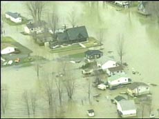 QUEBEC
CITY - Heavy rains across Quebec and New Brunswick have
brought flooding and forced dozens of families out of
their homes. QUEBEC
CITY - Heavy rains across Quebec and New Brunswick have
brought flooding and forced dozens of families out of
their homes.
Some areas have received as much as 100 millimetres
of rainfall in the past week. Environment Canada's heavy
rainfall warning was lifted on Friday, but the downpours
have not stopped.
Rivers across Quebec are overflowing and the rain
has caused landslides and washed out roads.
In the village of Petite-Rivière-St-François,
north of Quebec City, more than two dozen families have
been forced out of their homes. [...] |
Scattered thunderstorms brought
showers to parts of the Tennessee Valley and southern
Plains Friday, while light rain and scattered snow showers
lingered across the central Rockies.
The most severe storms were in northern Arkansas, where
1.75 inches of hail fell in White and Lanoke counties
and Russellville recorded 1.2 inches of rain.
Thunderstorms were also reported across the Tennessee
Valley and lower Mississippi Valley, while light rain
fell in portions of the Northeast, Ohio Valley and Mid-Atlantic.
Rain totals generally remained under .4 inches.
The Great Lakes, Deep South and central Plains were
mostly dry under partly cloudy skies.
In the West, the central Rockies saw light isolated
rain showers and a few snow showers. Up to 6 inches
of snow were recorded in elevations about 6,000 feet.
Light rain also fell in parts of the Pacific Northwest,
while the northern Rockies, Great Basin, California
and the Desert Southwest enjoyed partly cloudy skies
and dry conditions.
Friday's temperatures around the Lower 48 states ranged
from a low of 6 degrees in West Yellowstone, Wyo., to
a midday high of 92 degrees in Laredo, Texas. |
BUCHAREST - Heavy rains in western
Romania have flooded hundreds of villages, forcing 3,700
people to abandon their homes and disrupting rail and
road traffic, the Environment Ministry said on Friday.
Television stations showed army helicopters and national
guard dinghies arriving at disaster areas to evacuate
shivering victims from what authorities called the worst
floods in 50 years.
"I lost everything. My pigs drowned and I couldn't
rescue them after my house crumbled in the water," said an elderly peasant from Otelec, where floods were
two meters deep.
Up to 2,000 people, mostly from Timis county at the
border with Serbia and Montenegro, were displaced to
temporary shelters on nearby highlands. They are likely
to stay there until at least Sunday, the Orthodox Easter.
But TV reports said many were risking their lives to
defend saturated homes from looters by taking refuge
in their lofts, which were liable to collapse at any
moment.
In the city of Arad, near the border with Hungary,
apartment blocks and streets were flooded, with stranded
residents forced to use dinghies for transport.
The Environment Ministry said the floods were partly
caused by broken 300-year-old dams on the Timis river
but that waters were now beginning to ebb. [...]
Prime Minister Calin Tariceanu, who visited the flood-affected
areas, said the government would rebuild destroyed houses
with materials from the state reserves. The houses are
expected to be ready by the winter.
The government has allocated 500 billion lei ($18 million)
to repair the collapsed railway infrastructure and 280
billion for the dams. Some 30 billion will also go toward
vaccines to prevent epidemics spreading, emergency food
and basic supplies. [...]
The government had yet to present an overall assessment
of the damage, but the farm ministry said 110,000 hectares
(271,800 acres) of wheat, barley, sunflower and vegetables
fields had so far been damaged at an estimated financial
loss of 300 billion lei. |
Giant waves have been lashing some
parts of Andhra Pradesh coast leading to panic, but
experts have assured people that there is no threat
of another tsunami.
Six to seven ft tall waves struck Uppada beach, about
20 km from the port town of Kakinada in East Godavari
district, on Thursday. People living in other coastal
villages in Prakasam district also experienced the unusually
high tidal waves.
No loss of life or property was reported. [...] |
Brigham City leaders have
declared a state of emergency as they prepare for a
few more days of heavy rain and flooding.
BRIGHAM CITY-(KSL News) -- Brigham City has declared
a state of emergency because of the flooding.
"The reservoir is filling into the mayor's pond
which is spilling into the Box Elder Creek."
Mayor Lou Ann Christensen says they've let water go
into irrigation canals and onto the golf course so it
doesn't clog the creek any more.
The city's emergency services director says the rain
is what's causing this flooding. |
Brigham City leaders have declared a
state of emergency as they prepare for a few more days of heavy
rain and flooding.
BRIGHAM CITY-(KSL News) -- Brigham City has declared a state
of emergency because of the flooding.
"The reservoir is filling into the mayor's pond which is
spilling into the Box Elder Creek."
Mayor Lou Ann Christensen says they've let water go into irrigation
canals and onto the golf course so it doesn't clog the creek any
more.
The city's emergency services director says the rain is what's
causing this flooding. |
QUEBEC
CITY - Heavy rains across Quebec and New Brunswick have brought
flooding and forced dozens of families out of their homes.
Some areas have received as much as 100 millimetres of rainfall
in the past week. Environment Canada's heavy rainfall warning
was lifted on Friday, but the downpours have not stopped.
Rivers across Quebec are overflowing and the rain has caused
landslides and washed out roads.
In the village of Petite-Rivière-St-François,
north of Quebec City, more than two dozen families have been forced
out of their homes. [...] |
Scattered thunderstorms brought showers to
parts of the Tennessee Valley and southern Plains Friday, while
light rain and scattered snow showers lingered across the central
Rockies.
The most severe storms were in northern Arkansas, where 1.75
inches of hail fell in White and Lanoke counties and Russellville
recorded 1.2 inches of rain.
Thunderstorms were also reported across the Tennessee Valley
and lower Mississippi Valley, while light rain fell in portions
of the Northeast, Ohio Valley and Mid-Atlantic. Rain totals generally
remained under .4 inches.
The Great Lakes, Deep South and central Plains were mostly dry
under partly cloudy skies.
In the West, the central Rockies saw light isolated rain showers
and a few snow showers. Up to 6 inches of snow were recorded in
elevations about 6,000 feet.
Light rain also fell in parts of the Pacific Northwest, while
the northern Rockies, Great Basin, California and the Desert Southwest
enjoyed partly cloudy skies and dry conditions.
Friday's temperatures around the Lower 48 states ranged from
a low of 6 degrees in West Yellowstone, Wyo., to a midday high
of 92 degrees in Laredo, Texas. |
BUCHAREST - Heavy rains in western Romania
have flooded hundreds of villages, forcing 3,700 people to abandon
their homes and disrupting rail and road traffic, the Environment
Ministry said on Friday.
Television stations showed army helicopters and national guard
dinghies arriving at disaster areas to evacuate shivering victims
from what authorities called the worst floods in 50 years.
"I lost everything. My pigs drowned and I couldn't rescue
them after my house crumbled in the water," said an elderly
peasant from Otelec, where floods were two meters deep.
Up to 2,000 people, mostly from Timis county at the border with
Serbia and Montenegro, were displaced to temporary shelters on
nearby highlands. They are likely to stay there until at least
Sunday, the Orthodox Easter.
But TV reports said many were risking their lives to defend saturated
homes from looters by taking refuge in their lofts, which were
liable to collapse at any moment.
In the city of Arad, near the border with Hungary, apartment
blocks and streets were flooded, with stranded residents forced
to use dinghies for transport.
The Environment Ministry said the floods were partly caused by
broken 300-year-old dams on the Timis river but that waters were
now beginning to ebb. [...]
Prime Minister Calin Tariceanu, who visited the flood-affected
areas, said the government would rebuild destroyed houses with
materials from the state reserves. The houses are expected to
be ready by the winter.
The government has allocated 500 billion lei ($18 million) to
repair the collapsed railway infrastructure and 280 billion for
the dams. Some 30 billion will also go toward vaccines to prevent
epidemics spreading, emergency food and basic supplies. [...]
The government had yet to present an overall assessment of the
damage, but the farm ministry said 110,000 hectares (271,800 acres)
of wheat, barley, sunflower and vegetables fields had so far been
damaged at an estimated financial loss of 300 billion lei. |
Giant waves have been lashing some parts
of Andhra Pradesh coast leading to panic, but experts have assured
people that there is no threat of another tsunami.
Six to seven ft tall waves struck Uppada beach, about 20 km
from the port town of Kakinada in East Godavari district, on Thursday.
People living in other coastal villages in Prakasam district also
experienced the unusually high tidal waves.
No loss of life or property was reported. [...] |
MADRID: Spain has suffered its
driest winter and early spring since records began almost 60 years
ago, data from meteorologists showed on Friday.
Rainfall from November to the end of March this year was 37 per
cent below the average for the period and the lowest since records
started in 1947, the National Meteorological Office said.
With water reserves in Spain at just 60 per cent of full capacity,
farmers fearing water rationing say they are planting fewer crops.
Neighbouring Portugal is suffering its worst drought for 25 years
and authorities there have imposed irrigation restrictions in
the south, a popular tourist destination. |
Continue to May 2005
Remember,
we need your help to collect information on what is going on in
your part of the world! We also need help to keep
the Signs of the Times online.
Send
your comments and article suggestions to us 
Fair Use Policy Contact Webmaster at signs-of-the-times.org
Cassiopaean materials Copyright ©1994-2014 Arkadiusz Jadczyk and Laura Knight-Jadczyk. All rights reserved. "Cassiopaea, Cassiopaean, Cassiopaeans," is a registered trademark of Arkadiusz Jadczyk and Laura Knight-Jadczyk.
Letters addressed to Cassiopaea, Quantum Future School, Ark or Laura, become the property of Arkadiusz Jadczyk and Laura Knight-Jadczyk
Republication and re-dissemination of our copyrighted material in any manner is expressly prohibited without prior written consent.
|