Earthquakes
S


Seismograph

Seismic storm hits Italy's Campi Flegrei super volcano with strongest earthquake in 40 years

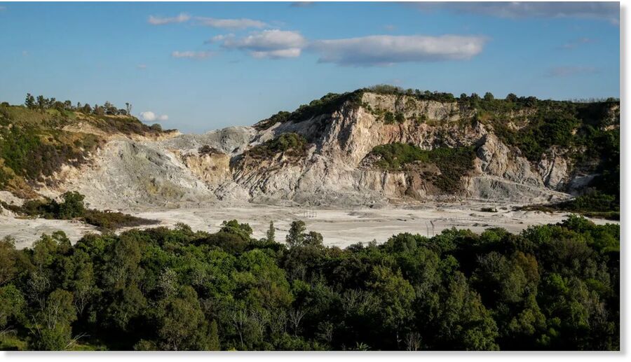
The Solfatara crater, part of the Campi Flegrei Volcano in Pozzuoli, the biggest caldera of southern Italy.
© Salvatore LaportaThe Solfatara crater, part of the Campi Flegrei Volcano in Pozzuoli, the biggest caldera of southern Italy.
A 4.4 magnitude earthquake struck Italy's Campi Flegrei super volcano Monday evening, causing mild damage in the town of Pozzuoli, the epicenter, and as far away as the city of Naples, some 20 kilometers (12 miles) away, according to Italy's National Institute of Geophysics and Volcanology (INGV).

Cracks in walls and falling cornices were reported, Italy's Fire Brigade spokesman confirmed to CNN.

The 4.4 earthquake at a depth of 3 kilometers is the strongest earthquake to hit the highly seismic area in the past 40 years, according to INGV data. The quake is part of an ongoing "seismic storm" that has seen more than a dozen events over 2.0 magnitude in the past 48 hours.

The 4.4 tremblor at 8:10 p.m. local time was preceded by a 3.5 earthquake an hour earlier.

The INGV recorded 1,252 earthquakes in the Campi Flegrei area in the month of April 2024, most with a magnitude less than 1.0.
Seismograph

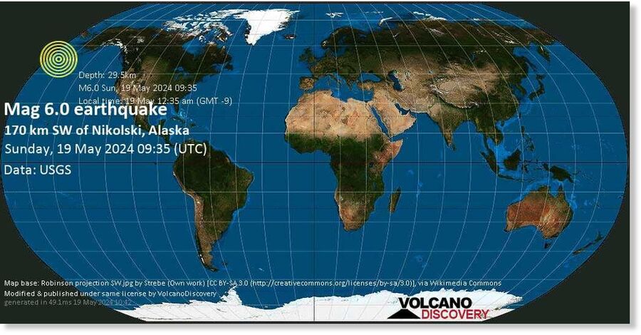
Shallow magnitude 6.0 earthquake near Aleutian Islands, Alaska

nnnnn
A very strong magnitude 6.0 earthquake occurred in the North Pacific Ocean near Amukta Island island, USA, in the early morning of Sunday, May 19, 2024 at 12.35 am local time (GMT -9). The quake had a very shallow depth of 30 km (18 mi) and was not felt (or at least not reported so).

No significant damage or impact is expected from this quake and no particular alert was issued.

Seismograph

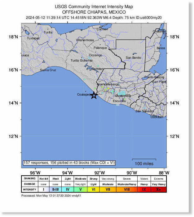
A magnitude 6.4 earthquake wakes people on the Mexico-Guatemala border

MMMM
A strong earthquake shook the border of Mexico and Guatemala early Sunday, driving frightened residents into the streets.

The temblor struck just before 6 a.m. near the Mexican border town of Suchiate, where a river by the same name divides the two countries. The epicenter was just off the Pacific coast, 10 miles (16 kilometers) west-southwest of Brisas Barra de Suchiate, where the river empties into the sea.

The earthquake had a preliminary magnitude of 6.4, according to the U.S. Geological Survey and a depth of 47 miles (75 kilometers).

In Mexico, there were no immediate reports of damage, but more mountainous, remote parts of the border are prone to landslides.

Across the border Guatemala's national disaster prevention agency shared photos of small landslides onto highways in the Quetzaltenango region and large cracks in walls in a hospital in San Marcos on its social media accounts, but there were no reports of deaths.


Attention

Odd earthquake swarm in Central Europe hints at magma activity in region far from tectonic boundary

Vogtland
© honza28683 via Getty ImagesThough it's nowhere near a tectonic plate boundary, the Vogtland region is known for its earthquake swarms.
An odd earthquake swarm on the border of Germany and the Czech Republic may hint at magma moving deep below the surface.

The quakes are in Vogtland, a region known for regular, low-level earthquake swarms. These swarms tend to last several weeks and lead to mostly mild shaking. The largest known quakes from the area are around magnitude 4.5, said Torsten Dahm, a geophysicist at the GFZ German Research Centre for Geosciences who's leading a project monitoring this region.

Dahm and his colleagues recently finished deploying a new network of seismometers installed in boreholes in the Vogtland area. These seismometers captured a late-March earthquake swarm unlike others seen in the area โ€” the center of the swarm jumped 9 miles (15 kilometers) to the north, compared with previous swarms. And instead of occurring on a vertical fault line underground, it seems to have taken place on a near-horizontal underground structure.

Comment: There's certainly been a significant number of 'surprising' and 'unusual' seismic and volcanic reports in recent years, and it seems reasonable to suppose that this signals an uptick in activity: Volcanoes, Earthquakes And The 3,600 Year Comet Cycle

See: Also check out SOTT radio's:


Seismograph

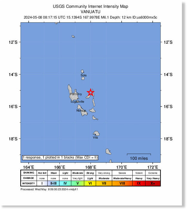
Shallow 6.1-magnitude earthquake hits Vanuatu

nnnnnnnnn
An earthquake with a magnitude of 6.1 jolted the Vanuatu Islands at 08:17:18 GMT on Wednesday, the GFZ German Research Centre for Geosciences said.

The epicenter, with a depth of 10.0 km, was initially determined to be at 15.26 degrees south latitude and 167.94 degrees east longitude, reports Xinhua.

Seismograph

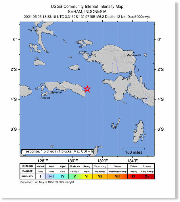
Shallow earthquake of magnitude 6.2 jolts Indonesia

nnnnnnnn
A magnitude 6.2 quake struck off Indonesia, the US Geological Survey said.

A very strong magnitude 6.2 earthquake occurred in the Ceram Sea near the coast of Maluku, Indonesia, in the early morning of Monday, May 6, 2024 at 3.33 am local time (Asia/Jayapura GMT +9). The quake had a very shallow depth of 29 km (18 mi) and was reported felt by some people near the epicenter.

No significant damage or impact is expected from this quake and no particular alert was issued.

Seismograph

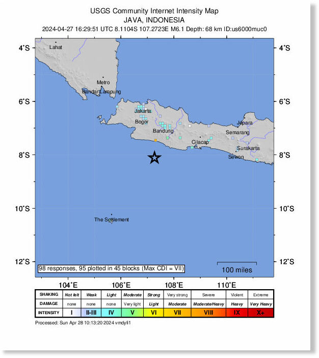
A strong magnitude 6.1 earthquake shakes Indonesia's Java Island, felt in Jakarta

mmmmm
A strong magnitude 6.1 earthquake shook the southern part of Indonesia's main island of Java on Saturday, but there were no immediate reports of injury or significant property damage.

The U.S. Geological Survey said the quake struck 102 kilometers (63 miles) south of Banjar city at a depth of 68.3 kilometers (42.4 miles). There was no tsunami warning.

High-rises in the capital Jakarta swayed for around a minute and two-story homes shook strongly in the West Java provincial capital of Bandung and in Jakarta's satellite cities of Depok, Tangerang, Bogor and Bekasi. The quake was also felt in other cities in West Java, Yogyakarta and East Java province, according to Indonesia's Meteorology, Climatology and Geophysical Agency.

The agency warned of possible aftershocks.

Seismograph

Japan's Bonin Islands hit by magnitude 6.5 earthquake

mmmmm
A magnitude 6.5 earthquake struck Japan's Bonin Islands, as reported by the United States Geological Survey (USGS) on Saturday (April 27).

The quake occurred at a depth of 503.2 km (312.7 miles).

The US National Tsunami Warning Center confirmed that no tsunami warning was issued based on the available data.

Seismograph

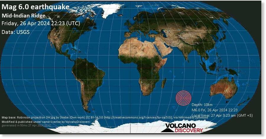
Shallow magnitude 6.0 earthquake - Mid-Indian Ridge in the Indian Ocean

mmmmmmm
A very strong magnitude 6.0 earthquake occurred in the Indian Ocean 103 km (64 mi) from French Southern Territories Fri, Apr 26, 2024 22:23 GMT. The quake had a very shallow depth of 10 km (6 mi) and was not felt (or at least not reported so).

No significant damage or impact is expected from this quake and no particular alert was issued.

Seismograph

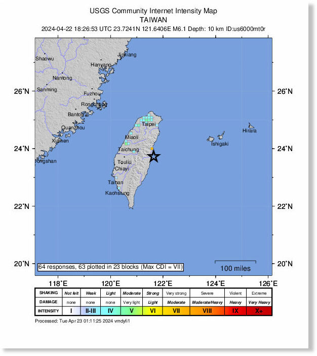
Taiwan rattled by shallow 6.1 magnitude earthquake amid numerous tremors

nnnnnnnnn
Taiwan was hit with a magnitude 6.1 earthquake in the early hours of Tuesday local time (2:32 p.m. ET Monday), according to the island's Central Weather Administration.

The earthquake struck about a mile from Shoufeng Township, Hualien County, the USGS said, and is the latest in a series of earthquakes that had been shaking the island since Monday afternoon. There was no tsunami threat, according to the Pacific Tsunami Warning Center.

The latest quake shook buildings in the capital, Taipei; an AFP reporter said they could feel their building swaying.

"Glass panels of (the) bathroom and windows were making noises," another AFP staffer said.