Storms
S


Snowflake Cold

Snowstorm during Easter dumps up to 11 inches on Nebraska

snow
Wintry weather contributed to crashes in Nebraska this weekend that claimed one life and critically injured a second person.

Snow on Easter — in some areas up to 11 inches — caused about two dozen crashes on Nebraska highways, including one that killed a Grand Island woman.

Ramona Senkbile, 84, died in a crash on U.S. Highway 30 in Grand Island on Sunday, the Nebraska State Patrol said.

Cody Thomas, a patrol spokesman, said Senkbile lost control on the snow and her vehicle was struck by an oncoming pickup.

Comment: See also: Omaha breaks 1899 record for low temperature with more snow back in the forecast


Cloud Precipitation

Hailstorm damages 135,000 acres of crops across Telangana, India

Hailstorms, unseasonal rains batter crops across Telangana
Unseasonal heavy rains coupled with high-speed wind and hailstorm that lashed different parts of Telangana in the last two days caused extensive damage to standing crops in nearly 1.35 lakh acres, agriculture department officials said on Tuesday after preliminary estimates.

Although the heavy rain brought a lot of respite to the people from scorching temperatures which had soared 40 degrees Celsius in several parts of the state, they also caused a lot of misery to the farmers by damaging crops which were almost for harvest.

Senior officials of the agriculture and horticultural departments, who reviewed the situation on Tuesday, estimated that paddy crop suffered the most due to thunderstorms and hailstorms in mostly Nalgonda, Suryapet, Siddipet, Khammam and Warangal districts, besides parts of Ranga Reddy.

Comment: See also: A taste of the future? Hailstorms damage crops in several districts of Bihar, India

Similar events in Asia have also occurred recently in Nepal, Bhutan and Bangladesh.


Windsock

Adapt 2030 Ice Age Report: Strange winds in the Arctic, early Pacific super typhoon and Antarctic sea ice returns

Super Typhoon Jelawat
© NASA/NOAA Suomi NPP/VIIRSSuper Typhoon Jelawat on March 30, 2018.
Winds are noticeably changing in the Northern Hemisphere due to the continued weakening of the magnetosphere as we descend further into the grand solar minimum. Zonal winds @65N and above had a dramatic reduction, but in the Pacific a super typhoon forms in March. Antarctic sea ice makes a massive recovery nearly breaking above the 1981-2010 average. The shift to a colder polar climate in beginning to show, now add in unstable global winds and I feel the result will be crop yield reductions.


Comment: Jelawat rapidly intensified into the first super typhoon of 2018


Info

The destruction of ancient Rome - The barbarians were not responsible

Destruction of Rome
© Malaga Bay
Rodolfo Lanciani was an archaeologist who produced "unsurpassed" plans of Ancient Rome.
Rodolfo Amedeo Lanciani (1845 - 1929) was an Italian archaeologist, a pioneering student of ancient Roman topography, and among his many excavations was that of the House of the Vestals in the Roman Forum.

Ancient Rome
© Malaga Bay
Lanciani's great work was the production of a map of the ancient city of Rome.

The work was realized as a set of 46 very detailed maps of ancient Rome issued in 1893-1901, which remains unsurpassed to this day, even if there have been many new discoveries since.

https://en.wikipedia.org/wiki/Rodolfo_Lanciani
Snowflake

UK: Snow, rain and floods make bank holiday travels a trial

snow, cars
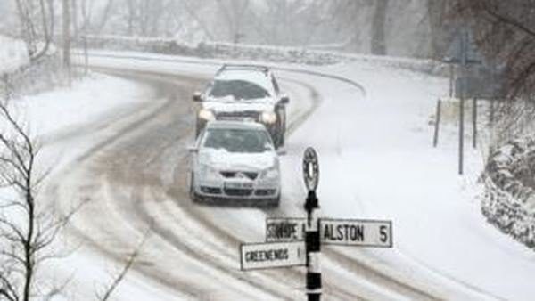
Drivers in Nenthead, Cumbria faced treacherous conditions as up to 4in (10cm) of snow fell in the north of the UK.
Travellers returning from bank holiday trips faced delays as heavy rain and snow closed roads.

Up to 4in (10cm) of snow covered parts of Scotland, northern England and north Wales, while torrential rain fell in southern England.

Flood warnings and alerts are in force in England, Scotland and Wales.

The Met Office has issued yellow weather warnings as the AA warns that motorists faced one of the busiest bank holidays on the roads in recent years.

As of 21:00 BST the Environment Agency had issued 41 flood warnings and 217 flood alerts in England, and the Scottish Environment Protection Agency issued one flood warning for people in Scotland.

Natural Resources Wales had one flood warning and 19 flood alerts in place for Wales.

Comment: Ice age on the way: Gulf Stream is slowing down faster than ever, scientists say


Ice Cube

America's North East continues to be battered by storms - with 'Spring snow' to follow

A storm is developing in the central Plains Sunday and rapidly moving off to the east.
© ABCA storm is developing in the central Plains Sunday and rapidly moving off to the east.
The first storm of the holiday weekend moved through the upper Midwest on Saturday bringing as much as a foot of snow in northern Minnesota. Now another storm is developing in the central Plains Sunday and rapidly moving to the east -- with snow likely from Nebraska to Ohio on Easter Sunday.

Snow will reach Missouri and Illinois by the early evening hours, and then move into Indiana and Ohio by Sunday night. Occasional heavy bursts of snow are likely, which will reduce visibility. Although the snow will have some difficulty sticking to roadways, slick and treacherous spots will develop in the region Sunday evening, and travel will be impacted.

Comment: This will be perhaps the fifth Nor'Easter after a string of other storms to hit the US in just under two months: Fourth Nor'easter this month to bring snow and on the first day of Spring - and we can expect more to come

And it's not just the US experiencing unusual cold:


Cloud Precipitation

Police retrieve 4 bodies following major flooding in Fiji

FLOOD
Fiji police are still searching for a 19 year-old man who was washed away by flood waters in Sabeto, Nadi.

Heavy rain and strong winds associated with Tropical Cyclone Josie, a category one, has caused major flooding in parts of the country.

Police have confirmed that five people have been washed away by flood waters and Police have retrieved four bodies.

A woman was found in Vatulaulau in Ba, a 55 year-old man was found in Lautoka and two people have been found in Uciwai in Nadi.


Attention

Study: Super typhoon may flood a third of Tokyo

Tokyo, Japan
© BLOOMBERGA Tokyo Metropolitan Government report says 99 percent of Sumida Ward, where Tokyo Skytree is located, will be flooded if a supertyphoon hits the capital.
One-third of central Tokyo could be left under water and nearly four million people affected if a super typhoon were to strike Japan's capital, causing storm surges, a new study has warned.

The Tokyo metropolitan government unveiled on Friday its first estimate of the capital city's vulnerability to damage from typhoon-related high tidal waves, as risks of storm damage continue to rise globally.

According to the report, 212 sq km, or one third of Tokyo's central area, could be inundated to a maximum depth of 10m if a super typhoon creates high tidal waves.

A severe event of this type would be estimated to affect as many as 3.95 million people in the city, flooding business and entertainment districts as well as major railway stations, the local government said.

Tokyo has a population of 13.7 million people.

Windsock

Jelawat rapidly intensified into the first super typhoon of 2018

Super Typhoon Jelawat
© NASA/NOAA Suomi NPP/VIIRSSuper Typhoon Jelawat on March 30, 2018.
Typhoon Jelawat not only became the first typhoon of 2018, but then exploded into a Category 4 super typhoon, a relative rarity this early in the calendar.

Jelawat was first categorized as a tropical depression last Saturday, then strengthened to become the year's first typhoon Thursday afternoon, U.S. time.

Over the western Pacific Ocean north of the equator and west of the International Dateline, tropical cyclones are called typhoons when they strengthen to the equivalent of a hurricane.

But Jelawat, named for a Malaysian word for a freshwater fish, wasn't content to merely slide across the typhoon threshold.

Because of a west-to-east cocoon of lower wind shear, strong outflow winds aloft providing ventilation for thunderstorms, and some warmer than average ocean water, Jelawat rapidly intensified, gaining 70 knots (roughly 80 mph) of intensity in just 24 hours, becoming the equivalent of a Category 4 super typhoon by Friday morning, U.S. time.

Tornado2

Amazed residents film tornado touch-down in Var, France

tornado france var
© Bryan Frt/ Facebook
Life on our planet is clearly undergoing serious changes that can be seen in the shifting seasons and also in individual, unusual but increasingly common events.

January in France saw every major weather station record above average rainfall with 30 departments on alert for flooding, areas of Paris underwater as the Seine swelled to 6 metres, and mountain areas saw unexpectedly high snowfall. Then, in 24 hours in February, France saw a magnitude 4.8 earthquake and a fireball.

So in keeping with what is actually a worldwide trend, today 31st March, La Crau residents in the Var region in France, saw Spring's grey skies birth a tornado which touched down early afternoon, and thankfully the locals whipped out their recording devices to capture the phenomenon. An investigation is under way to determine the strength of the winds.

Comment: See Also: