Storms
S

Cloud Precipitation

Yosemite National Park floods due to California deluge with 6 inches of rain in 2 days

In this Saturday, April 7, 2018 photo released by the National Park Service, floodwaters cover Cooks Meadow
© National Park ServiceIn this Saturday, April 7, 2018 photo released by the National Park Service, floodwaters cover Cooks Meadow and the pedestrian trail through Cooks Meadow in Yosemite Valley in Yosemite, Calif. Sections of Northside Drive, Southside Drive, and Sentinel Drive remain closed due to high water in the roadway. Parts of Yosemite National Park remained closed as the Merced River peaked several feet above flood stage through the Yosemite Valley.
Yosemite National Park reopened Sunday after flooding that washed out roads during a strong Pacific storm, park officials said.

Forecasters said up to 6 inches (15 centimeters) of rain fell over two days as rivers swelled in Northern California.

Roads within Yosemite Valley were swamped by up to 4 feet (1.2 meters) of water that affected electrical and water systems. Most facilities reopened at midday, but officials warned that traffic could be slow as cleanup work continues.

The area was closed Friday as a powerful "Pineapple Express" storm moved through. The heaviest rain was in the northern Sierra and in coastal counties from San Francisco north to Mendocino during a 48-hour period ending Saturday afternoon.


Cloud Precipitation

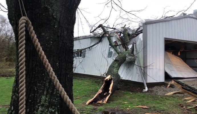
Tennis ball-sized hail smashes windows and damages roofs as huge storm downs trees in northern Texas

The ice storm only lasted 10 minutes, but hailed down with fury, covering the ground in white
A severe storm in Texas dropped tennis ball-sized hail in the Dallas Forth Worth area.

The massive storm saw thunder, heavy rain, and hail fall from the sky Friday night.

The deluge released a heavy downpour of hail around 7pm Friday for about 10 minutes, sending the balls of ice flying through the air, destroying windows and cars.

Locals shared the astonishing images of the hail on social media, where the balls of ranged from the size of a pea to a tennis ball, according to NBC.

Several people shared video footage of the torrential storm that covered front lawns in white as millions of pieces of hail fell to the ground.

In some footage viewers can hear the thuds and taps of the heavy ice balls hitting the earth.


Attention

Dozens of geese fall from the sky into Idaho Falls parking lot during severe hailstorm

dead geese
Dozens of geese plummeted from the sky during a severe hail and thunderstorm Saturday evening.

Witnesses tell EastIdahoNews.com the birds suddenly fell into a parking lot near Yellowstone Highway and Lincoln Road in Idaho Falls around 7 p.m. It's likely they were struck by lightning.

Workers with the Idaho Department of Fish and Game arrived with a truck and picked up the geese, according to witnesses.

EastIdahoNews.com is working to get more information from IDFG and will post additional details as we receive them.


Cloud Lightning

Lightning bolt kills woman, injures 4 others in White Springs, Florida

lightning
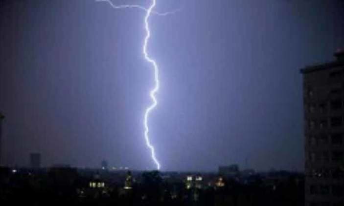
Five people were struck by lightning in White Springs, Florida on Saturday as storms moved through the northeast part of the state.

A woman died and four people were injured, according to a local storm report by the National Weather Service.

A source tells us the woman is Kourtney Lambert.

The people were struck at Woodpecker Mud Bog, officials say.

A source tells Action News Jax the strikes happened at about 2:50 p.m. near a camper where people were seeking shelter under the camper's gooseneck.

The source says a 23-year-old woman was struck and killed instantly.


Comment: In Asia fatalities caused by lightning strikes during the past week across India include a woman killed in Bengaluru, 3 struck in separate incidents in Jaipur and 2 hit by bolts in Odisha while in Jamalpur, Bangladesh a teenage boy succumbed.


Tornado2

Eight tornadoes touch down across the Heartland

Crenshaw Road in Marion, Ill.
© Brittany Jacob/KFVSCrenshaw Road in Marion, Ill.
Eight tornadoes hit the Heartland on Tuesday, April 3, according to the National Weather Service. The latest report was a twister in New Madrid County, Missouri.

There were two tornadoes reported in Hickman County, Ky., one in Massac County, Ill., one in Williamson County, Ill., one in Livingston County, Ky, in Saline County, IL, one in Dunklin County, Mo and one in New Madrid County, Mo.

Comment: See also: Tornadoes and deadly storms strike in South, Midwest US


Sheeple

Death toll for Scotland's lambs sees a sharp increase after heavy snow

lambs
The death toll on Scottish sheep farms has seen a sharp increase following spells of heavy snow this winter, according to official figures.

Farming leaders said sheep farmers were facing a "war of attrition" from the weather after a severe winter followed a wet summer and autumn.

And they warned that it could affect productivity for the rest of the year.

Gary Mitchell, vice-president of NFU Scotland, said spring lambs were having a "really tough time".

Cloud Precipitation

Hailstorm destroys orchards, vegetables in several areas of Kurram Agency, Pakistan

hail damaged
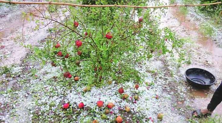
Heavy rain and hailstorm has destroyed fruit orchards and vegetable fields in most of the areas of Kurram Agency the other day.

According to Peshawar correspondent , the Kurram Agency areas of Zeran, Malana, Karman Boghki and Para Chamkani were hit by heavy rain and hailstorm where scores of fruit orchards and fields of vegetables were destroyed.

In Zeran Brabata area, the roof of the house of a poor man, Ilayas caved in causing him losses of thousands of rupees besides death to his two cattle. On other side thousands of acres of land along side Kurram River was in danger of being washed away due to lack of protected embankments.

Windsock

Powerful windstorm leaves thousands without power in Ontario, Canada

Crane snapped in Ontario
© @RositaLanger/TwitterA crane was snapped amid the storm in the Eglinton Avenue and Glen Erin Drive area in Mississauga, Ont., west of Toronto.
Strong winds battered region Wednesday - knocking down trees, cranes and a brick wall

Tens of thousands of people were without power in southern Ontario after heavy winds tore through the region Wednesday.

About 60,000 customers were estimated to be without power by late evening, according to the utility company Hydro One. That number was more than 80,000 earlier in the day. Toronto Hydro said there were numerous reports of downed power lines and that about 3,300 of its customers were blacked out by about 10:10 p.m. ET, down from some 21,400 customers.

The winds are also limiting restoration efforts as bucket trucks can't be used because of safety concerns. Toronto Hydro said restoration times aren't available but efforts will continue into Thursday.

Spokeswoman Tori Gass said the blackouts scattered throughout the city were directly related to the wind, which had been gusting upwards of 90 kilometres an hour.

Gass said extra crews were currently working to fix the downed lines and repair outages; however, priority is given to cases where there is risk to the public's safety.


Cloud Lightning

Lightning bolt kills 3, injures 2 in Uganda

lightning
Three people were killed and other two injured when lightning struck during a downpour in Bukasero village in Bukatube sub-county, Mayuge district on Sunday.

The Police identified the deceased as Muniru Dembele, 41, Rashid Mutebe, 27, and Ronald Okware 16, all residents of Bukasero. The survivors are Kadiri Kadabo, 17 and Matia Mugalya, 27.

Moses Kato, the LC1 chairperson said the incident happened on Easter day.

Cloud Precipitation

Much of US will see below normal temps this weekend, similarities to storm of 1982 - cold expected throughout April

US north east April 5th 2018 storm
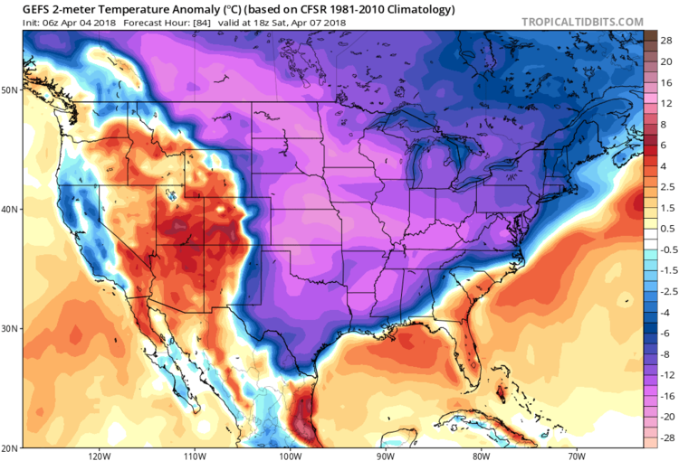
Much of the eastern two-thirds of the nation will feature well below-normal temperatures on Saturday afternoon as depicted by the 06Z GEFS 2-m temperature anomalies; courtesy NOAA, tropicaltidbits.com
Overview

A very active weather pattern is bringing the I-95 corridor intense winds today associated with a strong cold frontal system and there may be another round of springtime accumulating snow this Saturday for much of the region. Winds could gust past 50 mph this afternoon and early evening following the passage of a strong cold front as a fresh cold air mass rushes into the region. On Thursday, it'll be dry and quite cold for this time of year and the winds will start off the day quite strong though they will likely diminish during the mid and late afternoon hours. A "clipper-type" low pressure system will then bring rain showers to the I-95 corridor on Friday and push a cold front through the region. This front will usher in very cold air for this time of year by early Saturday and low pressure will form along the stalling frontal boundary zone and likely generate accumulating snow in the DC-to-Philly-to-NYC corridor.

Comment: Winter in the US has been brutal, but it's reflective of a much wider trend: